The campaign measurements actually go further than just validating the CryoSat satellite data, they contribute significantly to the continuous improvement in the quality of ice-thickness maps.
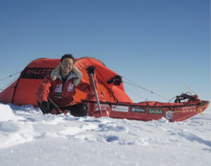
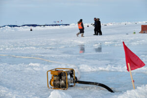
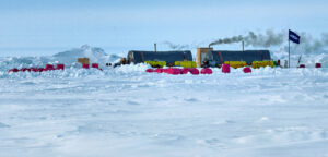
Trekking to the far reaches of the Arctic for the sole purpose of collecting snow and ice measurements may seem extreme, but it is thanks to these efforts that scientists will soon have even better satellite information at their fingertips to assess changes in polar ice.
Over the last year, the measurements made by scientists camping on the ice and from various aircraft during a month-long expedition have been painstakingly processed so that they can be used to confirm data from ESA’s CryoSat ice mission.
CryoSat measures the height of ice – both of that floating in the polar oceans and of the vast ice sheets covering Greenland and Antarctica. This information is essential for working out the thickness of the ice and how it is changing and, ultimately, how the volume of Earth’s ice is being affected by the climate.
Given the crucial nature of understanding the links between ice and climate, it is important to make sure that CryoSat’s measurements remain accurate, even if this means heading out to one of the most inhospitable places on Earth.
Read more…