Fuchs-Messner route skiers are well underway
In an Explorersweb/Pythom interview with Arved Fuchs, he told us, he and Reinhold Messner had very little information about the new route from 82°05’S, 071°58,5’W, “if any at all,” Fuchs added. “I had made a plotting sheet at home where I marked our daily position. Navigation was still by sextant, artificial horizon but mainly by compass. We also had a so called, hodometer, which was basically a bicycle wheel with a meter measuring the distance. We were also carrying the first prototype of portable GPS receiver. However, in 1989 the system was still not operational or reliable all the time. Some days it was even shut down completely, during other days you had to be lucky to get a position. So since I was the navigator I didn’t dare to rely on GPS only.”
Interactive Map: Antarctica Skiing Routes
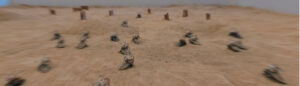
Currently, two guided teams are on the Fuchs-Messner route. According to Ryan Waters, it is quite hot for sledge-hauling. Snow conditions are getting tougher as they take a detour to avoid the crevasse fields of the Foundation Ice Stream.
2016-17 Antarctica Ski Expedition List
From 80ºS, Hercules Inlet skiers make good miles.
Fuchs-Messner start point (890 km in a straight line)
1989: Arved Fuchs traversed Antarctica, with Messner (Interview)
Ryan Waters to guide Fuchs-Messner route (Antarctica 2016-17 interview)
Ryan Waters (US) guiding for Mountain Professionals: Katrina Follows (England, lives in Chamonix), Paul Adams (USA) and Scott Kress (CA): The team started skiing November 17. They are unassisted (no resupplies) and the start weight of their sleds was around 100 kg. The first day they knocked off about 3.5 Nautical Miles in under 3 hours of skiing to just get started, reported Ryan. “We finished early to go over some additional ways we will put up camp, make water from snow blocks, and all the many tasks.” The second day they managed 8.89 Nautical in 6 hours skiing. They ski routine consists of 8 pitches of 45 minutes, which will eventually be increased. In the tents, they were snacking on toasted breads with salami and olive oil. The -10 to -15 degrees Celsius temperatures were too warm for sledge-hauling and they were skiing in one layer of underwear and zips open on outer-layers.
Latest report on November 23: they had a strong day out in some rather tough surface conditions. “There is an ice stream that begins close to where we are now and so the elevation gain is quite a bit more dramatic as we can look out to the east part of today and see the flat horizontal cloud layer at odds with our own ice horizon so we could visually see we were climbing, ever so gently. We skied 6:45 hrs/mins and covered another 10.79 Nautical Miles (19.9 km). They have set their short-term sights on 84 degrees, with a longer term goal at a navigational waypoint to avoid the crevasse fields of the Foundation Ice Stream.
Check their map by Explorers House here. Latest position: 2016-11-24, 18:53UTC, Latitude: -83.3536 Longitude: -069.8753, Altitude: 717 meter
Carl Alvey (UK), guiding for ALE, and Bob Maxwell (NZ). The team also started on November 18, and covered 3.6 nm, reported ALE. No further news.
Hercules Inlet start point (80ºS, 1130 km)
Rerun – AdventureStats Special: What is Solo?
Risto Hallikainen (FI): His latest position, sent over by home team member, Vesa Luomala: Nov 25, 2016, 2:59:15 UTC Elevation: 710.83 m Lat: -81.509081 Lon: -079.912920
Johanna Davidson (SE) had a rest day and has been dancing, beading, resting, reading, eating and sleeping, she reported. On November 23, Johanna had covered almost 25 km, with 955 km to get to the South Pole. Latest position 2016-11-24, 20:34UTC, Latitude: -81.4500 Longitude: -079.9001, Altitude: 717 meter.
Emma Kelty (UK): no news from Emma since she had received assistance when encountering difficulties with her cooker, the sastrugi, the hills, her neck, GPS, glove and fuel canisters.
Brits Lou Rudd (leader), Oliver Stoten, Chris Brooke, Alex Brazier, Alun George and James Facer-Childs: Alun reported on a personal note, “I had a very, very difficult first few days. It was probably the hardest week I’ve ever had, certainly in my time in the Army.” He had difficulty eating, drinking, blisters and keeping up. Some of his sled weight had to be distributed between the other team members. “Each day I felt I was getting closer and closer to complete physical exhaustion, getting colder all the time.” Yesterday he reported that he is getting better. Chris reported great team work. Distance Nov. 23, 13.8 nautical miles (25.6 km)
Novolazarevskaya start point
Michele Pontrandolfo‘s latest position yesterday 4:24 PM UTC. S 70 54’41.36” E 011 20’39.93”, elev 833 m. Still no favorable kiting winds. He reported heavy snow, which could mean that Michele is man-hauling his heavy sled for the 3620 km traverse.
Follow team blogs in the Dispatch stream on pythom.com
South Pole 2016-17 Interviews on Explorersweb/Pythom:
Exweb South Pole Interview with Johanna Davidsson: kite return attempt
Cycle Antarctica: Hank van Weelden Pole to Coast attempt (Interview)
[UPDATE 2] Risto Hallikainen, solo South Pole return ski attempt (Interview)
Canadian Sébastien Lapierre to attempt solo ski to South Pole (Interview)
Emma Kelty: speed ski and return attempt (Exweb South Pole interview)
Previous/Related on Explorersweb/Pythom:
Inside 80ºS, UPDATED: solo status lost
Antarctica Current: Polar How-To-Guide Heads-Up
HumanEdgeTech Expedition Technology (e.g.CONTACT software)
AdventureStats.com for Polar Statistics and Rules Note that a solo claim has to be unassisted, therefore no supplies carried by pilots or car drivers, or anything (food, fuel, etc) received from any person along the way. A solo person may be wind supported (kites/sails). Claiming to have ‘skied to the Pole’, a full route (from a coastal start point) has to be completed, without flying part of the route.
1 nautical mile = 1,852 km
Hercules Inlet is located at 80°S near Union Glacier, 1130 km from the Geographic South Pole.
The Fuchs-Messner start is 890 km in a straight line from the Pole.
Novolazarevskaya to South Pole of Inaccessibility (POI) is 1610 km in a straight line.
South Pole of Inaccessibility (POI):
2011-12 position: S82°06.696, E055°01.951 (Copeland/McNair-Landry)
On Dec. 14, 2014 Frédéric Dion reported the position the POI (at Lenin’s bust) as S82º 06.702′ E55º 2.087′ at an elevation of 3741 m.
Geographic South Pole (GSP): 90 degrees South
Gateway port Cape Town, South Africa:
To ALCI /TAC base camp Novolazarevskaya / Novo
70° 46’37”S, 011° 49’26”E
Gateway port Punta Arenas, Chile, South America:
To ALE main camp, Union Glacier
79° 45’S, 083° 14’W elev 708m
Lat: -79.760591 Lon: -82.856698
Weather:
https://www.yr.no/place/Antarctica/Other/Union_Glacier/
ALE Union Glacier weather cam 79º 46’S, 83º 16”W
#polar #antarctica #Southpole #thepoles #skisouthpole