You may not see another person for six weeks on these remote rivers. For those longing for adventure, Canada’s Barren Grounds offer some of the wildest rivers in the world.
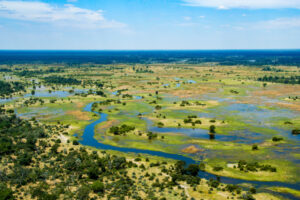
Few countries in the world feature single wilderness rivers where you can canoe for weeks. Canada is one of those places. While parts of southern Canada are as industrial as anywhere else — just google Golden Horseshoe — you can still fly for hours over vast tracts of the country without ever seeing a road. Nunavut, a northern territory three times the size of Texas, has no roads whatsoever.
But what the Canadian north lacks in roads it makes up for with dozens of the wildest rivers in the world. These are places where the only noise is the screech of a peregrine falcon or the sound of waves lapping on the shore or boiling in a rapid.
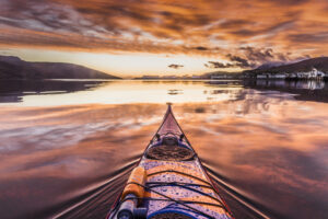
The canoe is an ideal craft for the exploration of such country. Only a canoe (and pulks in winter) can hold six weeks of supplies or more. Because of space limitations, sea kayaks can’t manage more than about four weeks. Ditto the backpack, and even a four-week backpacking trip means shouldering a staggering weight.
Meanwhile, the canoe has both ample space and weight-bearing ability. Portages — toting canoe and gear around unrunnable sections of a river — can be done in one difficult carry or two or three easy ones.
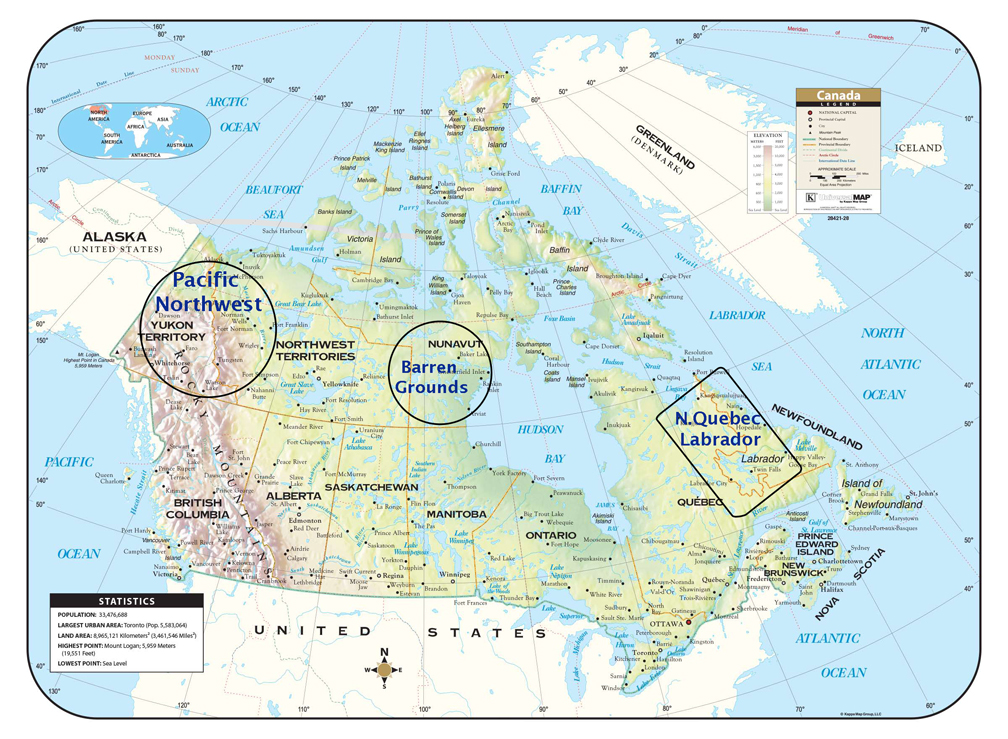
In this occasional series, we’ll look at the world’s greatest wilderness rivers for canoeing, starting with those in Canada. Here, we’ve divided our coverage into three areas: the Barren Grounds west of Hudson Bay; the Pacific Northwest, in the Yukon and western Northwest Territories; and northern Quebec/Labrador, in the northeast of the country.
Since Canada has too many long wilderness rivers to cover each one, we’ve selected a few classics and given enough resources to allow readers to track down other waterways not on this list.
The lack of roads means that access always begins with a chartered floatplane flight to a lake near the headwaters. From there, you’re on your own.
None of the following are for the inexperienced. All feature whitewater that requires skills to paddle safely. If you have to look up the meaning of a J-stroke, a cross-draw, or an eddy line, these wild rivers will be too much. People have died on these rivers, most famously, Arthur Moffat on the Dubawnt River (see below). Apart from their technical sections, these wild rivers are so remote, the water so cold, the land so uncompromising, that you have to be comfortable being totally self-sufficient for four or five weeks at a time.
If this is you, these river vignettes may inspire expedition ideas. For the rest of us, they’re something to aspire to.
Wildest Rivers In The World: Barren Grounds
Kazan River

One of the most technical of the Barren Ground rivers — as well as the buggiest — the 850km Kazan River begins in northern Saskatchewan’s Kasba Lake. From here, it flows north through Angikuni Lake and other large expansions into Baker Lake, which eventually outlets into Hudson Bay. Access to Kasba Lake is via charter aircraft, usually from Lynn Lake, Manitoba.
How many portages you need depends, as always, on the water level and your whitewater skills. One couple in a single open canoe needed 14 portages. A larger, more expert group with decked plastic boats ran everything except waterfalls and Class V rapids and got away with just five portages.
The Kazan begins in the boreal forest but opens into tundra after just a couple of days. Rapids kick in immediately after leaving Kasba Lake. As you might expect from a river that begins just 367m above sea level, plenty of placid sections temper its tumultuous rapids.
The Kazan’s five big lake expansions present a different challenge — wind-whipped waves that lead to frequent days off — an issue on all the Barren Ground’s wildest rivers but especially the Kazan. Of the Kazan’s length, these five lakes make up 235km of it.

An unconventional portage on the Kazan.
Dene and the inland or Caribou Inuit have lived here for thousands of years, and their ancient camps scatter the river’s edge. To the Inuit, the Kazan was Inuit Ku, the River of Men. In 1770, explorer Samuel Hearne passed by, and geologist J. B. Tyrrell first paddled it in 1894.
The Kazan is one of 28 Heritage Rivers in Canada and is home to caribou, muskoxen, wolves, arctic foxes, and many migratory birds. Wildlife is a main draw on the Barren Ground rivers, although mosquitoes and black flies make up the largest biomass.

Barren Ground mosquitoes, a less desirable form of wildlife.
Since Tyrrell, many canoeists have paddled the Kazan, and their trip accounts are valuable blueprints to those who would follow. One unexpected challenge: Long subarctic days can be swelteringly hot — the subarctic has some of the highest summer temperatures in Canada — and bugs or not, it’s hard to be in the tent until the sun goes down late in the evening.

Kazan River. Photo: Britannica
| Length | 850km |
| Estimated time | 35-50 days |
| Access Point | Lynn Lake, Kasba Lake |
| Exit Point | Baker Lake |
| Maps, 1:250,000 | 65D, 65C, 65F, 65K, 65J, 65I, 65P, 55M |
| Maps, 1:50,000 | 65D7, 65D8, 65D9 (incomplete) |
Dubawnt River

Beginning near the Saskatchewan-Northwest Territories border, on the edge of Canada’s central Arctic, the Dubawnt River flows northeast for 840km through a chain of big lakes before abruptly turning northwest to join the Thelon River at Beverly Lake. Many parties continue down the Thelon to exit at the community of Baker Lake.
You access the river by floatplane to Hinde Lake or Selwyn Lake, just to the north. Paddlers who love writing up detailed trip reports cite three to five portages. The length of a trip varies from 23 to 38 days.
The Dubawnt was discovered by Samuel Hearne in 1770, and it too was first paddled by J. B. Tyrrell in 1893. Nowadays, however, it is most commonly known for its role in the death of Arthur Moffatt.
Moffatt, 36, led a six-man expedition in the footsteps of Tyrrell in 1955. They had dawdled, it was already late in the season, and they were hurrying to get off the lakes before freeze-up. They came to a set of rapids that at first did not look any harder than many others they had previously managed. Within minutes, two of the three canoes had capsized, and four men were struggling in the icy water. The two men left in the upright canoe struggled to rescue their friends. Although they managed to get everyone to shore, Moffatt died of hypothermia within the hour.
This expedition has become a cautionary canoeist’s tale of what not to do. Many have painted Moffatt as someone too inexperienced to lead such a trip, a self-absorbed individual who ignored the need to stick to a schedule. But debate remains alive, and some time ago, an experienced canoeist tried to reassess the myth of Moffatt’s incompetence.

A portage during Arthur Moffatt’s expedition, before things went awry.
Apart from the obvious rapids, the Dubawnt may also throw unusual obstacles in a canoeist’s path. Lakes may be still icebound in July, turning canoeists into manhaulers. Of course, even after the thaw, all water is frigid.
The rapids on the Dubawnt vary widely in difficulty. Some are “nothing but fast water…you could float through them with an open beer in hand,” one canoeist said. Others require at least modest attention: After Shults Lake, a 110km stretch of Class I to Class II water is “as close to being on a roller coaster as you can imagine,” says canoe advocate James Raffan. “It is just the most exhilarating downhill paddle.”
But mainly, the Dubawnt is neither beer-in-hand or roller-coaster water. Many, many stretches require proper whitewater skills for dodging rocks and being able to ferry constantly from one side of the river to the other, as the clear line shifts back and forth. A paddler describes one section between Nicholson Lake and Dubawnt Lake:
“Then it really gets crazy! The next rapid is an S-turn that has the first turn heading to river left. We started on the right side…but backferried to the centre, then to the far left margin. From an eddy on the left side…we did a full front ferry to river right, and let me tell you, the river here is really moving big time.”
So while another party cites just four portages — including one four-kilometre detour around the Dubawnt Canyon — the river offers many opportunities for long swims in refreshing ice water, where rocks banging against your swiftly moving body parts are an almost a welcome distraction against the rapid onset of hypothermia.

A lazy day on Arthur Moffatt’s expedition.
| Length | 840km |
| Estimated time | 26 days |
| Access Point | Hinde Lake |
| Exit Point | Beverley Lake |
| Maps, 1:250,000 | 74P, 75A, 65D, 65E, 65L, 65K, 65N,650, 66B, 66C, 66A |
| Maps, 1:50,000 | 65E4, 65E6, 65E11, 65E14, 65L2, 65L7, 65L15, 65L16, 65N10, 65N16, 65012, 65013, 66B4, 66B3 |
Thelon River

The largest river in Nunavut, the Thelon flows east for 904km from the Mackenzie District into Baker Lake. Many canoeists start paddling from Lynx Lake, accessed by a chartered floatplane from Yellowknife. If 904km isn’t enough for you, some paddlers extend the journey another 200km by starting at Vermette Lake and paddling the Elk River to the Thelon. This extension cuts through classic Precambrian Shield country, and the Elk, a classic pool-and-drop river, offers many class I, II, and III rapids. It empties into the Thelon River in a chain of falls stretching more than a kilometer long.
The start of the Thelon at Lynx Lake has been described as “confusing for navigation”. Eventually, a swift current and a series of rapids inform you that you are in the unmistakable groove of the river.
A 12km section of boulder gardens and ledges tests even experienced canoeists. Not only do numerous rapids challenge whitewater skills, but the Thelon’s many big lakes often lead to many windbound days.
Trip reports tend to split the river into three distinct sections: the upper Thelon, from Elk River to the Hanbury junction; the middle Thelon, from Hanbury junction to Beverly Lake, and the lower Thelon, from Beverley Lake to Baker Lake.
Sand is a key feature of the upper Thelon, and the only major obstacle of the section is the Thelon Canyon. Cut into 25m vertical walls, the canyon presents over three kilometres of huge holes and ledges. Many who have dared to tackle it in their canoes have said that they are not sure they would do it again. Fortunately, portaging is possible on both sides of the river.

The sandy upper Thelon River. Photo: Canadian River Expeditions
The middle Thelon runs through the 52,000 sq km Thelon Wildlife Sanctuary, established to protect muskoxen back in 1927. It was a time when muskox blankets were de rigueur in every fashionable horse and buggy in southern Canada. This sheltered section of the Thelon is a good place to make up distance.

Photo: Canadian River Expeditions
Many whitewater-oriented canoeists avoid the lower Thelon because of the significant chance of becoming windbound on Beverly, Aberdeen, and Schultz Lakes, which make up a combined distance of 180km.
This designated Heritage River has many archaeological sites, especially at Schultz and Aberdeen Lakes and the Iarurjuaq Peninsula. Canoe writer and advocate James Raffan admits that the Thelon “holds a special place in my heart. I’m pretty sure it’s the most beautiful place I have ever been in my life.”
As with so many other Barren Ground rivers, Samuel Hearne was the first European to view it, during his 1770–1771 expedition. And the tireless J.B. Tyrrell explored it in 1893.
Former Canadian Prime Minister Pierre Trudeau (the father of the current PM) paddled the Thelon in 1979 with the Rideau and Arctic Canoe Club, a swank group that included Trudeau and several prominent journalists. As usual, they traveled in style, with cases of fine wine and thick steaks kept fresh in boxes of dry ice as they paddled one of the wildest rivers in the world.
| Length | 904km |
| Estimated time | 26 days + 10 days for Elk River extension |
| Access Points | Lynx Lake, Vermette Lake |
| Exit Point | Baker Lake |
| Maps, 1:250,000 | 75I, 75J, 75P, 65P, 66D, 66C, 66B, 66A, 56D |
| Maps, 1:50,000 | Set is here |

More sand, sand, and low land: the Thelon River. Photo: hikebiketravel.com
Back River
The Back River begins at Aylmer Lake, Nunavut, and flows northeast for 974km to Chantrey Inlet on the Arctic Ocean. The longest river located entirely above the treeline in the Canadian Arctic is often considered the most challenging river in the Northwest Territories. There are numerous falls and more than 80 sets of rapids, plus headwinds that can leave you windbound in unending isolation.

As with most of these wildest rivers, the only access is by floatplane from Yellowknife to Sussex Lake, although the few trip reports on the Back River note a few other access points as well. Regardless, the pilot who drops you off is likely the last person you will see.
At first, the paddling is more akin to tackling a series of lakes rather than a channeled river, and some windbound days are almost a certainty. One perk of the wind is that it keeps the bugs away.

The Back River: rock gardens, rapids, and big open water, all together. Photo: Wikipedia
This river was named after its first European explorer, George Back, who discovered it during a two-year expedition (1833–1835) to locate a missing British expedition. Before this, it was known as the Great Fish River.
A canoeist’s river descriptions are more art than science, because everyone experiences a river slightly differently, depending on water level and even the era: The river is lower now than when Back first paddled it, making it easier in some spots (big rapids become smaller) and more difficult in others (formerly smooth passages turn into boulder gardens).
One detailed canoeist’s report found a particular rapid that Back described as “a long and appalling rapid,” neither long nor appalling. His party thought another rapid that Back never even mentioned was much longer and more difficult. If you are experienced enough to attempt these wilderness rivers, you will already know this “paddler beware” aspect. Use reports as a guide, but trust nothing absolutely.

Portaging around a rapids on the Back River.
There are no communities at the mouth of the Back River, so you must make prior arrangements with a charter airline company for pickup.
| Length | 974km |
| Estimated time | 35-50 days |
| Access Point | Sussex Lake, Jim Magrum Lake, Beechy Lake |
| Exit Point | Chantrey Inlet |
| Maps, 1:250,000 | 76C, 76B, 76G, 76H, 66E, 66F |
| Maps, 1:50,000 | 76C9, 76B12, 76B13, 76B14, 76G4, 76G3, 76G6, 76G1, 76G8, 76H4, 76H3, 76H2, 76H1, 66E4, 66E5, 66E6, 66E11, 66E10, 66E9, 66E16, 66F13, 66F14, 66F15 |
Burnside River

Relatively short but feisty, and ideal for a 10- to 14-day trip, the Burnside River flows 258km from Contwoyto Lake in the Low Arctic to Bathurst Inlet on the Arctic Ocean.
Entry points to this paddle include both Contwoyto Lake and Kathawachaga Lake, accessible by floatplane from Yellowknife. A Contwoyto Lake start requires immediately negotiating a continuous set of rapids for 23km before Kathawachaga Lake. The rest of the way features abundant Class II, III, and even IV whitewater.
Even during summer, trip reports note a significant chance of ice on the lakes at the start of the journey. After ice-out, wind is the issue on these big waters. A dramatic cleft in the landscape called Burnside Falls requires a six-kilometre portage.

Some easy rapids on the Burnside.
The hapless John Franklin explored this area in 1821-22 before almost starving on a trek back west to his base, for which he became known as The Man Who Ate His Boots. In the 1840s, Franklin and all 129 men on two ships vanished while searching for the Northwest Passage.

The long portage around Burnside Falls.
Inland Inuit used the Burnside for centuries. On Nadlak Island, more than 40,000 pieces of caribou antler once formed the frames of winter homes for the Copper Inuit. Barren Ground grizzlies are common along the Burnside, and this is also one of the best places to see large numbers of caribou, hence the rich archaeology. And where there are caribou, wolves are not far away.
Trudeau never paddled the Burnside, but another Prime Minister, John Turner, did. And the Rideau and Arctic Canoe Club, sans PMs but with good wine, ventured here as well.

Former journalist and politician John Godfrey opens some French wine on the Burnside.
| Length | 258km |
| Estimated time | 9-12 days |
| Access Point | Contwoyto Lake, Kathawachaga Lake |
| Exit Point | Bathurst Inlet |
| Maps, 1:250,000 | 76E, 76L, 76K |
| Maps, 1:50,000 | 76E14, 76L3, 76L2, 76L8, 76K5, 76K6, 76K11, 76K10, 76K15, 76K16 |
Hood River

The Hood River flows out of Napaktulik Lake and ends, as so many Barren Ground rivers do, at Bathurst Inlet. The five- to eight-week window in which canoeing is possible begins in July. The earlier you go, the higher your chances of seeing wildlife like muskoxen, which move higher as summer progresses.
But it’s a fine balance: Go too early, and you deal with ice. The initial 100km of the river is a series of narrow lakes, and the lack of current keeps them ice-locked until at least early July.

Ice near the headwaters of the Hood River.
Beyond the lakes, the meandering river features many tough rapids, from lazy Class I to unrunnable Class V, according to trip reports here and here. The Hood also boasts 52m Wilberforce Falls, the greatest drop of any arctic river and possibly even surpassing Virginia Falls on the fabled Nahanni for beauty and impact. Of course, portaging around Wilberforce Falls is essential. For many, this marks their pickup point.

Wilberforce Falls.
John Franklin mapped the Hood on his 1820-1821 expedition. In August 1821, Franklin and his men tried to travel upstream. By Wilberforce Falls, they gave up. They cached all non-essentials to lighten their load and ended up walking 400km overland. Many canoeists have searched for their abandoned equipment but so far, only ax heads and a cooking pot have turned up.
The Hood offers rich wildlife habitat, and sightings of muskoxen, caribou, peregrine falcons, and golden eagles are common.
| Length | 295km |
| Estimated time | 14-21 days |
| Access Point | Tahikafaaluk Lake |
| Exit Point | Bathurst Inlet or Wilberforce |
| Maps, 1:250,000 | 86I, 76L, 76K, 76N |
| Maps, 1:50,000 | Set listed here |

Hood River. Photo: Black Feather
Faced with so many possibilities, some ask which is the “best” or “hardest” river, but there is no real answer to those questions. For some, a close encounter with a wolf makes a journey. Masochists may yearn for long, brutal portages. Technical canoeists may focus on the whitewater, but even that depends on the year or even the day.
While a few adventurous parties paddle one of these wildest rivers on their own every summer, canoe outfitters also guide experienced clients on a few of them. Because of the length, remoteness, and charter aircraft costs, the tours are not cheap, typically in the $10,000 range. They include the Hood, Burnside, and Thelon Rivers.