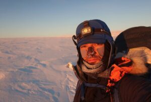
Earlier today, American Colin O’Brady became the first person to complete a solo, unassisted, unsupported crossing of Antarctica. He finished the 1,700km in just over 54 days, including a blazing 15 days to cover the last 600km from the South Pole to the beginning of the Ross Ice Shelf. Lou Rudd, a Briton who is attempting the same route, has 80km to go and should finish later this week.
But was O’Brady’s crossing really unassisted? O’Brady and Rudd have been skiing on a packed road all the way from the South Pole to their finish line. Known as the McMurdo-South Pole Highway, or the South Pole Overland Traverse Road (SPOT), it is a flattened trail groomed by tractors towing heavy sledges. It conveys personnel and supplies from McMurdo Station to the South Pole. Flags every 100m or so make navigation easy during whiteouts, and all the crevasses were filled in by the original construction crew. Most importantly for a skier, it eliminates the rock-hard, bumpy sastrugi that the wind shapes out of loose snow.
“It is a highway,” says veteran polar guide Eric Philips, “[that] more than doubles someone’s speed and negates the need for navigation. An expedition cannot be classed as unassisted if someone is skiing on a road.”
In polar travel, while “unsupported” means no supply drops, “unassisted” additionally requires no outside help of any kind to make the distance easier: no kites, dogs, roads or navigation flags. Norway’s Borge Ousland crossed Antarctica alone and unsupported in 1996-7, but his journey is not considered unassisted because a kite towed him part of the way.
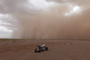
Most recent published photos from the two solo travelers do not show the ground — usually just tight shots of their camp, presumably a little to the side of the road. But a recent image from O’Brady, above, clearly reveals an artificially flattened route, without sastrugi, but with vehicle tracks.
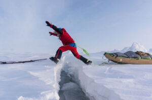
The photo below, taken during an unrelated trek, better shows the width and flatness of the road compared to the ungraded snowfield to the left of it. Yet this location was well before the actual sastrugi fields begin, so the pristine surface is much easier for skiers than most of the way to the Ross Ice Shelf.

The packed road from the South Pole through the Transantarctic Mountains to the Ross Ice Shelf and beyond to McMurdo Station. Photo: Eric Philips
The use of the road doesn’t negate the magnificent achievement of both men. For almost two months, they endured the worst that Antarctica could throw at them, including gales, frequent whiteouts and the unusually poor snow at the beginning that has bedeviled all manhaulers this year. The first 1,000km of their route had no road to guide them.
Nevertheless, this does raise the question whether either expedition was truly unassisted. “I was in touch with Colin before the trip and he confirmed that he is going down the Leverett Glacier,” said Philips. “The only reason people go down the Leverett is because they are after an easy route that follows the road. I suggested [that] he take the Kansas Glacier … The route is stunning, slightly shorter but is pristine. He wasn’t interested.
“Most expeditions skiing the usual Hercules route are likely following vehicle tracks,” he added.

The McMurdo-South Pole Highway. Photo: Wikipedia