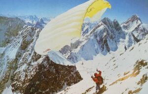
You don’t need a PhD to forecast the weather on Mount Everest. Sometimes, all that’s required is an internet connection. At first, these many free and small fee-based utilities seem convenient. If you’re looking for simple information, such as current temperature or if it may rain, they may be enough. Paying less, however, brings greater limitations and less potential for practical use.
The weather sites for Mount Everest (and we’ll list a few below) give details ranging from the basics, such as forecasts for temperature (supposedly accurate to within 1.5°C), wind, humidity, cloud conditions and whether it will snow and how much. Typically, all you need to pull a forecast is a mountain name or zip code.
Some sites also specialize in certain features: composite weather maps, a list of nearby weather stations (sometimes so far away from one another that temperatures differ by 20°C) and whether current conditions are typical for the season. Some forecasts even look at individual mountains and try to specify precisely when it will snow. Existing snowpack details, satellite imagery, webcams and more are also available.
The better free sites for Mount Everest divide their forecasts into Base Camp, summit and in-between. The strongest even include details about temperatures and winds at various altitudes.
Fee-based apps and sites, on the other hand, are more precise, sometimes offering down-to-the-minute information, based on exact coordinates rather than broad general areas.
Computer-generated forecasting
Numerical weather prediction (NWP) models presently perform 2.8 quadrillion calculations per second. That sounds plenty exhaustive, but in reality, our atmosphere is so chaotic that even the calculating power of a supercomputer is often not enough for sharp forecasts. The fastest computers are limited to about a 16km resolution: a 16-by-16km grid area. That may be all we need in uniform environments like the Great Plains, but in the mountains, that’s a very blunt instrument. Most typically, NWP model forecasts use just one model, often the popular US-based GFS (Global Forecast System).
The GFS works best for long-term, low-resolution forecasts. It excels at forecasts for shipping lanes, for example, but in places with high microclimatic variability, such as the Greater Seattle area, it struggles to be useful. Key details, such as whether it will rain or snow when near freezing, are also less trustworthy. In general, precipitation timing, types and totals are not the model’s strong spots.
A professional meteorologist looks at far more than the GFS when making custom-tailored forecasts. Some NWP models average out their forecasts from multiple sources. Years of practice improves a meteorologist’s performance. Analyses of the jet stream, troughs, ridges, weather systems, ground conditions, ENSO and which models to rely on for specific conditions are superior to mere statistics and robots simply applying algorithms.
For these reasons, you should use free internet forecasts with care. Why? First, as we’ve already pointed out, some of them use only one model. Any model is inaccurate at times. On Monday, for example, the forecast might show wind speeds of 32kph for Everest on Wednesday. Meanwhile, 500km to the east of Everest, winds of 80kph are predicted. If you just plug in the Everest coordinates, you would not get any hint that 80kph winds are possible. You’d just get the 32kph forecast. Alas, it is not unusual that a forecast made two days in advance has an error of 500km. So climbers risk planning for a moderate breeze and running into a gale.
These forecasts also don’t offer text discussing the weather patterns and general conclusions. The current location of the jet stream and where it will be several days later is important. Whether a big area of low pressure will move in soon is also critical.
Suppose a storm in the Bay of Bengal may track towards Everest in the next four to six days. There are several pitfalls here: One, the free forecast has no discussion of this. Meanwhile, the numerical forecast does a poor job forecasting snowfall during such storms. An actual discussion and constant monitoring by an expert is critical.
We have not tried to judge the accuracy of these mostly free internet forecasts. This site judges accuracy for major locations. Sites offering Everest weather forecasts include: Dark Sky, Snow-Forecast, Meteo Exploration, and Mountain-Forecast.
Mount Everest Forecast, Spring 2019
Although the climax of the Everest climbing season remains almost two months away, we can already predict a few things about spring 2019. The Climate Prediction Center suggests a 40% chance of a drier-than-normal spring and cooler temperatures for most of Tibet. This should lead to normal or slightly less-than-normal snowmelt and sunnier weather. The snowpack should remain until late in the season. ENSO (El Niño/Southern Oscillation) predicts a slight El Niño this spring, with slightly above normal sea temperatures in key regions.

Photo: IRI
ENSO Forecasts
How accurate are ENSO forecasts? In brief, loosely. They give probabilities for what may happen. The chances of opposite events may be so similar that the forecast becomes almost useless: for example, a 30% chance of above-normal temperatures, a 30% chance of below-normal and a 40% chance of near-average.

Photo: IRI
One last point with El Nino: Normally, the early monsoon stage over India and the Bay of Bengal is characterized by low rainfall and a later-than-normal monsoon. We’ll see if that is the case this year: As we’ve seen, weather forecasting in the Himalaya and elsewhere remains an imperfect art.
Written with the help of meteorologist Geoff Linsley
Related article:
High-Altitude Forecasting: The Weather Wizards of the Greater Ranges