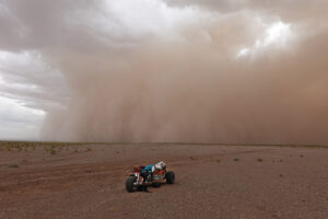
Manaslu (8,163m) is the most popular 8,000m peak in the post-monsoon season, at least since China closed Cho Oyu and Shishapangma to foreigners during the pandemic.
Its accessibility and fully fixed route make it popular as a first 8,000m experience. It is also excellent training for those who want to tackle Everest six months later. Yet, did you know that the crux of the climb is not near the summit, but far below? And that despite a long list of summiters, few have actually reached its highest point?
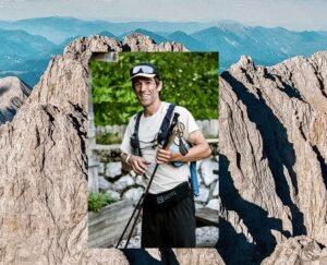
To help with this climber’s guide to Manaslu, the latest in our series, Adventure Consultants’ CEO Guy Cotter spoke to ExplorersWeb from his home in New Zealand.

Guy Cotter on Mount Cook, near his New Zealand home. Photo: Adventure Consultants
Cotter climbed Manaslu in spring 2012 and then in autumn 2014, so he can describe how conditions vary before and after the monsoon rains. He has also led clients to Manaslu’s “true” summit. Here, he offers an educated opinion about how reachable and obvious that elusive spot is.
Finally, Cotter has been guiding around the world for decades. He has been with Adventure Consultants since the legendary Rob Hall and Gary Ball founded it back in 1992. After Hall famously died on Everest during the 1996 Into Thin Air disaster, Cotter took his place in the company. His resumé includes IFMGA-accredited mountain and ski guiding, five Everest summits, and the Seven Summits.
Based in strict and sensible New Zealand, AC suspended its international activity when COVID began. It will not return to the Himalaya until the situation is safe. “I was surprised when outfitters and climbers decided to launch expeditions in spring,” said Cotter. “It was clear what would happen in these spread-prone COVID environments [Base Camps].”
Cotter remains uncertain how the current season on Manaslu will go. “I am not aware of the COVID or vaccination situation in Samagaon,” he said. “Samagaon is the starting point of the Manaslu trek and has quite a big population.”

Manaslu normal NE Face route, marked in red. Photo: Alliance Treks
The approach trek
The approach to Manaslu from the town of Samagaon is among the shortest to any 8,000m Base Camp. It’s highly scenic, yet doable in a single day.
“It’s like approaching a peak in the European Alps,” Cotter said. “The route goes up past an alpine lake surrounded by trees, then along a steep ridge leading to Base Camp. None of it has any technical difficulty.”
Because of the short trek, climbers often acclimatize longer in the region before heading to Base Camp. For example, some start on foot farther down the Budhi Gandaki River.
“In our case, we stay at Samagaon (3,530m) for three days and do day hikes to nearby peaks before trekking up,” said Cotter. “Other expeditions follow a different strategy. A number of them fly directly to Base Camp.”

Manaslu’s scenic Base Camp. Photo: Adventure Consultants
Base Camp (4,800m) to Camp 1 (5,500m)
In the wide, flat, and comfortable Base Camp, climbers enjoy different views, depending on whether they have chosen the pre-monsoon or post-monsoon season.
“In spring, prepare for loads of snowfall,” Cotter warned. “The moisture moves straight up the Kali Gandaki River valley until it hits the mountains. This is why Dhaulagiri and Manaslu register many more snowy days than other peaks, especially Everest. Everest lies further behind the range and is therefore much dryer.
“After the monsoon, Base Camp is mostly rocky, or with patches of snow and rocky outcrops, and many rainwater lakes. It’s quite a nice camping area.”
From there, the way to Camp 1 goes up the moraine for a few hours and then onto the long glacier. The moderately uphill trek eventually steepens before it reaches a col. From here, a small ridge leads to Camp 1 at 5,500m. Like Base Camp, C1 is a wide area with plenty of room for tents. But it also marks the end of the easy going.

Manaslu climbers head for Camp 1. Photo: Adventure Consultants
Camp 1 (5,500m) to Camp 2 (6,250m)
Although it doesn’t involve much altitude gain, this is the crux of the climb, over a very steep and broken glacier. Climbers must navigate “through a maze of steep ice walls, deep crevasses, and menacing seracs,” Cotter said.
This section has always been complicated, but in recent years, it has become increasingly difficult because of glacial recession. This year, Sherpas will likely set at least one or two ladders in place, as in the Khumbu Icefall.
“Some aluminum ladders are stacked at Samagaon,” said Cotter.

Broken, steep terrain between Camp 1 and Camp 2 on Manaslu. Photo: Phelipe Eizaguirre/Alex Txikon expedition
Last winter, that section presented the biggest obstacle to expedition teams, because a gigantic crevasse blocked their way. Alex Txikon’s group, Simone Moro, and Nepalis Tenji Sherpa and Abiral Rai had to join forces to find and fix a route around this difficult obstacle.
When the crevassed zone gives way to a more regular terrain on the face, it’s time to set up Camp 3. Most teams look for a small col a bit to the right, safe from avalanches.
Camp 3 (6,800m) to Camp 4 (7,500m)
From Camp 3, the climb is easier, as long as the snow is not too deep. In fact, the main danger comes from potential avalanches down the NE Face of Manaslu, especially after storms.
“That was why we didn’t summit in 2014,” said Cotter. “The terrain was overloaded with snow, and the slope needed to stabilize. This might be, especially in the post-monsoon, the most hazardous section.”

Camp 3 with Manaslu’s Pinnacle in the background. Photo: Adventure Consultants
The route follows an oblique line across the face, past some seracs. Eventually, climbers get onto the mountain’s huge shoulder, which provides a flat, nice location for Camp 4, before the summit ridge.
“In 2012, we went all the way from Camp 3 to the summit, because the weather window was short and we couldn’t wait,” Cotter said. “But teams usually want to set a fourth camp, then enjoy a comparatively short summit day.”

Climbers approach Camp 4. Photo: Adventure Consultants
Camp 4 (7,500m) to the summit (sort of)
“It’s 600 vertical metres to the summit so it is not a long summit day for an 8,000’er,” Cotter said. “In addition, the route goes up a series of gentle, easy slopes. It continues like that until the sharper part of the summit ridge. Basically, it’s not a difficult route until that last section at the end, just before the true summit.
“Before that, there is a series of small cols or foresummits, but the highest point is actually obvious. Climbers and guides stop before this for a number of reasons, but I doubt that it is because they have mistaken what is the highest point. Of course, conditions change everything, and sometimes the task of reaching that highest point is just too risky.”

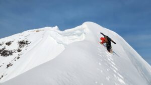
Summit ridges on the north side, with a climber on top. Photo: Guy Cotter/8000ers.com’s report on Manaslu’s true summit
“Once you get to the first of those flat areas, let’s call it the false summit, you’ll see about 150m of steeper ridge ahead of you,” Cotter said. “It’s sharp but not that hard, and it takes you to another flatter point or foresummit with celebratory prayer flags. Here, most people stop. But you can see that there is a bit more to go to reach a slightly higher point.”
Cotter also confirmed those details to ExplorersWeb when he summited back in 2012.
“When I got to that point in 2012, I just saw more mountain above me, so I kept climbing,” he said.
Fixing ropes on the go, it took him another hour to reach the true summit. It was a small place that didn’t have much snow in spring, and the rock underneath was very bad — dangerous climbing.
“It was rotten rock on the southern, sunny side, and some snow on the shady, northern side,” he recalled. “I had to put an anchor there and then passed a sling over the rock, and let only one person at a time reach the summit and return.”
In autumn, the summit should have a lot more snow, making it easier. “But if there is too much soft snow, conditions would be equally difficult,” Cotter said. “I don’t know, because I was not that high up in fall [2014].”

Guy Cotter took this picture after fixing ropes to the summit and letting his clients (such as the one on top) get to the summit and back, one at a time. Photo: Guy Cotter/8000ers.com
The real summit is obvious
About those last exposed 20m, the late Sergi Mingote also told ExplorersWeb that the highest point was pretty clear, but that it took technical climbing on very steep terrain and unstable snow.
This year, Imagine Nepal’s leader Mingma G has claimed that he’ll make sure to reach the highest point of the mountain.
“I am sure he can do it,” said Cotter. “But the area is so narrow, there is no room to manage a group, and it’s quite slow to get people up and down. This can develop into a serious problem on busy days. Of course, Mingma G may be able to fix ropes to the true summit.”
On the other hand, if conditions are bad and the summit is too difficult or dangerous, climbers will stop at the foresummit with the prayer flags, Cotter suggests.
“In the past few years, expedition leaders may have decided that they were close enough to call it a summit,” he said.
But did they reach the summit?
“It doesn’t matter that much, as long as one is totally honest,” Cotter said. “If there is a good reason, especially safety, why you don’t get to the highest point, that’s no problem.”

A busy summit day (before COVID) on Manaslu. Photo: Sanu Sherpa
But then, what about the stats, about the “firsts” and the “records”, and those collecting the 14×8000’ers?
“Well, I think…mostly all those on the list of 14×8,000m summiters have not reached the highest point of all of them,” said Cotter. “For instance, on Kangchenjunga, most stop two metres shy because of religious respect for the mountain spirits. For me, you just have to say exactly how high you got, and why.”
Changing times
This season, Manaslu will attract attention for the debate around the true vs the convenient summit, but also about the increasing number of climbers on the mountain, and the massive use of manpower, oxygen, and helicopters.
“Things have changed, indeed,” said Cotter. “Some of the changes have been positive, others not.
Cotter has used O2 on both his Manaslu expeditions because he was guiding. But traditionally, his company’s policy was to start using O2 from the highest camp and on the summit day. Except on Everest: Here, climbers start sipping gas between Camps 3 and 4.
“But it is true that O2 supplies have increased a lot, and climbers are much more dependent,” he said. “Either that’s because they pay an extra fee to have extra oxygen, or [that amount of oxygen] is included.”
Such dependency on oxygen is all right as long as everything goes well, he says. But if the O2 pipeline fails, then it’s a real problem.
“What I can say is that…many more people want to do all 14×8,000’ers than previously,” said Cotter. “This puts more pressure on the industry. And then, there are good operators and bad operators. That’s always been the case. But unfortunately, some people shop for expeditions online as if they were shopping for a handbag or a pair of shoes. Then they decide based on price or whatever. And in the end, some people turn up with high expectations but not enough preparation.”