The ice caps which cover our planet’s poles are key to understanding global weather patterns and changing climate. But we still don’t have a complete understanding of how they work, and what goes on beneath the frozen surface.
A group led by researchers at the UK’s University of Durham used radar to glimpse beneath the coast of East Antarctica. In a new study, they announced their findings: Ancient riverbeds beneath Antarctica control the behavior of the ice sheet above them.
Left, a bedmap of the Eastern Antarctic coast. Right, radargrams where the solid black line marks the ice surface. Photo: Paxman et al
Reconstructing ancient landscapes
It is crucial to understand how much, and how quickly, the East Antarctic Ice Sheet is going to melt as temperatures continue to rise. It’s the largest of Antarctica’s three ice sheets, and it contains enough water to raise the sea level by over 50 meters.
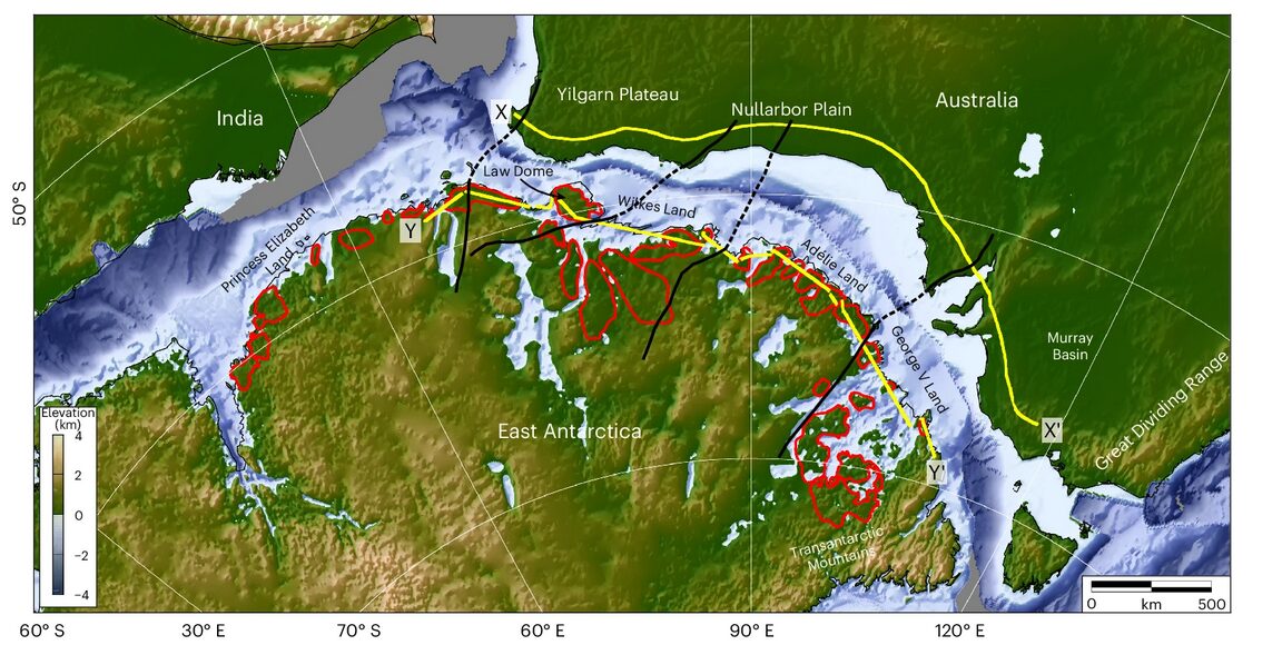
The behavior of an ice sheet depends on more than just surface conditions. The landmass hidden beneath the ice impacts how quickly it melts and where it collapses. To get an idea of what that hidden landscape looks like, researchers analyzed a series of radar scans covering 3,500km of East Antarctica.
The scans found what was once a coastal plain formed by fluvial erosion. Between 80 million years ago, when Antarctica divorced Australia, and 34 million years ago when it became covered in ice, rivers flowed across East Antarctica and into the sea. Those rivers carved out a smooth, flat floodplain all along the coast. Breaking up the plain are deep narrow troughs in the rock. These plains covered about 40% of the area they scanned.
This find confirms previous, fragmentary evidence for a very flat, even plain beneath the icy expanse.
This map shows India, Australia and Antarctica 157 million years ago, in the process of pulling apart. Photo: Paxman et al
Hopeful findings
This is good news for those of us who enjoy not being underwater. Computer programs modeling future climate behavior now have more data to work on. Before, as the study’s lead author, Dr. Guy Paxton, said in a Durham press release, “The landscape hidden beneath the East Antarctic Ice Sheet is one of the most mysterious not just on Earth, but on any terrestrial planet in the solar system.”
Understanding the terrain beneath the ice makes it much easier to understand how and where the ice will move. “This in turn will help make it easier to predict how the East Antarctic Ice Sheet could affect sea levels.”
More than that, however, the ancient fluvial plains may be slowing down the melt. The study suggests that the flat plains may be acting as barriers to ice flow. Fast-moving glaciers pass through the deep channels, but the bulk of the ice, atop the plains, is moving much more slowly.
Ultimately (as they always do), researchers stressed the need for more investigation. Further studies would involve drilling all the way through the ice and taking samples of the rock below. So look forward to that.