As snow disappears from the land, even in the High Arctic, most northern ski expeditions have wrapped up. This week’s roundup brings fresh updates from a major ski crossing still unfolding on Ellesmere, newly named first ascents on Baffin, the end of several Northwest Passage treks, as well as long awaited details on an intriguing journey in northwest Greenland.
Ellesmere Island
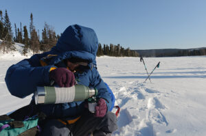
Borge Ousland and Vincent Colliard have just reached the second ice cap on their 1,100km attempt at the first unsupported north-to-south ski crossing of Ellesmere Island. Three weeks into the expedition, they are now at the edge of the vast Agassiz Ice Cap on the island’s central eastern side.
As they left the Grant Ice Cap, they spotted muskox in the distance and numerous wolf tracks, and their pace increased to about 20km per day. The 90km stretch between the Grant and Agassiz Ice Caps had minimal snow cover, so to avoid damaging their sleds on exposed rocks, Ousland and Colliard chose a detour along the frozen Dodge River.
They found the river system poorly defined, with a wide riverbed filled with gravel and stones. Scattered snow patches provided just enough coverage for travel.
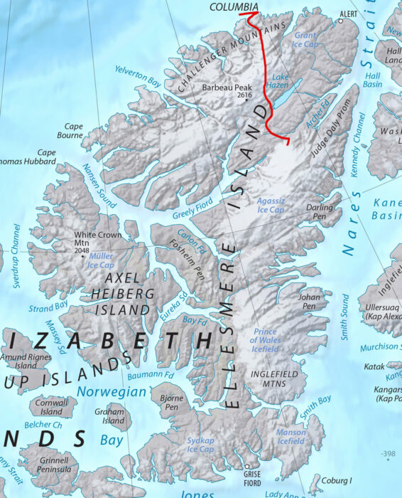
The route covered by Ousland and Colliard so far. Grise Fiord, at the bottom, is their final destination. Map Source: Shadedrelief.com
Last week, the Royal Geographical Society in London awarded Ousland the 2025 Founder’s Medal in recognition of his “unparalleled contributions to polar exploration.” Past winners include adventure giants such as Knud Rasmussen, Douglas Mawson, and Chris Bonington. Ousland will still be out on the ice during the award ceremony in early June, so he will rely on his satellite phone to relay his acceptance speech back to his team in Norway.
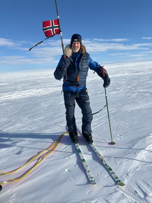
Borge Ousland in good spirits. Photo: Ice Legacy
Northwest Passage
Spaniards Jose Trejo, Sechu Lopez, and Francisco Mira completed their sled journey to Gjoa Haven on May 13. After an initial charter flight to Prince of Wales Island, they skied approximately 600km over 39 days. Despite occasional poor visibility, deep snow and strong winds, the three-man team made light work of their route, covering more than 20km on most days.
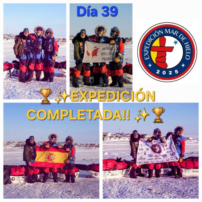
The Spanish Northwest Passage team in Gjoa Haven. Photo: https://mardehielo2025.com/
Further east, on May 10, Norwegian Anders Brenna completed his shortened route from Gjoa Haven to Cambridge Bay, racking up around 400km in 50 days. Brenna reported difficult snow and ice conditions along the way, but it’s not clear what slowed his progress down to eight kilometers per day.
Baffin Island
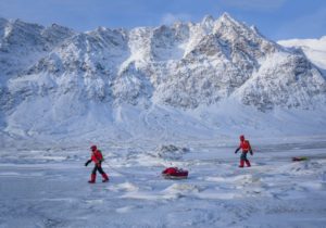
Last week, we updated on the British team of Tom Harding, Ben James, Leanne Dyke, and James Hoyes which made seven first ascents on peaks east of Pangnirtung. After consulting with locals, the peaks have now been named as Uppijjuaq (1,823m), Minas Tirith (1,950m), Aqviq (1,860m), Inutuaq (1,637m), Ukaliq (1,532m), Uvingajuq (1,615m), and Atangiljuq (1,600m).
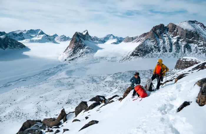
Untrodden peaks. Photo: Ben James
Greenland
Camilla Ringvold’s kite-skiing group reached their finish point in the Bowdoin Fjord near Qaanaaq on May 15. In 23 days, they covered around 1,600km, putting in big days up to 280km in the final week.
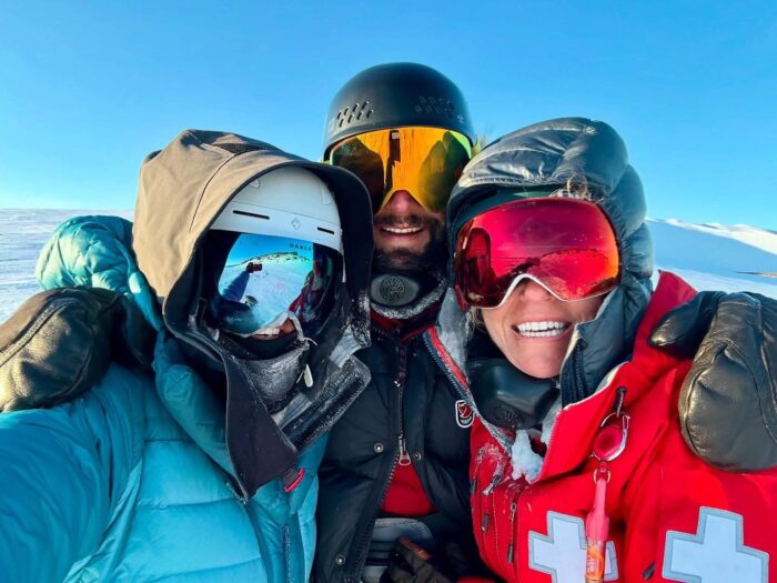
The snowkiting team at their finish near Qaanaaq. Photo: Camilla Ringvold
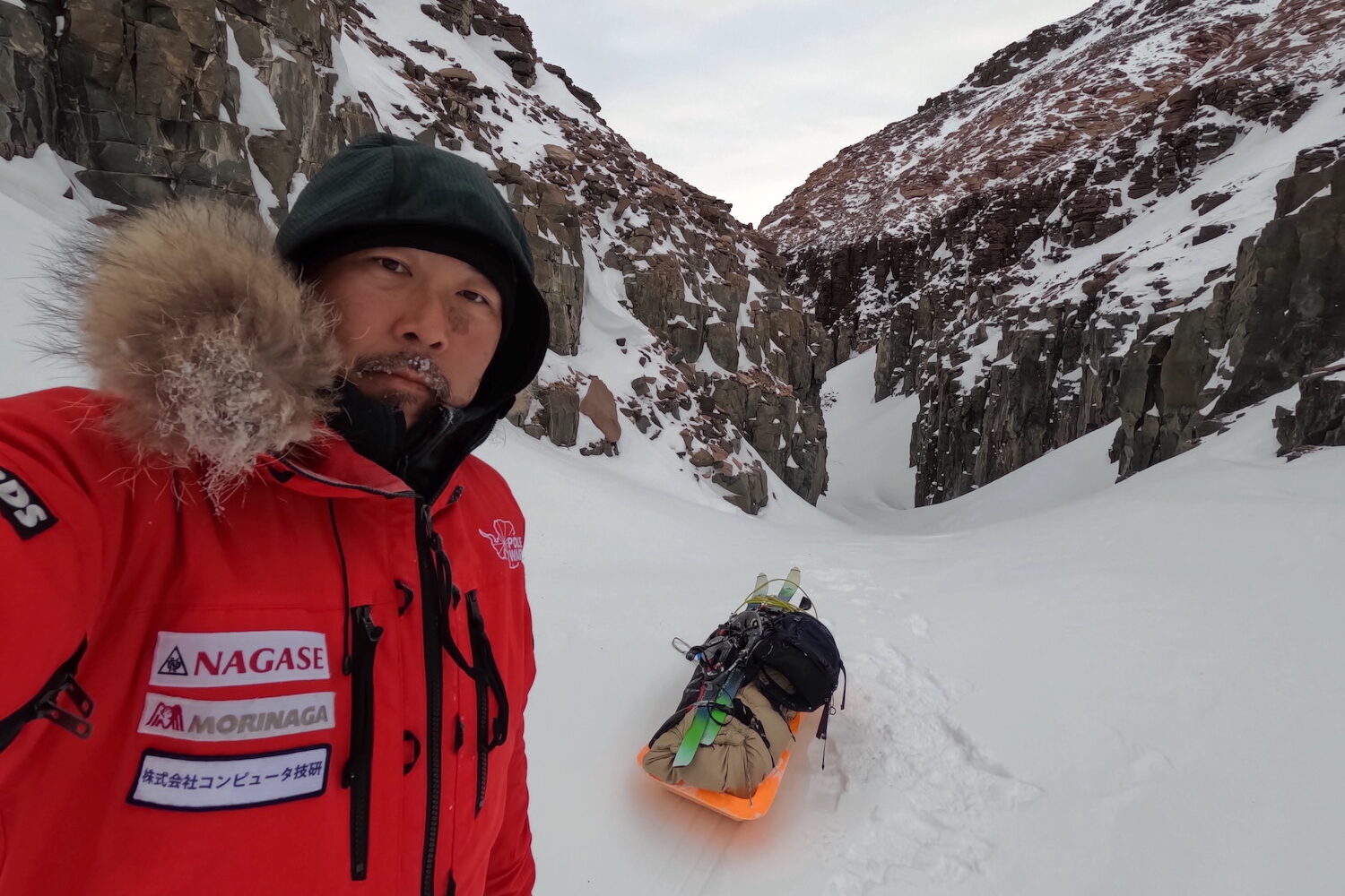
After a long period of radio silence, we have word that Japanese arctic adventurer Yasu Ogita has completed a 15-day, 400km solo ski journey through northwest Greenland to reach a rock near a place known as Anoritoq. The rock is central to an Inuit legend.
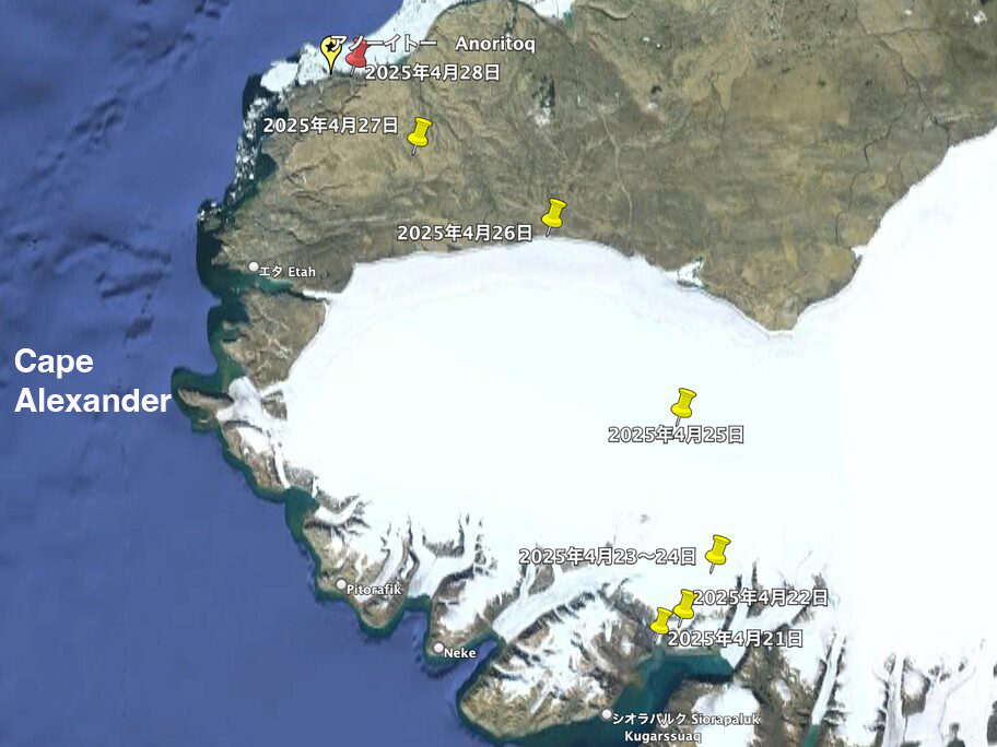
Yasu Ogita’s route over the Inland Ice from Siorapaluk to Anoritoq. Photo: Yasu Ogita
Ogita set out from Siorapaluk on April 21 after a week-long delay due to transport issues. His route led him up a steep glacier and across a remote section of the Greenland Ice Sheet to an elevation of 1,200m, before descending through deep valleys toward Anoritoq. He took this traditional glacier route to avoid the open water off Cape Alexander.
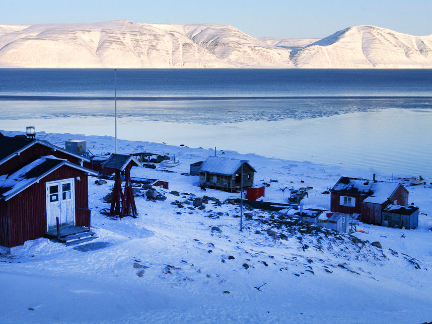
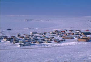
Siorapaluk, the world’s northernmost civilian settlement. Photo: Yasu Ogita
Ogita’s main goal was to find the “Mother’s Stone.” Everyone in Greenland knows this legend about the mother and her polar bear son.
A woman who used to live in Anoritoq lost her son, the only provider, so she asked the hunters to give her a polar bear embryo when they killed a pregnant mother bear. So they did, and she raised him as her own son. When he grew, he started to catch seals for his mother. She painted a black spot on his side, but only on one side, because she did not have enough soot.
One day, when the son went far away in search of seals in the middle of a long polar night, a stranger from another settlement did not notice the black spot, because he only saw the other side. He killed the bear.
When the mother learned about her son’s death, she cried so hard that her tears froze on her cheeks, and her body turned into a rock. When Inuit hunters visit, they smear the rock with seal blubber to nourish her spirit and honor her eternal vigil.
On April 29, Ogita reached the Mother’s Stone. “I was deeply moved,” he reported via satellite phone. “I was able to reach my destination, Anoritoq, without any problems, and I…smeared [the rock] with seal blubber.”

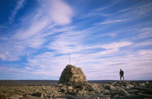
Somewhere near Anoritoq. Photo: Yasu Ogita
For Ogita, the expedition was a cultural pilgrimage. With Siorapaluk’s population dwindling to around 40 residents and traditional hunting practices in steep decline due to environmental and regulatory pressures, legends like this risk disappearing forever.
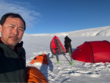
Yasu Ogita enjoys clear weather in camp. Photo: Yasu Ogita
The return journey for Ogita was not straightforward, with deteriorating weather and whiteout conditions. Despite this, Ogita completed the round trip on May 5 without issue, exactly two weeks after departing. He now plans to collaborate with artist Nana Inoue to turn the story of the Mother’s Stone into a picture book.
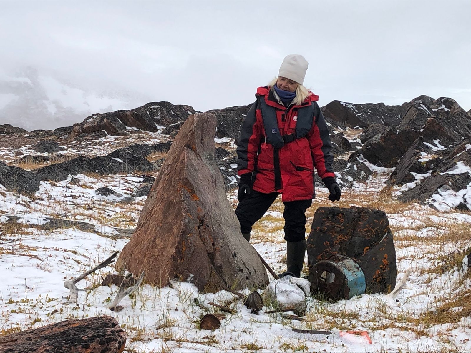
The legendary rock, as seen earlier by anthropologist Christiane Drieux. Photo: Christiane Drieux