A good weather window is all Jost Kobusch needs to launch his solo summit push up Denali.
The young solo climber is currently at his high camp, waiting. When the right conditions appear, he will head up the Messner Couloir to the summit of Denali. Previously, the climber’s tracker has shown him going back and forth, possibly shuttling loads up the Kahiltna Glacier.

Kobusch’s position today, relative to the West Buttress and the summit of Denali.
In earlier messages to his friends at home, Kobusch mentioned how the cold was really challenging him. He also had to deal with some unspecified health issues at first.
Today, his tracker located him at 14,200 feet (4,340m) — still a long way from the summit.

Kobusch’ position today. Note the hour is set to Germany’s Central European Time. In Alaska, his position was as of 7:30 pm on Thursday.
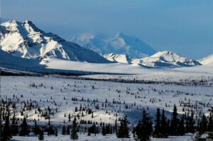
Full winter
Multimodel charts show that the German climber will probably need patience. A gale is expected next week. The chart shows lighter winds on Sunday and Monday and temperatures in the -40s. However, climbers typically need four to five days of acclimatizing at 4,300m. It’s doubtful he has enough time to take advantage of the brief Sunday-Monday window before winds increase to an unbearable speed.

Multimodel forecast for Denali summit by meteoexploration.com
Top of the Kahiltna Glacier
Jost Kobusch’s location at 4,320m coincides with Camp 3 on Denali’s West Buttress. It is a flat basin on top of the Kahiltna Glacier, just before the headwall. It is also where the West Buttress and the Messner Couloir routes separate.
Here is Kobusch’s location today on Google Earth:

Jost Kobusch’s coordinates show his position at the 14,200m Camp. Click the Google Earth link and zoom in to see the summer tent city.
West Buttress climbers set up another camp at 17,200 feet (5,242m). The Messner Couloir is mainly used for ski descents but less often for the actual climbing. In summer, it would involve breaking trail in deep snow. The present winter conditions in the couloir are unclear.

The Messner Couloir route on FATMAP‘s 3D image of Denali. Camp 4 is the high camp for West Buttress climbers before the summit day.