For over 20 years, all the standard geographic sources gave the same answer: the highest point of the country of Benin, in Africa, was 658m Mont Sokbaro. But this month, a team of surveyors proved that the record books had been looking at the wrong mountain all along.
The expedition, composed of Eric Gilbertson, Jared McCullough, and Serge Massad, proved that the true summit of Benin isn’t that remote border peak, but a hill roughly 130-150km further north, near the Burkina Faso border. The new high point sits on a hill near a mud hut a few kilometers south of the village of Kotopounga.
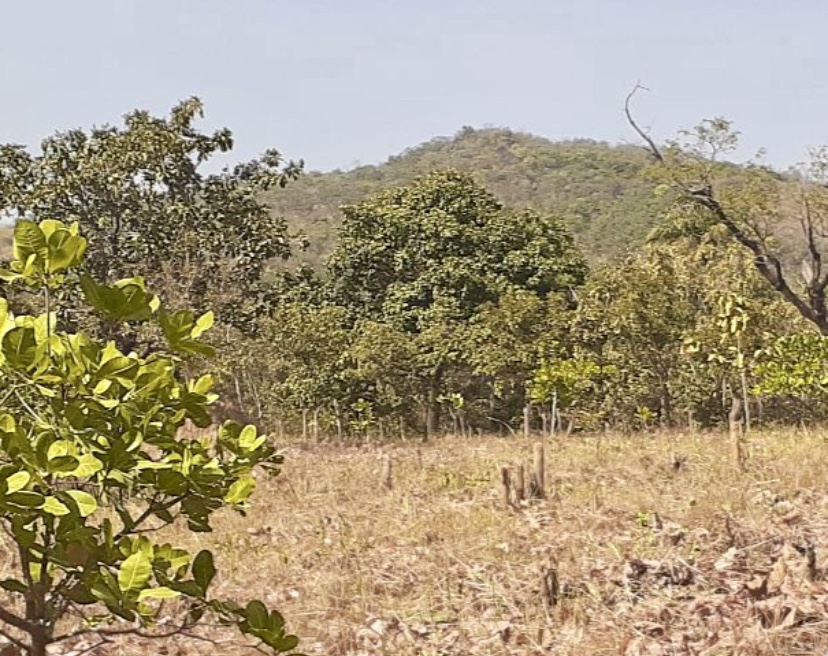
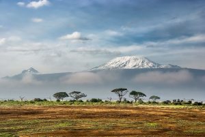
Mont Sokbaro. Photo: Eric Gilbertson
A geographic mystery
The story of this discovery is a classic tug-of-war between old maps and new technology. Since the early 2000s, Mont Sokbaro was the undisputed champion. It was the official height used in diplomatic records and by the U.S. State Department. As part of the Atakora Mountains — a quartzite massif that extends into Togo (as the Togo Mountains) and Ghana (as the Akwapim Hills) — it was the go-to destination for hikers looking to stand at the top of the country.
The first cracks in Sokbaro’s title appeared when NASA’s Shuttle Radar Topography Mission mapped the area from space in 2000. The satellites “saw” a point near Kotopounga that registered at 672m. However, because satellite data can be fuzzy (with an error margin of about 16m), geographers weren’t ready to rewrite the maps just yet.
In 2021, professional surveyor Gilbertson confirmed Mont Sokbaro’s height at 658.9m. But security issues kept him away from the “mystery” point in the north. It wasn’t until January 24, 2026, that he and his team finally reached Kotopounga with professional-grade GPS gear.
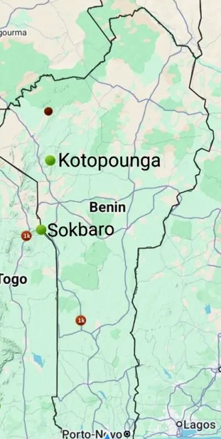
Location of Sokbaro and Kotopounga. Photo: Eric Gilbertson
The new highest point of Benin
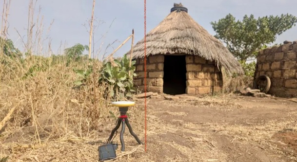
The 2026 expedition was a lesson in persistence. At first, working in 32˚C temperatures caused their equipment to overheat. Gilbertson set up a professional Trimble DA2 GNSS receiver next to the mud hut to collect precise elevation data, which was transmitted via Bluetooth to a dedicated phone for logging. After the initial shutdown from the heat, they cooled the phone with a water-soaked hat wrapped around it and shaded it under a pack, allowing a full hour of reliable measurements.
The result was definitive: the ground near Kotopounga sits at 669.2m, about 10m higher than Sokbaro. While some older maps call this area Taneka, the locals living on the hill confirmed to the team that the land is specifically called Kotopounga.
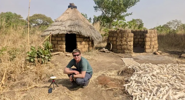
Eric Gilbertson on the roof of Benin, Africa. Photo: Eric Gilbertson
While Sokbaro is a classic mountain peak on the Togo border, the new high point at Kotopounga offers a different view of Beninese life. The summit isn’t a jagged peak, but a high, sun-drenched plateau where local families live in traditional mud-walled homes. It’s a place where geography meets daily life: a summit that isn’t just a point on a map, but a backyard for the people of Kotopounga.
For travelers and high-pointers, the destination has officially shifted. If you want to stand at the highest point in Benin today, you’ll need to head north, past the old border trails, to the quiet hills of Kotopounga.
For the full expedition account, check out Eric Gilbertson’s trip report: New Benin Highpoint – Kotopounga.

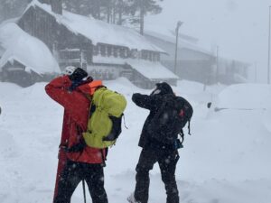
The team. Photo: Eric Gilbertson