For the first time, the 2025 list of Piolet d’Or candidates includes Nepalese and Chinese climbers, determined to do exploratory alpinism in their homeland.
In the next few weeks, we will take a close look at some of them, starting with an impressive new route on Sichuan’s Mt. Siguniang, by Zhou Song and Zhang Qingwei. This article was made possible thanks to journalist Xia Zhongming, who shared information with ExplorersWeb about the most interesting 2024 climbs in China.
Zhou and Zhang represent an emerging group of climbers who have learned their trade in the mountains of Sichuan. Gradually, they began to tackle other ranges in China, particularly in the remote mountains of Tibet.
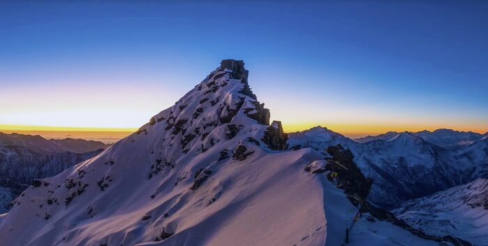
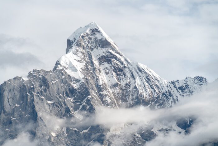
Mount Siguniang. Photo: zhjq.sgns.cn
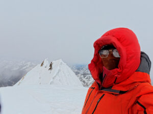
Mt Siguniang (6,250m) is a spectacular peak, and a familiar name among veteran European climbers in the history of Piolets d’Or. Mick Fowler and Paul Ramsden opened a new route on the northwest face, earning them the first Piolet d’Or for a climb located in China.
The Chinese pair had set their sights on the north side of the mountain, which had been partially climbed or used as a descent route by Russian and French expeditions during the 2000s. However, no one had ever climbed it from bottom to top, as its avalanche risk forestalled previous expeditions.
“Mt. Siguniang became the entry ticket for Chinese climbers into the elite alpinist club,” Xia Zhongming explained.
Hidden expedition
Zhang Qingwei attempted the south face of Siguniang in 2017 but retreated at 5,700m. Later on, Zhang teamed up with Zhou Song to climb Crown Peak and Yutu Peak. While exploring potential new goals, Zhang again raised the idea of climbing Siguniang, this time up the north face.
“On November 15, the duo entered the Siguniang Park together with two friends, who helped them by carrying supplies to Base Camp and then left,” Xia wrote. “They set Base Camp at 4,400m, 200m lower than planned.”
Their friends left, leaving the climbers alone, or so they thought. After some rest, they set off before dawn toward the summit.
The climb
On November 16 at noon, the pair reached 4,700m and confronted their first dilemma. They had to choose between two potential routes to the glaciated slope, one on rock and steep scree, and the other continuing on glacial terrain, once they rappelled down to reach it. They took the rocky option. The climbers told Xia how it went from there:
Zhang climbed the first 5.6-5.7 pitch to the start of easy terrain on scree. At the end of it, they downclimbed six meters to the moraine. On the way, they saw old ropes left by a previous expedition. They walked along the central section of the glacier upward and reached the base of a rock section at 5,100m. Above, they found a crevasse suitable for a tent. Although it was lower than they had planned, they pitched their first bivy there, at 5,200m.
Mixed terrain
A problem with the boot of one of the climbers, which was soaked with melted snow, delayed their departure on the following day. They climbed in the afternoon, simul-climbing on 30-40° firm snow up a couloir to their left. They then continued on moderately steep snow and rock terrain. At 6 pm, they stopped for the night on a snow patch beneath a big rock.
They spent the third day navigating between rock and ice sections. Eventually, Zhou Song led an M4+ gully that brought them to an ice field and the north ridge. Two pitches later, it was dark, and there was no place to bivouac. Looking for options, they continued up an unknown gully with their headlamps.
After traversing a couple of meters, they headed up the vertical gully, which immediately increased in difficulty. Zhou led this pitch, climbed the thin ice on the right side, and placed racks into the cracks at the left side. Then they faced a smooth block with a crack, which Zhou dry-tooled. The front teeth of his crampons scraped on the rock, and the sparks flew in the darkness.
Near the top of this block, his feet slipped, but fortunately, his ice tools held him. Finding no logical line to climb, Zhou Song downclimbed one meter, then slanted rightward and climbed over the col onto the ridge at 5,820m. They rated this 30m pitch M5+.
There, the climbers found a flat cornice and planted their tent on top of it.
On the ridge
The north ridge proved much narrower and steeper than the photos from a 2011 French expedition to the north summit had led them to believe.
The following day, the climbers gained only 115 vertical meters. The climb was mostly a traverse along the exposed ridge, first on 70° snow, then along the rocky crest until it proved unclimbable.
“At 6 pm, they found a rock hole slightly lower than the crest as shelter for a sitting bivouac,” Xia said.
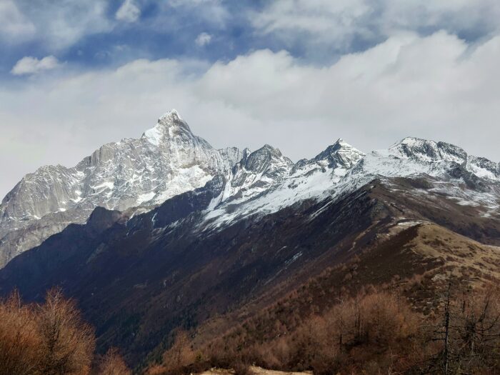
The four points of Mt. Signuanian: Yaomei Feng, Sanguniang Feng, Erguniang Feng, and Daguniang Feng. Photo: Wikipedia
The fourth day of climbing should have been the summit day. It was not. The climbing transitioned to rock again, featuring an overhanging section that was particularly exhausting at that altitude. Gaining 10 meters took one hour. Then followed a section of rock covered in soft snow, difficult to protect.
It was a stressful day, with little progress and a lot of exposure. It ended again after dark with no apparent place for a bivouac. They had to cross the crest until they found a ledge looking down the east side of the peak. The climbers had only one fuel canister left to cook and melt snow, and the weather window would last just two or three more days.
Last ounces of strength
On November 21, they left their tent and continued traversing on exposed terrain. At a rocky section, Zhou Song said, “I am scared. You lead or we retreat.”
Zhang led, overcame the traverse, and climbed 20 meters upward. Zhou Song made the next 50m on an M4-M5 pitch. Taking turns, the day passed. At night, they cut a small snow cave and a ledge for an open bivouac.
To make things more exciting, it snowed that night. The following day, they would have to start descending, with or without a summit. They had no fuel left, meaning no water. Zhang Qingwei was also not feeling well.
“Up or down? I can accept both decisions,” Song asked. “Let’s go,” Zhang answered.
Yaomei Feng Peak, the highest point of Mt. Siguniang. Photo: Wikipedia
Summit
And off they went on mixed terrain, tackling a rocky block, a traverse, and a rappel to avoid a rock step. Both climbers were exhausted, and yet they continued. At the end of the technical section, waist-deep snow awaited them.
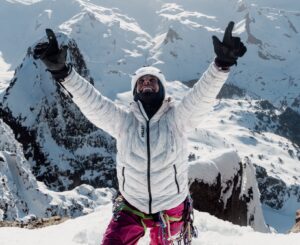
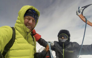
Zhou Song cleared snow until ice or rock were exposed, and finally, he saw the icefield above the northwest face. After two more pitches on the icefield, Zhou stood on the summit ridge connecting the three summits of Mt.Siguniang. Zhang Qingwei followed soon, and they walked together to the nearest north summit. At 5 pm, they stood on top.
Descent
They started down half an hour later. By 10 pm, they had reached their sixth bivouac site.
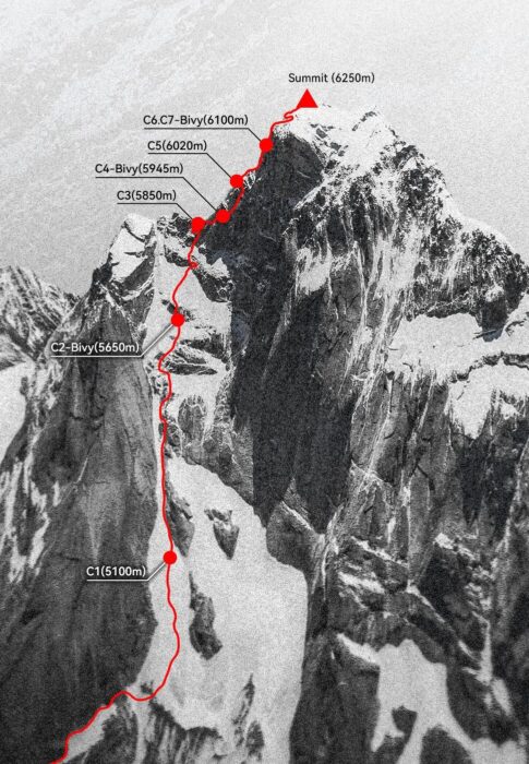
Topo of the route on Siguniang. Photo: Zhou Song/Zhang Qingwei
They barely slept; they needed to get down.
“The route looked unfamiliar, and they couldn’t remember how they climbed. Zhang had some frostbite in his fingers, so Zhou descended first to set the anchors. On the ridge close to their Camp 5, Zhou slipped and pendulumed at the end of his rope. There was no way to climb back up to the ridge, so they had to discard all the material that they had deposited in Camp 5 and descend directly down to the glacier and their Camp 1, where they had left a fuel canister.
After finally melting some snow and drinking, they continued back to their start point, where, to their surprise, one of their friends was waiting for them. It was 9:30 pm. After eating and drinking, they collected all their belongings at Base Camp and returned to Mu-Luo-Zi (a stopover for hikers), where they took a horse at 3 am. Half asleep and barely conscious, they rode back to town. Then took a taxi back to Chengdu.
Route data: D/1400m/VII//AI4/M6+/snow 75°
The area
Mount Siguniang is the highest mountain of the Qionglai Mountains in Sichuan, Western China. Its name, which means the Mountain of the Four Maidens, comes after its four points: Yaomei Feng, Sanguniang Feng, Erguniang Feng, and Daguniang Feng.
Mount Siguniang National Park was identified as a UNESCO World Heritage Site as part of the Sichuan Giant Panda Sanctuaries in 2006. The park comprises Mount Siguniang and the surrounding three valleys, covering an area of 2,000 sq km, according to Wikipedia.
Their climb has been shortlisted for a 2025 Piolet d’Or.