History and geography already make excellent bedfellows, but OldMapsOnline.org has taken the alliance one step further. The website is 50% map room of the Royal Geographical Society, 50% British Museum, and 100% awesome.
Here’s why. OldMapsOnline.org combines a map of the world with a sliding timeline. With a few tweaks of the computer mouse, you can watch history unfold before your eyes.
Take Europe, Northern Africa, and Central Asia, for instance. With the site’s default “Regions” tab active, you can start way back in 2,000 BC (or further) and scroll forward, watching as the Aegean, Sumerian, and Indus civilizations become Greecian, Assyrian, and Gandhāran, respectively. Keep scrolling and watch the Macedonians, Romans, and Babylonians arise — Egypt, of course, sticks around through the millennia (because that’s how Egyptians roll).
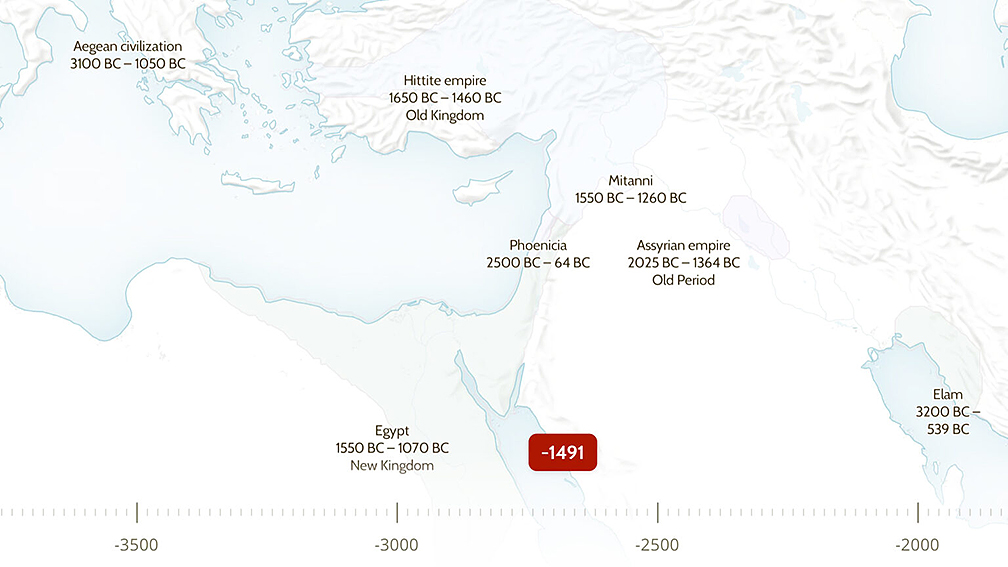
Using the interface, it’s easy to tell at a glance where ancient civilizations first took root — and when they crumbled, conquered, or collapsed. Photo: Screenshot
And whatever you do, don’t take your eyes off the Goths, Visigoths, Ostrogoths, and Germanic peoples. As you probably know, their moment is coming.
Fans of more modern history will be just as enthused. If you’re curious about what, where, and when the Holy Roman Empire turned into the modern nation-state of Germany, this site is your huckleberry.
But wait, there’s more
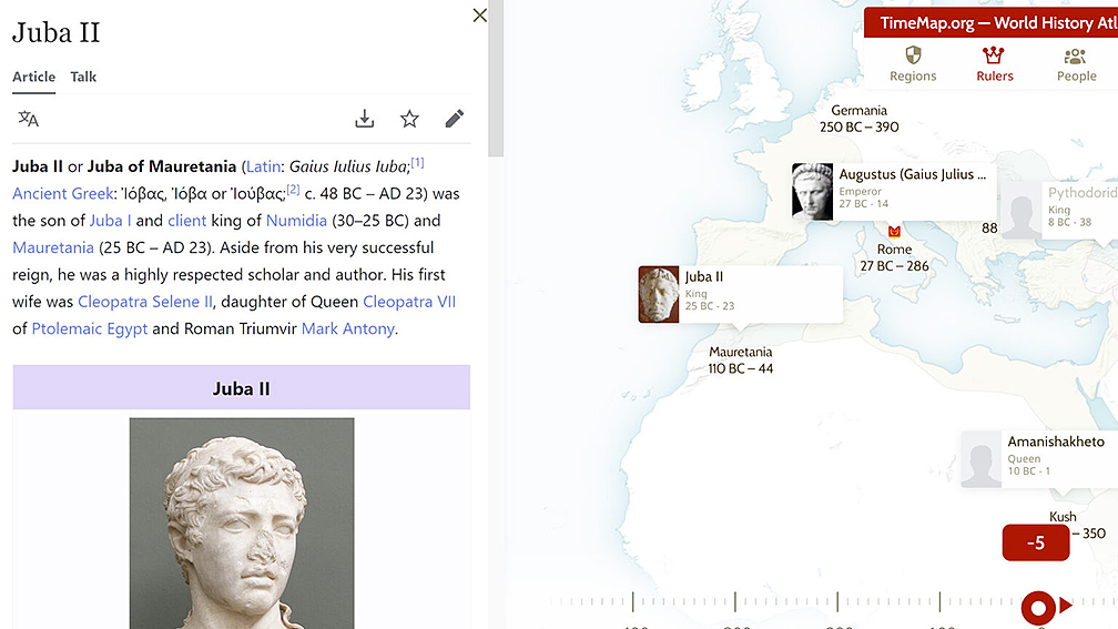
And that’s just the “Regions” function. The site also has tabs for “Rulers,” “People,” and “Battles.” Swapping back and forth between the tabs and rolling the slider back and forth is bound to be addictive to all but the most history-resistant dilettante. The tools are especially useful for students, journalists, and anyone else with more scholarly interests. It was hard not to get distracted even while writing this story!
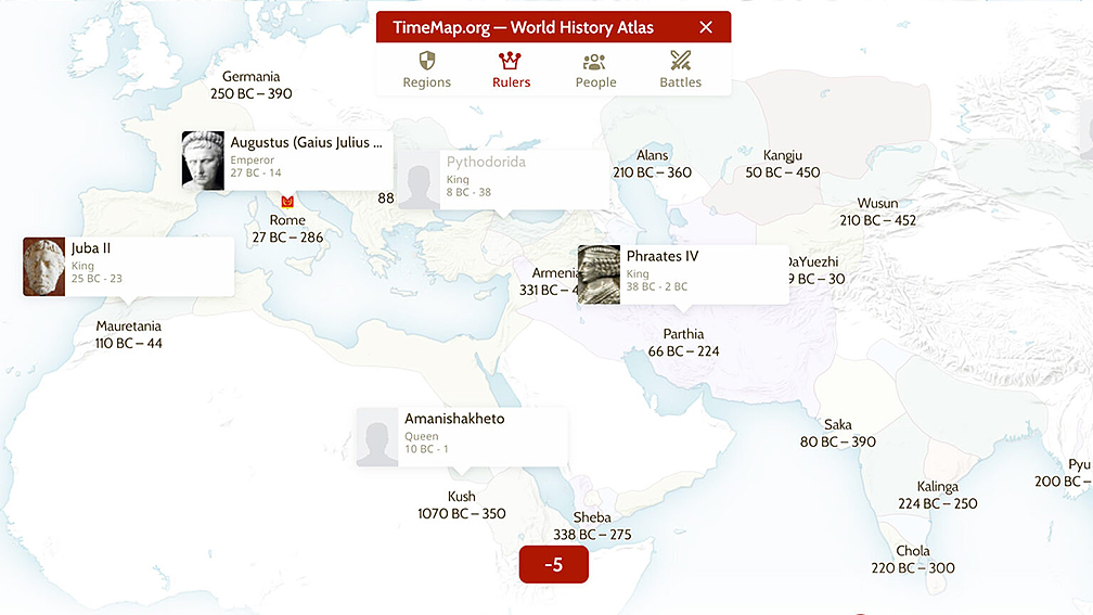
The ‘Rulers’ tab makes it a cinch to compare the reigns of world leaders from across the ages. Photo: Screenshot
That’s because the interface is so clean and easy to interact with — and because of the inclusion of a Wikipedia interface. See a name you don’t recognize? Click it and prepare to spend the next three hours going down a Wiki wormhole.
An intuitive Wikipedia interface? Well, there goes my workday. Photo: Screenshot
As a final touch, you can choose from a selection of old maps to overlay against the base interface, then use the “compare” tool to see how things have changed over time. And even better, the site has a Chrome extension that allows you to add suitable maps to the database.
As you’d expect from something that is both relatively new and somewhat crowd-sourced, OldMapsOnline isn’t perfect. North America in the 1700s, for instance, doesn’t currently show the traditional lands of the many native people who called the continent home at the time (only the Sioux and Iroquois). But we can foresee a near future where folks who run the site fix that.