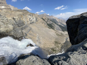
Breathtaking beauty times two. First traverse of Shackleton Glacier.
(Correne Coetzer) “The scenery is breathtaking. Mt Wade dominates the eastern skyline, a broad and massive peak – over 4000m – with sweeping ridges, ominous banded faces, a corniced summit and surrounded by pyramidal peaks. Beautiful hanging glaciers drape from its base like a necklace.” A diary entry by Eric Philips, 17 years ago.
During the 1998-99 Antarctic season, Australian explorer, Eric Philips, and his team mates, fellow countryman, Jon Muir, and New Zealander, Peter Hillary, became the first people to traverse the Shackleton Glacier.
Currently the Shackleton Glacier is in the Polar News, with Henry Worsley who, in the coming days, is attempting to traverse this Glacier south to north. Last week, Pythom/Explorersweb checked in with Eric Philips to take a walk back Shackleton Glacier Memory Lane, as well as to another “breathtaking scenery,” Queen Maud Land.
“Our expedition from McMurdo to the South Pole was in 1998-99. My team made the first traverse of the Shackleton Glacier, between December 16 and 21, it took 6 days travelling north to south.”
“Wally Herbert (who was our patron) and his team of surveyors mapped the upper slopes of the Shackleton in late 1961, early 1962 (just a few months before I was born). Wally helped us a bit in our planning, he even sent me some copies of his original maps. In fact, just today I received in the mail a book written by Peter Otway of New Zealand, a surveyor on Wally’s team. It’s a magnificent large-format book full of colour photos, maps and diary-style anecdotes. I can’t wait to read it, it’ll bring me back to the Antarctic summer of 98-99. Peter (now almost 80) and I have been emailing recently about Henry’s progress, urging him on, in spirit at least.”
Pythom: What were the challenges on this route?u2028
Eric Philips: Actually the Shackleton Glacier posed very few problems. The entrance to the glacier from the Ross Ice Shelf was almost seamless, I recall a couple of cracks less than half a metre wide.
The route we took, primarily hugging the west bank, was relatively smooth and few crevasse problems, at least none that we couldn’t easily deal with. We never needed to rope up. Along the west flank ran the Swithinbank moraine, a major feature of the Shackleton, which we crossed towards its southern end.
Higher up on the glacier, particularly as we peeled off onto the steep Zaneveld Glacier, we started getting katabatic winds (from the south), which eventually forced us to camp for a few days until they relented.
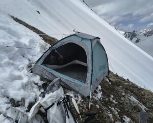
Here’s an excerpt from my diary on the first day on the glacier. The scenery is breathtaking. Mt Wade dominates the eastern skyline, a broad and massive peak – over 4000m – with sweeping ridges, ominous banded faces, a corniced summit and surrounded by pyramidal peaks. Beautiful hanging glaciers drape from its base like a necklace. The surface underfoot was a mixture of sastrugi, frozen melt-laes, bare ice, small crevasses and a series of rising slopes, all covered in a mantle of fresh snow that had fallen during our last few days on the shelf.
Pythom: What kites have you used? Was the wind blowing to the Pole? And what would you use today on that route?
Eric: I used Quadrifoil kites in Greenland (1995), Antarctica (98-99) and in Patagonia (2002). Quadrifoil was one of the first makers of ram-air traction kites and not entirely dis-similar to modern kites, such as the Ozone kites I used in December in Antarctica. We had some northerly winds on the lower section of the Shackleton but the surface wasn’t suitable at the time, lots of rotten ice.
Today, I’d use modern kites such as I used on my Ulvetanna trip (Ozone Access and Ultralight snow kites), they are super easy to fly.
Pythom: What kite handles and lines did you use and use today?
Eric: We used twin handles in those days and our lines were only 10m long, too short. I now use the bar and chicken loop control system, which is really simple to use and has fool-proof release mechanisms if you get in trouble. I use 25m lines.
I got all my advice about the latest kiting equipment from Australian kiter Geoff Wilson who did a big solo crossing of Antarctica from Novo to Hercules Inlet in record time a couple of years ago. He’s a kite surfer and a true specialist in expedition kiting, on water, land and snow.
Pythom: You called your Queen Maud Land (QML) trip, a Discovery Trip. What have you ‘discovered’?
Eric: I didn’t take any maps, just a Google satellite image of the area. No-one has ever gone overland direct to Ulvetanna from the Airbase (165km), so I wanted to do that, to see if it was feasible. There was no reason why it wasn’t, as Google Earth didn’t show any nasty crevasse fields. ALCI Airbase commander, Oleg Sakharov, had made a 700km overland trip using tractors towards Ulvetanna back in the 70’s when he worked at nearby Novolazarevskaya base. They drove up onto the plateau to try and get access, but didn’t make it to Ulvetanna. A couple of Norwegians skied to Ulvetanna and back in 2014-15 but took a more southerly route. Arctic Trucks has also driven a more southerly route to a point around 50km east of Ulvetanna before turning back.
I also re-discovered my love for kiting, I hadn’t really done any since Iceland in 2003 and it was like I’d never had a break. In March I’m taking my daughter to Svalbard for a couple of weeks of kite skiing, including a little expedition north to the highest peak. And it was also my first solo trip in Antarctica. I’ve done a lot of solo trips in Australia and the US of up to a week or so, but this was a longer trip and a bit more risky. I covered a leisurely 360km or so in 14 days, doing a few little side trips along the way.
Pythom: The QML trip was pretty much on unknown terrain. How many crevassed areas have you encountered and how easy was it to see them?
Eric: The route direct from the airbase to Ulvetanna was definitely on unknown terrain, or at least, untraversed terrain. It got a bit nasty when I reached the southern end of ANI’s old ‘Blue One’ runway around 40km north of Ulvetanna, maybe because I was still intent on kiting over crevassed bare ice. Eventually, I needed to deviate too far off the wind so reverted to crampons. A couple of hours later I was through the worst of it and back using the wind. Aside from that I saw a few little crevasse fields, mostly on the tops of the long ice waves typical in Antarctica. They’re easy to spot, easy to avoid.
Pythom: You like to experiment with gear and make new gear, e.g. your bindings. Any thoughts on new improvements?
Eric: My Flexi ski bindings are a very mature product now, used extensively by the US army. However, I am starting to design some accessories such as a high-back cuff to give more ankle stability when kiting or downhill skiing and serrated side plates for edging. I’m really happy with my new sled design too, I used one for the Ulvetanna trip and it was super stable even at high speed. It also glides well and it’s amphibious, a feature very useful on the Arctic Ocean, though I needed to use it when traversing a partially-frozen melt pool in Queen Maud Land.
When I guided on the Walking With The Wounded South Pole trip I got somewhat of a reputation for butchering almost every piece of equipment I was given and rebuilding it so that it was useful in 30 below temps. If an item of clothing or equipment doesn’t function optimally on the ice there is a real risk of getting frostbite, hypothermic or at best very frustrated. So I modify it so that it can be used with minimal dexterity.
Pythom: Anything else?
Eric: Lastly, I’m guiding a new route to the South Pole at the end of this year. If people want to find out what it’s like to be on a trip of pure discovery then they should go to www.icetrek.com or contact me at eric@icetrek.com. It’s a very expensive trip, one of Antarctica’s necessary evils, particularly remote trips such as this one, but there’s time enough to raise the money and get prepped.
This Antarctic season, Eric Philips guided another group to Queen Maud Land, visiting the South Pole and an Emperor Penguin rookery, with side trips climbing local peaks and walking to the Ice Tunnel at the edge of the Lazarev Ice Shelf. They flew with ALCI/TAC from Cape Town to ALCI Airbase on the Princess Astrid Coast of Queen Maud Land and then by vehicle to their base at Oasis Guesthouse in the Schirmacher Oasis. Thereafter, Eric did a more than two week solo kite-ski trip from the Airbase to the Drygalski range in the Orvin Mountains. Nestled in this range, are the iconic peaks of Ulvetanna and Holtanna.
Previous/ Related on Pythom
Eric Philips Profile on Pythom
Icetrek Antarctic season (Queen Maud Land and South Pole)
South Pole new ski route: Call for mates (2016-17)
Previous/Related on Explorersweb
Eric Philips solo kite-ski Queen Maud Land 2015, “a discovery trip”
South Pole new ski route: Call for mates (2016-17)
Top North Pole Tips: Eric Philips, veteran polar explorer
ExWeb interview with Eric Philips, innovation and North Pole expeditions (2014)
ExWeb interview with Eric Philips, three decades of polar experience (2013)
#Antarctica #SouthPole #EricPhilips #ShackletonGlacier