Ski expeditions cross the ice on the horizontal route and kite-skiers start from the South at Narsaq or near Point 660 to end northwest in the vicinity of Qaanaaq. Ronny Finsås, Thorleif Nøkleby and Geir Norland kited 300km in 12 hours, a record they say.
Some of the Greenland teams skiing and kite-skiing already finished their expeditions. Those on the West side (Point 660) reported a lot of meltwater in the Icefall.
Here go updates on the teams.
Expeditions365
Last two days’ Tracker updates from Carl on the Icecap:
Really light wind in the morning today hoping for better wind tomorrow, May 18th, reported the team over their tracker. Elevation: 2005.02 m
Lat: 69.366700 Lon: -45.941691
Really nice start to the day with good but cold wind turn a little light in the afternoon but still a great day out, snow started to get a little bumpy:) Elevation: 2260.87 m
Lat: 70.669845 Lon: -46.226113
Carl Alvey (UK) is guiding a kite team from Narsaq in the South to Qaanaaq in the Northwest, a distance of about 2500 km. They have food for 40 days. Team mates are Eric Leegwater (The Netherlands) and Bjørn Lindhardt Wils (Denmark). The men left on May 1st at 9:00 to climb the glacier.
Kitekurs: White Horizon – Kite Greenland 2016
On May 16th Camilla and Hakon reported on their tracker. “We don’t have words for what the last 22hours behind our kites has put us through and what we’ve seen and experienced – BUT- WE ARE ON ROCK:)!!!!!” They were picked up by the dog team at sea level
Norwegians Camilla Ringvold and Håkon Mæland started in the West: Kangerlussuaq/Søndre Strømfjord – Point 660 on April 27th to the Bowdoin fjord in the Northwest. At the fjord they will be picked up of by local Inuits and two traditional Greenland dog sleds and ride the 50km across the sea ice to Qaanaaq.
Leo Holding and Bruce Corrie
May 17th: Camp 12 – well that was a hard earned 100km. Whiteout, low winds, nearly gave up at the 64km mark, but added another 25m to the kite lines and started again.
May 18th: Day 13 Leo wrote: “The last few days of snowkiting in whiteouts has brought back that appreciation of GPS technology. When we are riding in formation one behind the other in a whiteout the lead person feels the wind on their face, this gives a reasonable clue about direction of travel with maybe with an error of about +/- 20 degrees. The feeling of wind on your face has to be adjusted for apparent wind, which is the wind you generate through your own speed (Google it, to see how it changes the angle of wind you feel). We also use the sun, or in our case slight areas of brightness caused by the sun through the cloud. Together with knowing the time, we hold a mental view of what position the sun is in. Then every hour or so we check our heading with the two GPS trackers that we have.”
Thu May 19th, Elevation: 2051.74 m
Lat: N 75°06.0841’ Lon: W 52°03.4058′
The two guys are on a 1000 mile kite-ski mission on Greenland, starting from Kangerlussuaq and ending at Qaanaaq.
https://community.berghaus.com/greenland-snowkite/map/
https://community.berghaus.com/greenland-snowkite/
https://twitter.com/leohoulding
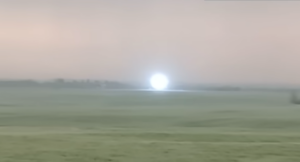
Ronny Finsås, Thorleif Nøkleby and Geir Norland
The tree Norwegians completed their kite-ski from Kangerlussuaq (Søndre Strømfjord) area to Qaanaaq, a distance of about 1600 km, on May 17th.u2028
Thorleif reported on May 16 “a new record kited in 12 hours, 300 km.” Editor’s note: not sure who’s record is beaten, but Ronny is a previous 24-hour record holder (in a straight line between camps), on Greenland and on Antarctica.
In 2008, Norwegian Ronny Finsaas reported kiting a distance of 502,73 km between two camps in less than 24 hours on Antarctica. Last year in May two other Norwegians, Hugo Rolf Hansen and Bjørn Einar Bjartnes, kited 505.90 km between camps on Greenland. Canadian Eric McNair-Landry and American/French Sebastian Copeland topped that in 2010 with 595 km in 24 hours in a straight line between camps.
Related to that, Canadian Frédéric Dion ended his 3620 km traverse of Antarctica, kite-skiing 603 km in a straight line in 24 hours and 53 minutes.
https://www.facebook.com/kitetur2016
Newland Expeditions
No new news.
Start May 6th: Torbjørn Oiesvold (Norwegian guide), Andrea Foster (UK), Paul Fidler (UK), Michael Foster (UK), Mike Kraft (German), Lars Henrik Lauritzen (Norwegian).
Borge Ousland Polar Exploration
Are Johansen guided the Apple for Isortoq team, Ingvild Lille-Homb, Gunnar Chr. Nyhus, Mari Lundby, Terje Øversveen, Wenke Gamme and Gunnar Holien. Yesterday, they saw the sea on the East side with 35 km left to finish their West-East (Point 660 – Isortoq) crossing. The previous day they saw the first mountains.
“An Apple for Isortoq” team started on April 27th and will be doing some charity for the kids in Isortoq; giving the school in Isortoq clothes, toys, games, books, dental equipment and more, to hand out amongst the kids.
Facebook An Apple for Isortoq Expedition
Veteran Greenland guide, Bengt Rotmo is also on the Ice Cap with a team. They Started at 660, onward to Isortoq. They started on May 11th and found a big meltwater lake at 660. Day 8 at 66º 48’N, 47º36’W
Another Ousland team with Monica (Moa) Hundseid is crossing from Point 660. The 6-team group started on May 14 and encounter lots of meltwater. Moa reported on May 18th: “We got up 23.30,started “swimming” at 01.30. I guess we have crossed around 1200 streams, rivers and lakes now, and 200 of them we have swam across.”
Fram Expeditions (Norway)
According to their website, Fram Expeditions has three teams on Greenland this season. They ski from West to East; Point 660 to Isortoq.
May 4-29 guides Marianne Larsen and Bjørn Sekkesæter.
Fram – Amundsen May 19:
Elevation: 2482.53 m
Lat: N 66° 17’07.2816″ Lon: W 43° 43’04.2240″
April 27 – May 23 guides are Truls Wæraas and Harry Tiller.
Fram Gjøa May 18
We have plenty of time to reach our endpoint on the East side. Where should we be about four days. Cloudy and warm today – good skiing conditions. All is well. Elevation: 1874.43 m
Lat: 66.052648 Lon: -40.904996
April 27 – May 23 Guides Camilla Isaksen and Christian Iversen Styve
Fram – Nansen May 19 Camp 22
Elevation: 1984.36 m
Lat: N 66°06’22.6476″ Lon: W 41°13’11.5176″
Henry Cookson Expeditions
No new news from the kites-skiers.
Henry Cookson Adventures Facebook
Icelandic Mountain Guides
Finished. The team reached Point 660 on May 15th. The ice fall was proving to be really tricky with crevasses and cauldrons to navigate through and the slushy and wet conditions had not been favorable, Maxime reported. The team sledge-hauled with crampons on their boots instead of skis.
The guide is Maxime Poncet. The team started in the West. From Tasiilaq they were airlifted to the Hahn Glacier on April 21st.
https://expeditions.mountainguides.is/category/greenland/greenland-crossing-2016
BACKGROUND:
The Classic Horizontal Ski Route runs more or less along the Arctic Circle and is done from West to East, or East to West. West gateway: Kangerlussuaq with, on the Ice Cap, Point 660 as start point or end point. East side gateway: Tasiilaq with start/end points Isortoq Village, Nagtivit Glacier or Hahn Glacier.
Blog updates with RSS feeds can be followed in the Daily Dispatch Streams on Pythom.com
Previous/Related
Greenland 2016 update: Teams on the Ice Cap – UPDATED
Greenland “Dream-Mile” broken: Lars Ebbesen talks
#polar #Greenland2016