It wasn’t easy for climbers to find the NE Ridge Route, but today it’s the standard line up Dhaulagiri, the seventh highest mountain in the world.
It takes just a look to realize that Dhaulagiri is a tough peak. Its steep slopes and five sharp ridges make its 8,167m summit close to impregnable.
In fact, the White Mountain (rough translation from Sanskrit) was hard to summit for the first time. This was the mountain originally targeted by Maurice Herzog’s French team for the first ascent of an 8,000m peak. But the French could find no suitable route to the top, so switched to Annapurna, on the opposite bank of the Kali Gandaki River.

Dhaulagiri and the normal NE Ridge route.
Five subsequent teams tried and failed to find a way up the mountain’s mighty north face via the so-called Pear Buttress (later climbed during an epic Japanese expedition). But a Swiss team led by Max Eiselin first found the way to the top of Dhaulagiri using the Northeast Ridge. Since then, their itinerary has become the normal route.
While not extremely technical, Dhaulagiri is exposed and steep. Many climbers have lost their lives on its flanks, especially during the descent, from falls or avalanches. Only very recently have fixed ropes festooned it for ease and safety. Even so, climbers need to keep focused during the many long traverses.

The normal route, by Seven Summit Treks
Climbing Dhaulagiri: Meet Our Guide
For Ralf Dujmovits of Germany, who has summited all 14 8,000m peaks, Dhaulagiri has a special significance: It was his first 8,000’er in 1990, and his first commercial expedition on an 8,000m mountain.
Now, he will serve as our guide to our Dhalagiri. Below, we detail the classic climb that most expeditions follow nowadays.
“The NE Ridge route mostly follows the original itinerary opened by the Swiss, but teams currently avoid the upper part of the summit ridge from Camp 3 (7,300m), where the NE Ridge merges with the East Ridge,” Dujmovits said. “Instead, expeditions take an ascending traverse across a huge icefield on the mountain’s north face. I continued up the ridge until the top, so I have no personal experience of that last part.”

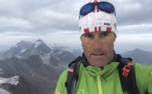
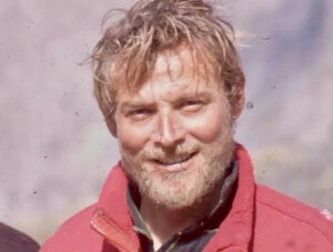
Guide and 14×8,000m summiter Ralf Dujmovits. Photo: @ralfdujmovits
Until that point, then, the route goes as follows:
Dhaulagiri Base Camp (4,700m) to Camp 1 (5,900m)
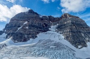
“Base Camp is rather low compared to other 8,000m BCs and it includes the first tricky section: crossing a glacier that traverses right beneath the so-called Eiger, a rock formation resembling the Eiger North Face. In spring, it’s pretty easy walking, because winter snow still covers the lower part of the Eiger. In autumn, there is more rock-climbing involved because the crevasses are open. Sometimes it is really difficult.
“Anyway, climbers need to keep going up the glacier underneath Dhaulagiri’s North Face, which gets steeper and more difficult at the so-called Dhaulagiri Icefall. The terrain eventually flattens on reaching the huge NW saddle at 5,600m between Dhaulagiri and Tukche Ri Peak. The Swiss pioneers used an aircraft to carry the gear directly to the saddle so they didn’t have to go up and down the glacier. Camp 1 is usually on the edge of the mountain, at 5,900m.

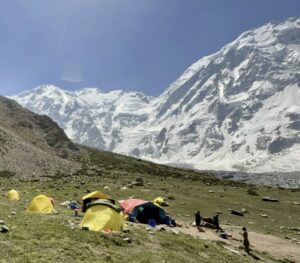
Dhaulagiri’s lower section, featuring the glacier, the base of the Eiger on the right, and, in the background, the icefall, and the saddle. Photo: Tommy Joyce
Camp 1 (5,900m) to Camp 2 (6,600m)
From the NE saddle, climbers proceed up the NE Ridge. At first, the ridge is rather wide, more a rounded edge than a proper ridge. It progressively steepens and becomes a proper sharp ridge. Camp 2 is usually at 6,600m. Here, climbers often make a serious mistake, trying to avoid the wind hitting the ridge, and set their camp on the other side of the ridge, on the East Face. It seems easier to camp on the other side, where it’s snowy and protected from the wind.
The problem is that the wind carries all the snow falling on the north side over the ridge to the east side, forming very avalanche-prone slabs. “I know at least four expeditions which had deadly accidents there,” Dujmovits stated. “So, it is really important to stay on the NE ridge.”

Camp 2 on Dhaulagiri, with Annapurna in the background. Photo: Adventure Consultants
“Sometimes there are seracs that can shelter the tents from the wind. But even if they aren’t there, the tents should go on the ridge.”
Camp 2 (6,600m) to Camp 3 (7,300m)
From Camp 2, the ridge gets increasingly steeper and sharper until climbers reach a spot at about 7,300m, where a series of ledges provide good platforms for Camp 3. This is more or less the point where the NE and the E Ridges merge. The original Swiss route followed the ridge, but more recent expeditions traverse across the icefield, about 500-600m long, on the North Face.
Summit day on Dhaulagiri
Dujmovits climbed the Eastern Ridge, but commercial expeditions fix ropes and break trail, greatly increasing safety. However, this is a relatively new phenomenon. Some years ago, outfitters only provided logistics until Base Camp, and climbers were on their own on the upper slopes. This was the case of Juanito Oiarzabal, who climbed it in 1998 and warns climbers about that traverse.
“It requires all your attention,” he said. “The face is steep, and a fall is unforgiving. Be especially careful on the descent, when you’re tired and the motivation to reach the summit is over. Watch every step you take.”

Peter Hamor climbs up the East Couloir toward the summit ridge of Dhaulagiri.
The traverse follows a straight ascending line until reaching a 45º couloir leading to the summit ridge. This ridge leads to the main summit, which lies on the western part of the summit ridge. There are actually several couloirs, whose conditions vary, but the most popular routes go up the East or West Couloirs. On one of his multiple attempts on Dhaulagiri, Carlos Soria climbed the wrong couloir in 2019 because of poor visibility and found his way blocked by cliffs and cornices. According to Dujmovits, the East Couloir is the best option.
In order not to miss it, aim for an obvious rocky outcrop, called the Western Rocky Foresummit (WRF). Once below it, you reach the ridge via its west side.
Here, it gets confusing. The WRF is pretty obvious, and even in spring is mostly rocky. Several commercial expeditions treat this as the summit, but the true summit is at least 100m further. Climbers must turn left, pass the WRF, and continue to the main summit.

Dhaulagiri summit ridge with all features. Topo by 8000ers.com. Photo: Boyan Petrov
Eberhard Jurgalsky of 8000ers.com and a team of experts have studied the summit features of Dhaulagiri thoroughly. Download their research and study it carefully before heading up!
A somber landmark of the summit region is the dead body of German climber Albrecht Hammann, who suffered severe High Altitude Cerebral Edema and froze to death there in 1995.
False Summits
If you decide to skip the icefield traverse and choose instead to keep following the East Ridge to the summit, you must accept that you are moving onto more technical, exposed terrain. You will also have to pass another false summit, marked by a metal pole.
“Finding the metal pole was very surprising, but it was clearly not the summit,” recalled Dujmovits. “I went around some cornices and did some rock climbing in order to reach the main summit and made 100 percent sure that it was the highest point. There was also a small metal cross stuck between two rocks.”

Romano Benet, above, and his partner Nives Meroi stopped at the metal pole, seen behind Benet, thinking it was the summit. Because of their error, they had to return to the mountain the following year to summit properly. Photo: 8000ers.com
Added Dujmovits: “I remember that final summit climb was a bit like the Eiger’s Mittelegi route, where you struggle to get to what you think is the highest point, and when you’re about to reach it, there appears another one behind.”
However, while it’s easy to check that the metal pole does not mark the summit, the difference in height between the WRF and the main summit is just one to five metres. It takes a full 10 minutes to cover that distance, according to the late Boyan Petrov.

Nives Meroi in 2006, this time approaching the main summit of Dhaulagiri, marked by 8000ers.com
The 8000ers.com team proposes a “tolerance zone” for those past climbers who believed that the WRF was the highest point. But what to do about the teams that summited after his report came out in 2017? Should the tolerance zone be respected?
“[In the past] I didn’t want to be involved in those decisions, because I’m too close to the topic and I know some people personally who –- like myself on Manaslu — didn’t climb to the very highest point,” Dujmovits said. “But from the date the study was published, the main summit is perfectly clear and nothing else should be accepted. As Iñaki Ochoa said, the summit is the point where it’s going down in all directions.
“The tolerance zone is a nice idea to avoid having to rewrite the whole history of mountaineering. Otherwise, you’d have to delete many of the greatest climbs in history.”

