Greenland’s brief summer sledding season is drawing to a close, with two guided crossings of the ice sheet done and one independent team still on the ice. Elsewhere, a two-man team made a short kite journey on the southern part of the ice sheet in preparation for an upcoming Antarctic expedition later this year. All teams noted significant challenges with meltwater.
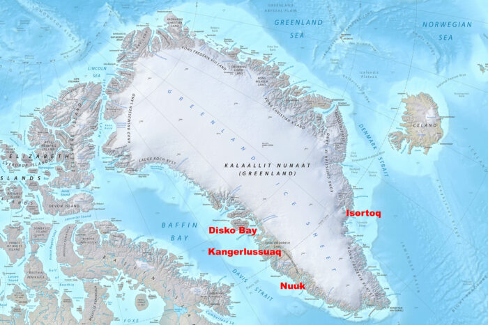
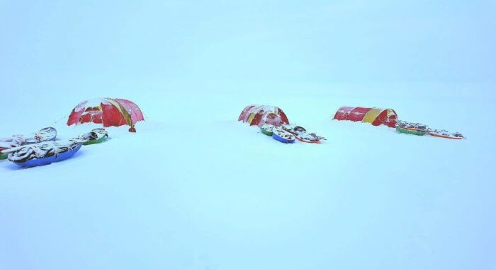
Start and finish points of this year’s east-to-west ice sheet crossings.
A classic east-to-west crossing
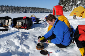
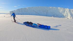
Dutch polar guide Henk-Jan Geel led a ski crossing of the ice sheet from east to west. The team included three male clients from the Netherlands and one female client from the United States. The five-person party reached Kangerlussuaq after 26 days of travel, including two rest days, on September 9.
The crossing started at Isortoq on the East Coast and finished at point 660 near Kangerlussuaq, following the classic east-to-west route. After a few days of navigating the initial icefall, the team made rapid progress.
“From day three, we managed to make 25 kilometers a day,” explained Geel. “I was thinking okay, the first 10 days we do like 20 kilometers a day. The second 10 days, we do 25, and then after that, we’ll see. But [this group] just went on.
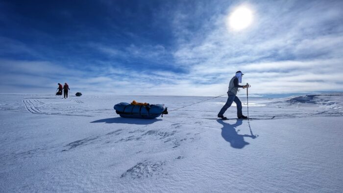
Photo: Henk-Jan Geel
More polar bears
In recent years, polar bears have become more visible on both coasts and have occasionally ventured onto the ice sheet itself. Geel’s team took full precautions, including bear watches, firearms, and flares, although no bears or tracks were encountered.
“The first night, we had a bear watch. And at some point, you just have to decide, well, what are the odds?” said Geel.
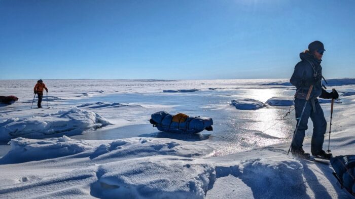
His team experienced milder temperatures compared to previous crossings he has guided, with significant meltwater, particularly on the west coast.
“The temperatures were warmer than two years ago,” he told ExplorersWeb. “At that time,] we experienced -32˚C. This time, the coldest we recorded was -18, -19 during one morning. During the day, it was -6˚, -7˚. Some of the days, it was even above freezing, especially in the beginning. So we had some melt, which concerned me, because there was a lot of melt in western Greenland.”
Frozen meltwater. Photo: Henk-Jan Geel
In their final week, the team encountered flowing rivers and meltwater lakes as they descended toward Kangerlussuaq. These features required significant detours and careful navigation.
“We have seen at least four rivers still flowing,” Geel said. He had scoped out the most obvious rivers by using satellite imagery before hitting the ice.
Crossing small meltwater streams. Photo: Henk-Jan Geel
“Two years ago, I still remember that we crossed a river, which by then was dry and frozen, and went down through the riverbed and up the other side. But this time, the river was still flowing,” Geel continued.
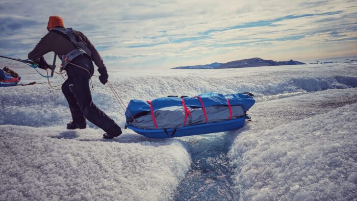
To avoid wet feet, the team carefully navigated around the streams, carving through the ice. They also had to be mindful of crevasses, which were visible and easier to navigate thanks to the lack of fresh snow.
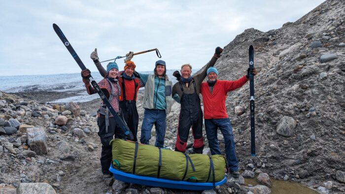
Geel’s team at the finish. Photo: Henk-Jan Geel
In the footsteps of Nansen
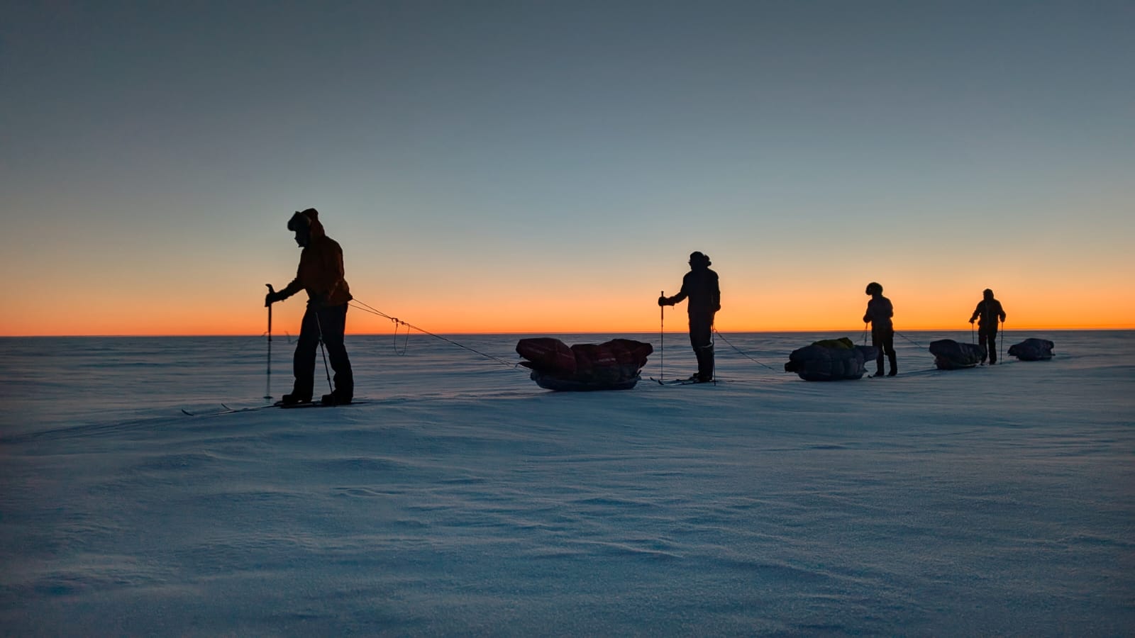
A six-person team led by guide Kathinka Gyllenhammar of Ousland Explorers completed a ski crossing of the ice sheet from Isortoq on the east coast to Nuuk in the west. Following the historic Nansen route, the journey lasted 35 days and finished two days ahead of schedule on September 17.
In the early stages, the group negotiated crevasse fields and the lower icefall.
“[We] started off with getting stuck in a crevasse area, but we backtracked and went around it,” the team reported.
By Day 4, conditions improved, and they were able to ski consistently.
“The sun shone in the blue sky all day, and after half the day, we were rewarded… There is a lot more snow melted than usual. So it has been trekking till here.”
Over the next week, the team advanced steadily up onto the plateau, often in clear weather.
“We did 28.5 kilometers today in beautiful weather and great conditions,” one entry noted.
Sweaty days
Their diary also described unusually warm days: “First part of the day was sweaty with pants on and the last half of the day was sweaty without pants on! We skied in just our Brynje netting!”
Periods of volatile weather slowed progress, and on Day 10, the group reported rain.
Inclement weather in camp. Photo: Ousland Explorers
By September 2, the team had reached the highest point of the ice sheet, 2,633m. The descent toward the West Coast presented greater challenges.
“We have gone through more crevasses today than I have ever done [in a] day ever before!” Gyllenhammar wrote. “Several of us have gone through the ice on the rivers today, so we have a lot of wet feet. Magnus went in almost to his hips!”
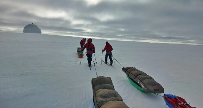
Approaching the DYE-3 disused radar station. Photo: Ousland Explorers
After leaving the ice, the expedition continued across moraine and river valleys. Using a packraft to cross flooded rivers, they trekked through the final valleys before reaching Nuuk, completing a full coast-to-coast crossing of Greenland.
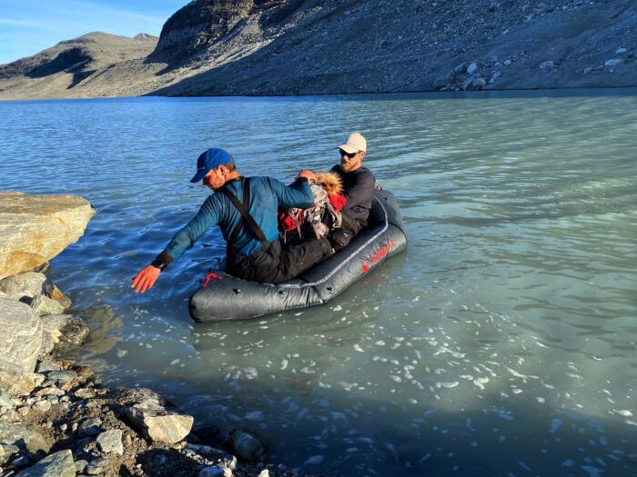
Lightweight packrafts were used near the end of the journey. Photo: Ousland Explorers
An independent journey
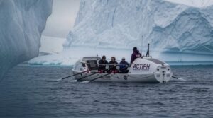
A third group remains on the ice, an independent three-man team made up of Jordan Manning and Stafford Tyrrell of Ireland, and Ole Nilsen of Norway. They began from Isortoq after sailing there from Bergen, Norway, aboard Tyrrell’s small sailboat. They plan to finish their journey at Disko Bay on the West Coast.
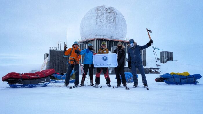
Geel’s team at DYE-2. Photo: Henk-Jan Geel
Henk-Jan Geel made contact with them while on the ice. When his team reached the former U.S. radar station DYE-2, Tyrrell’s group was about six days behind. By the time Geel’s party arrived in Kangerlussuaq, the gap had widened to around 10 days. Geel offered to cache spare provisions, but Tyrrell’s team was carrying 35 days of food and chose to continue. There has been no update yet on their arrival in Disko Bay.
Training for Antarctica
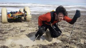
French adventurer Matthieu Tordeur, formerly the youngest person to ski solo and unsupported to the South Pole, returned to Greenland with glaciologist Dr. Heidi Sevestre for a brief science-focused snowkite journey.
The pair set out from Qaqortoq in southern Greenland, covering 635km by kite before finishing near Kangerlussuaq on the west coast. Their goal was to test a custom-built 50m ground penetrating radar system that will be used in Antarctica later this year.
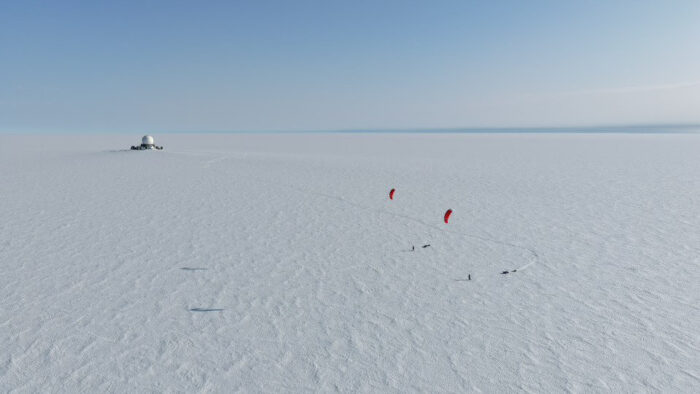
Photo: Matthieu Tordeur
Tordeur told ExplorersWeb that the journey was mostly about scientific testing. However, it also revealed striking changes in the ice in the five years since Belgian polar traveler Dixie Dansercoer died in a crevasse accident on the ice sheet.
“I was…at exactly the same GPS location at the end, near Kangerlussuaq,” said Tordeur. “And we had so many meltpools this year that we didn’t have five years ago.”
They also had unseasonably warm weather and lots of rain.
“We had rain at 2,400m of altitude, and it was not like small drops of water,” Tordeur said. “It was proper rain, and we were totally wet.”
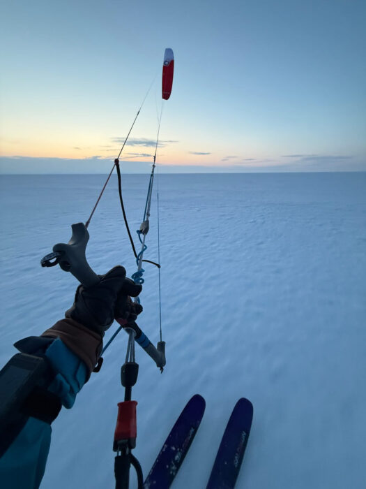
Photo: Matthieu Tordeur
Helicopter lift required
Because of crevasses at the start and extensive melt lakes at the finish, the pair could not enter or exit the ice sheet entirely under their own power and so took a helicopter. This experience of significant melt corresponds with a report from Henk-Jan Geel. He told ExplorersWeb that another kite team in the southern part of the ice sheet was helicoptered out (pre-planned) due to extensive meltwater.
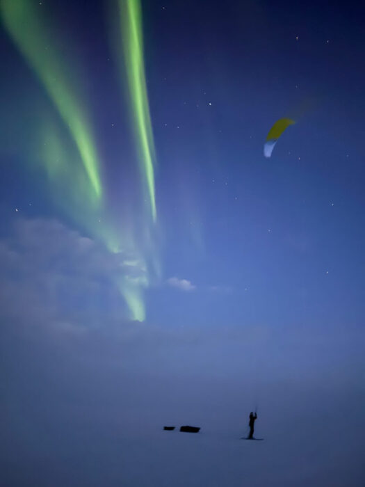
Kiting through the night. Photo: Matthieu Tordeur
Daytime heat also forced a shift in schedule.
“It was so warm during the day, and the snow was so soft, that we switched to night kiting,” Tordeur explained. “We had the stars above our heads, and we even had some northern lights.”
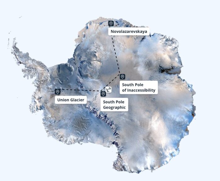
Tordeur and Sevestre’s upcoming snow kite journey in Antarctica, travelling from Novo Station to Union Glacier. Image: www.underantarctica.com
Despite the challenges, the pair achieved their main objective of testing radar equipment. Next, Tordeur and Sevestre will head to Antarctica at the end of October for an 80-day, 3,650km snow kite journey, pulling ground-penetrating radar to study snow accumulation rates and ice layering and detect subglacial lakes and rivers.