When the explorer Otto Sverdrup first spotted Axel Heiberg Island in 1899, its jagged peaks and wild precipices transfixed him. If a gale hadn’t distracted the great Norwegian from the new island’s beauty, “there is no knowing what we might have done –- stood on our heads, or written verses, or some other madness,” enthused the normally understated explorer. He named the island after a diplomat, who was one of the sponsors of his expedition.
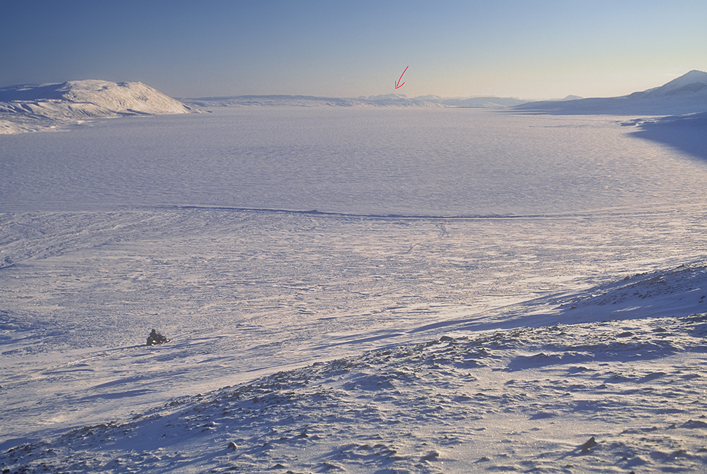
The spot on Ellesmere Island where in 1899, Otto Sverdrup first saw Axel Heiberg Island in the distance, red arrow. Photo: Jerry Kobalenko
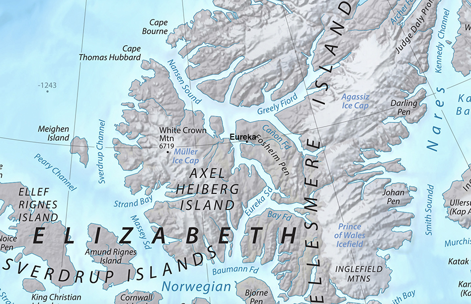
In the century-plus since Sverdrup’s discovery, few people have had the chance to share his enthusiasm. Axel Heiberg remains one of the most remote and difficult places to visit, even more so than its better-known neighbor, Ellesmere Island. Ellesmere has a village, two weather stations, a military base, and a national park. It also has abandoned but functional RCMP buildings, Hunter and Trapper Association cabins, and science camps.
The entirety of Axel Heiberg has just a couple of huts where scientists come for a month or so every year, mainly to study glaciers. Two-thirds the size of Ireland, it is the third-largest uninhabited island in the world, after nearby Devon Island and Alexander Island in Antarctica.
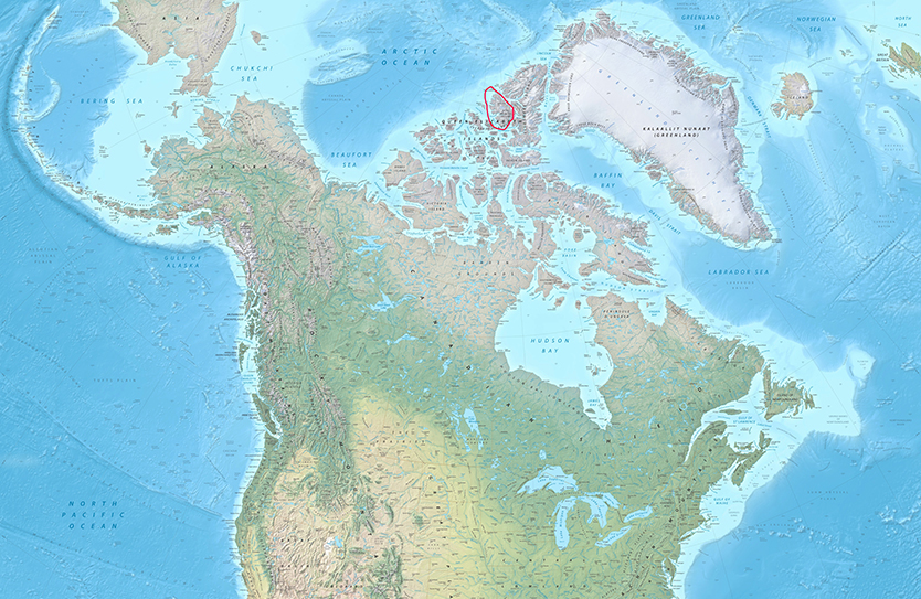
Axel Heiberg Island, circled in red.
First explorations
Two years after Sverdrup spotted the island from a distance, he led a dogsled expedition to explore its uncharted coastline. From his base on southwestern Ellesmere, he worked his way up Axel Heiberg’s storm-battered west coast. He grappled with deep snow, pressure ice, and ripping winds, but he made it almost to the northern tip of the island.
Here, he built a cairn and left a note declaring sovereignty over the High Arctic for Norway. It is usually easy to find cairns in the open Arctic landscape, even those built 100 years ago. But this significant construction, which he called slutvarden, or the end cairn, has never turned up, despite a few attempts to find it.
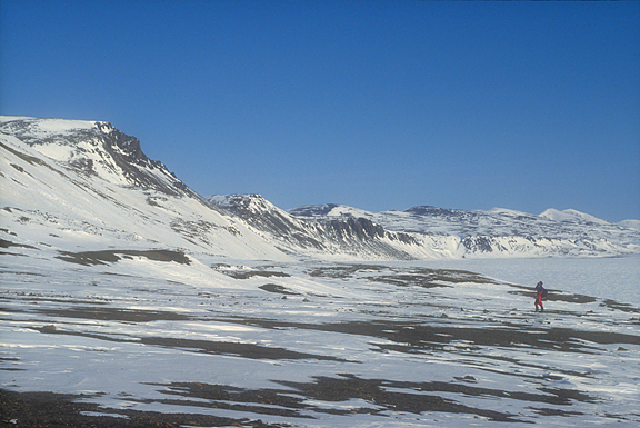
Searching for Sverdrup’s end cairn, 80˚55′, western Axel Heiberg Island. Photo: Jerry Kobalenko
Until the late 1930s, only seven or eight other explorers touched the wild shores of Axel Heiberg. The first Canadian, the great RCMP traveler Alfred Herbert Joy, didn’t set foot there until 1927 -– and that was in response to a sovereignty challenge from an American aerial survey. When Canada objected to the Americans laying fuel depots on Axel Heiberg without Ottawa’s approval, one of the Americans asked pointedly, “How many Canadians have been on Axel Heiberg?”
The embarrassing answer was none. The following year, Joy became the first, during the first of several pioneering dogsled patrols that eventually helped secure the High Arctic islands for Canada.
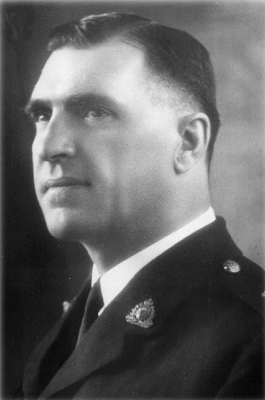
A. H. Joy.
A Starvation Coast
Of course, Inuit explorers and their predecessors had left their footprints here for centuries, though they too generally avoided the west coast because of its poor hunting. Small numbers of Peary caribou couldn’t make up for the lack of seals and other sea mammals around the multi-year ice. Even muskoxen mostly confined themselves to the gentler east side, which is shielded from westerly storms by the high mountains and ice caps of the interior.
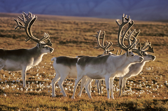
Small herds of Peary caribou roam western Axel Heiberg Island, above. Photo: Jerry Kobalenko
The west coast’s shortage of game imperiled competent and novice explorers alike. On his aborted journey to the North Pole in 1908, Frederick Cook and his two Inuit companions circumnavigated Axel Heiberg Island, then spent the winter on Devon Island in an old stone shelter, before walking back to Greenland the following year.
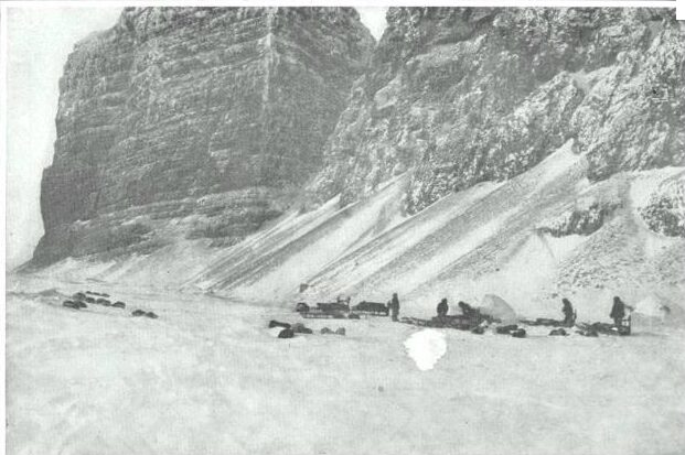
The image above, which appeared in Frederick Cook’s book, was accidentally printed as a mirror image: The dogsleds should be pointed to the right, their direction of travel, not to the left. Photo: Frederick Cook
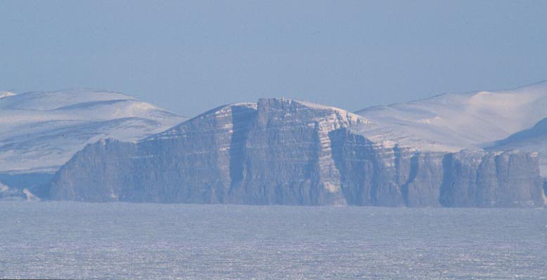
Svartevoeg, or the Black Cliffs of northern Axel, was Cook’s last verified location on his 1908 North Pole expedition. The cracks in the cliffs are distinctive; there’s nothing else like them on the island. Photo: Jerry Kobalenko
Cook may have lied about reaching the Pole, but mastering western Axel Heiberg seemingly without effort was a singular accomplishment. In 1930, a German geologist named Hans Krueger disappeared after dogsledding that Starvation Coast. Two years later, an RCMP team searching for him barely made it around the island alive. Even in modern times, geologist Ray Thorsteinsson felt starvation licking at his heels in the 1950s, during a scientific journey by dogteam to western Axel Heiberg and Meighen Island.
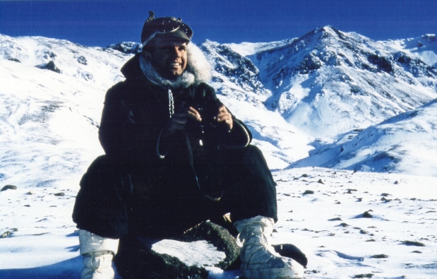
Geologist Ray Thorsteinsson in his element. Photo: Ray Thorsteinsson
Glacier studies
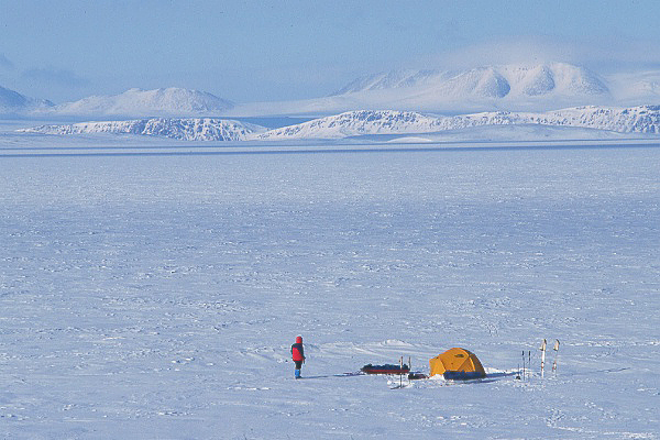
If anything, modern Axel Heiberg has belonged to the scientists. In 1959, McGill University glaciologists explored a region on the central west coast near what they eventually called Expedition Fiord. They established a permanent camp beside Colour Lake, just north of the fiord. For over 60 years, they have returned almost every spring to measure two nearby glaciers, the White and the Thompson. The years of continuous data have made these two polar glaciers among the best-researched in the world. They also studied the mineral springs that keep the Expedition River partly open most of the year and Colour Lake itself, which is as acidic as vinegar.
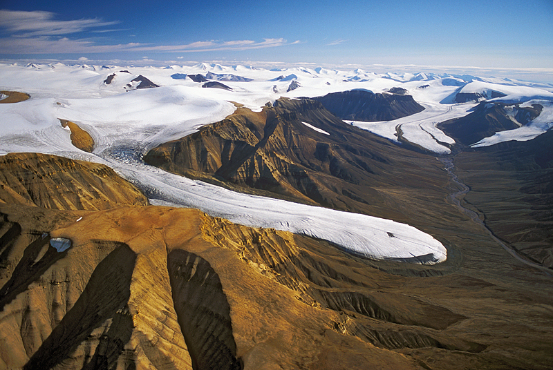
Overlooking the Thompson Glacier near the science camp on Axel Heiberg. Photo: Jerry Kobalenko
The McGill Arctic Research Station may have done the longest-running scientific work on the island, but the best-known site on Axel Heiberg lies just 30km west of Ellesmere’s Eureka Weather Station. In 1985, helicopter pilot Paul Tudge noticed what looked like large tree stumps sticking out of a badland hillside. Landing, he discovered that they were, in fact, tree stumps. Located 3,000km north of the nearest contemporary tree, this puzzled and excited those who heard of it.
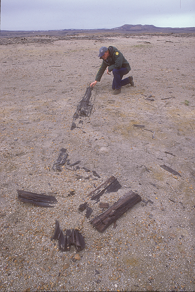
A fossil tree, Axel Heiberg Island. Photo: Jerry Kobalenko
The following year, paleobiologist James Basinger from the University of Saskatchewan investigated what turned out to be a 45-million-year-old fossil forest. The cypress and redwood stumps and trees date back to a time when Axel Heiberg had the climate of modern Louisiana, and alligators, turtles, and flying lemurs existed where now only a handful of Arctic species eke out a cold living.
The wild north end of Axel Heiberg Island. Photo: Jerry Kobalenko
Wonders of the past
Axel Heiberg’s isn’t the only fossil forest –- neighboring Ellesmere has at least six –- but this one is by far the best. It covers up to five hectares and has more than 200 trees. These trees have not petrified; they remain wood, they can burn, and sometimes freshly liberated pieces still smell of pitch. The state of preservation of some trees is so good that even the growth rings can be counted.
Since the discovery of the fossil forest, researchers have unearthed other wonders from Axel Heiberg’s semi-tropical past, including a 90-million-year-old turtle, a giant rhinoceros-like creature, and an eight-foot-long crocodile relative called a champsosaur.
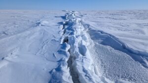
Ren Bay, near the northern tip of Axel Heiberg Island. Photo: Jerry Kobalenko
In all the loveliest parts of the Arctic, tourism has begun to make inroads. But though Axel Heiberg has scenery as beautiful as any, it remains off the radar. In the last 20 years, only a couple of outfitters have led exploratory tours here. Yet Axel Heiberg’s highest peak reaches an impressive 2,120m.
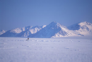
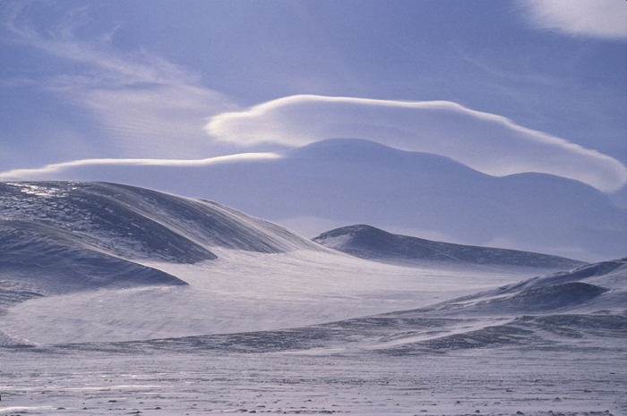
Near the northern tip of Axel Heiberg, the ice caps disappear, and some short, simple crossings of the island through frozen river valleys are possible. Photo: Jerry Kobalenko
The ‘lone white beauty’ of Axel Heiberg
In 1972, a British military expedition did several first ascents of nunataks emerging from the ice cap near Li and Middle Fiords. One member of this party even died when he struck his head during a fall into a crevasse. The Swiss also climbed here.
A few years ago, some Canadian mountaineers skied the ice caps of Axel Heiberg, doing almost a full north-to-south traverse. I’ve managed to travel the island half a dozen times, on various skiing, kayaking, and hiking journeys. Like most people lucky enough to see the place even once, I’ve fallen in love with what one explorer called “the lone white beauty of Axel Heiberg.”
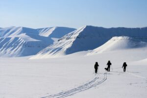
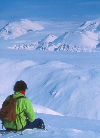
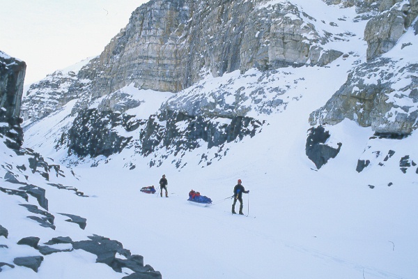
Crossing one of the 1,121 glaciers on Axel Heiberg Island. Photo: Jerry Kobalenko
Admittedly, obstacles hinder travel here. Ice caps and exactly 1,121 glaciers (a grad student once counted them) cover one-third of the island, including most of the interior. It’s hard to do long summer hikes because no matter where you go, you soon run into either glaciers or large meltwater rivers that are impossible to ford. Hiking is by necessity more limited and intimate than in many parts of the North. Rather than cover large tracts, you pick a pocket area and explore it thoroughly.
The hardest part is an old story for High Arctic hands: getting there. The only way is by charter aircraft from Resolute. Once in Resolute, Axel Heiberg is not too far away, but it remains a destination neither for the faint of heart nor the faint of wallet.
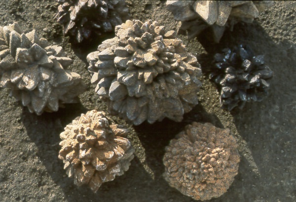
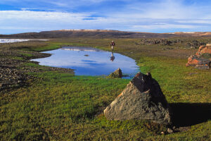
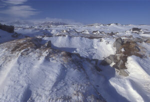
Rose rocks, one of the natural wonders of Axel Heiberg Island. Photo: Jerry Kobalenko
But when you see its magnificent whiteness, the long silent glaciers slipping down between the choppy sea of peaks, the white fingers of eroded hillsides pressing lightly on fiords rarely if ever trodden on, the giant expanses of almost featureless ice caps, it’s impossible not to be smitten.
In some ways, Axel Heiberg is the dark side of the moon.
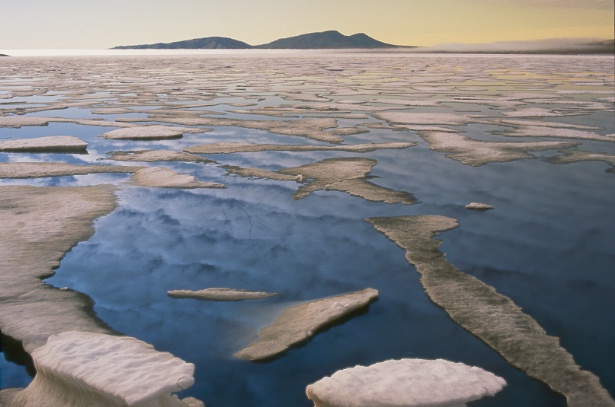
Sand Bay, Axel Heiberg Island, shortly after breakup. Photo: Jerry Kobalenko