In their classic reference book, Arctic Canada From the Air, Moira Duncan and Keith Greenaway memorably described the shape of Devon Island as “a legless donkey with its head thrown up to bray.” They then divided the island into three geographical parts: the hindquarters of the donkey were a high ice cap, the main body a flat plateau, and the head and neck a complex upland.
Devon Island: “a legless donkey with its head thrown up to bray.”
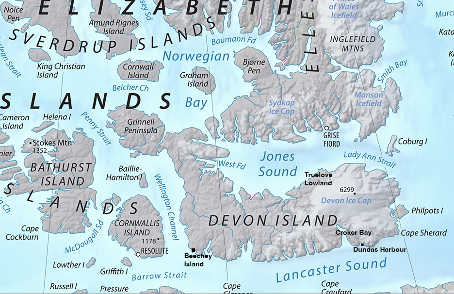
Map: Wikipedia
At 55,247 square kilometers, Devon Island is about the size of Croatia, but no one lives there. The two nearest Arctic communities, tiny Resolute and tinier Grise Fiord, are about 70km away. As an adventure destination, the presence of these nearby hamlets makes Devon slightly easier to reach — that is, less stratospherically expensive — than its beautiful neighbors, Ellesmere and Axel Heiberg Islands.
Devon Island was named in 1819 by Matthew Liddon, explorer William Parry’s second-in-command, who was pining for his native county of Devon, England. The Inuit who traveled through the area called the island Tallurutit — Tattoos of the Chin — because its vertical ravine-slashed coast resembled the vertical chin tattoos of Inuit women.
The Inuit called Devon Island Tallurutit — Tattoos of the Chin — because its vertical ravines resembled the vertical chin tattoos on women. Photo: YouTube
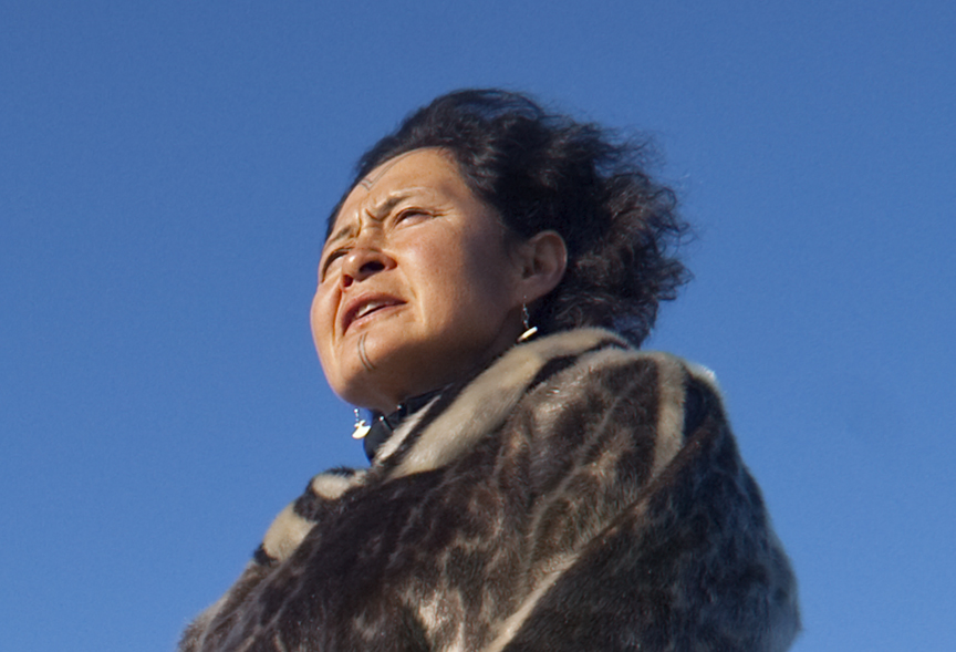
In recent years, facial tattoos have come back into fashion among Inuit women, partly thanks to Inuit lawyer and activist Aaju Peter, above. Photo: Jerry Kobalenko
Getting to Devon Island
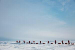
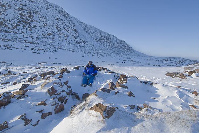
Most adventurers go in the spring sledding season. They take the scheduled flight from Resolute to Grise Fiord — expensive but subsidized and cheap compared to chartering your own aircraft. Then they either ski the 70km across frozen Jones Sound or hire a snowmobile to drive them.
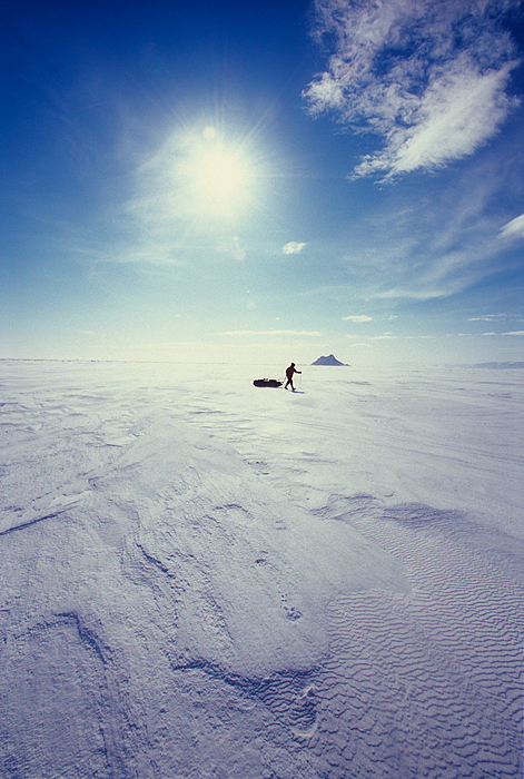
Crossing Jones Sound. Photo: Jerry Kobalenko
At times in the past, people lived on Devon Island. The shaman Qidtlarssuaq and his party spent several years in two or three spots there in the mid-1800s, during their migration from Baffin Island to Greenland. From 1924-1933 and again from 1945-1951, the Royal Canadian Mounted Police had a small post called Dundas Harbour near the southeast corner, to promote Canadian sovereignty in the High Arctic. During those periods, two policemen and a few Inuit helpers lived there year round.
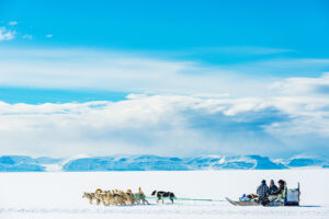
The ocean currents on the south coast of Devon are quite strong, and once or twice, the RCMP officers dogsledding the south coast almost lost their lives when the sea ice unpredictably broke away from the shore with them on it. Because of this danger, they stopped traveling that way. Instead, they crossed the short, easy ice cap to the north side of Devon — as Borge Ousland and Vince Colliard did in 2022 — and continued their patrols on the secure ice of Jones Sound.
A glacier ramp near Dundas Harbour leads to the interior ice cap. Photo: Jerry Kobalenko
The Dundas Harbour Royal Canadian Mounted Police Post was opened in the 1920s for sovereignty reasons. It closed once sovereignty was secured, then reopened again briefly in the mid-1940s. Photo: Jerry Kobalenko
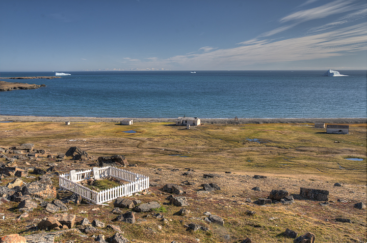
The graves of two RCMP officers who perished at Dundas Harbour. One accidentally shot himself in a hunting accident, the other was a suicide. Photo: Jerry Kobalenko
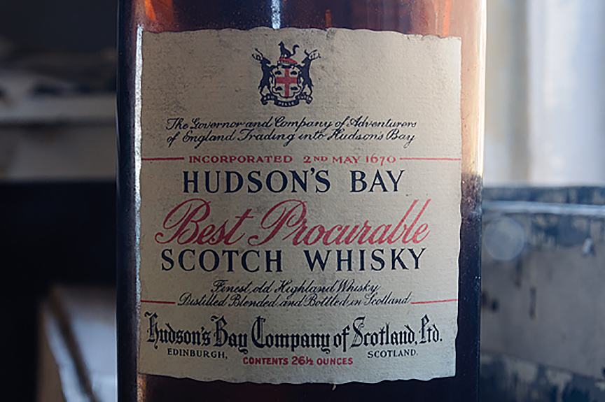
After the RCMP post at Dundas Harbour shut down in 1933, the Hudson Bay Company established a trading post there, but there was no one to trade with. It shut two years later. An empty whiskey bottle from that era remains in one of the cabins. Photo: Jerry Kobalenko
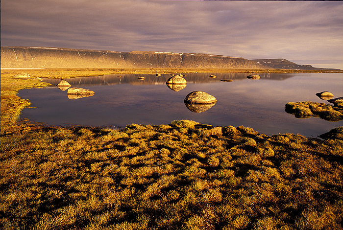
Truelove Lowland
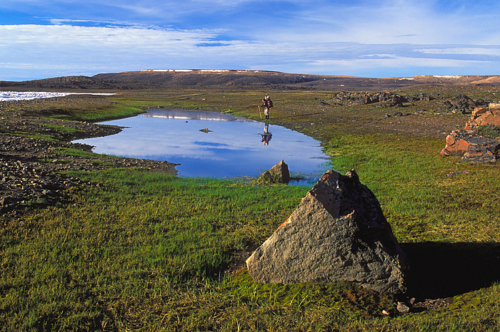
Starting in 1960, a group of mainly botanists built an elaborate science camp at Truelove Lowland on northern Devon. Truelove (named after a whaling ship, not a romance, although I did propose to my wife there) is one of five polar oases in the High Arctic. Polar oases have comparatively wonderful weather and rich plant growth, but are also the only places in the High Arctic with enough mosquitoes to be truly pesky. Everywhere else, if you find any at all, they are just one or two very lost individuals.
For several seasons, for two or three months every summer, the researchers studied the plants, muskoxen, foxes, and the many ducks that bred in the large ponds. However, the scientists never lived there full-time.
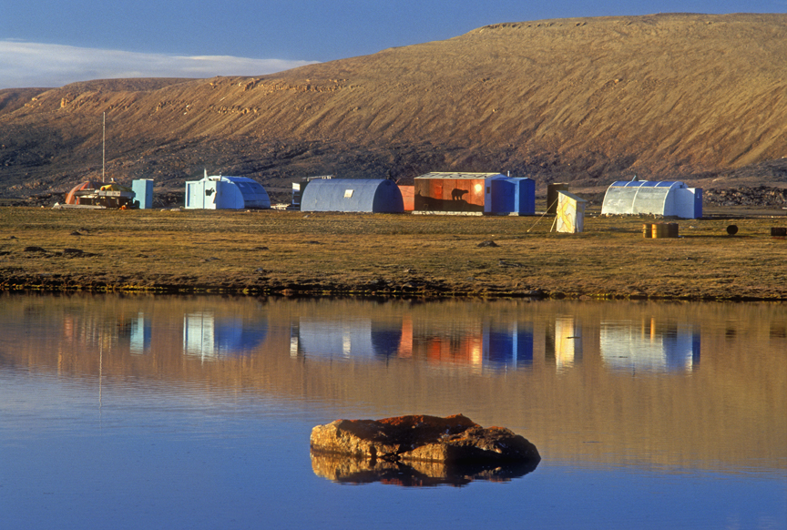
The old science camp at Truelove Lowland. Botanists began coming here in 1960 to study the plants and animals of this unusually fertile area. They lived here for a month or two each summer, but never year-round. Photo: Jerry Kobalenko
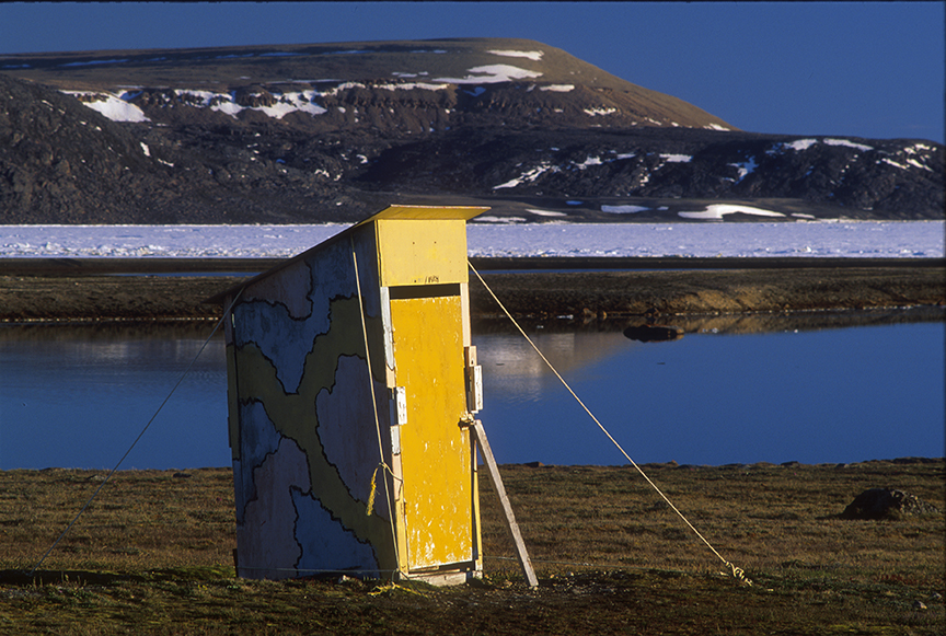
Graffiti in the interior of the outhouse at Truelove Lowland reminds botanists to watch out for polar bears: “Though you may be entranced by a passion for flora, do not ever forget the Order Carnivora.” Photo: Jerry Kobalenko
Nowadays, the main visitors to that part of Devon Island are the Inuit from Grise Fiord. In the springtime, it’s popular to snowmobile to Devon Island to ice fish for char in the lakes. The sea ice is still so thick that occasionally, some even drive their pickups across the frozen ocean.
One of the many small lakes at Truelove Lowland, Devon Island. A researcher drowned in one of these ponds when he went canoeing alone under the midnight sun. A sudden wind came up when he was far from shore, capsizing his canoe. He died of hypothermia and sank into the deep silt of the lake bottom. Searchers could not find his body, though part of his remains drifted to shore years later. Photo: Jerry Kobalenko
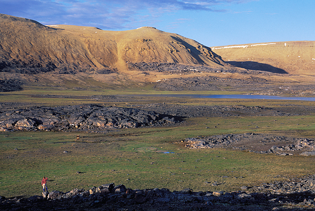
Truelove Lowland features good but occasionally soggy summer hiking through sedge meadows popular with muskoxen. Photo: Jerry Kobalenko
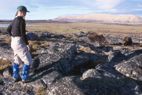
Hiker and unperturbed muskoxen, Truelove Lowland. Photo: Jerry Kobalenko
Beechey Island
The southwest corner of Devon Island was Act I of the most famous tragedy in Arctic history. There, Sir John Franklin and his 129 men overwintered in 1845-6 in a barren cove between Devon and Beechey Islands. Three men died and were buried on the slate beach. The following year, Franklin’s expedition sailed further west, seeking the Northwest Passage, and eventually perished to a man.
Beechey Island, foreground, is connected to Devon Island at low tide by a slender isthmus. Photo: Jerry Kobalenko
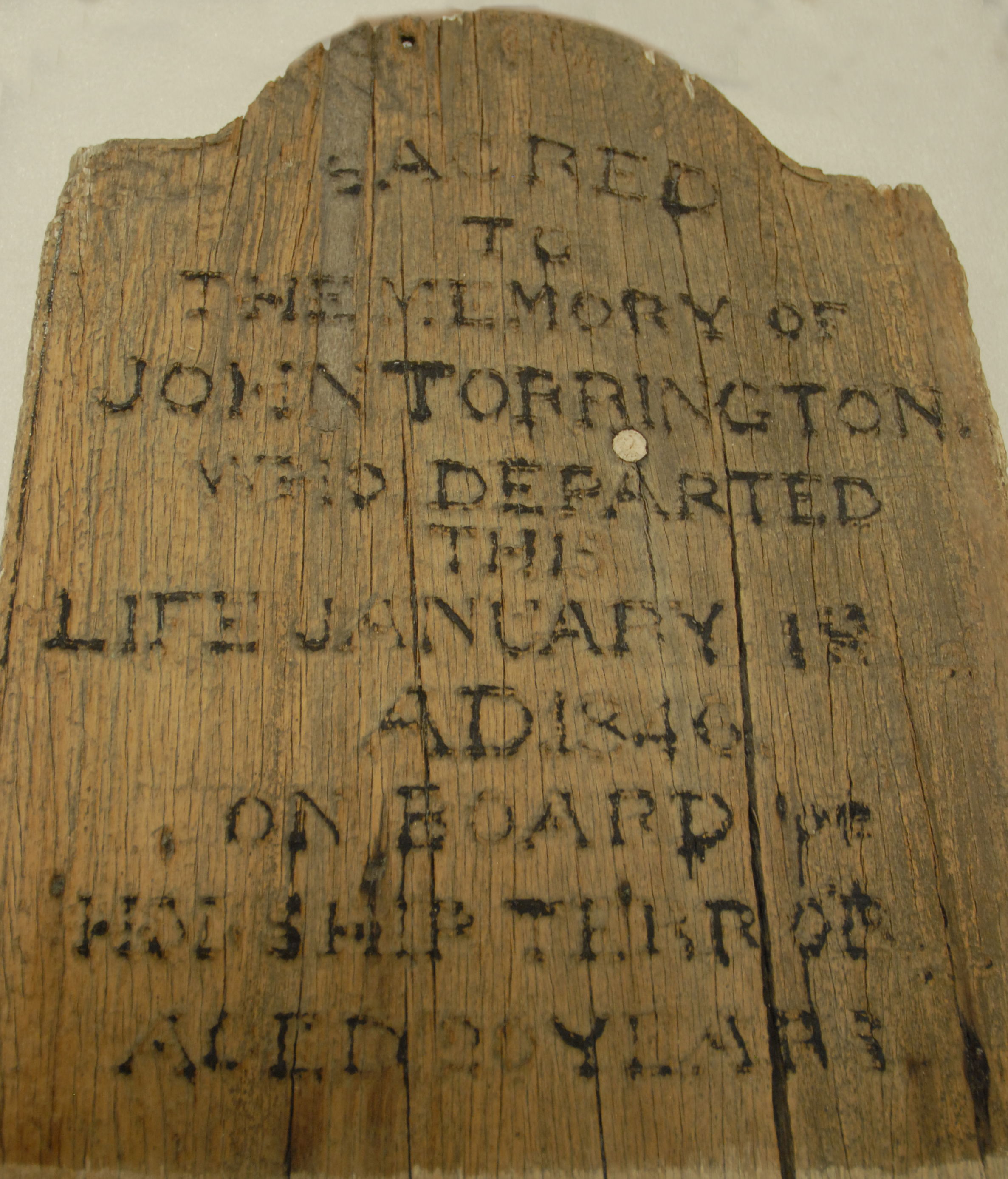
The original grave marker of John Torrington, one of Sir John Franklin’s men, is now in a museum in Yellowknife.
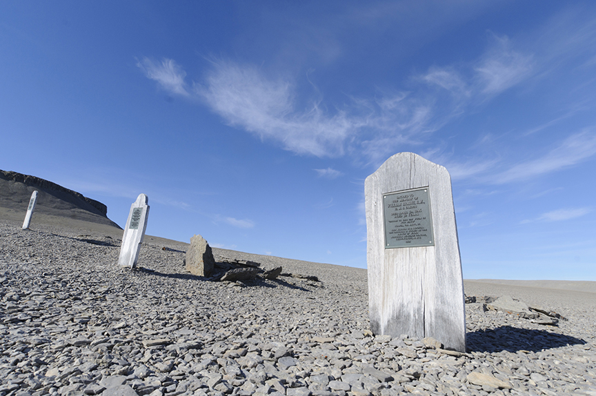
The bodies of Franklin’s men, briefly exhumed for scientific reasons in the 1980s, were reburied under the gravel. But the headstones are artful replicas. Photo: Jerry Kobalenko
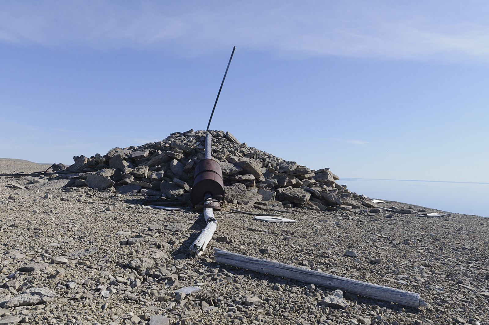
While thousands of cruise ship passengers visit the Beechey Island graves every summer — it is by far the most-visited tourist site in the Canadian Arctic — few get to Franklin’s cairn on top of the island, overlooking the Northwest Passage. Photo: Jerry Kobalenko
Apart from the history of that one spot, western Devon Island is not particularly interesting. The low, barren ridges of the Central High Arctic have replaced the jagged, glaciated mountains further east. The weather is crappier; windier, colder, foggy in summer. So few plants grow that you have to be a botanist to notice that plants grow at all.
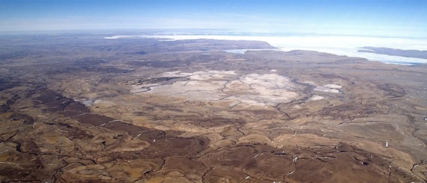
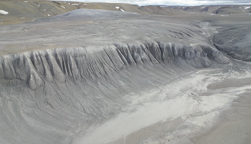
The Haughton Crater from the air. Photo: Pascal Lee/Haughton-Mars Project/Mars Institute
The Haughton Crater
The interior of western Devon has one well-known feature: the Haughton Crater. Twenty to 30 million years ago, a meteor struck Devon Island, leaving an impact crater about 22km in diameter. In the late 1990s, some Mars aficionados decided that the word “crater,” combined with the extraterrestrial barrenness of that part of the Arctic, made the site a good analog for Mars.
Over the years, people have romped around there in space suits, lowered an ersatz rocket ship, complete with side thrusters, onto the site by helicopter for publicity photos, and in recent years, have done some serious science. Permanent living quarters exist there now. Like the old camp at Truelove Lowland, visitors come during the brief summer, but it’s uninhabited for much of the year.
Finally, a point of land just east of Truelove Lowland was a key site in a dramatic polar expedition. In 1908, Frederick Cook vaguely tried to reach the North Pole. He didn’t succeed, but with two Inuit companions, he did a giant encirclement of Axel Heiberg Island before making it back to Devon Island. Here, the three of them spent the winter in an old stone hut built by prehistoric Thule, which they roofed over with skins. In the spring, they trekked the 700km back to Greenland. Cook then pretended he’d reached the North Pole, which is too bad, because his actual journey was quite magnificent.
The stone ‘hut’ on Devon Island where Frederick Cook and his two Inuit companions spent the winter of 1908-9 before trekking back to Greenland. Photo: Jerry Kobalenko
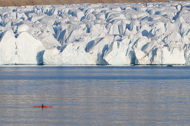
Kayaking past a tidewater glacier, Croker Bay, Devon Island. Nearby, explorer John Ross professed in 1818 to see what he called the Croker Mountains, barring the way west. These mountains don’t exist, and back home, Ross was accused of chickening out to avoid heading further into the Northwest Passage. The charitable suggested he’d been taken in by a polar mirage, but his crew knew better. Photo: Jerry Kobalenko