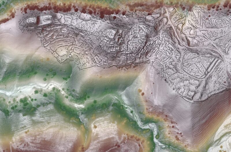
Archaeologists have mapped two lost cities of the Silk Road in Uzbekistan using drones and LiDAR. The fabled cities had lain buried under mountain pastures for centuries.
Light detection and ranging technology (LiDAR) uses laser pulses to detect structures hidden beneath vegetation. The two settlements lie five kilometers apart at around 2,000m above sea level. Called Tugunbulak and Tashbulak, they were two of the largest mountain settlements on the famous trade route between Europe and China.
Tugunbulak, the largest of the two, contains watchtowers, plazas, fortresses, and large complexes. Tens of thousands of people once lived here.
Speaking about Tugunbulak, Farhod Maksudiv — co-author of a new paper on the find, said, “The people inhabiting Tugunbulak for more than a thousand years ago were nomadic pastoralists who maintained their own distinct, independent culture and political economy.”
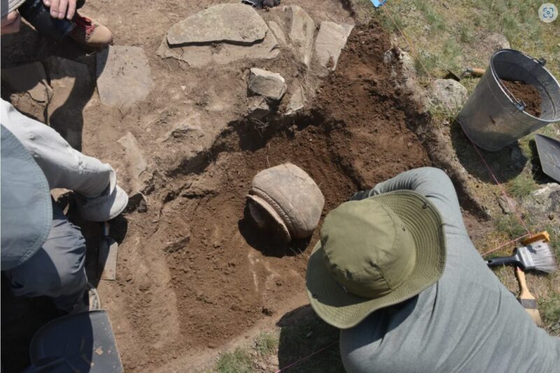
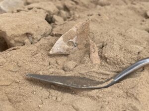
Preliminary excavations at Tugunbulak. Photo: Michael Frachetti
Backyard find
The research team has been uncovering the Tashbulak site for almost a decade. In 2015, a forestry official commented that he had seen ceramics in his backyard that were similar to what they were unearthing at Tashbulak. This tiny tip is how Frachetti discovered the larger Tugunbulak site.
“We got down there, and right in his backyard is a medieval citadel,” Frachetti told CNN. “He just didn’t know it. We go up to the mound, and we look out, and we can see mounds and pyramidal [shapes] all over the place, and we’re like, oh my gosh, this place is huge.”
At first, they used foot surveys and computer modeling to figure out the layout of both sites. It took a long time, but this proved to be a silver lining. Over the years, the technology has improved tenfold, and now they can use LiDAR and drones.
Drone use is strictly regulated in Uzbekistan, and the team needed special permission to use them. This year, they finally mapped out both cities, thereby discovering the largest urban layout of any medieval Central Asian city at high altitude.
“The final high-res maps were a composite of more than 17 drone flights over three weeks,” Frachetti said. “It would have taken us a decade to map such large sites manually.”

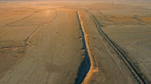
Beneath this pasture is a 1,000-year-old buried city. Photo: Michael Frachetti
High-altitude hubs
The research proves that the Silk Road did pass through high-altitude areas. Some have speculated that it only wandered through the lowlands. The Silk Road was such a commercial success that setting up settlements along its branching paths was incredibly lucrative, and cities began popping up along it.
Despite this, the archaeologists believe these settlements existed for a different reason. Life at this altitude would have been incredibly difficult, making it an odd choice for a simple stopover along the route. They are also much larger than other rest stops.
Instead, the team thinks they were built to harvest the nearby iron ore. They hope that future excavations will reveal who built the cities and why they were abandoned.