White-outs, blisters, broken tent poles and more sastrugi pose challenges, but stunning views and a parhelion are rewarding.
(Correne Coetzer) One of Carl Alvey’s clients aborted the expedition in the first degree on the Hercules Inlet route and was picked up by a Twin Otter. Michele Pontrandolfo got a chance to kite and changed his route. White-outs, blisters, broken tent poles and more sastrugi pose challenges. Doug Tumminello gives his list of repair kit. Henry Worsley crossed 86ºS. Eric Philips experienced stunning views in every direction; skiing, kiting and climbing.
Note: Definitions below according to AdventureStats.com:
assisted = resupplies
supported = kite/car/skidoo support u2028
HENRY WORSLEY UK solo
Unassisted Unsupported traverse 1100nm / 2037km
Berkner Island – Geographic South Pole – Shackleton Glacier (Ross Ice Shelf)
Started November 13, 2015.
Shapes in the sastrugi – polar bears, flying fish, lions with huge manes, a pelican, faces with large noses and even Bart Simpson – kept Henry intrigued during the day, although they slowed him down. The sled and skis bashed through and into the sastrugi. He fell over at least 6 times on Day 30 and didn’t find that amusing. On Day 31 (13 Dec.) a white-out set in, which meant battling invisible sastrugi. Henry says he is preparing himself psychologically for the big sastrugi in 87 degrees.
Day 32 December 14: S86º 03.413 W52º 27.570
Time Travelled 10 Hours 30 Minutes
Distance 13.9 Nautical Miles
Accumulated Distance 332.9 Nautical Miles
Altitude 6170 Ft
Temperature -18 °C
Wind Speed 2 Mph
Weather Changeable with spectacular parhelion.
LUKE ROBERTSON UK/Scotland, solo
Unassisted Unsupported 1130km
Hercules Inlet to Geographic South Pole
Started December 5, 2015.
Luke reported headwinds, fine weather and soft snow, and covered 18 miles on Day 9. Latest, Day 10: “Felt like good progress in difficult and changing conditions.”
Location: Time UTC 12/14/2015 11:20:00 PM
Lat. -81.640058 Long. -080.631086 Elev 854.38 m
DOUG TUMMINELLO USA solo
Unassisted Unsupported 1130km
Hercules Inlet – Geographic South Pole
Started December 6, 2015, at 7 pm, skiing for an hour.
“Antarctica is a hard, hard place – hard on equipment, hard on bodies!” says Doug on Day 5; he broke two tentpoles and is nursing a foot blister that hampers his progress to maximum 9 nautical miles. He also said navigating is difficult on the sea of white. On December 12th, Doug left Three Sails behind [three mountains to his left].
His repair kit is extensive, “and includes wire, duct tape, electric tape, plumbers tape (in case a water bottle or gas bottle threads start leaking) epoxy glues, super glue, hacksaw blades, screwdriver and pliers, a c-clamp for ski repairs, steel wool, parachute cord, a sewing kit, stove repair kit, extra lighters, a flint and steel (Firesteel), tent repair materials, etc. basically I have to be able to fix every bit of equipment I use.”
Time 12/14/2015 12:58:00 PM UTC
Latitude -80.830053 Lon -080.594458 Elev. 836.85 m
DEVON MCDIARMID (CA, ANI guide), STEW EDGE (UK), MOSTAFA SALAMEH (Jordan), SHAHROM ABDULLAH (Malaysia)
Unassisted Unsupported 890km
Ronne-Filchner Ice Shelf (Messner) – G. South Pole
Started Dec. 9, 2015.
Stew reported good weather on Day 2 and they had to be careful not to sweat. They were using their shadows to navigate – shadows move 15 degrees in an hour. They covered 9.3nm in 6 hours.
Next day a white-out had them checking a chest-mounted compass all day. Stew said, when he was navigating, he also used the angle of snow blowing across his skis as a guide. “Even with the compass, the constant whiteness all around was disorientating and it felt like we doing circles.” 7.93nm in 6 hours.
Next day visibility was down to 20m. They managed 7 stints of 50min with a 10min rest in between and covered 10.38nm. Poor visibility continued till yesterday with more sastrugi, as well as soft snow from the previous night’s snowfall. “It was a bit harder to pull the sleds but not too bad. It is a lot easier than pulling tyres which was our training,” assured Stew.
Jordanian Mostafa said it is like being in the desert there, “but filled with snow that we have to break in every hour you walk you think you are going to see something but there is no one here no human or animal apart from us.”
Stewart Edge location map: Dec 15th, 2015 1:52:00 pm
Elev: 527.00m Lat: S 83°06’58.0356″ Lon: W 68°34’59.4588″
MICHELE PONTRANDOLFO (Italy) solo
Unassisted Kite-supported traverse: Coast at Novolazarevskaya – South Pole of Inaccessibility – Geographic South Pole (POI) – Hercules Inlet
Started November 19, 2015.
Michele’s home team reported to Pythom/ExWeb that he has changed his route. Due to the time loss caused by the lack of favorable kite winds, he is not going to the POI anymore, but is heading directly to the Geographic Pole at 90ºS.
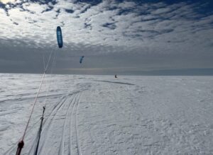
Snow conditions and visibility are good, but not the kiting wind. Temperature: -22°C yesterday. On Sunday Michele was able to get a kite in the air and covered 33,4 km, kiting uphill, with the wind E 20-25 km/h. Yesterday he was able to kite 5 km, then the wind dropped.
Fri Dec 11th, 20157:24 pm UTC+2
S 71 58’36.77” E 11 2’11.03”, elev 2143 m
Sat Dec 12th, 20157:32 pm
S 72 2’51.09” E 10 58’42.42”, elev 2249 m,
Sun Dec 13th, 2015 5:06 pm
S 72 16’22.48” E 10 48’6.79”, elev 2573 m
Mon Dec 14th, 2015 3:24 pm
S 72 21’45.13” E 10 35’0.22”, elev 2705 m
ERIC PHILIPS (Australia, solo)
Unassisted Kite-Supported
Queen Maud Land “Discovery Trip”
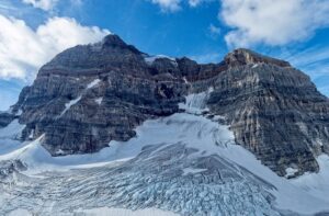
“Breathless: The stunning views in every direction. From where I have come, with Ulvetanna rising above all. What I’ve just passed, “Mount Colossus” as I call it, with it’s guardian swathe of moraine that stymied my passage between it and the range south. Where I’m going, the austere snow plains that lead down to the coast of Antarctica, and my destination, ALCI Airbase.”
“Breathless: The sky. Not a whisp of wind to ruffle my ruff. And with it a blue you only find in Antarctica. Each of my three breaks were warm and windless, with lunch sitting on the long strip of hard blue ice that lines the western edge of this mountain range. What a joy and relief to crampon along it for 10km.”
CARL ALVEY (UK, ANI guide), EMMA TAMSIN KELTY (UK), KHAI NGUYEN (CA/US)
Unassisted Unsupported 1130km
Hercules Inlet – Geographic South Pole
Started December 5, 2015.
Emma reported two days of high winds with gusts up to 45 knots, “making skiing with the sled impossible.” Yesterday they skied 11.43 nm and have nearly reached the first degree. They ski in sessions of 50min with 5 min breaks.
Khai reported on December 12th: “I never took the trip lightly, in fact a little too serious that I quit my job for this. Whenever time allowed (week nights and weekends), I trained and prepared for it. I think I was well prepared for it mentally and physically. But in the past few days I came to realize that my body needs to handle much more for the intensity and speed of traveling. In fact if we ski at the pace my body can handle it’ll take us beyond the last flight out of Antarctica which is Jan 27. Time is not my friend at this point. The endless series of delay due to weather gave us no wiggle room either. And I don’t think it’s fair to drag down the team on their expense. With all disappointment and sadness, I made the decision to stop my ski journey to the South Pole this time.”
WEATHER MAPS:
Gateway port Cape Town, South Africa:
To ALCI /TAC base camp Novolazarevskaya / Novo
70° 46’37”S, 011° 49’26”E
Gateway port Punta Arenas, Chile, South America:
To ALE/ANI base camp, Union Glacier
79° 45’S, 083° 14’W elev 708m
Lat: -79.760591 Lon: -82.856698
Hercules Inlet is located at 80°S near Union Glacier, 1130 km from the Geographic South Pole.
The Ronne-Filchner Ice Shelf (Messner) start is 890 km in a straight line from the Pole.
Novolazarevskaya to South Pole of Inaccessibility (POI) is 1610 km in a straight line.
South Pole of Inaccessibility (POI)
2011-12 position: S82°06.696, E055°01.951 (Copeland/McNair-Landry)
On Dec. 14, 2014 Frédéric Dion reported the position the POI (at Lenin’s bust) as S82º 06.702′ E55º 2.087′ at an elevation of 3741 m.
Geographic South Pole (GSP): 90 degrees South
According to the Rules of Adventure at AdventureStats.com, to claim a “solo” achievement, requires an unassisted status – therefore no supplies carried by pilots or car drivers, or anything (food, fuel, etc) received from any person along the way. A solo person may be wind supported (kites/sails). Note that the Polar Rules were compiled by early Norwegian and British Polar explorers and are maintained today by the current community of veteran polar skiers.
1 nautical mile (nm) = 1.852 km
1 nm = 1.151 miles
1 knot = 1.852 km/h
1 degree of Latitude is 110 km / 60 nm / 70 miles
Sastrugi are hard snow bumps and can be as high as 10 feet
A nunatak is a top of a mountain visible above the snow surface.
Previous update: Mind-numbing white-outs; Climbers in gale force winds
“}

