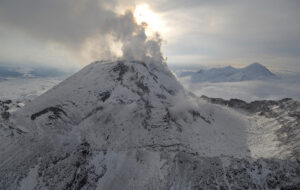
In 2016, a helicopter pilot in British Columbia, Canada noticed a huge new hole in the Job Glacier as he flew over. The glacier lies on Mount Meager, one of the volcanoes on the Cascade Arc. The pilot happened to have studied geology and sent photos to his old professor.
The photos aroused Professor Williams-Jones’ curiosity. He wanted to find out how active the volcano was. But the vent he needed for measurements was under the glacier, and the gas released is deadly to humans. To get meaningful data, someone had to go into the glacio-volcanic cave. There are only a handful of people on Earth with the skills to do that. One of them is Christian Stenner.
Stenner spoke to ExplorersWeb about the project and how he went from caving for fun to being one of the world’s foremost experts.
This interview has been edited for clarity.
How did you get into glacio-volcanic caving?
It’s such a niche thing. I’m primarily involved because of research. I had a lot of caving and expedition experience and I was able to get in touch with some folks and branch into this. For a caver, exploration and science are intertwined.

Katie Graham and Christian Stenner after their successful first descent into the lower level of the cave system. Photo: Adam Walker
Mapping vital
I don’t want to sound disdainful of mountaineers or other explorers, but for caving, we’re always making maps. When you do a first cave descent, if you didn’t make a map of it, you weren’t really doing anything useful.
The culture in the speleological community is that at the very least there’s going to be a mapping component. You’re publishing your data.
And how did you get involved in the Mount Meager project?
When we first heard that there was an opening in a glacier on a Canadian volcano, that was very enticing. I was able to get in touch with the researcher.
I was on cloud nine. There was the minimum objective of getting into the cave, making some observations, and getting out. But the other objectives — taking biological samples, getting the volcanic measurements, and so forth — we hit all of them fairly safely.
We were doing something that had never been done and using equipment that had never been used for that purpose. To find that it all worked, we were really happy.
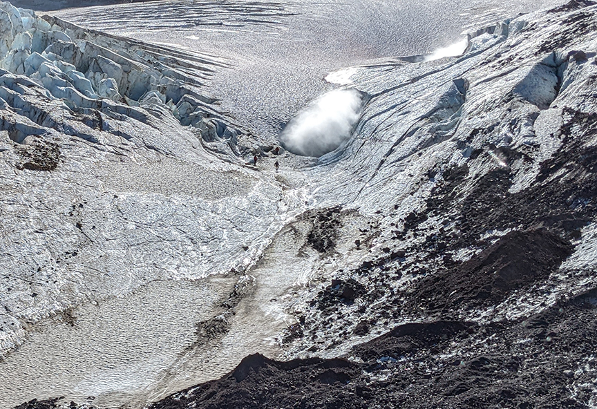
A tiny figure stands near the entrance to the Mount Meager cave. Photo: Glyn Williams-Jones
Minimizing risks
How do you lessen the risks and make peace with such a dangerous project?
A huge part of the mitigation is experience. If I were to come into that without any background of exploring other glacial volcanic systems, it would be much more dangerous.
Every single glacial volcanic cave we found has been different. They all have their characteristics and this one especially, because of the dangerous gas and the icefall coming off the ceiling. The whole cave was essentially disintegrating around us while we were trying to explore.
Another thing that helps is time to prepare. For Mount Meager, I first entered the cave in 2019. I was able to go in a little bit and came back out. So by the time we went last year, we had years to plan.
A huge part of the planning is the equipment. This time, we didn’t use a rebreather life support system. We came up with a different one that filtered the air, rather than recycled our exhaled breath. It was a matter of doing the math and trusting that the filtration equipment would be able to deal with the gases.
Rescue unlikely
Katie [Graham] and I were the only ones who entered deep into the cave system, but we had a support team of very experienced people on the upper level of the cave with additional breathing apparatus and extra air bottles. Both of us went in with no expectation of anyone being able to rescue us. I’m sure our team would have put in a good effort, but there were no guarantees.

The mouth of the glacio-volcanic cave releases a cloud of steam and toxic volcanic gases. Photo: Adam Walker
On Mount Meager, scientists wanted you to take temperature and gas composition and concentration readings. What are the significance of those measurements?
They signal how active the volcano could be. If the magma chamber is close to the surface, the vent will be at a higher temperature. So the temperature of the vent indicates how the volcanic system behaves and how near the bottom of the glacier it might be.
The gas composition will shift from more hydrogen sulfide-based to more sulfur dioxide-based as pressure increases. It indicates that things are changing and could mean that it’s getting closer to an eruption. The volcano is near a populated area, so it’s critical to see what we were dealing with.
We found that the fumarole was 90°C. That’s not a nice floor to be walking on, but it’s fairly safe from a volcanology perspective. The gas levels had much more hydrogen sulfide than sulfur dioxide. That’s another good sign that we’re not in imminent danger.

Two supporting researchers take a spectrometer scan of the ice near the cave entrance. Photo: Adam Walker
From hobby to career
How did you go from recreational caving to becoming one of the foremost experts in glacio-volcanic caves?
When I joined my first volcano expeditions in the U.S., they were led by Eddy Cartaya. He had been exploring glacier caves in the Pacific Northwest. I was there as a surveyor, to help with mapping. I learned a huge amount from him and the team.
The formation mechanism is also different in different locations. We have some other considerations, like the gas issues, which we have to deal with. We learned a lot going to Mount Rainier and Mount St. Helens and were able to use that on the Mount Meager project.
The dynamic of the teams is interesting. For this, there were a lot of science folk that we had never met before. There has to be an understanding that they are experts in their fields. While we are gathering our data and heading into the caves, they have crucial things they need to do, too. I had to be comfortable with their ability to be safe, make good decisions, and do the right thing. There was also an understanding that the volcano had the final say over whether we accomplished anything.

Katie Graham walks through the cave toward the light of the lower entrance, obscured by a vapor cloud. Photo: Christian Stenner
No GPS down there
How do you map a cave?
That’s one of the big challenges with caves. GPS’s and conventional radios typically don’t work. They won’t transmit through rock or large chunks of ice.
For cave mapping, we use regular surveying techniques that you might have used on the surface before GPS. A decade ago, it was still a compass, an inclinometer, and a tape measure. You would take the measurements from point A to point B and sketch all this data out while plotting it with a protractor on a piece of paper.
Nowadays, we’re using lasers. So it’s a custom device that does the compass bearing and inclination, plus it measures the distance. You can get all the data and visualize it in real-time as you make those measurements.
The next level up is LiDAR, but with caves that are full of steam, some of the newest technologies don’t cut through. We did have a LiDAR at Mount Meager, but it was only useful up to a certain point. In the heavy steam, it quit working.
The map we made was a combination of LiDAR and basic compass measurements. It is reasonably accurate, but some detail isn’t 100%.
Good caving
What qualities do you think someone needs to be a good caver?
It’s very similar to people who do other types of exploration. You have to have endurance and fitness. Moving through a cave is a full body workout and you end up using muscles that you wouldn’t use day to day.
Imagine you’re crawling over rocks with a 30 or 40-pound pack, and you’re doing that for hours on end. It’s cold and wet, you’re covered in mud. You have to have the ability to deal with the discomfort and the physical challenge.
There’s also the mental aspect of being so far removed from civilization and being so deep under the earth that you know that if anything happened, it would be incredibly difficult to get any help.

Katie Graham takes a water sample from a pool near a fumarole vent inside the cave. Photo: Christian Stenner
How do you process that kind of fear?
I get anxious over these trips. The best way to deal with it is to rely on memories of similar times when we have been able to achieve something. I can rely on that experience.
Earlier, when I didn’t have that experience, I also didn’t understand the risk that well. I would jump in with both feet, and only in hindsight do you see that you should maybe have approached it a different way. I think fear can be healthy if it’s not incapacitating. It helps you to understand what could go wrong.
A close call
What would you say your most nerve-wracking moment on Mount Meager?
I stepped onto a mound of rocks to take the temperature, and as I turned, a huge column of steam came shooting out of the ground. It was partly because it was so surprising, I didn’t expect it [the steam] to be that bad, I really couldn’t see anything.
I had to take a deep breath and understand that I wasn’t in immediate danger as long as I didn’t trip and fall. I had to just stand still for a little while and make sure I had switched to my air supply because it was a high level of volcanic gas that I was being exposed to. My gas monitor was going off. The next thing was just to take a few breaths and get myself out of there.

Photo: Christian Stenner
Have you ever found yourself in a situation where you think: “I actually might be in trouble here?”
Oh, yeah. At Mount Rainier, I fell into a pocket of volcanic gas. It was in a place where we weren’t expecting to have that kind of issue. Most of the cave system there has perfectly safe air.
At first, I thought I was having trouble breathing because we were at 4,300m elevation. I’d just done something physical and was at a higher altitude. Then I realized I wasn’t able to breathe properly, and panic kicked in. Then a real wave of sadness like, wow, I’m really sad because I didn’t wake up today thinking I would die.
Luckily, I was able to extricate myself at the last minute. I’m not sure how long I would have had. Had I been there much longer, I wouldn’t have had the energy or the capacity to climb out and would have suffocated.
Mount St. Helens
Despite the risks, you keep going back. Is there one project that you’ve just enjoyed the most?
They are all so unique. I’m very happy with the Mount Meager Project because I think we got great results that were quite meaningful.
Mount St. Helens is another one. I’ve been there seven times on different expeditions, all inside the crater. So any one of those times could have been the experience of a lifetime. I’ve just been so lucky to have been able to go back so many times and to go into the caves and see them change over the years…it’s just incredible.
Are there any that have been significantly harder than others?
The most difficult was Mount Rainier. It’s a glaciated, high-altitude mountain. It takes two to three days to climb. Just getting to the summit was a challenge, and we had to bring all of our scientific equipment up there. Even with porters helping each of us, we had 70 or 80-pound packs.
We had to bring all of that stuff to the summit because we were living at the summit for a week to explore the cave system. It was a physical, mental, and logistical challenge.
An alien world
Do you see yourself doing this your whole life?
At some point, I might stop. But for now, there’s just so much opportunity for further discovery. Even in the places we’ve been before, we’re still doing a lot of interesting work, like microbiology studies and partnerships with NASA. They like these environments as analog environments for icy moons and the search for life outside of Earth. There’s so much more than just the physical exploration of the caves, we’re going to another level with it.

Photo: Christian Stenner
Are there other glacio-volcanic caves that are on your bucket list?
Only a few places have been researched. I’d like to go to some of the new ones. In Antarctica, there are 100 potential cave entrances, and most of them are pristine. They’ve never been entered by humans.
But we have to balance that out. Being in pristine environments means that they have a lot of value, especially when it comes to microbiology. As soon as a human goes in, there’s a chance to affect anything in there. There’s also a lot of potential in Alaska and other remote places. It’s a matter of time and funding.
You’re the first person that’s ever stepped foot in some of these places. How does that feel?
That is the magic of caving, that we have so much that is unexplored, and different caves that we’re still discovering. It is an incredible feeling, but for me, that feeling kicks in when you’re on the way home or out of the cave and it’s safe. While I’m there, I’m focused on the task at hand.
Afterwards, it’s an amazing feeling to reflect on the fact nobody has ever seen that before. You were the first. That place has been in darkness for half a million years and your light was the first to shine on this environment that’s been created over millennia from the erosion of rock by water. It does feel like you’re on another world, a different planet.

