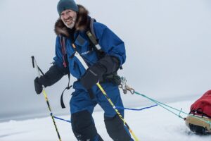
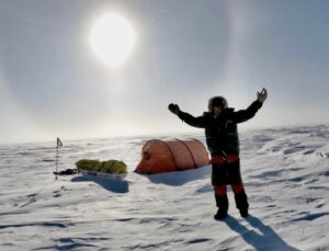
Mike Horn “flying” over crevasses. Risto Hallikainen racing the clock. Małgorzata Wojtaczka nearing 89ºS. Guidelines for NGO Visitors to the South Pole Station.
January 19, 2017 UPDATE
Vesa updated about Risto: “He is about to reach 82ºS, and has skied lately 50-60 kms per day. He reported last three days has been whiteout, and forecast says there is three more ahead.” Risto has basically 220 km left to cover, of his 2260 km return journey.
January 18, 2017:
Mike Horn has close encounters managing his safety in strong winds and going downhill. He has already covered about 27 degrees of latitude. The British men are also going downhill and should finish on the 20th at the bottom of the Shackleton Glacier, on the Ross Ice Shelf (about 15 degrees of latitude). Risto has to cover ultra marathon distances to complete his 2260 km (20 degrees of latitude) before the season closes.
Guidelines for NGO Visitors to the South Pole Station
When Mike Horn was at the South Pole, he talked about the Rules he had to obey at the Pole and his “freedom of choice gets taken away.” Apart from the skyway and many flights coming in per day, there are several research areas around the South Pole, for example, the Clean Air Sector, the Dark Sector, the Downwind Sector and the Dark Sector. Bill Spindler gives details and maps about the management plan, which “basically outlines the NGO access restrictions in various areas… restrictions on uses of chemicals and melting of snow… access to unsafe areas… and similar procedural guidelines.” All revised for 2016.
S70.1015 W009.8249 start point, kite traverse, Mike Horn ZA/CH.
January 13, 2017: S 87º 56′ and E 149º 23’. Covered 50 km.
January 14: S 87º 56’ E 149º 23′. 0 km, lack of wind.
January 15: S 86º 18′ E 143º 52’. 185 km in 12 hours.
January 16: S 85º 10’ E 144º 50′. 130 km. He needed a 2 square meter kite in 35 knots wind, and landed on his head when his ski got caught in sastrugi.
January 17: S 82º 57′ and E 143º 16’ He said he did his best distance, 247 km, and kited over and around 2-meter high “ice mounts” and flew over crevasses. Going downhill, the sled caught up with him. He had to stop for the day because his sled got damaged in the sastrugi and he could have lost most of his equipment if he hadn’t stopped.
January 18: 211 km. Altitude 2270 m. Used 12.5 square meter kite. “I crossed maybe 18 massive crevasses on snow bridge very uneven ice and gusty winds. Each KM I do is hard work at the end of the day. Another 1600km to go.”
Hercules Inlet 80ºS return Journey, Risto Hallikainen (FI, no kites): November 14, 2017: Vesa Luomala sent the following news about Risto: “Risto has now crossed the halfway line on a way back home and picked up second depot (one to go). He is still putting in long days and says he has to ski near to 50 km/day last days to reach the target. All well with him!”
Jan 17, 2017 4:22 PM Lat: -83.086821 Lon: -79.978408 Elevation: 1,063.34 m
Jan 18, 2017 3:44 PM Lat: -82.605063 Lon: -79.538548 Elevation: 1,007.21 m.
Lou Rudd (leader), Oliver Stoten, Chris Brooke, Alex Brazier, and James Facer-Childs (ALL UK) Hercules Inlet traverse to Shackleton Glacier, no kites: The Army Reservists had passed the late Henry Worsley’s last campsite and held a memorial service for him on the Roberts Massif. Lou and James headed out on a recce (Day 61) up the Massif. Working their way up, they fell into a crevasse, up to their armpits, but were suitably equipped, and able to extract themselves. “We carried on, on crampons, with some safety gear, and gradually worked our way up, right up onto the real high point on the Roberts Massif. And when we got onto the top, it was absolutely spectacular. The views were incredible. […] So we decided this was the ideal location and the appropriate place to conduct a suitable memorial for Henry.” Full details of the ceremony will be revealed when they get back home.
The men got down, a storm came in, and they were tent-bounded for a day. James reported from the tent, “The winds are howling around outside, and the chill factors of -57, spindrift and snow flowing throughout the air.”
Chris reported on Day 63 that they continued down the Zaneveld Glacier, which was filled with crevasses. He was walking (his one ski binding broke) and fell through a crevasse up to his armpits. This one was “maybe 10 feet deep. And then literally some, you just couldn’t see the bottom, it was so far down, so it was quite scary.”
Day 64 was their first full day proper on the Shackleton Glacier, reported Lou. They were walking the whole day on crampons on the rippled blue ice. Controlling the sleds passing them and running into the back of their legs, were challenging. Again a lot of crevasses, and between them, they fell in “probably 25-30 times.” Finding snow to camp on and make water with, was a mission on the ice surface. 50 nm to the end.
Hercules Inlet 80ºS unassisted unsupported to the Pole, Małgorzata Wojtaczka (PL, solo): January 11 she reported that she handles the cold well. She has “practically” no frostbite. Her feet are warm in her boots. As hand protection, she wears a thin pair of woolen gloves inside, what seems to be, pogies, according to her description. She has attached them to her ski poles. To set up camp, Malgorzata has gloves filled with primaloft. She also tells about the dry air, which skiers notice well on the plateau. 88° 02.683S, 082° 21.465W.
On January 15 she was at 88° 35.263S, 082° 28.307W, so no more steep climbing, but still headwinds. Temperatures are much colder (-30ºC) and she pays attention to dressing warmer, covering up her face, and protecting her hands. Fresh snow made sled-pulling hard work. She said, to achieve her daily distances she has to increase her daily skiing time. Malgorzata says she is running a bit low on food. ALE offered to drop her extra food but, after consulting with her home team, she decided not to take up their offer. She says she wants to do her expedition without outside help.
Ed note: According to the Classifications on AdventureStats, drafted by veteran explorers decades ago, claiming a ‘solo’ expedition, a skier, climber, rower, trekker, sailor, cyclist, pilot may not receive any assistance/supplies/food from anybody. A few days ago, solo sailor Lisa Blair postponed her Antarctica Circumnavigation due to problems with her boat. ”Because the circumnavigation is expected to take 3 months and [the solo] does not permit land stops, personal contact with another person, or assistance of any kind, a decision has been made to delay the departure …” On Antarctica ski routes, it had previously happened that skiers, who were not far into their expedition, had started over, to keep their unassisted status. Related articles:
Marcin Gienieczko and the Great Guinness Hoax
Queen Maud Land climbing: Patrick “Pata” Degerman (Fi, leader), Pekka Ojanpää (FI), Mika Listala (FI), and Jón Ólafur Magnusson (IS). Last week Pata reported that they could not fly out of Novolazarevskaya because the surface of the runway was too soft for the Ilyushin-76 to land on. They flew to the Norwegian Research Station, Troll, one hour away by Twin Otter. Their gear and snowmobiles were taken there by Basler. The IL-76 could land at Troll’s blue-ice runway.
Interactive Map: Antarctica Skiing Routes
2016-17 Antarctica Ski Expedition List
Follow team blogs in the Dispatch stream on pythom.com
South Pole 2016-17 Interviews on Explorersweb/Pythom:
Exweb South Pole Interview with Johanna Davidsson: kite return attempt
Interview with Pata Degerman: Longest Snowmobile attempt on Antarctica
[UPDATE 2] Risto Hallikainen, solo South Pole return ski attempt (Interview)
1989: Arved Fuchs traversed Antarctica, with Messner (Interview)
Ryan Waters to guide Fuchs-Messner route (Antarctica 2016-17 interview)
Canadian Sébastien Lapierre to attempt solo ski to South Pole (Interview)
Cycle Antarctica: Hank van Weelden Pole to Coast attempt (Interview)
Emma Kelty: speed ski and return attempt (Exweb South Pole interview)
Eric Philips, South Pole 2016-17 New Start Point attempt (Interview)
Previous/Related on Explorersweb/Pythom:
First Female Antarctica Circumnavigation attempt
Johanna Davidsson completed Return; Emma Kelty in Hospital – UPDATED
Exweb/Pythom Best of 2016: Girard’s Flight of the Century… and more
Johanna Davidsson set New Solo Female Speed Record
Editorial: Might is The Answer to Why (Updated)
Antarctica Current: Polar How-To-Guide Heads-Up
HumanEdgeTech Expedition Technology (e.g.CONTACT software)
AdventureStats.com for Polar Statistics and Rules. Note that a solo claim has to be unassisted,
therefore no supplies carried by pilots or car drivers, or anything (food, fuel, etc) received from any person along the way. A solo person may be wind supported (kites/sails). Claiming to have ‘skied to the Pole’, a full route (from a coastal start point) has to be completed, without flying part of the route.
1 nautical mile = 1,852 km
Hercules Inlet is located at 80°S near Union Glacier, 1130 km from the Geographic South Pole.
The Fuchs-Messner start is 890 km in a straight line from the Pole.
Novo to GSP is 2,140 km in a straight line
Novolazarevskaya to South Pole of Inaccessibility (POI) is 1610 km in a straight line.
South Pole of Inaccessibility (POI):
2011-12 position: S82°06.696, E055°01.951 (Copeland/McNair-Landry)
On Dec. 14, 2014 Frédéric Dion reported the position the POI (at Lenin’s bust) as S82º 06.702′ E55º 2.087′ at an elevation of 3741 m.
Geographic South Pole (GSP): 90 degrees South
Gateway port Cape Town, South Africa:
To ALCI /TAC base camp Novolazarevskaya / Novo
70° 46’37”S, 011° 49’26”E
Gateway port Punta Arenas, Chile, South America:
To ALE base camp, Union Glacier
79° 45’S, 083° 14’W elev 708m
Lat: -79.760591 Lon: -82.856698
Weather:
https://www.yr.no/place/Antarctica/Other/Union_Glacier/
ALE Union Glacier weather cam 79º 46’S, 83º 16”W
South Pole webcam 90ºS
#polar #antarctica #Southpole #thepoles #skisouthpole

