Can an island be “undiscovered?” Apparently, it can. Throughout the centuries, explorers have mapped thousands of islands, some of which turned out to never have existed. These glitches in the cartographical matrix are called phantom islands. Here, we explore five such elusive specks of land.

Elizabeth Island
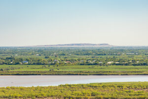
From 1577 to 1580, Sir Francis Drake was circumnavigating the globe. Among many other achievements, he became the first Englishman to navigate the Strait of Magellan in southern Chile. While passing through this area in order to get to the Pacific, he and his men became caught in a tempest.
They took shelter on an unidentified island at 57° S for four days. The island had an ample supply of wood, a freshwater lake, herbs, and berries. After recuperating, they left, but not before claiming the island for the Queen and naming it Elizabeth Island. Drake also called the harbor in which he and his men anchored Port Sir Francis Drake.

Sir Francis Drake. Photo: German Vizulis/Shutterstock
Several historical documents, including those from the expedition’s chaplain and Drake’s colleague Richard Hawkins, speak of the island and its details. Maps showed its location until 1747. Subsequent voyages never came across the island, and many began to doubt its existence.
Historian Felix Riesenberg attempted to explain this vanishing act in his book, Cape Horn. He believes that Elizabeth Island disappeared in a volcanic eruption. After learning about the island’s features in the notes of Drake’s chaplain and contemporary maps, he found that the island had volcanic characteristics. He also noted the geology, earthquakes, and volcanism in that area. He concluded that “the island of Elizabeth might have been blown to kingdom come a year or so after Francis Drake left.”
Also backing up his claim is the existence of the Pactolus Bank, which he says is in the same position as Elizabeth Island. The bank, which is most likely a deposit of volcanic material, has disappeared and reappeared. Riesenberg suggests that the bank was initially part of Elizabeth Island.

Elizabeth Island lay in the Strait of Magellan. Map: World Atlas
Thule
Many sources from antiquity and the Middle Ages speak of a mysterious island in the far north. These classical scholars spoke of Thule as a place that lacked sunshine and experienced heavy rains but abounded in fruits, grain, and honey. Isidore of Seville and the historian Avienius claimed that Thule experienced a midnight sun.
Some linked Thule’s residents to the Scottish Picts, who painted their bodies blue. Thule was approximately a six-day sail from Britain over a frozen sea. According to wacky German occultists during the Second World War, Thule was the birthplace of the “superior” Aryan race.

Map including Thule. Photo: Olaus Magnus (1539)
Clearly, Thule was an arctic realm, but where? From Ireland to the Shetland Islands, to Scandinavia or the Estonian island of Saaremaa, the scholarly hunt for Thule continues. According to writer Rolf Gilberg, “As the frontiers of exploration gradually expanded, the legendary Ultima Thule acquired a more northerly location.”
The midnight sun detail is also very telling. A place needs to be north of the Arctic Circle to experience the midnight sun.
After referring to ancient maps and using modern geographic technology, geologists from the Technical University of Berlin determined that Thule might be the island of Smola in Norway.
The name Thule is not exclusive just to this legend. You can find several Scandinavian areas with the name, especially in Greenland. Famously, it refers to the place and culture of Northwest Greenland, the most northerly inhabited place on earth. But this name came long after the legend — Europeans did not discover Thule until 1818 — and the original Thule remains elusive.

Thule Air Base, Northwest Greenland. Photo: Jerry Kobalenko
Hy-Brasil
Do not confuse this phantom island with the South American country. According to some, the name Hy-Brasil is rooted in Irish myth and etymology, after the clan name Uí Breasail. It first appeared on maps in the 14th century under various spellings. Different versions include “Bracile,” “Illa de Brasil,” and “Brasil Rock”.
Supposedly, this mythical island lies a few hundred kilometers west of Ireland. Perpetually shrouded in thick mist, it revealed itself to onlookers just once every seven years. On maps, the island is circular with a river flowing straight across it.

Map of Hy Brasil. Photo: Diego Gutierrez, 1562
It also bears the nickname, Isle of the Blessed. The island acquired a magical connotation, not just because of its ability to vanish and reappear.
Some claimed to have set foot on the island. One famous report in 1674 from a Captain John Nisbet recalls the island housing strange black rabbits. He also met a resident necromancer who lived in a castle, he said. Nevertheless, maps began to phase the island out around 1873.
A shallows called the Porcupine Bank lies very close to Hy-Brasil’s former position on maps. Many cite this as the fabled island. It would certainly explain how it disappeared from the action of tides, waves, and erosion.

The supposed location of Hy-Brasil.
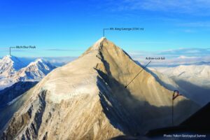
Nimrod Islands
Captain Eilbeck aboard his ship Nimrod first spotted and named the Nimrod Islands in 1828. According to maps, they lay southeast of New Zealand, between the Emerald and Dougherty Islands, which happen to be phantoms as well. There is not much information about their physical features or inhabitants. Strangely enough, it did not stop explorers from trying to find the unexplored place.

Nimrod Islands. Photo: J. K. Davis
English explorer John Biscoe, known for his 1830-3 Southern Ocean expedition, tried to find the elusive group of islands in 1831. Almost 80 years later, Australian explorer John King Davis launched his own expedition after serving as chief officer on Ernest Shackleton’s Antarctic Expedition of 1908-9. He found no sign of the group.
Norwegian Lars Christensen undertook the last search attempt in 1930. Still nothing. By 1940, mapmakers stopped including the Nimrod Islands on maps.
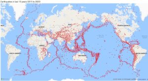
It is possible that the islands were a result of the Fata Morgana phenomenon, a common mirage in the polar regions. Arctic exploration likewise has illusory discoveries — the Croker Mountains and Crocker Land — pinned, perhaps spuriously, on mirages.

Mirage of land over the Arctic Ocean. Photo: Jerry Kobalenko
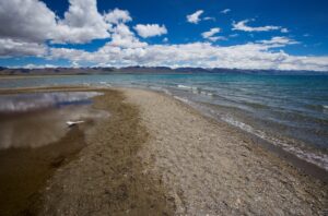
Kianida Island
Kianida or Cyanida Island lay off the coast of Thrace in the Black Sea, bordered by what is now Turkey and Bulgaria. It appeared on maps in ancient times, particularly Ptolemy’s Geography and Nicolaus Germanus’s 1467 version of that book. Much like the Nimrod Islands, we don’t know much about it except its large size depicted on maps.
Bulgarian geomorphologist Dinyo Kanev shed some light on what might have happened to it. He claims it might have sunk or been destroyed by earthquakes and erosion sometime around the late 1400s or early 1500s, based on geological evidence on the Black Sea coast.