In September 2023, a colossal landslide in East Greenland triggered a mega-tsunami in remote Dickson Fiord. The vibrations were felt around the world for nine consecutive days. For a year, scientists have grappled with what caused the incident.
The area where the landslide and tsunami occurred is uninhabited, but monitoring stations across the world picked a huge seismic signal. The readings showed waves ricocheting back and forth through the fiord every 90 seconds.
Although no one lives there, cruise ships do enter the fiord. Luckily, none were there that day. However, one did venture into the fiord the following day and noticed that on nearby Ella Island, a research station’s boat and a shipping container, both usually on land, had been washed out to sea. The station itself was also damaged.
Unidentified Seismic Object
Kristian Svennevig from the Geological Survey of Denmark and Greenland (GEUS) suspected an earthquake or a tsunami. But the nine days of reverberations baffled scientists. The vibrations did not match those of an earthquake or tsunami. They dubbed the incident a USO — an Unidentified Seismic Object.
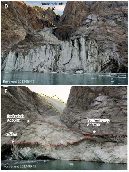
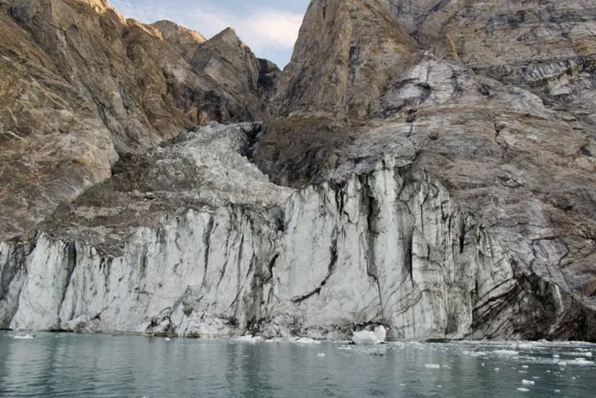
D) Shows the position of the mountain ridge that collapsed in a massive landslide. E) Shows the disappearance of the mountain ridge and markers of the tsunami triggered by the landslide. Photo: K. Svennevig et al.
Svennevig and 68 scientists from 15 countries spent a year trying to figure it out. They used everything from seismometer data, satellite imagery, field measurements, and tsunami simulations to piece together what actually happened.
The first thing they looked at was satellite imagery and aerial photos. This revealed that vegetation along the shoreline of the fiord had been wiped out. On Ella Island, plants had disappeared up to four meters above the water line. This distance increased as they looked at more westerly photos. This indicated that the waves must have come from the west and moved eastward.
Sloshed back and forth for nine days
Other satellite photos, taken on September 15 and 17, the days before and after the tsunami, revealed that a mountain ridge west of the fiord had disappeared. Approximately 25 million cubic meters of rock and ice from the mountain had plunged into the sea, generating a 200m-high tsunami that sped along the fiord at 160kph. The waves fell to seven meters within a few minutes but bounced back and forth for nine days against the cliffs of the fiord, gradually getting smaller and smaller.
Tsunamis usually dissipate after a few hours but this one was trapped in the narrow fiord and couldn’t.
“This landslide happened about 200km inland from the open ocean, and these fiord systems are really complex, so the wave couldn’t dissipate its energy,” Stephen Hicks, co-author of a paper on the event, told the BBC. “We’ve never seen such a large-scale movement of water over such a long period.”
The study concluded that climate change caused the initial landslide. The glacier next to the fiord sits at the base of the mountain and supports it. As the glacier thinned from rising temperatures, it became unable to support the overlying rock mass, leading to the catastrophic collapse.
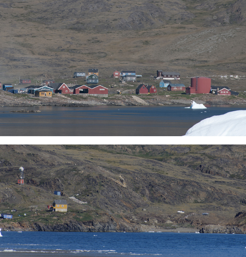
Nuggaatsiaq, Greenland two months after the tsunami. In the lower photo, note the two boats that the wave flung high above the beach. Photos: Jerry Kobalenko
Another tsunami
A similar event occurred in Greenland in 2017. A landslide fell 1,000m into Karrat Fjord and set off a 100m-high tsunami. By the time it hit the remote community of Nuggaatsiaq, it was nine meters high. Four people were killed and nine were injured. Buildings were washed out to sea, boats landed 50 meters uphill. All residents were evacuated, and the settlement is now abandoned because of the ongoing threat of landslides.
Researchers are calling for enhanced monitoring of mountainous regions to protect people from similar events, which will happen more often as the climate warms and the ice that glues the frozen mountains together thaws.
