The British Antarctic Survey (BAS) has released an interactive map of Antarctica. It combines information on coastlines and contours and is available to everyone from tourists to researchers to the merely curious.
Antarctica is constantly changing due to climate change, and many of its frozen features have become out of date. New data keeps up with these changes, and the frequently updated map reflects the latest details about the White Continent.
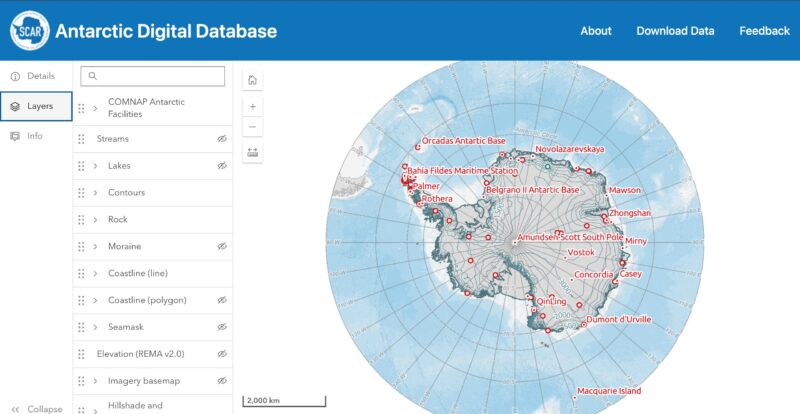
The interactive map. Photo: Antarctic Digital Database
The Mapping and Geographic Information Centre (MAGIC) at BAS maintains the Antarctic Digital Database. The database began in 1993, as a CD-ROM of existing topo maps. The BAS and other research organizations have expanded that information over the decades.
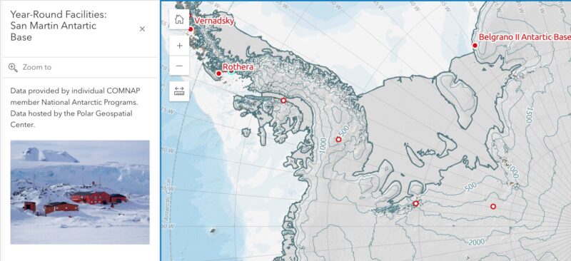
The map shows moraines, outcrops, contours, lakes, streams, and coastlines. Small red dots on the maps highlight an ice formation, land feature, or research base. Clicking on it gives specific information about that particular place, including photos, elevation, and the source (and age) of data.
The solid red dots indicate research bases; the hollow dots, depots and other features. Photo: Antarctic Digital Database
This release ties in with the map’s latest update, which focuses on Antarctica to 60°S. The BAS updates the maps every six months and is reaching out for feedback from anyone who has used them in case inconsistencies exist.
The new map even shows the giant icebergs that have recently separated from the continent, the ice shelves that still grow in some areas, and the changing coastline of the South Orkney Islands. New islands, exposed by retreating glaciers, are added to the map.
The BAS hopes that the maps will help advance polar research. “Free and open access to reliable data is extremely important in all areas of Antarctic work,” says mapping specialist Laura Gerrish.