Seizing an improvement in the weather, the Climbalaya team on Shishapangma has launched their summit push.
The team is the only international expedition to climb in Tibet since 2019 and is the only one with a permit for this spring. It comprises six Sherpas, Kristin Harila of Norway, Sophie Lavaud of France/Switzerland, and Viridiana Alvarez of Mexico.
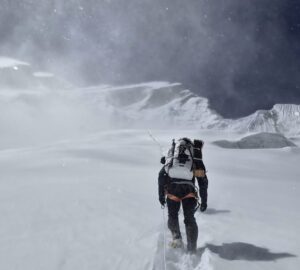
Alvarez is the only one who is posting short messages via her InReach. Thanks to it, we know that the climbers spent a night in Camp 2 and moved up to 7,150m — their highest point so far, according to Alvarez. They then returned to Base Camp. This was their first (and apparently only) rotation up the mountain.
Sophie Lavaud confirmed to her home team that the team was unable to reach Camp 3’s usual location at 7,300m because of very high winds.

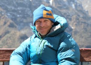
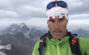
File image of Viridiana Alvarez of Mexico. Photo: Viridiana Alvarez/Facebook
Alvarez reports that the team is spending Sunday night in Camp 1 on their way to the summit. She also mentioned she has a swollen ankle after a fall during the descent to Base Camp on Friday. “[Going up] with a blue, swollen ankle, but excitement at top level,” she texted today.
A tricky way to the top
If the team moves one camp a day, they should be ready for the final push on Tuesday night. Shishapangma’s normal route usually involves three camps, the last at around 7,300m.
It is unclear if the Sherpas managed to fix ropes beyond 7,150m. But even that altitude should be enough for a final rest before the summit push, especially if the team uses supplementary oxygen.
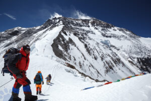
After Camp 3, they will have to make an important decision about which way to go. They may opt for the long summit ridge across Shishapangma’s central summit at 8,008m, and then along a knife-edge snow ridge to the highest point — the peak’s eastern summit at 8,027m.
Or they may climb a variation route, up one of the couloirs leading to the highest sections of the summit ridge. This option is increasingly popular among expeditions on the normal route. Although harder than the first part of the ridge, it leads directly to the highest point.
Either way, the team will need to look around carefully and make sure they are at the highest point.

The red line marks the team’s first and only rotation. Map: FaceBook