Tim Howell and guide Jon Gupta of the UK arrived in Everest Base Camp yesterday to join the hundreds about to climb Lhotse or Everest. But their plan is dramatically different. Howell wants to make the highest altitude wingsuit jump ever. This involves not only the default high risk of wingsuiting from that altitude. He and Gupta will have to climb unknown ground above 8,000m to the jump point.
From Base Camp, Howell and Gupta immediately advanced through the Khumbu Icefall to Camp 1.
Next, with Siddhi Tamang of Himalayan Guides in front, they will head up to Camp 2, common to Everest and Lhotse. There they will rest and then advance straight to Lhotse’s Camp 4. That lies around 7,600m, between the Yellow Band and the Geneva Spur.
In Camp 4, they will wait days if necessary, until the wind and weather are just right. At that point, things get really exciting.
New route, but not to the summit
As Howell explained in a recent interview with ExplorersWeb, he is not interested in summiting Lhotse. Nor does the style of the climb matter, which is why sherpas and supplementary oxygen will assist the pair all the way.
Howell’s goal is simply to wingsuit from the highest possible point on Earth, which happens to be on the ridge of Lhotse. To find a suitable shortcut, they will traverse the upper face of Lhotse via a new, unclimbed variation.
That new line does not lead to the summit, but lower down to the ridge, closer to Nuptse.
“From Lhotse’s Camp 4, we will follow the normal route up the couloir, then probably head off and fix a new line across to the exit point,” Gupta told ExplorersWeb from Base Camp. See the photo below.
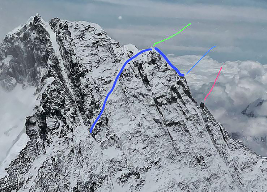
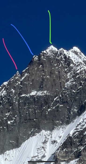
The Lhotse Face and the planned traverse route, leading to the ridge some 500 meters below the summit. They must find a suitable exit point somewhere along the blue line on the right. The blue line to the left is the new variation. The green and pink lines mark mountain features for orientation purposes. Photo and topo: Jon Gupta
” ‘Cutting the corner’ hopefully saves some time and energy…and is a more direct line,” Gupta said. “There are still a lot of unknowns. We need to fix approximately 600m [of rope] to the area where we hope to find an exit point.”
If the traverse isn’t feasible, they will shift to plan B: summit and then try to climb “across and down” toward an exit point.
The team will be in completely unknown and probably highly difficult terrain. They are not on the Everest-Lhotse ridge, but on the other side: the East Ridge leading to Nuptse.
The proposed exit point on the ridge will also be unclimbed terrain. The Soviet team that first climbed the entire South Face of Lhotse in 1990 arrived at the col just below the main summit, said Edward Morgan, author of Lhotse South Face: The Wall of Legends. A Japanese team reached further west along the ridge in 2009, but still close to the summit.
The West Ridge has been visited on two other occasions, Morgan went on. “By Knez and Matejevic in their 1981 climb onto the ridge (but they were a lot lower down, around 8,000m) and by Cesen (if we accept his account), who reached the ridge a few hundred [horizontal] meters from the summit. Cesen would therefore have been nearest to the point that Howell and Gupta are aiming for, but his route was closer to the summit.”
Either way, reaching that point may be as difficult as the wingsuit flight itself.
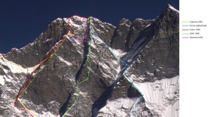
The routes on the South Face of Lhotse; the 1990 Soviet ascent is in green. Topo: Edward Morgan/Facebook
Possible exit point in blue, on a photo of Lhotse’s South Face. Photo: Jon Gupta
Gupta explained that the pink line marks a rocky finger on the ridge, and the green line points to a small summit marked on Google Earth as Lhotse Nup Peak.
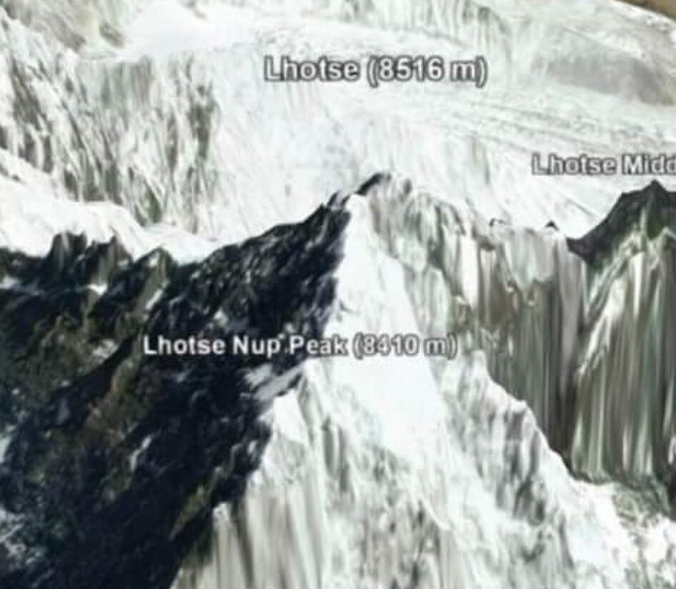
Lhotse and Lhotse Nup on Google Earth.
New landing point
Howell explained that he had spotted the potential exit point in a helicopter recce last fall.
“[The flight] made me sure there is an exit on Lhotse South Face but not on Lhotse Shar, even though I thought it would be the other way around,” he wrote on Instagram.
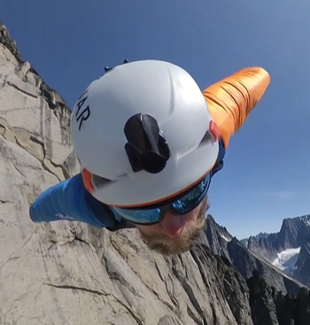
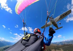
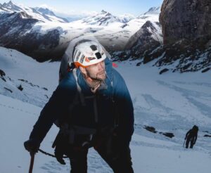
Howell on a previous jump. Photo: Instagram
Howell originally planned to land in the village of Chukung but has reconsidered.
“Landing in Chukung would also make it the longest flight in history, but I don’t like the margin for error, so I’ve decided to play it safe and land near the Island Peak base camp. [It’s] a sandy field where high-altitude cricket has been played in the past. The flight will be 3,000m in altitude loss and around 6km in distance.”
Howell realizes that because of the thinness of the air, he’ll be flying faster than normal. “I’m expecting to be flying at maybe 260kph,” he said.