With spring just two weeks away, it’s almost time to hang up the ice axes and screws until next winter — unless you go really far north.
Above the Arctic Circle, the sun has returned after the winter darkness. Swedish Lapland offers excellent ice, good access, and magical light. This is where Fredrik Strang spends most of his time between the Himalayan seasons. Rather than an 8,000er climber, the aspiring IFMGA guide considers himself an ice climber most of all.
“Compared to rock, which is immobile, ice is alive,” he says. “I feel it is feminine and masculine at the same time. It requires a climber to be vigilant, and attentive like a ballet dancer. At the same time, it demands determination and strength.”
The best ice climbing in Swedish Lapland is northwest of Kiruna, mainly in and around two of the northernmost national parks in the country. Abisko National Park stands about 195km north of the Arctic Circle, and Stora Sjofallet (Great Lake Falls) National Park is slightly southeast, just 20km inside the Arctic Circle, on the Norwegian border.
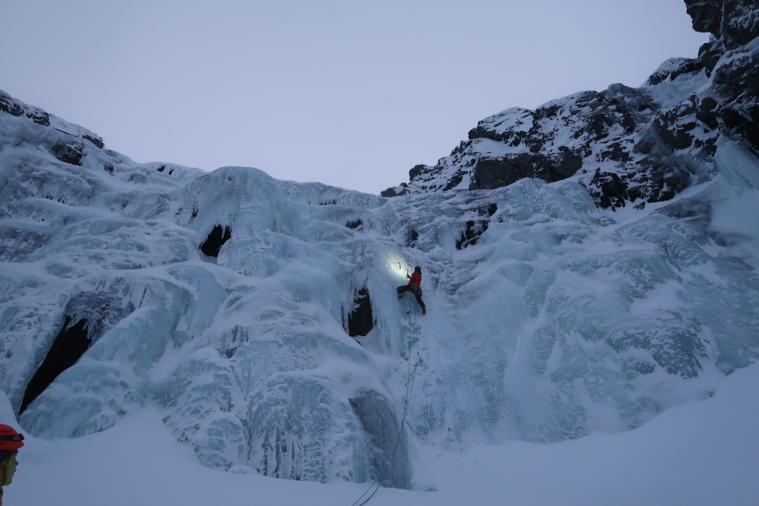
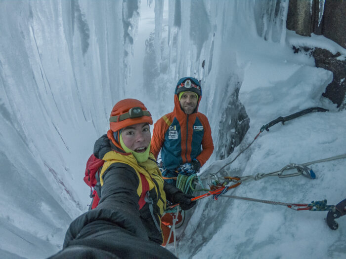
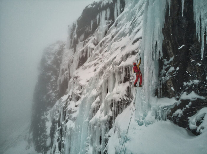
Fredrik Strang rappels down an ice route at Loktatjakko. Photo: Fredrik Strang
Under northern lights
“Normally at this time of the year, [ice routes within the Arctic Circle] are safe to climb everywhere,” Strang said.
The best time to go is from the end of February into March. “Winter is too dark and too cold,” he explained.
The second half of November is also an option for those wanting to enjoy the dimming arctic light and the northern lights.
“The key is to have some sun, even if only for a few minutes,” he says. “It creates this fabulous light with a pink sky. It’s like having a six-hour sunset.”
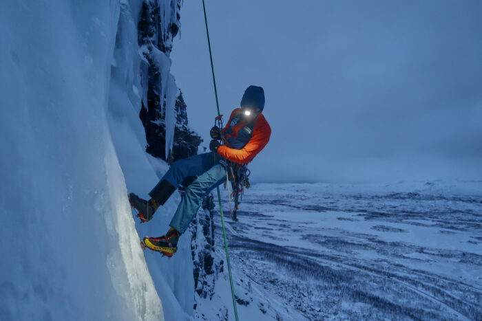
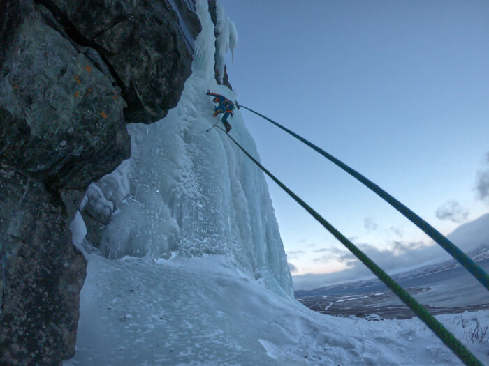
Joda Dolmas rappels down Istappslinjen, WI4, 80m. Kaisepakte. Photo: Fredrik Strang
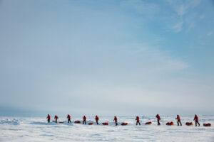
Another advantage of Lapland is solitude. “You don’t have any competition on the same route,” Strang said. “It’s the opposite of other ice climbing spots in Europe, with climbers crowding all routes. Here, you are almost guaranteed you’ll have no one else around.”
Self-sufficiency needed
However, this also means you must be self-sufficient. If you get into trouble, a helicopter pickup or ground rescue may take hours. “You need to be a competent climber and skilled in risk management,” Strang noted.
There is a cell connection, but only for phones operating through Telia, Sweden’s biggest mobile network operator. Otherwise, a satellite device is recommended.
“Carrying an InReach is a good idea because if your phone runs out of batteries up there, you’ll be totally isolated. InReach batteries last longer and can send SOS signals in case of trouble.”
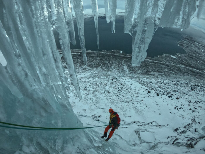
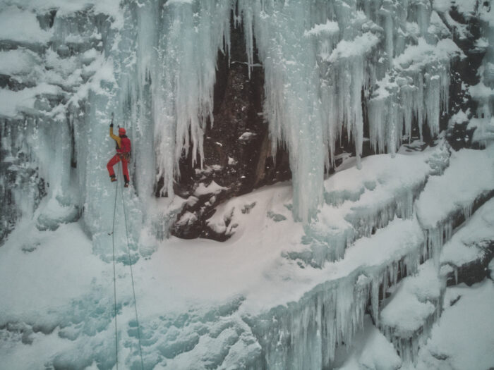
Climbers amid a curtain of icicles. Photo: Fredrik Strang
Base Camp at Abisko
Abisko is a great first stop for those new to the area. A train runs from Stockholm to Kiruna. “Here, you can rent a car, buy groceries, and drive to Abisko,” says Strang. “Or you continue by train to Abisko and stay at the full-service Abisko Mountain Lodge.” It even offers guided trips to the ice.
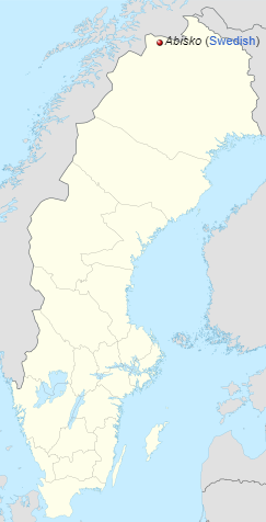
Abisko is in northern Sweden, east of Norway and west of Finland. Map: Wikipedia
For more self-sufficient climbers or those on a tight budget, the most economical option is to carry and cook your food. “Anyway, it will be completely dark by 2:30 pm, so you’re going to have plenty of time to cook!” says Strang.
The simplest option: the STF (a privately owned hiking association) runs the Abisko Touristation, a big (200-bed) hostel with open kitchen areas and a sauna. There are other options in the village, but it is wise to check whether they are open in winter.
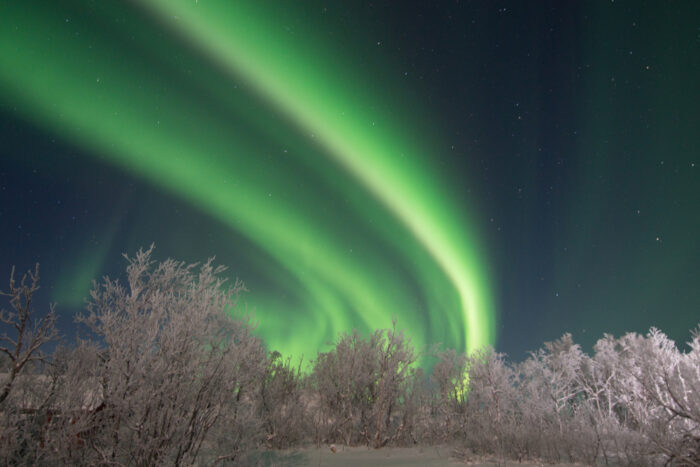
Northern lights in Abisko National Park. Photo: Shutterstock
As for daylight at this time of year, the sun starts peeking over the horizon around 9 am.
“Bear in mind that most ice routes are north sides, and the sun will not be visible,” Strang said. “But you’ll see the pink horizon, immaculate and stunning.”
Approaches
The best way to approach the waterfalls is by car. Winter is dark and bitter cold, with lots of snow, and the avalanche danger is usually high. Temperatures in November range from -8˚ to -12˚C, which is bearable. There are places along the road to park, and train stations also have parking areas.
“It is essential to study the approach to the waterfalls carefully, or you risk spending the entire light of day and your energy just getting to the route,” Strang said. “Some approaches involve a lot of ups and downs, fences to climb over, thick birch forests, and slippery rocks. Check if you need snowshoes or skis, in case there is a lot of snow.”
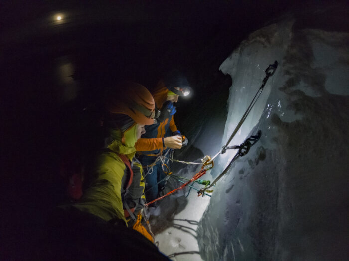
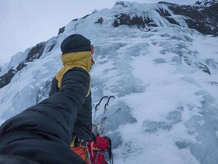
Fredrik Strang and Joda Dolmas topping out in full darkness on Huvudväggen (WI4-5, 90m) on Kaisepakte. Photo: Fredrik Strang
In the coldest months, some areas are accessible by walking over hard snow, with no need for skis or snowshoes, but that is not the norm. Check the conditions by asking locals in advance.
Favorite spots
For Strang, Gomda Dalen (Hidden Valley) is a special gem, an amphitheater filled with frozen waterfalls. It’s relatively accessible and has lots of routes from WI3 to WI5, plus some couloirs and mixed routes for those with rock gear.
“It is a beautiful, serene place with lots of options,” he says. “Make sure you get up early and get there by first light. You’ll need all day to make the best of it.”
Joda Dolmas in the muted light on Huvudväggen WI4-5, 90m, Kaisepakte. Photo: Fredrik Strang
Also famous is Abisko Canyon, a gorge formed by the Abisko River, beside the E-10 (which links Kiruna and Norvic in Norway). The canyon offers a confined space with many routes and pristine blue ice. Most lines are short, less than 15 meters, but they are a great warm-up for your first day in the region.
“The ice may be quite chopped-out, since many locals go there,” said Strang. “Otherwise, it’s a very photogenic spot. If you like selfies, it’s the place for you.”
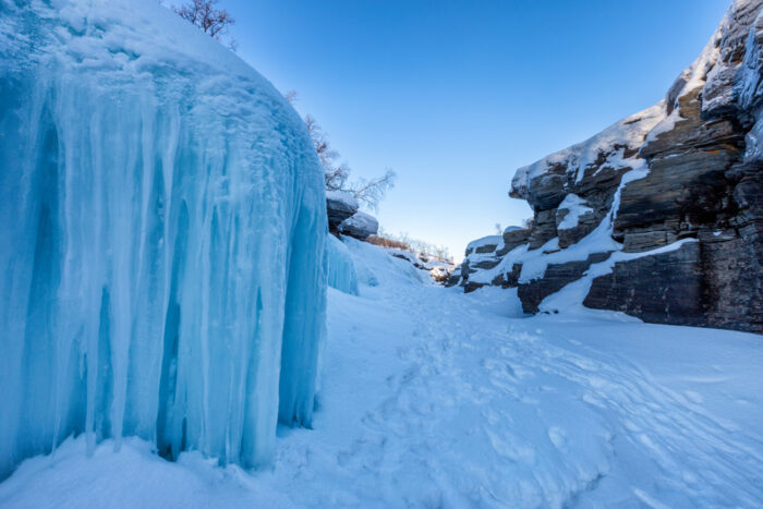
Blue ice at Abisko Canyon. Photo: Shutterstock
Driving for another five mins on E-10 toward Norway, on the left side, is a wall with half a dozen lines. You can park right beside the road, practice short routes, and see the iconic Lapporten, a perfect U-shaped col between two flat-topped mountains. It’s the best-known landmark in Abisko National Park.
‘Stora Bla,’ WI4-5, 60m, on Loktatjakko. Photo: Fredrik Strang
Stora Bla (Big Blue), a WI5 icefall, is also worth a try. Another, Baby Blue, features numerous routes but a tricky approach that depends on snow conditions.
See more routes in this guide compiled in 2014 by Rick McGregor.
Dolmas on Huvudväggen. Photo: Fredrik Strang
Style and ethics
In general, a no-bolt philosophy applies to the area. “If you want to climb a mixed route, please refrain from bolting” Strang notes. “Just be careful, because the rock is quite loose unless it is properly frozen.”
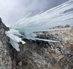
Istappslinjen WI4, 80m. Kaisepakte. Photo: Fredrik Strang