Peter van Geit spent three months during the initial lockdown creating online trail maps of 2,000 passes, 700 alpine lakes, 50,000km of trails and 25,000 remote hamlets across the Western Himalaya. Now that restrictions have eased, he is off to fast hike the state of Uttarakhand for four months along the trails he has mapped. Averaging 30km a day, he will cover approximately 5,000km and cross over 150 mid-level passes by March 2021. “The Himalaya in winter will be quite the experience” compared to his previous summer treks, van Geit admits.

Photo: Peter van Geit
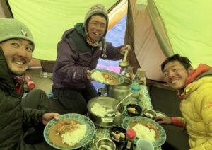
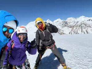
The Belgian-born ultra-runner, who now lives in India, started his traverse of Uttarakhand in Mussoorie, on November 20. After just a few kilometres, the first snowy peaks hove into view. Already, van Geit has had to adapt his minimalist style to the more severe conditions. With subzero temperatures overnight, he is trying as much as possible to replace camping with community stays.
During his first couple of weeks, he is also burning more calories than usual, so he has to stock up in rural villages every few days, to keep his kit light. So far, villagers have welcomed him into their homes enthusiastically, for meals or an overnight stay.

Photo: Peter van Geit
Many of the routes on his maps are unexplored, and “sometimes the maps are pretty accurate, other times the trails are no longer in use and completely overtaken by forest,” he says. Routes confirmed on the ground will be recorded by GPS and added to Open Street Maps by his team at home, “so that anyone in the world can hike these beautiful routes through the previously undocumented Indian Himalaya.”

Photo: Peter van Geit
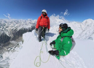
Van Geit has already gone astray on multiple trails because of snow cover. Last week, as he made his way from Kharadi to Chatralli, deep snow forced him to abandon an attempt at 4,000m Darwa Pass. He tried an unnamed lower pass at 2,700m, but 200m below the ridge, the trail vanished in deep snow.
Eventually, he discovered a new, negotiable pass at 2,640m, but the snow kept him from finding his way back down. He tried traversing a narrow ridge but aborted this because of its steepness. He backtracked until he came upon the prints of a man and his dog. When these faded, he continued along a gradual ridge until he was once again below the snowline.

Photo: Peter van Geit
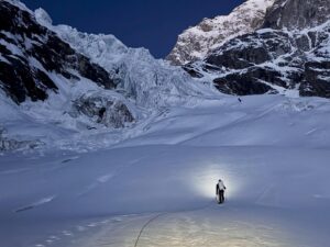
After overnighting in the mud home of a tribal family in the remote village of Chatrali, he set out again. The trail started out well but soon “a uniform white blanket covered the forest floor” and he again lost the way. He continued, following his map, but as he approached the pass, it became steeper and he had to wade through knee-deep snow.
His main fear was that he might not find a safe way down, given the steepness and uncertain footing, but after a 1,300m descent, half-postholing, half sliding, he made it to the “beautiful hamlet” of Gaioli, embedded on a mountain slope surrounded by high peaks.

Challenging terrain. Photo: Peter van Geit
On November 30, after a 10-hour hike with no water, he reached Jamal, in the Bhagarati River valley. Although the snow cover and overgrown trails have forced a trial-and-error approach to some extent, he has already amended his charts, and the new routes are now available on Open Street Maps.

Photo: Peter van Geit
You can follow his journey through Uttarakhand here.