In northwestern New Mexico lie the architectural remnants of the Chaco Culture. Starting in the 9th century AD, these ancestors of the Pueblo built multi-storied houses, long-distance trade networks, and broad roads carved straight into limestone.
When the U.S. government first started mapping the ruins in the 1980s, they assumed the Chaco roads were merely for transport. Today, archaeologists disagree. The recent discovery of a six-kilometer-long Chaco road that aligns, Stonehenge-like, with the winter solstice highlights how far our understanding of these roads has come.
Astronomical symbolism
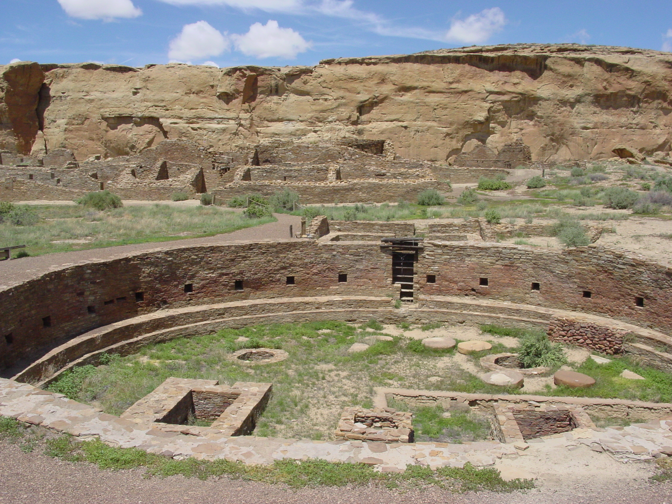
The most famous site in the Chaco Culture is Chaco Canyon. This metropolitan sprawl features massive stone mansions known as Great Houses, more modest dwellings, temples, and burial grounds. The Chaco elites nibbled chocolate from Mesoamerica and kept macaws as pets. When they died, they were buried beside their ancestors in multi-generational crypts, evidence of some of the earliest known class divisions in America.
Chaco Canyon also records celestial symbolism. Astronomers often cite a strange painting of a fiery star as a record of the supernova of 1054 — an interpretation many archaeologists and modern-day Pueblo dispute. Many buildings aligned with the cycles of the Sun and Moon. And one of the most famous sites, known as the Sun Dagger, manipulates the light of the summer solstice to illuminate an elaborate carving.
Broad roads
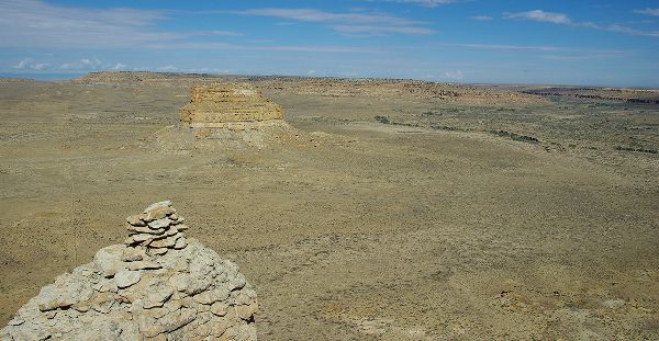
Elaborate three-meter-wide roads extend out from most major Chaco settlements. Early surveyors for the U.S. Bureau of Land Management assumed these roads served the same purpose that modern American roads do: to move people and goods from one settlement to another. But while most of the roads start at a settlement, many end seemingly in the middle of the desert.
In recent years, archaeologists have started investigating the road networks with a more open mind. The field also became a more hospitable place for Pueblo and Diné scholars. They contributed to our present understanding that many Chaco roads led to herraduras, horseshoe-shaped buildings thought to be roadside shrines. But are the shrines there because of the roads or are the roads there because of the shrines?
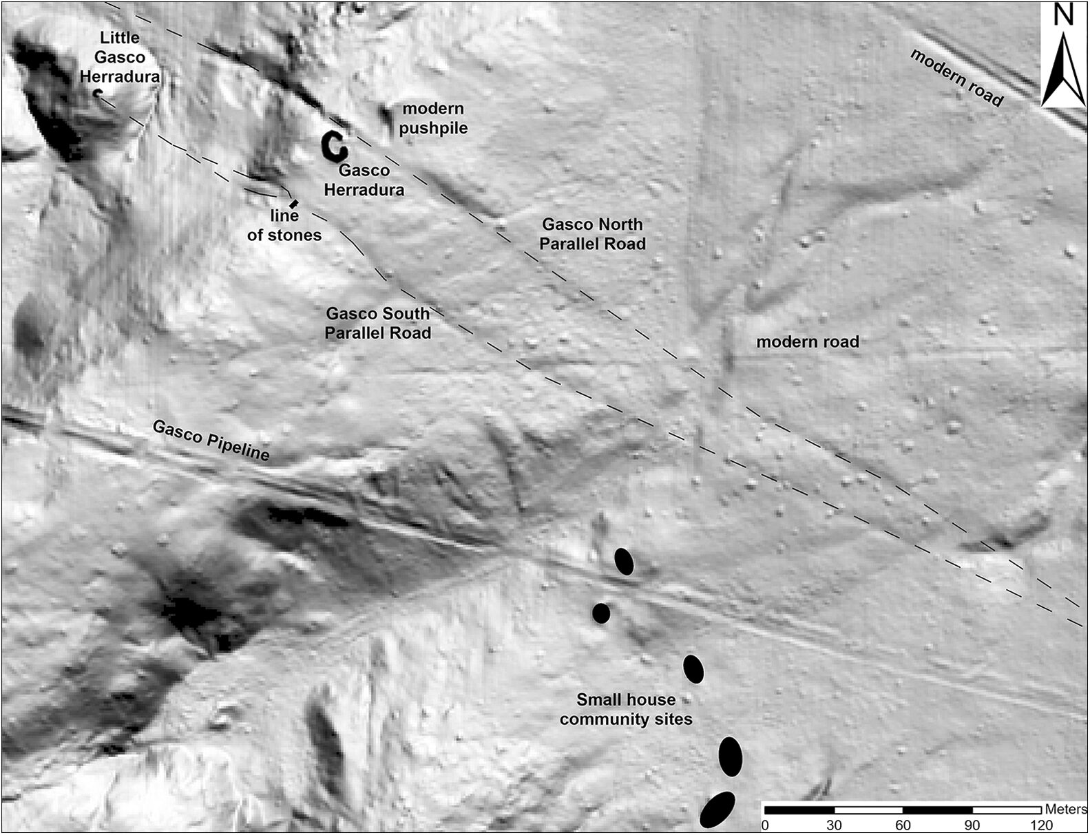
We certainly don’t know everything about Chacoan architecture, but a paper published last month in Antiquity gave us another clue. Archaeologists used LiDAR to map a small, oft-forgotten ruin 70km from Chaco Canyon called the Gasco site. The Gasco site had the largest herradura of all, and archaeologists had also previously identified about 75 meters of road.
The new LiDAR mapping showed that the road was actually six kilometers long. And it wasn’t one road but two, running parallel beside each other.
Sunrise over Mount Taylor
Both roads point straight at Mount Taylor, also known as Tsoodził in Navajo. The gentle slopes of this volcano rise to the east of the Gasco site. Uranium mining in the 20th century has left them riddled with rusting fences and radioactive debris. In 2009, though, an alliance of five tribes succeeded in protecting Mount Taylor from further mining due to its importance in local belief.
When the authors of the new paper saw the roads led to Mount Taylor, they carefully noted its orientation relative to the sky. They found that it aligns with the path of the Sun through the sky during the winter solstice.
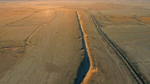
On a hunch, they returned to the site during the 2022 winter solstice. As expected, the Sun breached the horizon right above Mount Taylor, casting the landscape in gold against the deep blue sky.
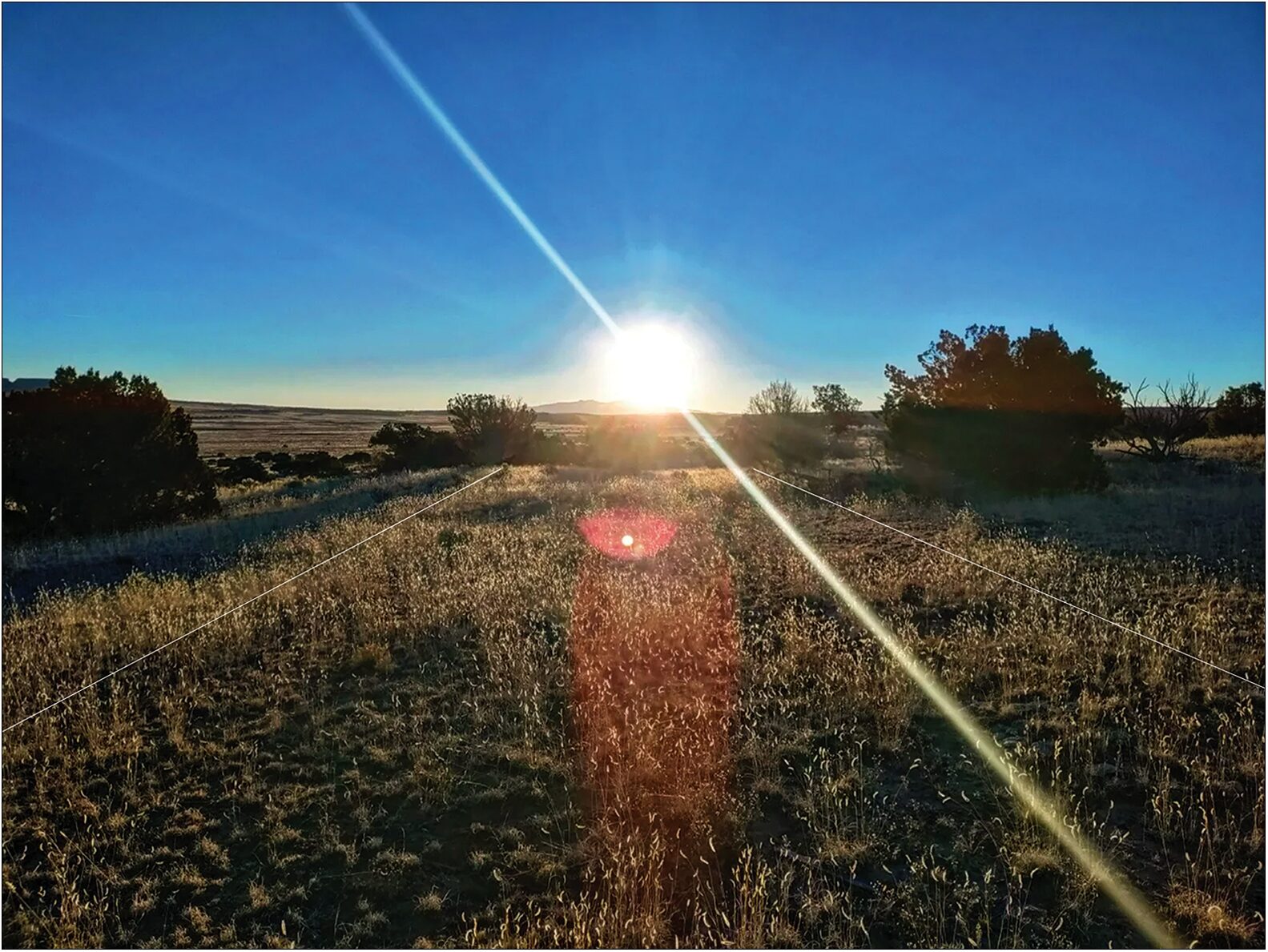
Sunrise over Mount Taylor on the winter solstice. Photo: Weiner et al., 2025
Roads, the solstice, and water
“One of the really exciting things about the work we’ve been doing with Chacoan roads is that they’re forcing us to reconceptualize what a road might be, what a road might mean,” lead author Robert Weiner told Live Science.
In fact, the roads don’t just point at Mount Taylor. They start and end at water sources: a spring and the head of a canyon river. River pebbles have been found at the Gasco herradura, too, linking the roads to their shrine.
Archaeologists need more time to understand the exact relationship between these roads, the herradura, and the local villages around the Gasco site. That’s something it’s not clear they’re going to get. Local tribal nations are at war with the federal government over drilling projects that could disrupt both the environment and the history of northwestern Mexico.
One thing is for certain: The 1980s interpretation of those roads as merely utilitarian was wrong. And it wasn’t just the Chaco Culture that placed a deeper meaning in the construction of elaborate, elegant roads in the American Southwest. What’s the deal with Route 66, anyway?