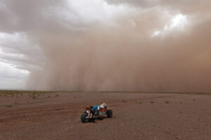
Imagine that a fictional polar traveler named Aarne Järvi plans to lead a three-person Finnish team across Antarctica. His press release declares, “Finns Attempt Unsupported and Unassisted Traverse of Antarctica.” Elaborating, they state that they won’t use resupplies and will manhaul on skis, without “wind assistance”. Never before, the press release concludes, has anyone skied across Antarctica from coast to coast without resupplies or the use of kites.
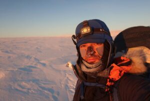
Despite benefiting from modern clothing and equipment, satellite communications and daily weather forecasting, as most expeditioners do, our imaginary Aarne will experience an Antarctic plateau not dissimilar to his predecessors, from Ernest Shackleton in 1908 to the recent (and real) guided South Pole expedition with schoolgirl Jade Hameister.
Nevertheless, the description of Aarne’s expedition is confusing and, it turns out, inaccurate. Many similar, and real, expeditions suffer from the same problem. Why and how to fix it is the point of this article.
Precedents
A decade before Shackleton, Captain Joshua Slocum eased his gaff-rigged sloop, Spray, into the Rhode Island docks after completing the first single-handed global circumnavigation by sailboat. His book, Sailing Alone Around the World, together with a few sightings of him during his three-year journey, stand as testimony to this world first.
His voyage brought sailing squarely into the modern world of record-setting and breaking. A classification system quickly developed to handle subtleties, such as crewed vs single-handed, monohull vs multihull, eastward vs westward, non-stop, unassisted, following great circles and touching antipodes.
When Frenchman Français Gabart claimed the speed record in 2017 for sailing Solo and Nonstop Around the World, embedded in his claim were established targets that are widely accepted by the sailing community. These are easy to verify and set a clear benchmark for similarly inclined sailors to exceed.
A year before Captain Slocum began his circumnavigation, the Austrian mountaineer Fritz Benesch developed the first-known grading system for rock climbing. Eventually, the UIAA adopted it, and his open-ended scale is still used today. At least a dozen grading systems operate across the various fields of climbing, from the French adjectival system for mountaineering to the numerical ice and mixed climbing scale. Should you ever like to shimmy up the Supercanaleta line on FitzRoy in Patagonia, the 5.9 YDS WI4 M5-6 Steep Snow PG13 gradings, readily decipherable online and incorporating subtleties such as terrain steepness, blankness and length, gives you some indication of what to expect.
So why not polar travel?
Despite the number of journeys in Antarctica, Greenland and on the Arctic Ocean, and the high level of sponsorship and media exposure, the lack of an established classification system in polar expeditioning makes it easy to pull the merino wool over the public’s (and the media’s) eyes. By comparison, not just sailing and climbing, but ocean rowing, paragliding and white-water kayaking have clear standards on how to classify their endeavours.
Some in the polar world object to adopting a classification system, because they prefer to think of polar travel as non-competitive. Almost every year, a burgeoning pool of record-seekers taunts that pleasant fiction. Most of them have no sustained interest in polar adventuring or how expeditions are understood historically. This was starkly illustrated in Colin O’Brady’s recent expedition, branded before, during and after as the first solo, unsupported and unaided crossing of Antarctica.
Unlike ocean sailing, those descriptors contain nothing of substance. Few of us even know what the terms unassisted, unaided and unsupported mean. Those who do know regularly mix them up. Even the words solo and crossing come with nuance. It’s no wonder that followers of adventure got sucked into the hype: No one, including O’Brady, had a blueprint to follow. If they did, they would have realized that Børge Ousland of Norway achieved this more than two decades earlier.
It’s time to tighten up the polar tradition of loose-fitting terminology. Consider this an attempt to fashion a simple, clear and unambiguous way to describe polar expeditions. Since most of us like acronyms, let’s call this the Polar Expeditions Classification Scheme (PECS).
The Five Elements of a Polar Expedition
Element 1. Team or Solo
Let’s start with the easy one. A single person traveling alone for the entire length of a journey is solo. To retain solo status, an expeditioner may not enter any buildings, vehicles, aircraft or tents other than his or her own. In the absence of Solo in the Label, Team is assumed. So O’Brady’s journey was solo and our fictional Aarne’s is not.
Element 2. Mode of Travel
The Rules of Adventure, found at adventurestats.com, were an initial attempt to define some of the qualifiers bandied around since the pioneering 1985-86 In the Footsteps of Scott expedition. But the polar community was bound to fracture over the following adventurestats line: “Support refers to external power aids used for significant speed and load advantage. Typical aids are wind power (kites)…”
Ice is a neutral medium, and just as ocean rowers and sailors share the sea without primacy, so too should manhaulers, snowkiters, snowshoers, fat bikers and dogsledders. Apart from a common travel surface, these activities are largely incomparable. By de-emphasizing superficial comparisons and allowing each one to be independently graded, we lay an even ground for classification, as long as the expedition label includes the specific method of travel. In our theoretical example, Aarne should rewrite his press release to read “Ski Traverse” rather than just “Traverse”. Even better would be “Ski Crossing”, as “crossing” is a more common term.

Keith Tuffley, left, rides his fat bike towards the Transantarctic Mountains and the South Pole, while Rob Smith manhauls on skis. Photo: Eric Philips/icetrek.com

Ben Galbraith paddled along the east coast of Greenland, then used his kayak as a sled during a full crossing. The classification scheme includes — and at the same time, distinguishes — non-traditional modes of polar travel, such as paddling and fat biking. Some forms of travel will become more common because of climate change. Photo: EricPhilips/icetrek.com
Element 3. Margins
Several large, freshwater ice shelves are permanently attached to the Antarctic coast. Without the Ross Ice Shelf, for example, Shackleton could have sailed 500km further south to the base of the Beardmore Glacier before leading his men to the high interior.
Instead, they plodded across the Spain-sized shelf, as much a part of Antarctica as the inland ice. In the end, the distance was too much for them and they had to turn back 180km short of the South Pole. Scott, Amundsen, Byrd and Fuchs all established their bases and began their inland crossings on or very near these outer perimeters.
In 1988-89, fledgeling logistics company Adventure Network International conducted the first guided South Pole ski expedition. They began from a contrived inner coastline start on the southern perimeter of the Ronne Ice Shelf, the now-familiar Hercules Inlet.
A slew of similar journeys quickly followed. South Pole expeditions and Antarctic crossings suddenly became shorter by a third. They are, in effect, imperfect projects because their start/endpoints use an inner coastline that is only detectable by remote sensing tools, such as Differential Interferometric Synthetic Aperture Radar (DinSAR).

Jon Muir and Peter Hillary kite the Ross Ice Shelf toward the South Pole in 1998. The larger ice shelves, such as the Ross and Filchner-Ronne, are permanent features of Antarctica. Photo: Eric Philips/icetrek.com
For most expeditions, these hidden coastlines are now accepted start or endpoints. Of my own five South Pole expeditions, three have started from one of them. But the lack of formal classification, and the bickering over definitions or the practice of ignoring them totally and using your own convenient interpretation of “unsupported”, for example, means that the public has no clue that some journeys, like Ousland’s seminal 1996-97 solo kite-ski crossing of Antarctica, are far longer and harder than others. All are simply advertised as “unsupported crossings”.
Through PECS, I am trying to draft clear, unambiguous definitions that, if widely adopted like those of the Ocean Rowing Society, will clear up the embarrassing confusion that detracts from otherwise worthwhile projects. The journeys that Lou Rudd and Colin O’Brady did last year were very good, but they didn’t do what they advertised. This wasn’t a reprisal of the Scott and Amundsen race; nor was it a quest to bag some Last Great Polar Journey. Rather, it was a truncated route that was a first in only a very limited way.
In our definitions, the term “Coastal” denotes land fronted by sea or annual sea ice, and “Inner Coastal” as an ice shelf coastline that is not within sight of the sea or annual sea ice. Furthermore, journeys starting on neither coastline are “Inland“, or “Offshore” for North Pole journeys, and are classed as “Partial“.
Individual journeys may occasionally fall outside these definitions. For example, Mike Horn and Børge Ousland are currently crossing the Arctic Ocean. However, they started not from land but from Horn’s yacht, Pangaea, in mid-ocean, around 85° north. Should they reach the Svalbard coast or a waiting offshore yacht, most would support theirs as a full crossing.
Greenland
Few Greenland crossings go from sea level to sea level. Most skiers travel by vehicle to the edge of the Inland Ice. Rather than re-labeling hundreds of past Greenland and Antarctic expeditions as incomplete or partial, we can instead apply the label “Crossing“, while reserving “Full Crossing” for those that began and ended at the coasts.
One must earn the right to be classified as Full, and Aarne’s theoretical trip doesn’t qualify, because it turns out that he’s starting from Hercules Inlet and finishing at the base of the Axel Heiberg Glacier, an inner coastline. O’Brady, too, used inner coastlines. There’s no need to amend their Crossing designation. At the same time, they don’t merit the term Full.
Maps used to depict these crossings should also be more geographically accurate. To downplay the importance of ice shelves, O’Brady (or the NYT) coloured them light blue, just a shade short of the surrounding ocean, to imply that they are temporary or irrelevant features. In fact, they are essentially permanent and are, of course, white, not blue.

Jade and Paul Hameister at the end of the road that runs from Kangerlussuaq to the western edge of the Greenland ice sheet. This location is a 45km bus ride from the coast and is the most common start or endpoint of Greenland crossings.

The route map published by The New York Times before O’Brady’s expedition, highlighting the ice shelves as more ocean than ice. Photo: The New York Times

The Reference Elevation Model of Antarctica (REMA) shows the Antarctic ice shelves as they really are. (Image: © National Geospatial-Intelligence Agency)
Element 4. Aid
Now that we have eliminated wind, dogs, fat bikes and any future type of non-motorized travel as aid, let’s look at what this term really means.
Resupplies – accepting food or equipment that is not part of the original sled load and thus reducing weights. Any team that evacuates one or more members also falls under this ruling.
Roads – compressed, tracked or flagged routes that significantly decrease and often eliminate the encumbrances of sastrugi, crevasses and/or navigation.
Any expedition that uses one of these is Supported. Conversely, any expedition not benefiting from either is Unsupported. All other loose terms — assisted, aided, etc. — are absorbed under Supported and can be permanently dropped.
A journey must earn the right to use Unsupported. In its absence, we assume Supported. In our hypothetical example, Mr. Järvi and his colleagues do not use either form of support, so they qualify as an Unsupported Ski Traverse of Antarctica, or more consistently, UNsupported Ski Crossing of Antarctica.
O’Brady, however, used the graded South Pole Traverse (SPoT) road running from the Pole to his end point on the inner coastline of the Ross Ice Shelf, about a third of his total distance. Under these guidelines, he would not be able to describe his expedition as Full or Unsupported, bur rather a Solo Ski Crossing of Antarctica. Ousland, incidentally, used no such road.

The graded SPoT Road runs between McMurdo and the South Pole. There are no sastrugi on this road, so travel is easier and faster. Any expeditions traveling on or next to a road, track or flagged route are Supported, unless they are following roads into or out of stations, as directed by authorities. Photo: Eric Philips/icetrek.com

Kite-skiers crossing Antarctica from the Ross Ice Shelf via the Axel Heiberg Glacier and South Pole, 2012. They are traveling next to a road that ran much of the way between the Pole and Thiel Corner runway and fuel depot, and much of the way to Hercules Inlet. Such an expedition is aided in its navigation and so is Supported. Photo: Eric Philips/icetrek.com
Element 5. Path
The route a journey takes is its Path. In general, there are three types: Circumnavigation, Crossing and Expedition. Any journey in Greenland, Antarctica or on the Arctic Ocean from one side to another is a Crossing; a circular path around a prominent point, such as a Pole, is a Circumnavigation; a journey that finishes at the North or South Pole is an Expedition. Expedition variations include Return, Alternate Return and Reverse.

Examples of PECS Margins (start and end points) and Paths (routes) in Antarctica
The MAP Code
For simplicity, we can abbreviate our Margin, Aid and Path elements with the letters A through D. The more A’s in the Map Code, the more committing and arguably the more difficult the journey. Thus:
MARGINS
A = Full
B = Not Full
C = Inland or Offshore (Arctic Ocean)
AID
A = Unsupported
B = Supported
PATH
A = Crossing, Alternate Return Expedition or Circumnavigation
B = Return Expedition
C = One-way Expedition
D = Reverse Expedition
DISCONTINUOUS
Denoted by a slash symbol (/) after the MAP Code letters, a journey that takes multiple seasons or expeditions, such as Lonnie Dupre’s and John Hoelscher’s dogsled-and-paddle circumnavigation of Greenland, is discontinuous.
VARIANT
A Variant is denoted either by a Distinction (+), indicating an unsupported journey achieving a historical record that cannot be broken; or a Misconduct (-), an earmark for any unauthorized or environmentally reckless journey.
Like the label, the shorthand expression of a MAP Code reveals the particulars of a journey. For example, the fictional Finnish team is BAA, O’Brady BBA and Ousland AAA+. Followers of Antarctic expeditions will know that kite skiers have succeeded at an Unsupported Full Crossing but manhaulers have not — at least, not yet. AAA+ awaits the skiers, either team or solo, who do.
Description
The Label can’t fully describe a polar journey, so a narrative should follow. This includes such specifics as route, firsts, estimated distance and duration, gender, how many members, nationalities and whether it will be guided. Which begs the question: Is a guided journey not aided? Well, the guide is not guided so, no, but it must form part of the narrative, preferably referenced with the guide’s name, eg. Dwayne Pipe (guide).

A team receives a resupply on the Arctic Ocean while skiing from North Pole to Canada. Using the Polar Expeditions Classification System, this journey is labelled a Full Reverse North Pole Ski Expedition with a MAP Code of ABD. The more A’s in a journey’s code, the more committing and arguably more difficult. Photo: Eric Philips/icetrek.com
Classifying Journeys Old and New
Almost every high-latitude journey can be graded in a minimalist and elegant fashion, using the process outlined above. However, this represents just the tip of the PECS iceberg. For the full iceberg, and to generate your own Label and Map Code, visit https://icetrek.com/pecs
Acknowledgements
Thanks to Damien Gildea and Dixie Dansercoer for their valuable direction and to www.antarctic-logistics.com for info on remote sensing tools.