In mid-August, Peter Van Geit sets out across the Indian Himalaya to fast-hike 1,000km. He plans to cross 50 mountain passes in two months, about one per day. This is the third section of his 2022 project to explore Jammu and Kashmir in all seasons.
This late-summer and autumn leg will focus on 4,000-5,000m passes along the northeastern boundary of Jammu and Kashmir, bordering the neighboring state of Ladakh.

A map of mountain passes (red) and alpine lakes (blue) for northeastern Jammu and Kashmir. Image: Peter Van Geit
A long-term mapping project
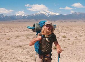
Over the last few years, Peter Van Geit has made it his mission to ultra-run and hike across large parts of the Indian Himalaya. In 2019, he started by fast-hiking 3,000km across 120 passes.
Van Geit discovered that the Indian Himalaya was not well documented. He wants to change that.
“One of the reasons very few hikers head to the Indian Himalaya is the absence of good, detailed hiking maps, compared to, say, Nepal or the European Alps,” he says. “Most of the Western Himalaya are undocumented, despite a vast, beautiful trail network.”
He used the COVID lockdown to compile data on hiking trails and passes from various sources and from his adventures. He created online trail maps of 2,000 passes, 700 alpine lakes, 50,000km of trails, and 25,000 remote hamlets across the Western Himalaya.
Since then, he has gone out for months at a time to explore the areas he has mapped and to add to his online database. He has now hiked 10,000km across 300 mountain passes.
Summer-autumn phase
Van Geit expects his current trek to be easier than those he did in winter and spring.
“Late summer and autumn are usually the best time for exploration,” he told ExplorersWeb. “The snowline has retreated, and snow and glacial melt have reduced, making streams more crossable. Shepherds are still up in the high meadows grazing their herds, offering nearby food supply points and shelter.”

Photo: Peter Van Geit
Jammu and Kashmir
As with other areas he has explored, Van Geit found little public information on trails in the region. But while he was still planning his journey, the Survey of India released topographic maps into the public domain. This allowed him to view thousands of kilometres of little-explored trails. With this information, he mapped 13,000km of trails, 50 hiking routes, 700 mountain passes, 600 mountain peaks, 500 lakes, and 5,000 settlements on Open Street Maps.

Photo: Peter Van Geit
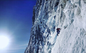
One challenge for this current hike has been planning a route that follows the ever-changing snow line. Though he planned a full traverse, he accepts that his actual route will be a dynamic one as he adapts to the weather and tries to keep below the snowline.
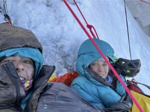
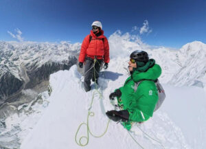
As usual, Van Geit travels light. To keep his pace swift, he carries a mere five-kilo pack. He doesn’t bring a tent, just a half-kilo bivy sack. Despite the variable weather, he opts for trail runners rather than hiking boots. Every two to five days, he resupplies and charges his electronics in remote hamlets. Snowmelt provides plenty of drinking water.

Photo: Peter Van Geit
Two seasons down
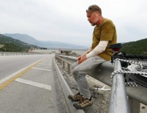
In February, he began with a 300km low-altitude traverse through the Jammu, Udhampur, Kathua, and Reasi districts. He hiked the 2,000-2,500m altitude range to “keep the winter snow below knee level” and identified 100 target passes.
A perk of staying at lower altitudes was the number of remote hamlets he passed through. They are all interconnected by forest trails, and he experienced overwhelming hospitality. Most nights, locals insisted that he stay with them rather than sleep outside. Many other times, he set up camp in abandoned summer dwellings in alpine meadows.
In April, he began his two-month spring traverse. This was at a slightly higher altitude. Van Geit hiked 800km along 3,000-3,800m high ridgelines in Kishtwar, Doda, and Ramban. The few months made a huge difference: The alpine meadows, empty during winter, were now full of life. He frequently met bakarwals (shepherds) who were moving their sheep, goats, and buffalo for grazing.

Photo: Peter Van Geit
Like the villagers, the bakarwals welcomed Van Geit, offering to share tea, goat’s milk, and their campfires. Exploring the higher altitudes meant that he could not stop for food as often and had to carry a slightly heavier load.
He completed this spring section with a friend, who had decided to join him at the last minute. Below, a short video from one of his previous treks.