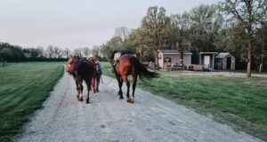
Laurent Berthod spent 95 days hiking from Leh in India to Everest Base Camp in Nepal. The Canadian set out in October 2023. By January 2024, he had walked 2,600km, climbed 115,000m of elevation, and crossed 75 mountain passes.
From Ladakh, Berthod made his way through Himachal and Uttarakhand in India before crossing into Nepal. He then picked his way through the Sudurpachchim, Karnali, Lumbini, Gandaki, Bagmati, and Koshi provinces. Finally, he finished up at Everest Base Camp.
This is by far the longest journey Berthod has undertaken. The first big challenge was planning his route. He linked existing trails from the Open Street Map database and newer trails found with the help of locals and survey maps in India. Experienced Himalaya ultrarunner Peter Van Geit helped Berthod to plan sections of his route.


The route.
Berthod spoke to ExplorersWeb about his expedition. This interview has been edited for brevity and clarity.

Photo: Laurent Berthod
Uncertain paths
What inspired you to trek from Ladakh to Everest Base Camp?
The Himalaya have been the source of some legendary expeditions. I wanted to experience the magic myself.
Walking was the obvious choice to explore the region. Crossing multiple Himalayan provinces across India and Nepal would allow me to see changes in the landscape and have genuine interactions with Himalayan dwellers.
I also thought it was the perfect challenge to push my limits. Logistically, it was quite complex. It taught me how to read and interpret topographic and survey maps, and how to build a coherent itinerary.
There was the obvious physical and mental challenge. I knew most days would be strenuous, with uncertain paths and sometimes brutal elevation.

Photo: Laurent Berthod
The plan
How long did it take to plan the trip?
It was three months of intensive planning. For the Indian sections, maps were readily available on OSM Street Maps, and a few trails were already marked. All I had to do was pick a logical route with the weather. After this, I connected those marked trails with footpaths indicated on the Survey Trail of India (SOI).
The next part was trickier, figuring out sections that weren’t mapped on the OSM or SOI maps. I tried using Google satellite images but knew I would have to ask locals once I was there.
Peter [Van Geit] proposed the route connecting the Spiti and Kinnaur valleys near Tibet. He thought it would be possible after seeing some trail signs on Google.
Planning Nepal was a challenge. There are no surveys or government maps that show footpaths. I relied entirely on OSM maps, which had quite a few trails that I could connect. The blanks had to be filled by asking locals, by using Google satellite images, or by taking a detour along a dirt road.
I knew my itinerary was dynamic and heavily subject to change. I had a pretty good idea of where I was heading and was confident I could adjust along the way if needed.
Have you done anything like this before?
I had some high-altitude trekking experience and completed some light alpinism in the Andes before the project, but I had never done anything remotely close to this in scale.

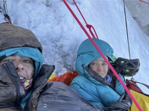
Photo: Laurent Berthod
A 2,600km hike on a budget
You’ve mentioned you had “minimal gear.” What did you carry?
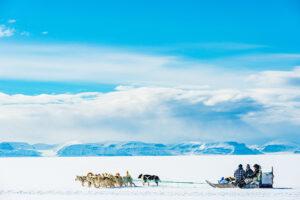
I had a 10kg backpack consisting of a quite heavy tent (1.3kg), a -2°C sleeping bag, and the bare minimum layers of clothes for the weather. It was especially cold in Ladakh, down to -15°C.
I also carried a stove, some electronics such as a power bank, a camera, my phone, and a headlamp with batteries. I carried some medicine, a journal, and some miscellaneous items like duct tape, a small tripod, and a water filter.
All in, it wasn’t the lightest pack. I know Peter [Van Geit] carries only 5kg on his hikes, but I didn’t want to spend a lot on lighter gear and was confident I would get used to the weight quite quickly.
What was your favorite section?
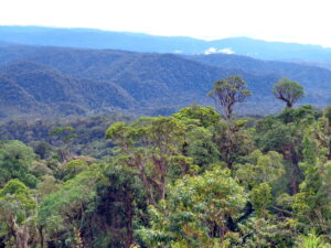
It is so difficult to say. I went through so many different climates and each had its beauty and challenges. The variety was something I enjoyed, the ever-changing scenery.
The remoteness of Ladakh was something I had never experienced before, walking in barebone valleys and gorgeous deserts without a soul in sight.
I also loved exploring the Indo-Tibetan border in Himachal Pradesh and walking new paths spotted via satellite images, which was thrilling. I felt the excitement and nervousness of true exploration.

Photo: Laurent Berthod
30 to 40km/day
What were the biggest challenges?
I quickly got used to walking 8-10 hours per day. I usually climbed around 2,000m of elevation and covered 30 to 40km, sometimes 45km+. It became routine. What I found more strenuous was going down. I was often descending more than a thousand meters on really rugged and slippery terrain. Fatigued from the climb, I had to be extra careful not to injure myself.
The first few days of the traverse were generally rough. I was quite aggressive with my acclimatization process, reaching 5,300m in barely three days from Leh and crossing multiple 5,000m+ mountain passes. I had to stop quite often to catch my breath. The cold was also quite a hurdle, especially on my nights in Ladakh and the nights camping at high altitudes.
But the biggest challenge by far was navigation. In the forests of Uttarakhand and Nepal, I very frequently lost the trail and had to scramble through dense vegetation, often on steep, slippery slopes. I knew which direction to go, but had to figure out a way when no paths were visible.
Detours and backtracking were inevitable when exploring unmarked shepherds’ trails. A definite path was rare. I learned that every inch in the Himalaya had to be earned and I armed myself with patience.
Finding food
How did you deal with sourcing food and water?
Water was readily available because of the abundance of streams. I rarely had trouble finding water.
For food, I ate most of my dinners in people’s homes, in the small settlements between mountain passes. Breakfast and lunch were often biscuits or noodles, definitely not the healthiest option. However, I could find them almost anywhere, which drastically reduced the weight I had to carry.
I did lose a couple of kilos along the way.
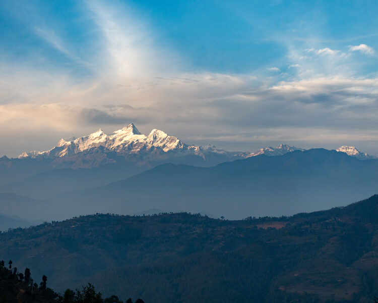
Photo: Laurent Berthod
Local generosity
What was your split between camping and staying with local people?
About 80 percent of the time I stayed with locals. When I didn’t end my day in a village, I would camp, usually next to a water source. Camping was more frequent in the early sections, Ladakh especially, because it is sparsely populated.
As I reached lower altitudes, I almost always ended up in a family’s house, sharing the fireplace and a warm meal. Meals were usually made exclusively with vegetables and rice grown in their backyard, as well as fresh cow, goat, or buffalo milk. I couldn’t have asked for more.
Do you have any other expeditions planned?
Not at the moment. I will be returning to school this fall, but this adventure has definitely sparked a desire for future endeavors.