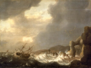
For a time in the 19th century, 7,134m Gaurishankar was thought to be the highest mountain on Earth. Unlike Mount Everest, you can easily see it from the Indian lowlands. Here, we look at the first expeditions to explore the Rolwaling Valley and take on Gaurishankar.
Rolwaling Valley
In the east-central part of Nepal, northeast of Kathmandu, the Rolwaling Valley lies along the border between Nepal and Tibet. Rolwaling means “deep, narrow valley” in the Tibetan language, and “groove” in the Sherpa language. This high, solitary valley lies at 4,000m. Yet Rolwaling boasts a biodiverse ecosystem of 565 species of plants, 35 species of mammals, more than 15 species of fish, and over 230 species of birds.

The Rolwaling Valley is populated by Sherpas who moved here from Tibet in the north and the Khumbu in the east. A local club, the Mount Everest Summiters Club, is currently working to develop this remote area. Photo: Arkaitz Saiz
Savage peaks everywhere
The Rolwaling Himal has more than 20 peaks over 6,000m. Notable ones include Dolma Khang (6,332m), Khang Karpo (6,704m), Bedding Go (6,125m), Langdak (6,220m), Chobutse (6,686m), Kang Nachugo (6,737m), and Lunag Ri (6,895m).

Chobutse from Sangma Kharka. Photo: Mountains of Travel Photos
The highest mountain in the Rolwaling Himal is Melungtse (7,181m), which lies within Tibet. New Zealander Bill Denz made the first attempt in 1982. The illegal climb mounted the southeast ridge after Denz entered Tibet from the Rolwaling Valley in Nepal. Denz did not summit, and Slovenians Marko Prezelj and Andrej Stremfelj Melungtse finally climbed it for the first time on October 23, 1992.

Melungtse (7,181m). Tibetans call it ‘Jobo Garu’. Photo: Wikipedia
Gaurishankar
The second highest mountain in Rolwaling is Gaurishankar (7,134m). On the border with Tibet, near the western edge of the Rolwaling Himal, Gaurishankar has two peaks. The secondary summit is called Gauri (7,010m) and the main summit is Shankar (7,134m).

Gaurishankar. Photo: Ranjan Neupane
The first expedition in the vicinity of Gaurishankar began on August 27, 1951. British climbers Eric Shipton, Tom Bourdillon, Bill Murray, and W.H. Ward joined forces with Shipton’s old friend, Ang Tarkay Sherpa, and his Sherpa team. Later, Tenzing Norgay himself also joined them.
Their goal was to find a better route up Everest, at the time still unclimbed. They looked for an alternative route from the southwest, so their route crossed Rolwaling.
Yeti footprints
On November 8, 1951, Shipton, Ward, and Norgay were crossing a pass in the Melung basin when they encountered some large footprints. Norgay quickly identified these as Yeti tracks. Norgay told his companions that it was not the first time he had seen Yeti prints. He even claimed to have seen a Yeti as close as 20 metres.

The footprint photos were published in 1952. Photo: Eric Shipton

W.H.Ward examines the strange footprints. The team followed the footprints for a kilometre to a crevasse. It seemed that the Yeti jumped over the crevasse. The group could not follow and instead continued with their expedition. Photo: Eric Shipton
Several other expeditions visited Rolwaling during the 1950s. A Scottish-Nepalese expedition under the leadership of Tom MacKinnon went in 1952, Swiss climber Raymond Lambert and his French partner Franz Lochmatter in 1954, and Brit Alfred Gregory in 1955.
The first attempt and the bandits
In 1959, a Japanese expedition from Fukuoka University set out to make the first ascent of Gaurishankar. The team included Hideki Kato (leader), Mitsuhari Oishi, Moriake Abe, and four Sherpas: Ang Temba (sirdar), Kilken, Kunga Norbu, and Ang Dawa III.
They started the trek from Kathmandu on September 17 and reached Beding village on September 28. On October 2, they left for Base Camp on Menlung Pokhari at 4,800m. They arrived 12 days later.
Between October 14 and October 25, they tried to find a route to the top of Gaurishankar from several directions. But they could not find anywhere to build camps because of the knife-edge ridges, and the mountain was itself full of dangerous icefalls up to 5,550m.

Chekigo Peak in the Rolwaling Valley. Photo: Peter W/Flickr
The group changed its plans and instead tried to climb Pangbuk Ri. This did not go well. Soon after, they were set upon by armed Tibetan Khampa bandits, who stole all their money. The expedition had to return to the safety of the southern valley, penniless.
The 1964 attempt
Another British-led team made an attempt in 1964. Led by Don Whillans, the team consisted of Terence Burnell, Ian Clough, Dennis Gray, Desmond Hadlum, Ian Howell, Girme Dorje Sherpa, Dawa Tenzing, and Ang Tsering.
But the monsoon came too early, and in mid-September, the porters went on strike in the last Nepalese town of Lamobagar. Therefore, on September 19, they had to establish Base Camp quite low, at 2,600m. The camp was unique, made in a cave at the bottom of the Rongshar Gorge and still quite far from the mountain. It was very difficult to determine a route from there.
Bandits force the pace
When bandits returned to the area, the group had to move quickly. They proceeded up the steep Chumal Chu through rock buttresses with all their equipment. On the ridge at 5,200m, they had their first glimpse of Gaurishankar. The imposing west face looked impossible to climb: almost 3,000m, and hit constantly by avalanches.
They had to turn and traverse the northwest face, toward the north ridge. On October 28, they made it to 6,700m but then had to turn around.
During the descent, an avalanche engulfed them. Clough barely held on to his ice ax, embedded in the ice. Thankfully, they managed to avoid tragedy and get down safely. Whillans said that it was the most dangerous route he had ever done.

Rolwaling Valley at Na Village. Photo: Caingram
Permits required
Subsequently, the Nepalese government was not keen to grant climbing permits. The mountain was quiet until 1971 when Norwegian Arne Naess made an exploratory approach from the southeast side. However, he did not climb the mountain.
In October 1972, Japanese climber Satoshi Aoki took some spectacular pictures of the south face of Gaurishankar. When a Japanese magazine published them, they inspired many Japanese climbers. So much so that in 1973, a Japanese team supposedly tried to make an illegal attempt. Police stopped them in the Rolwaling Valley.
Finally, in 1978, Nepal opened several mountains to “joint expeditions” (expeditions that featured a set number of Nepali mountaineers), including Gaurishankar.

Gaurishankar. Photo: Caingram
The first ascent of the main peak
In 1979, a joint U.S.-Nepali expedition acquired a permit for the northwest ridge. Authorities requested that there be two Nepalese climbers in the group. Expedition leader Al Read decided to split his team evenly between Americans and Nepalis.
Read picked 10 climbers: Pertemba Sherpa (co-leader), Dennis Paul Hennek, Jim Morrissey, John Roskelley, Kim Schmitz, Ang Jambu Sherpa, Dorje Sherpa, Pasang Ongchu Sherpa, Yong Tenzing Sherpa, and Ang Nima Sherpa.
All the Nepali climbers had high-altitude experience, but except for Pertemba, they had never had the chance on previous expeditions to summit. For this reason, the enterprise took on even greater importance. This time, everyone would climb with the same opportunity.

Kim Schmitz during the first ascent of Gaurishankar. Photo: John Roskelley
Hard choices
Two months before leaving for Nepal, the Americans were notified that the border with China had changed. Now the northwest ridge belonged to China. They had two options, either take the southwest ridge or try the west face. Both routes were extremely difficult.
On March 31, 1979, the team and 107 porters arrived at the town of Lamobagar. From there, they followed the British 1964 route through Chuma Chu. On April 6, they reached an unnamed glacier at almost 5,000m, where they established Base Camp. They then continued 200m further towards a col, where they could see the imposing west face of the mountain for the first time. Huge ice blocks hung on the only feasible route. The climb looked extremely risky.

Kim Schmitz on the west face of Gaurishankar. Photo: John Roskelley
The southwest ridge looked even worse. It was like the edge of a knife. Razor-sharp blue ice led to the south summit. It didn’t get any easier from there. The stretch to the main summit was full of cornices and complicated towers.
The group finally opted for the west face. They didn’t know where they were going to put their camps but they were hoping for some ledges on the face, or perhaps the chance to dig snow caves. They were very worried about the hanging glacier. If the ice fell, it would bombard their route.
“I think [I will] see Gaurishankar and die,” Pertemba said.
Establishing camps
On April 19, they established Camp 1 at about 5,200m at the foot of the west face. Six days later, they were able to ascend to a small crack at approximately 6,000m, where they set up Camp 2. From there, they had to climb through a rib covered by blue ice.
They climbed as high as possible on the ice rib, crossing the face. On May 3, on a small ice ledge, they established an uncomfortable, dangerous Camp 3 at about 6,500m. From Camp 3, Roskelley and Schmitz started work on the next 100m section of mixed climbing.

Kang Kharpo Peak (6,646m) in Rolwaling Himal. Photo: Highland Expeditions
Roskelley and Schmitz had already spent four nights sitting in Camp 3, unable to lie down and suffering from dehydration and hunger. But the group decided that they could not wait any longer for a summit attack.
Hennek had bronchitis and had to head down, and Morrissey and Read went with him. Meanwhile, Dorje Sherpa climbed to Camp 3. The team asked co-leader Pertemba if he wanted to go to the summit. Pertemba was a very experienced Sherpa with great climbing skills but said that out of respect and appreciation, he preferred to give this opportunity to Dorje Sherpa and the rest of the Sherpa team. While Dorje climbed to Camp 3, Schmitz descended to Camp 2. By this time, Schmitz couldn’t feel his feet because of frostbite.

The south face of Gaurishankar. This face was first climbed on October 23, 2013, by a French party led by Jerome Para. They reached 6,800m and stopped near the south summit. Photo: Mathieu Detrie
The summit
As Dorje Sherpa ascended to Camp 3, he noticed that the ice was getting softer. This meant that rock and ice avalanches could fall on them at any moment. On May 8, at 5:30 am, Roskelley and Dorje began the final push. Roskelley later said that the climb, starting below Camp 3, was more difficult than the North Face of Eiger.
They climbed over a mixture of rock and ice to a protruding bulge. The overhang was suspended above the entire 2,700m west face, but they made it.

A Sherpa from the Rolwaling Valley. Photo: Dr. Klaus Dierks
At 3.15 pm, Roskelly and Dorje reached the top of Gaurishankar. Read and Pertemba watched the moment through binoculars from Advanced Base Camp.
“I turned to Pertemba and we shook hands,” Read recalled. “A Nepalese and an American had reached the summit of one of Nepal’s most famous unclimbed mountains, on an expedition jointly led and composed equally of Americans and Nepalese. A feeling of camaraderie at the joining of our two diverse cultures.”