At 7,708m, Pakistan’s Tirich Mir is the highest peak in the Hindu Kush and the highest mountain outside of the Himalaya and Karakoram. Today, we give a brief overview of the Hindu Kush and in particular, the first ascent of Tirich Mir by a Norwegian expedition in 1950.

An Apollo 9 image of the Hindu Kush range. Photo: NASA
The origin of the name ‘Hindu Kush’
The ancient Greeks called the Hindu Kush Paropamisos. Later Latin authors called them Paropamisus or Caucasus Indicus. Sanskrit texts refer to them as Pariyatra Parvata.
There are two opposing theories about the meaning of the contemporary name Hindu Kush. Based on the writings of Moroccan explorer Ibn Battuta in the 14th century, some believe that it translates as “Hindu slayer.” This refers to the deaths of slaves transported there from India.
Another theory is that it simply means Hindu mountain range. Locals worshiped the mountains as they protected and nurtured the people of Hindustan, bringing water and protecting them from invasion. The words kosh in Sanskrit and koh in Persian mean mountain.

A map of the Hindu Kush, marked with a red dot. Photo: Wikiquote
The Hindu Kush range
The Hindu Kush range lies between Afghanistan and northwest Pakistan. It is the westernmost extension of the Pamir, Karakoram, and Himalayan ranges. A high, narrow valley called the Wakhan separates the range from the Pamirs.
The Hindu Kush extends more than 950km from east to west and 240km from north to south. Similar to the Himalaya, it’s a relatively young range, full of sharp mountains and deep valleys. It contains 38 peaks higher than 7,000m and numerous 6,000’ers.
The average altitude is about 4,500m. The western mountains are around 5,000m, while the Hindu Kush’s central peaks are higher than 6,800m. The eastern peaks are the High Hindu Kush. Most of the 7,000’ers lie in northern Pakistan and the Afghan provinces of Nuristan and Badakhshan.
The four highest mountains are 7,708m Tirich Mir, 7,492m Noshaq, 7,403m Istor-O-Nal, and 7,349m Saraghrar.

The Tirich Mir massif from the valley floor. Photo: Bob A. Schelfhout Aubertijn
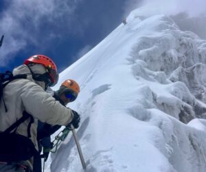
The Tirich Mir massif
Located south of the range’s main crest, the Tirich Mir massif has 11 peaks, many of them higher than 7,000m. There is a main peak, an eastern peak reached by a ridge, and the northwest rampart. This last constitutes “a wall not unlike the Grandes Jorasses in the Alps,” according to writer Jill Neate.
Tirich Mir is a rather isolated peak and can be seen from the valleys of Chitral. Its prominence is 3,908m.
Tirich Mir: name and superstitions
Tirich Mir lies entirely in Pakistan. Its climbing history, especially its first ascent, has much to do with the local folklore.
There are different interpretations of the mountain’s name. Tirich may refer to a lateral valley of the Mulkhow Valley in the Chitral district that leads to Tirich Mir. Another interpretation is based on the Wakhi language, where trich means “shadow” and mir means “king”, translating as “King of Darkness.” In fact, the mountain projects a large shadow on the Wakhan side of the peak.

The upper section of Tirich Mir. Photo: Tripadvisor
According to local writer M. Huzaifa Nizam, the Chitral district has long been dominated by two ethnicities, the Khos (also called Chitralis) and the Kalashas. The Khos adopted Islam and the Kalashas maintained their belief in the Kho state of Chitral. According to the Kalashas, Tirich Mir is dominated by the goddess Krumai, who takes the form of a wild goat and helps with childbirth.
Meanwhile, the Khos believe that the mountain is the home of a fairy fortress. They forbid climbing the peak.
Tony Streather, one of the members of the first ascent team, wrote about the fairy fortress in The Himalayan Journal. Locals believe that the fairies are guarded by gargantuan frogs the size of trucks that live in crevasses on the glaciers. The frogs may devour anyone who ventures on the mountain. Those who survive the frogs will die within a year.
“It’s is a cheerful thought and I am keenly awaiting to see what our fate will be,” Streather wrote.
First attempts to climb Tirich Mir
In 1928 and 1929, officials from the Survey of India made an unsuccessful attempt to reach the high peaks suitable for triangulation around Tirich Mir. Then in 1935, a German expedition made another attempt from the south. In 1939, just before the Second World War, Miles Smeeton and his party also attempted it from the south, up the Owir Glacier. They reached the southern ridge of the massif but continued no further.
In 1949, two Norwegians, philosophy professor Arne Naess and climber Arne Randers Heen, made a reconnaissance expedition to the South Barum Glacier. Eric Shipton and George Morgentiene, a Norwegian specialist in the Afghan and Khowar languages, recommended that they take a look at Tirich Mir.

Professor Arne Naess. Photo: Cultura de Montania
Naess and Heen didn’t take porters beyond 4,200m. They examined two possible routes to the main summit of Tirich Mir: the southeast ridge and a route via the South Glacier and the South Glacier Peak. The second route was dangerous because of avalanches, though it proved stable while they were on the mountain.
The duo considered both routes feasible, noting that the South Glacier was possible only in stable weather and would be risky even in the best conditions. Naess and Heen reached the ridges on both sides of the glacier. They also spotted a third route, a shortcut that they considered the most obvious and direct route. It involved a rib on the south wall of the Tirich pyramid and then the upper part of the south ridge above. However, in snowy weather, this route was the most avalanche-prone of the three. As a result, the two climbers didn’t try it.
After their expedition, they concluded that the southeast ridge was most promising.

Tirich Mir. Photo: Uzair Ali Khan
During the winter of 1949-1950, the Norwegian Alpine Club and the Norwegian Geographical Society prepared a major expedition for the summer of 1950. They targeted the main peak of Tirich Mir.
The team
The Norwegian party of 1950 consisted of leader Arne Naess, Hans Bugge, Henry Berg, Per Kvernberg, Fridtjot Vogt Lorenzen (the team doctor), and Tony Streather of the UK. He was a member of the Chitral State Scouts, whose knowledge of the area and its people was very important.
Two scientists, two photographers, liaison officer Abdul Hamid Beg, and Chitrali and Hunza porters rounded out the team.
Naess described Tirich Mir as a “glittering fairy castle” and knew well that the local beliefs would mean a lot of difficulties for their porters. “Previous attempts on the mountain had not succeeded, partly because of this problem,” Naess recalled.
The party reached base camp on the Barum Glacier on June 11. This glacier is 15km long and leads to the south and southeast walls of the Tirich Mir summit pyramid.
Over the following weeks, the team established an advanced base camp near the top of the glacier at 5,400m. However, they soon realized that snow conditions were quite different from the previous year. Avalanches hit the tents several times.

Tony Streather. Photo: Alchetron
A change of plan
Next, the party targeted the South Glacier Peak approach to the south ridge. But they were not lucky. Constant avalanches plagued the steepest part.
The conditions left them no option except for the shortcut on the south rib that led directly to the south ridge. This route seemed easy to reach, yet higher up, they would need to tackle a difficult traverse across a steep, smooth glacier on the main face. After this, there would be another even more dangerous segment: a very steep, partly rocky stretch before the final slopes.

Arne Naess in the Hindu Kush range reading Spinoza’s ‘Ethics.’ Photo: Arne Naess Collection
The summit push
On July 6, the team headed for the summit pyramid along the south rib in great weather.
“It was quite clear that in case of a change in the weather, complete disaster would threaten. We accepted the risk,” Naess recalled.
On July 8 at 6,250m, they established Camp 6. As they were on the tip of a hanging glacier, they decided to go a bit higher, up to 6,550m. Here, they set up Camp 7. During the ascent to Camp 7, two of the porters left the group. After heavy work carrying gear up the mountain, Streather descended back to Camp 5.
Meanwhile, Naess, Berg, Bugge, and Kvernberg set up Camp 7. The following day, Streather, Abdul Karim, and Mutaib went up to Camp 7, while Naess and company scouted the route ahead.

Fairies were known as ‘Bohtan Doyak’ (Stone throwers). Photo: M. Huzaifa Nizam
Struggles with fairies
The following morning, Mutaib suffered a panic attack and threatened to jump into the abyss, carrying the others with him. Mutaib could see fairies everywhere. According to local belief, the color red would make them furious and they would throw stones. Every time Mutaib saw something red, even the smallest detail, he reacted violently. Abdul Karim, Streather, and Mutaib descended to Camp 4 with Mutaib screaming. Finally, the team doctor calmed him with some morphine.
Meanwhile, the rest of the team reached Camp 8 at 7,010m. But they soon realized that something had gone wrong at the lower camp. This, coupled with Bugge suffering from pneumonia, led them to descend on July 12.
After a tiring search for the correct route, avalanches, Mutaib’s panic attack, and pneumonia, it was fair to wonder what else could go wrong. The answer was a violent earthquake!
“Avalanches came down all about us and we were quite sure that our end had come,” Streather recalled. Later they learned that the epicenter of the quake was right under Tirich Mir.

Avalanches from the glacier. Photo: The Himalayan Journal
The second push
Having survived the earthquake and after resting for a few days, they began a second summit push on July 20.
Despite deteriorating snow conditions, Kvernberg went ahead alone, with the remaining members behind him. The following day, they all reached the summit ridge at 7,130m. It was loaded with deep snow. Naess, Streather, and Berg spent the night in a snow cave in the high camp while Kvernberg topped out on July 22.

Arne Naess near the summit of Tirich Mir. Photo: The Himalayan Journal
Everybody was suffering from exhaustion. “I soon realized that I was very nearly exhausted when I saw, coming down the snow toward me, a large black elephant. I ducked down, hoping that it would pass over my head, but when I looked up again, it was still there, a small rock firmly bedded in the snow,” Streather said.
Finally, the next day, Naess, Streather, and Berg summited too.
“The view was magnificent, despite the clouds to the north and northwest,” Streather wrote. “The Western Karakoram and the Kashmir mountains, with Nanga Parbat, could be seen above the clouds 150 miles away. From where we stood, with a turn of the head, we could look into Pakistan, Afghanistan, Russia, China, Kashmir, and possibly even Tibet.”

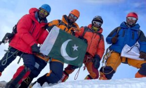
Naess and Streather on the summit of Tirich Mir, planting the flags of Norway, Pakistan, the United Nations, and Great Britain. Photo: The Himalayan Journal
They descended with some slight frostbite to base camp, where they met the porters. In his report for the Himalayan Journal, Streather credited the porters: “We could not have achieved success without them.”