After a decade of controversy, Nepal and China have agreed on the new height of Mount Everest: It’s the same as it’s been, plus a few inches.
Today, the two neighboring countries finally released the new height of their shared mountain, known as Sagarmatha in Nepal and Qomolangma in Tibet. Their result shows that Everest is…
Precisely 8,848.86m tall. The figure differs only by 86cm from 1954’s Survey of India, a remarkable fact considering that the original calculation was made by traditional surveying with theodolites. The new figure adds 43cm to the 2005 calculation by Chinese surveyors, which already drew upon satellite technology.

Nepal and China’s ministers of foreign affairs jointly reveal the new height of Everest earlier today. Photo: The Nepali Times
The good news is that books, corporate names, and documents will not have to change: Everest can still be associated with the number 8,848, though a case can also be made for rounding up to 8,849. Nepal’s Foreign Minister Pradeep Gyawali in Kathmandu and his Chinese counterpart Wang Yi in Beijing revealed the new height with a flourish by pressing a crystal ball simultaneously.
The long, secretive buildup to the great reveal led us to expect more. Rumors suggested that the new figure might be higher than previously thought, contrary to previous speculation that the 2015 quake might have shrunk the mountain slightly.
The Himalaya, under constant pressure from the Indian and Eurasian tectonic plates, continue to rise about one metre every 900 years, but erosion and earthquakes may counter this uplift. In fact, one of the goals of the surveys, conducted in 2019 and 2020, was to study the effects of the 2015 quake.

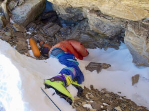
Chinese surveyor Zheng Lin survey from Everest BC in May, 2020. Photo: Xinhua/Purbu Zhaxi
Some background on Everest’s height:
The generally accepted height of Mt. Everest has been 8,848m (29,029 ft) since the Survey of India in 1954. A 1975 Chinese measuring expedition confirmed this figure. Rather than the theodolite measurements that previous researchers took from the base of the mountain, the 1975 Chinese team actually planted a marker on the summit, which allowed six survey points downslope to simultaneously measure the height of the peak. The result was 8,848.13m above sea level.
A 2005 expedition led to a slight adjustment. Using both theodolites and satellite technology, they measured the depth of the summit snowcap and came up with a rock height of 8,844.43m plus 3.5m of snow — still 8,848m in total.
In 1999, National Geographic and Boston’s Museum of Science came up with a slightly higher figure — 8,850m, including snow. This was adopted by a number of American expedition outfitters, eager to add a couple of metres to their clients’ achievement.

Everest ups and downs over the years. Table: The Nepali Times