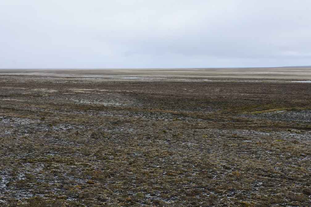
It isn’t hard to secure bragging rights as the first to do some adventure on massive Victoria Island in Canada’s Central Arctic.
Although it’s relatively easy to reach — one of its two towns, Cambridge Bay, is a northern transportation hub — few adventurers go there. Of the handful who have, almost all are wilderness canoeists. They come to paddle the Kuujjua or Nanook Rivers, or link shorter rivers like the Lauchlan, Ekalluk, and Greiner.
Some modern expeditions merely graze Victoria Island, such as the party that kayaked the whole Northwest Passage in 2023, or the yearly commercial tour run by Ousland Explorers that skis the 400km from Cambridge Bay to Gjoa Haven on nearby King William Island.
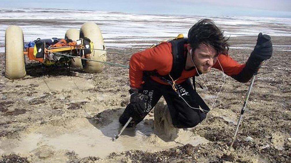
But to focus on Victoria Island, you have to be intrigued by its status as the eighth-largest island in the world. That seems to be what drew a pair of gonzo Australians in their early 20s who hauled a cart with outrageously large tires across Victoria Island in 2008. They did part of the route in 2005, then picked up where they left off three years later, giving the crossing one-and-a-half stars for purity but four stars for originality.
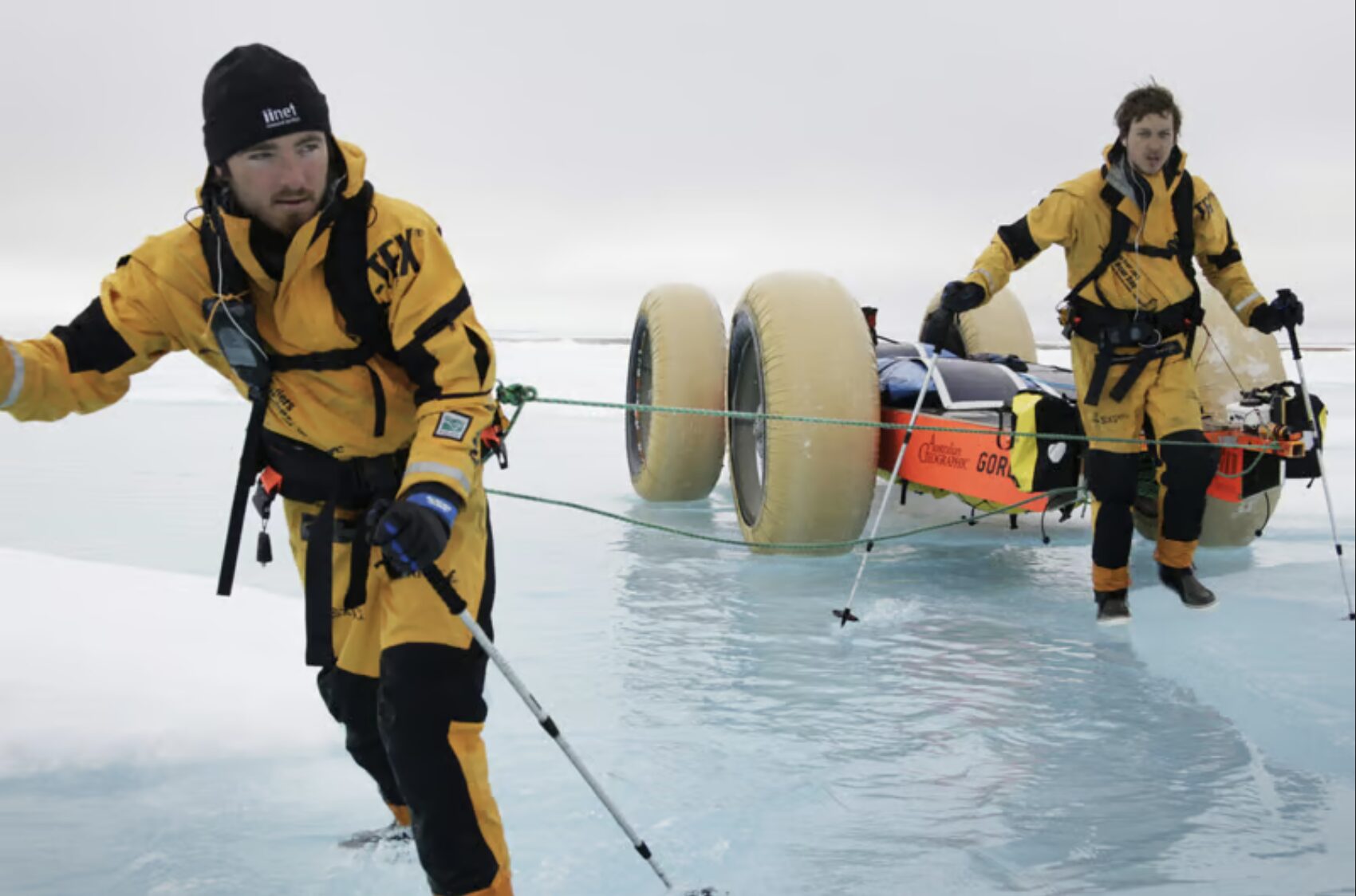
Clark Carter and Chris Bray with their world-record-sized cart tires. Photo: Carter/Bray
Kinda dull?
Why the lack of interest in Victoria Island?
Bluntly put, it lacks the magnetism of many Arctic islands. Like most of the western and central Arctic, it’s pretty flat. Its highest peak is not a peak but a 655m block without a name. Its dominant biomass is mosquitoes. Black flies, absent from many Arctic islands, also terrorize the brief summers here. A warming climate has recently increased their presence.
The often blah Victoria Island. Photo: Jerry Kobalenko
Despite the milder weather, summers are raw, cloudy, foggy; in short, kind of crappy. Admittedly, I speak as someone spoiled by the incredible spring weather of the eastern High Arctic, where I once experienced just two overcast days in two months. By the end of the expedition, I was weary of sunshine. No such worries on Victoria Island.
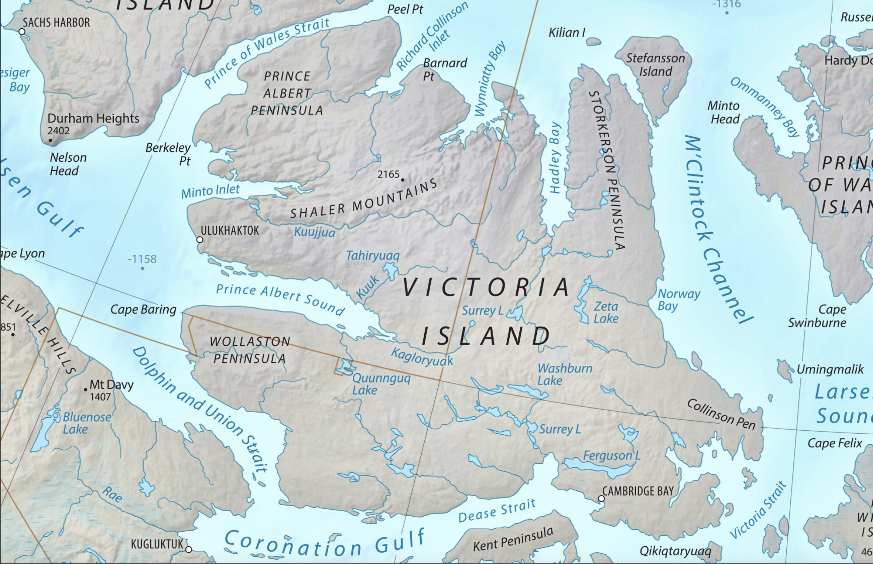
There is no record of anyone manhauling across Victoria in spring, despite the convenience of the island’s two towns, Cambridge Bay and Ulukhaktok (formerly called Holman), lying on opposing sides, ideal starting and finishing points. Undoubtedly, however, the residents of those two towns have worked out a snowmobile route across the island for occasional visits.
Map: Wikipedia
Exploration history
The island does have its plusses, apart from being easy to reach for an Arctic destination. In summer, Cambridge Bay has one or two charter airline companies, allowing adventurers to fly to their destination elsewhere on the island. Its dramatic 19th and early-20th century explorations make it appealing for history retracers.
In 1848, John Franklin died off the northwest corner of King William Island, almost within sight of Victoria Island, while searching for the Northwest Passage. Franklin searchers have poked around eastern Victoria for traces of that doomed expedition. The trek across the frozen sea from their iced-in vessels would have been straightforward. However, no traces of Franklin’s men have been discovered on the east coast.
Three years later, in 1851, John Rae first explored the south coast of Victoria Island and found two pieces of wood from Franklin’s ships — the only artifacts from that doomed expedition discovered on Victoria Island.
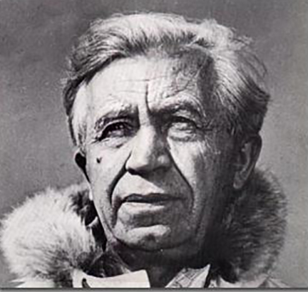
Vilhjalmur Stefansson.
‘Blond Eskimos’
More weirdly, during a 1908-12 expedition, explorer Vilhjalmur Stefansson claimed to have stumbled on a group of “blond Eskimos” on Victoria Island. They had fair hair and blue eyes, he averred, and hinted that they might be the descendants of ancient Icelandic explorers. The media, past and present, loves lost tribe stories, and Stefansson’s claim made quite a splash.
Arctic explorers, who travel silent country silently, living largely in their own skulls, tend to be poor writers, but Stefansson was an exception. Once, I went through his papers at Dartmouth College in New Hampshire and was surprised by how good his magazine article drafts were.
However, as good as he was at making his case in print, Stefansson was not a reliable narrator. His blond Eskimos — despite being good publicity for him — had the disadvantage of being fictitious.
A reliable narrator
Knud Rasmussen, who was a reliable narrator, laid this myth to rest a few years later when he spent months on Victoria Island with these people during his Fifth Thule Expedition. More recent genetic work has totally eliminated any potential ancestral link between these Inuit and northern Scandinavians.
Thanks to Victoria Island’s thin background in contemporary adventure, a lot can be done here. No one has kayaked or skied around the eighth-largest island in the world. No one has skied across it from north to south, and no one has done east to west in a single go.
It’s even hard to know whether anyone has ever stood on that unnamed high point of the island, which lies in the uplands of the northwestern peninsula. But since the 1970s, geologists in helicopters have poked around almost everywhere in the Arctic, so it is likely that some curious researcher has, at least, landed there.
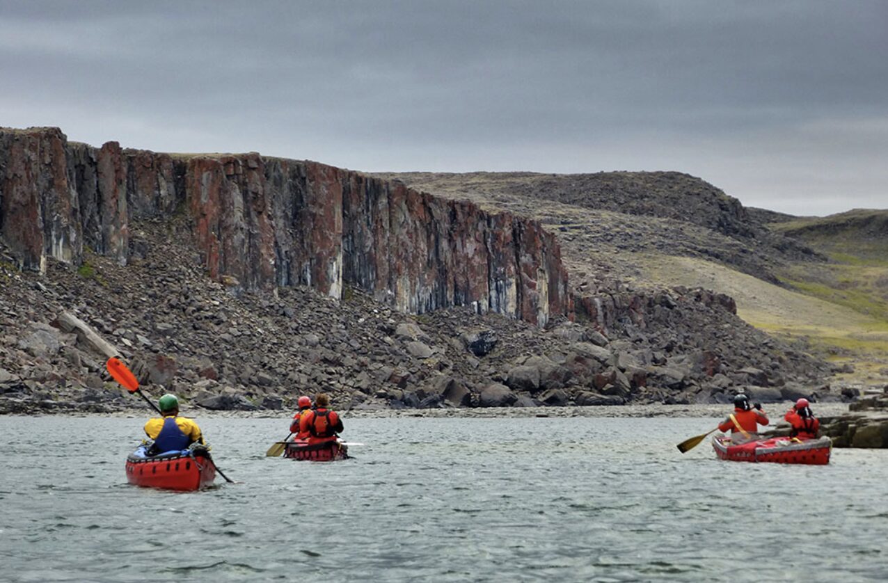
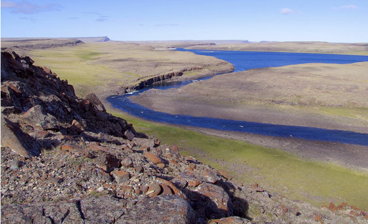
Kuujjua River. Photo: Chris Rush
Wilderness canoeing
As mentioned above, apart from crossings and circumnavigations, the most obvious kind of wilderness expedition is canoeing. Victoria Island doesn’t have Canada’s northernmost canoeable river — Banks Island, just to the north, has the gentle, interesting Thomsen River. A party of well-off Ottawa canoeists once even pretended to canoe the Ruggles River on northern Ellesmere Island, in order to claim they paddled the northernmost river in the world. However, calling this 50km-long, shallow, ice-choked waterway canoeable is a stretch. (And anyway, if you just want to drag a boat down a shallow river and say you’ve paddled it, Ellesmere’s Wood River is even further north.)
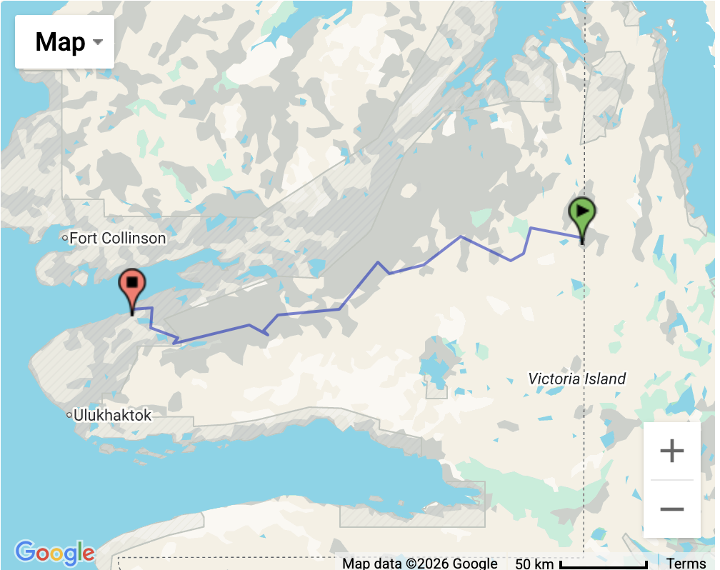
The Kuujjua River flows 350km from east to west. Fort Collinson is a long-abandoned Hudson’s Bay Company post.
Kuujjua River. Photo: Lester Kovac
Kuujjua River
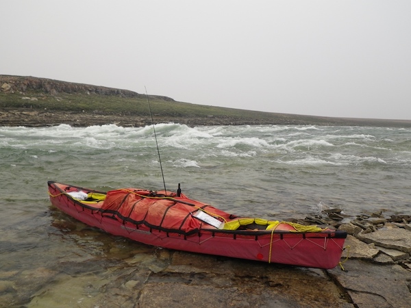
At least, Victoria’s Kuujjua River is a proper paddler’s destination. Its headwaters lie in the interior (charter flight from Cambridge Bay required). Only a handful of parties have canoed this river since the 1990s, including one group in 2012. One of the paddlers left an informative report on the Canadian Canoe Routes website, including detailed topo maps.
The 350km river begins painfully, with three days of dragging/lining canoes through rocky shallows. Since for ease of transportation, most canoes used here are folding PakCanoes, a well-stocked repair kit is vital to repair the abrasion damage to the hull from all the dragging over rocks.
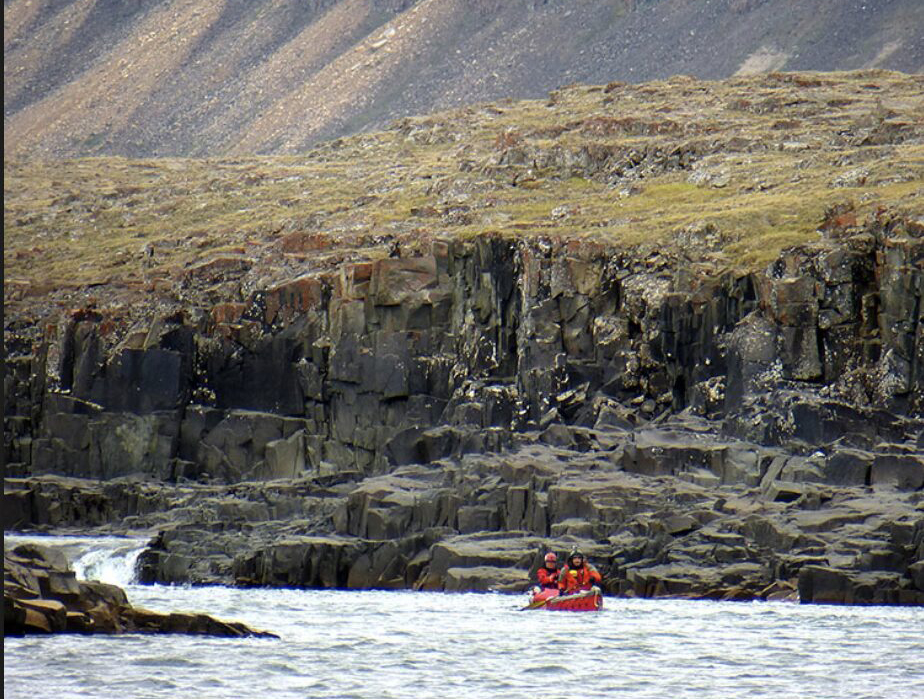
A small ledge, left, on the Kuujjua River. Photo: Chris Rush
Eventually, the river becomes deep enough to float a loaded boat. Depending on water levels, some sections have too much flow for canoes. The 2012 expedition featured three portages, including one 800m carry. The entire river down to the sea at Minto Inlet took this particular group 15 days. There, they had arranged for a boat from nearby Ulukhaktok to pick them up. Further route details here.
Nanook River
The Nanook River flows in the opposite direction, from west to east, and is about one-third the length of the Kuujjua, with a largely gentle current, except for the last five kilometers, which may require portaging.
Other rivers on Victoria Island are even shorter, but routes can be cobbled together, as this experienced party did in 2014.
Surrey River. Photo: Brian Johnson
Previous stories in this series: