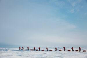
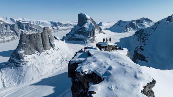
Americans Henry Penfold and Caleb McDaniels are set to begin a five‑month, 2,300km journey around the coastline of Baffin Island in the Canadian Arctic. Beginning later this month, they plan to combine skiing, hiking, and packrafting to circle the world’s fifth-largest island. It’s not a complete circumnavigation, as they cut off several corners, but it is a massive undertaking.
Conditions at the start in Iqaluit, the capital city of Nunavut, are expected to be mild, but with enough snow cover to begin on skis. As the seasons progress and the landscape changes, they intend to shift to hiking and packrafting.
Previously, the pair completed a three‑month, 1,200km journey along the southwest coast of Greenland, combining skiing, hiking, and packrafting. McDaniels has also spent several seasons in Greenland, including months of solo travel and fieldwork.
The route
Penfold and McDaniels will set out from Iqaluit in late May, traveling counterclockwise around Baffin. They have organized their route into seven legs, bordered by remote communities where they will resupply.
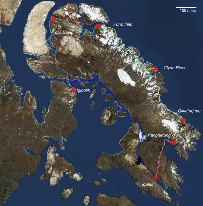
Their planned route cuts off several corners of Baffin but is a giant almost-circumnavigation. Map: Sanfords.org
The opening leg will cover the 400km from Iqaluit to Pangnirtung in a projected two-and-a-half weeks. They will likely go on skis, depending on conditions, with packrafts hauled behind as pulks.
Transition to hiking
From the small Inuit community of Pangnirtung, the second stage continues 240km north to Qikiqtarjuaq, across the popular Akshayuk Pass. As snow cover diminishes, the pair will shift from skiing to hiking.
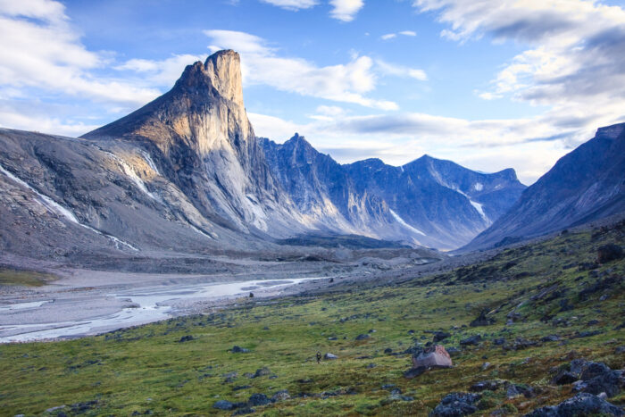
Evening light on Mount Thor in Auyuittuq National Park, Baffin Island. Photo: Shutterstock
Akshayuk Pass in Auyuittuq National Park is a relatively short but striking corridor, passing beneath prominent granite walls and the well-known peaks of Mount Thor and Mount Asgard. Whether traveled in summer or winter, it often serves as an accessible introduction to Baffin Island for first-time Arctic visitors.
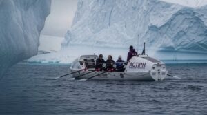
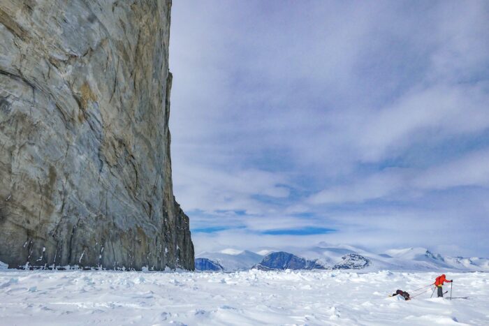
The third stage, approximately 560km from Qikiqtarjuaq to Clyde River, is one of the more complex sections. Here, conditions in the fiords will be in transition. Travel will depend on sea ice conditions, with skiing or walking over solid sea ice, paddling where it has broken up, and detouring inland when breakup is too advanced.
The two Americans will likely paddle through the striking Sam Ford Fiord between Clyde River and Pond Inlet. The fiord is pictured here in winter. Photo: Erik Boomer
Another 560km follows between Clyde River and Pond Inlet. Here, travel is expected to combine overland hiking with fiord paddling in increasingly ice-free conditions.
River and coastal paddling
From Pond Inlet to Arctic Bay, a 320km stretch, the route crosses the Borden Peninsula, mixing inland travel with sections of river and coastal paddling. The sixth stage turns south over roughly 480km, following Admiralty Inlet before crossing the base of the Brodeur Peninsula on foot.
The final leg is by far the longest, stretching around 1,130km from Igloolik back to Iqaluit. After resupplying and taking on additional winter equipment for temperatures down to around -20°C, the team plans to spend several weeks paddling south before transitioning back to hiking as sea ice begins to reform in autumn. Progress on this final stage will depend heavily on conditions in Foxe Basin, where timing the freeze-up will be critical to completing the circuit.
A skier works through rough sea ice on Baffin Island. Photo: Frank Wolf
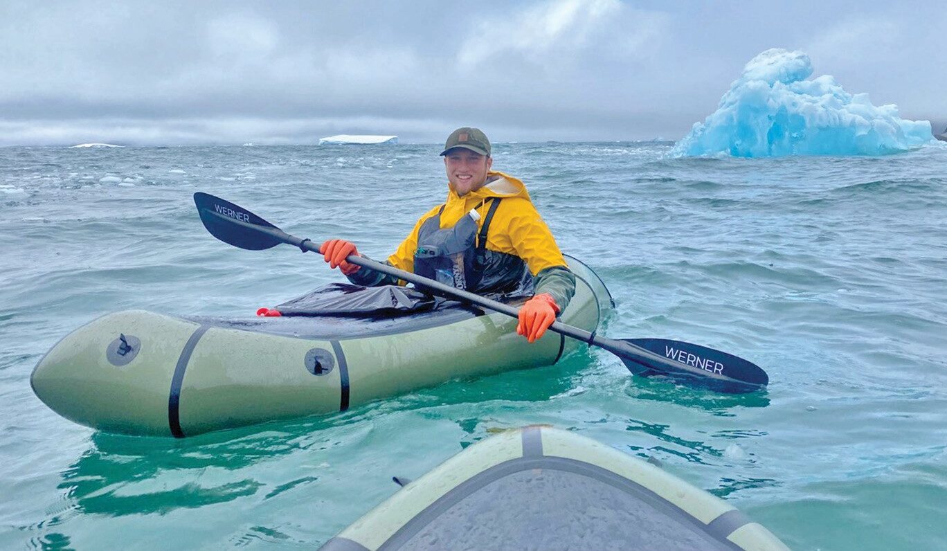
To manage the long stretch without resupply, they expect to rely primarily on packrafts during the first four weeks, using them to help carry roughly seven weeks’ worth of food. Progress will depend heavily on ice conditions. Extensive or unstable sea ice could prevent paddling and force adjustments to their approach.
For safety, they plan to carry a trip wire, flare guns, and a range of non‑lethal bear deterrents, with a shotgun as a last resort. If all goes to plan, they aim to finish by early November.
Past circumnavigation
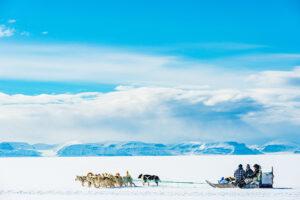
In 1990, Paul Landry, Matty McNair, and Jeff and Rosemary Murray completed a dogsled circumnavigation of Baffin Island, covering around 4,000km. Twenty‑five years later, Sarah McNair‑Landry retraced a route first traveled by her parents, Paul Landry and Matty McNair, when she teamed up with Erik Boomer for a similar journey.
Erik Boomer and Sarah McNair-Landry. Photo: Erik Boomer
In 2015, the pair covered roughly 4,000km over 120 days, traveling by dogsled across both land and sea ice before returning to Iqaluit. Their route followed much of the earlier circuit and included stops in Arctic communities such as Igloolik, Pangnirtung, Qikiqtarjuaq, Clyde River, Pond Inlet, and Arctic Bay.