Since our last Arctic update, two expeditions in Svalbard have been called off, while another attempt in northern Greenland now appears in doubt. Elsewhere, teams continue their crossings of the Greenland Ice Sheet, and veteran Arctic travelers are making steady progress along lesser-known routes in both Nunavut and the Northwest Territories.
Greenland
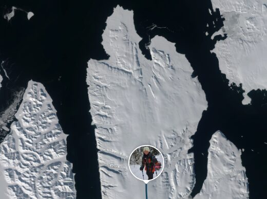
Keen’s route skirts the complicated, unstable ice of the North Water Polynya. Even this recent satellite photo does not show how reliable the ice is if Keen tried to hug the coast.
British chef-turned-adventurer Mike Keen has reached Kullorsuaq in northwestern Greenland after waiting for clear weather to allow a helicopter drop-off. In the past week, Keen has hinted on social media that his original plan to haul a sled 320km across Melville Bay to Savissivik is under threat due to uncertain sea-ice conditions.
Since arriving in Kullorsuaq, Keen has skied out to and spent a day and night at an old Knud Rasmussen trading post cabin north of town. There, the Briton butchered a seal in preparation. It will be his only food source for the journey, or revised journey, ahead.
Photo: Gilles Denis
The four-man international team of Gilles Denis, Sasha Doyle, Ed Luke, and Wilson Cheung started their 1,700km kite journey across the ice sheet from Kangerlussuaq in the southwest to Qaanaaq in the northwest on April 19.
They are now 12 days into their kite journey. The first four days involved hauling their sleds over glaciers to access the plateau of the inland ice. They often followed frozen meltwater channels to avoid crevassed areas.
Current location as of May 1. Their start point, Point 660, is marked at the far left.
Their tracker does not indicate a total distance covered, but they are currently at 68˚N and 2,000m of elevation and have recorded days with over 80km of kiting despite unfavorable winds.
Nina Teirasvuo and her clients access the inland ice. Photo: avotunturit.fi
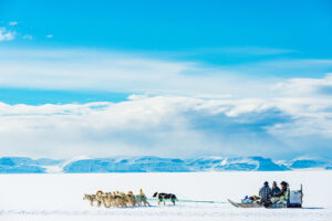
Finnish guide Nina Teirasvuo and her five clients are 15 days into a west-to-east crossing from Point 600 on the west coast to Isortoq on the east coast. On April 27, the team reached the abandoned Cold War radar station, DYE 2. They have covered around 220km of the 550km journey.
Svalbard
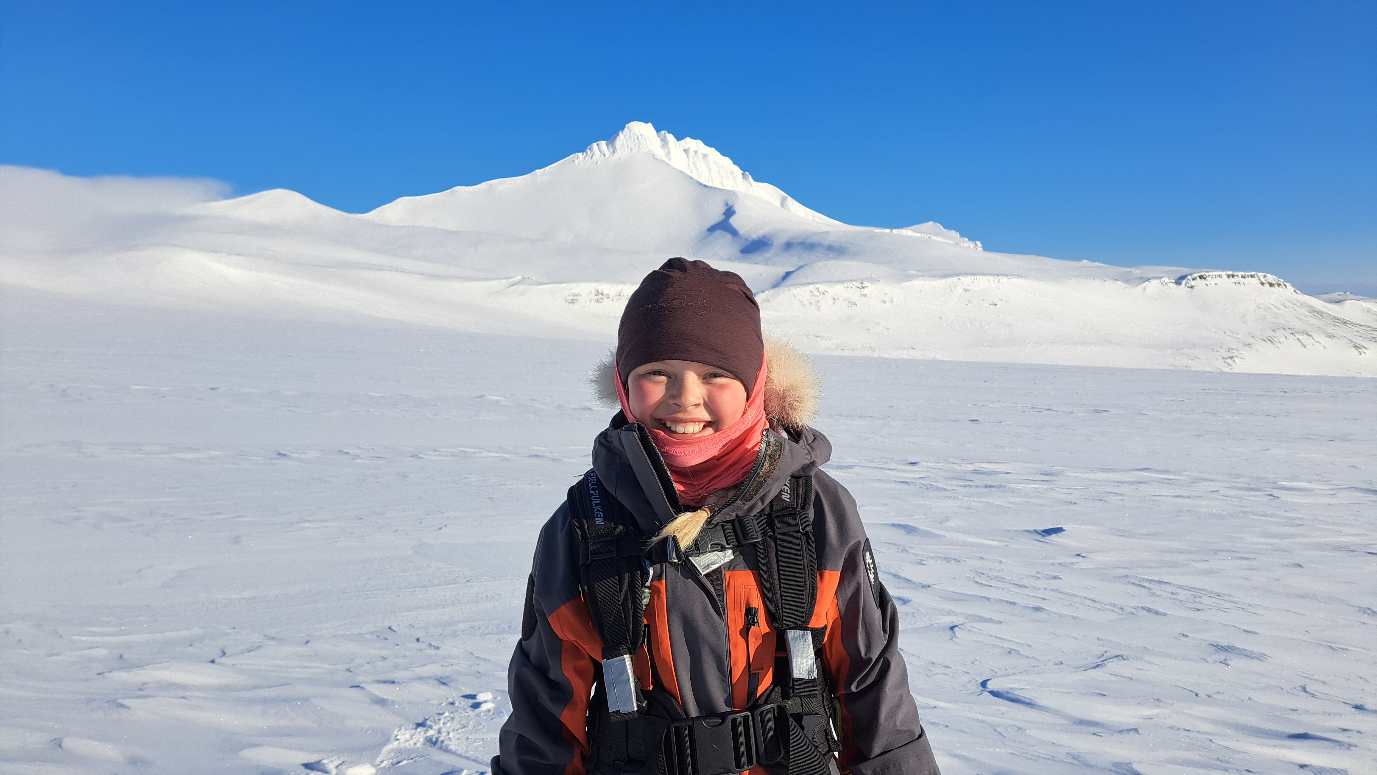
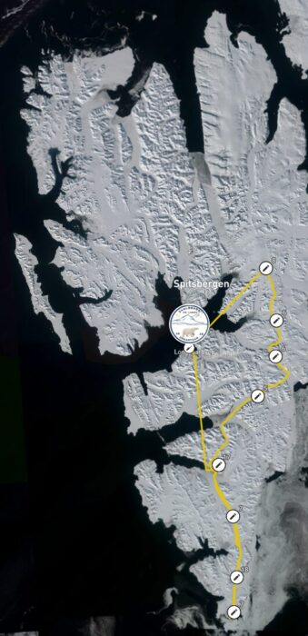
Norwegian Alexander Read and his 10-year-old daughter Mina are now 36 days into a 600km sled journey across Spitsbergen, traveling from south to north under the guidance of Norwegian polar guide Are Johansen. According to their tracker, the trio has already covered 608km. However, their support team has told ExplorersWeb that their original plan to be picked up by snowmobile is no longer viable due to melting snow and newly formed open rivers.
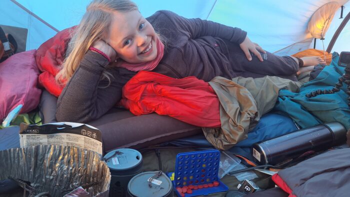
Ten-year-old Mina Read in camp. Photo: Mina og meg
“We are continuing north and are now starting a 1,000m ascent after nearly two weeks of cold and strong headwinds north that have taken their toll,” Alexander Read wrote on social media last week. “We still have around 200km to go to the northern tip of Svalbard. We’re keeping our fingers crossed that we’ll soon find a way to get picked up and back to Longyearbyen.”
The Reads’ current location.
“Together with the team, we live in our own world in the polar wilderness, close to nature. We’ve seen Arctic foxes, reindeer, birds, and many polar bear tracks. We’re creating magic moments and memories for a lifetime,” added Read.
The six-member Norwegian women’s team of Karen Kylleso, Christine Fors, Veronica Fors, Cecilie Rydberg, Ellen Burchard, and Ingvild Feragen has called off their planned 600km+ sled expedition from south to north Spitsbergen on day 28.
The route completed by Kylleso and co.
No longer within reach
On social media, Kylleso explained the decision: “After 28 days on a trip, where the last four were spent stuck in the tent at Lomonosovfonna, I saw that the goal of Verlegenhuken all the way north was no longer within reach. With poor weather forecasts and the coming time, we decided to turn south, and were picked up five days ahead of scheduled time.”
The five-person Belgian and French team of Merlin Cerise, Gael Loicq, Jean-Simon Gerard, Fabrice Yencko, and Nicola Sanchez has also cut short their planned 35-day ski journey from Longyearbyen to northern Spitsbergen and back, ending the expedition after 24 days. Details about how far they progressed and the specifics of their evacuation remain unclear.
Cerise explained: “The melting season began a month earlier than expected here in Svalbard. Positive temps, rain, and all this ice melting a month early. Feet in the water, pulka picking up pebbles, we decided to shorten our route home. We were planning to head south for a loop, but the lack of snow and wet conditions has forced us to change our route again.”
Earlier, on day 7 of the expedition, Jean-Simon Gerard withdrew due to foot issues and physical exhaustion. Then, on day 9, Fabrice Yencko also left the team because of a herniated disc.
The ‘Girls Trip’ team in good spirits. Photo: Girls Trip
All-woman’s team
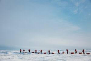
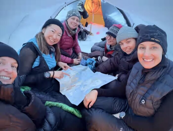
The all-female team of Britons Cat Burford, Amelia Rudd, Amelia Steele, Emma Maher, and Jen McKeown, along with Japanese-American Ayuka Kawakami, are nine days into a 200km ski journey across Svalbard’s glaciers from Ekmanfjorden to Magdalenefjorden.
Apart from a tent day due to poor weather, progress has been solid. The team’s tracker shows them having covered three-quarters of their route. Thanks to modern technology, McKeown was even interviewed for a job with the British Antarctic Survey yesterday.
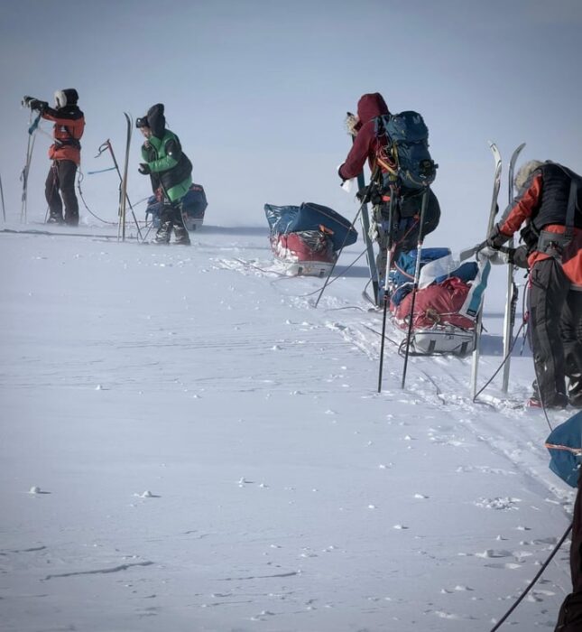
Photo: The ‘Girls Trip’
Nunavut, Canada
British adventurer Preet Chandi completed a circuit of Cornwallis Island in Canada’s High Arctic, skiing 506km over the course of 39 days. Her original objective had been a solo, unsupported expedition to the North Pole from Ward Hunt Island, but those plans were changed after she was unable to secure the necessary funding.
At the outset, Chandi indicated she was carrying 60 days’ worth of food with the intention of reaching Ellef Ringnes Island and back from Resolute. However, on day 16, after roughly three-quarters of the way along the northern edge of Bathurst Island, she shifted course eastward and began sledding along the north coast of Cornwallis Island. The reasoning behind this decision remains unclear, particularly given that the eastern coastline is known for a significant polar bear presence.
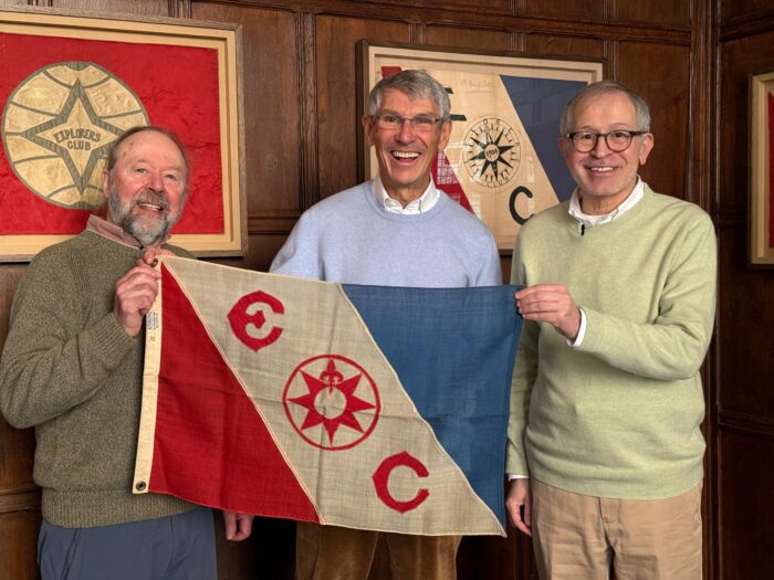
Mike Beedell, far left, and Hubert Sagnieres, middle, receive flag #12 from the Explorers Club in New York, before their expedition in the Western Arctic. Photo: routesnouvelles.com
Central High Arctic
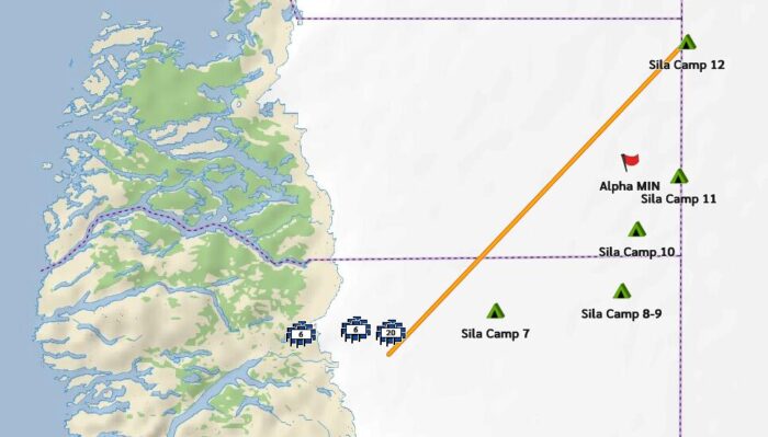
One of the most interesting expeditions of the 2026 Arctic season has unfolded with comparatively little attention. Veteran Canadian Arctic guide Mike Beedell has joined forces with French mountaineer Bertrand Delapierre and Canadian teammate Hubert Sagnieres for a 500km sled journey across a remote stretch of Canada’s High Arctic.
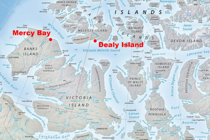
Now 31 days into their journey, the team is skiing from Dealy Island to Mercy Bay. This route cuts through the western Arctic Archipelago, an isolated region of islands and sea ice north of mainland Canada, historically associated with 19th-century polar exploration and the search for the Northwest Passage. While this route looks like the most straightforward way through the Northwest Passage — Lancaster Sound-Barrow Strait-Viscount Melville Sound-McClure Strait — heavy ice bedevils this channel most summers. The Northwest Passage successfully sailed by Amundsen and others was a complicated, twisty route further south.
Map: shadedrelief.com
Their expedition is examining locations documented by Victorian exploration figures such as William Edward Parry, Francis Leopold McClintock, and Bedford Pim, comparing historical accounts with present-day conditions directly in the field. It is likely that no one has traveled this route on foot since Pim and a small party in 1853.
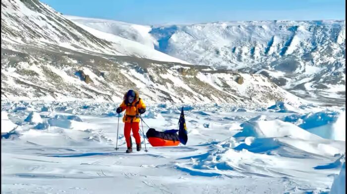
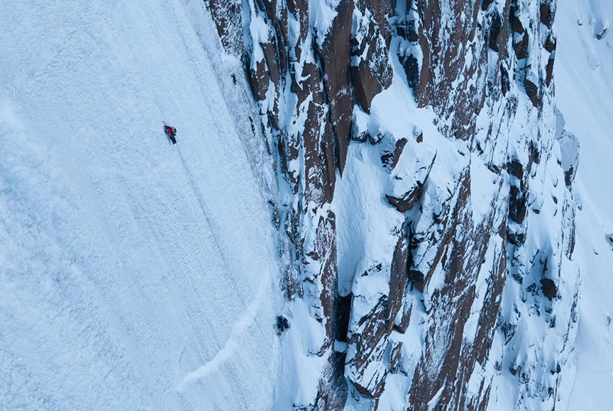
One of the team sleds near Cape Hay on April 21. Cape Hay marks the southwest extremity of Melville Island, overlooking the ice-choked waters of McClure Strait. From this vantage point, William Edward Parry first glimpsed Banks Island on August 8, 1820, before heavy ice forced his retreat. The distant land he observed would remain out of reach for three more decades, until Robert McClure approached it from the west in 1850. Photo: routesnouvelles.com
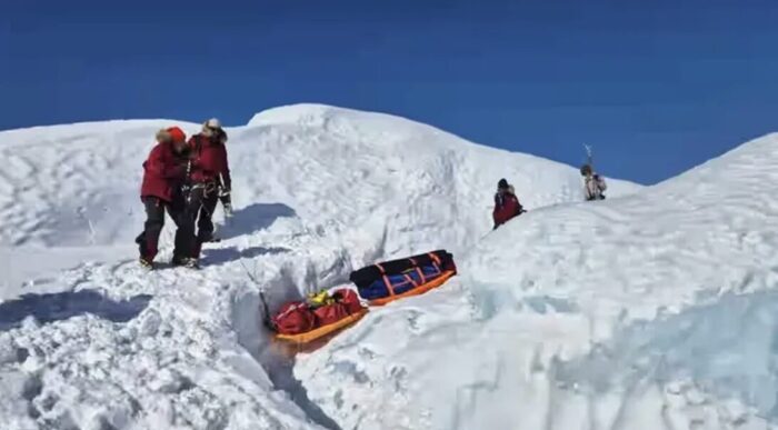
One evacuation
On day 8, the toe binding on Delapierre’s ski boot sheared off, and on day 14, Beedell, who is 70, was evacuated with frostbite injuries to his eyelids and a pulled intercostal muscle in his ribs. Delapierre and Sagnieres have continued on, thanks to a ski boot delivered by the resupply plane.
At this stage, the team has entered one of the most exposed parts of the journey: the crossing of McClure Strait, a wide channel of sea ice that separates Banks Island from Melville Island.
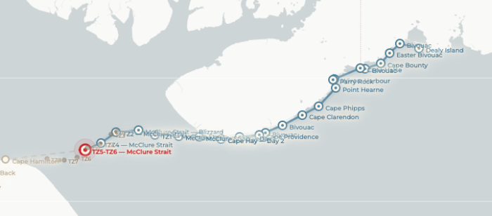
Current location of Delapierre and Sagnieres.
Elsewhere in the Canadian Arctic, Baffin Island-resident and adventure polymath Erik Boomer is heading out on a 45-day multisport adventure in search of unclimbed ice, with some rock climbing thrown in later in the trip. Last month, Boomer climbed a large new ice line outside Pangnirtung, Baffin Island.
Erik Boomer and partner on the new 300m ice line. Photo: Erik Boomer
Northwest Territories
At 81, American polar legend Will Steger is 29 days into a solo journey of around 1,300km, expected to take roughly 60 days. He began on the northeastern shore of Great Bear Lake and is traveling north toward Paulatuk, a small Arctic community on the Arctic Ocean coast.
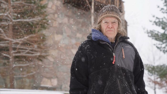
Will Steger. Photo: KARE 11 News
Around 10 days ago, Steger endured a dramatic 60°C temperature swing within 48 hours, shifting from -30°C to +30°C. While conditions are now trending toward spring, they have since stabilized. At times, he has had to relay his sleds in several trips to manage the difficult terrain and heavy sled weight.
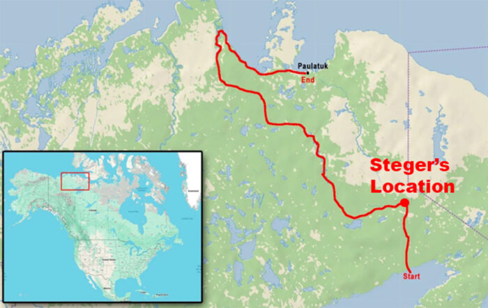
The approximate location of Will Steger.
Steger has crossed the watershed between the Haldane River and Horton systems and is currently making his way north along the Horton River. As spring advances, the frozen rivers he relies on will begin to break up, but he is equipped with a packraft to use when conditions allow.