Since there are no new continents to discover, and a growing shortage of unclimbed mountains, modern adventurers and athletes often focus on lists: the Seven Summits, the 14 8,000’ers, the six great North Faces of the Alps, the Explorers’ Grand Slam. As time goes on, we will need to look harder for interesting lists.
Projects encompassing the 10 largest islands in the world are a great start. There isn’t just one project linking all of them, there are several. You can circumnavigate all 10 — by kayaking, by swimming, by trekking. You can cross them all on foot from north to south or from east to west. You can reach their high points or their geographical centers. You can do all these things, then go one step further by traveling from one island to another under your own power as you tick them off.
You get the idea. Many of these islands are suitable destinations for wilderness travelers. Two of them are not, but there are ways to focus on the wild corners of even the most civilized places.
In this series, we consider these 10 islands from the perspective of a self-propelled traveler. Four of these islands are in the Arctic, and three are in the Tropics, so you will need versatility. Many of these islands have been circumnavigated and trekked lengthwise individually, but never all of them together in one vast linked project.
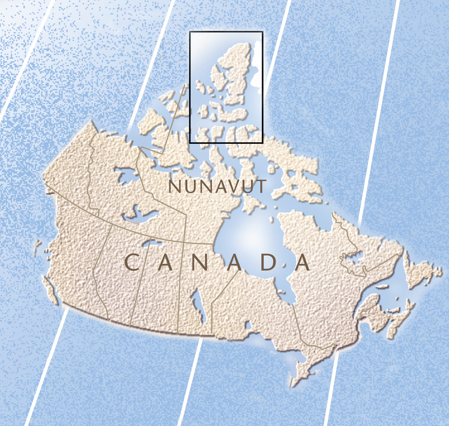
#10: Ellesmere Island
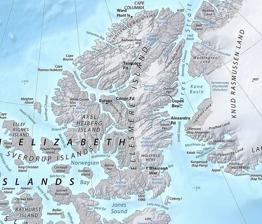
Ellesmere is not only one of the largest islands in the world, but it is also the northernmost land except for Greenland, which nudges about 50km closer to the North Pole. It also has the highest mountains in Canada and the U.S. east of the Rockies.
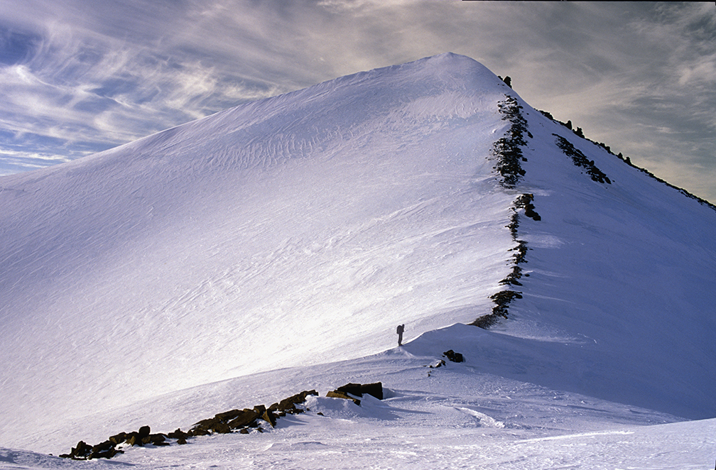
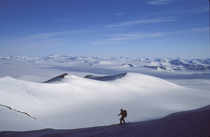
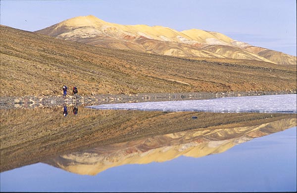
These highest peaks, reaching up to 2,616m, are all nunataks — little frozen gravel lumps erupting from the high ice caps. There remain many possible first ascents, but unlike on Baffin Island’s granite cliffs, no great technical climbing. However, standing on top of a peak you’ve just walked up and gazing 200km in every direction over an utterly pristine, ice-age world will give a summit thrill to all but the most jaded.
Hiking up Ellesmere’s Barbeau Peak, the highest mountain east of the Rockies. The last bit, where the rocks end, required crampons and an ice ax, but no actual climbing. Photo: Jerry Kobalenko
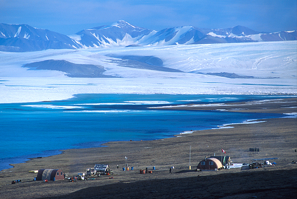
That said, Ellesmere is mainly an island for travelers — sea kayakers, hikers, skiers pulling sleds. Yet few travel here. A national park that takes up the northern one-third of the island gets maybe one group of eight hikers every couple of years.
The main impediment is cost. It used to be difficult and time-consuming to get here, but a small number of people, including myself, did so regularly. Guided hiking and kayak tours ran almost every year. Teachers and car salesmen saved up for their big Arctic adventure. Now, the few who can afford the rare commercial trip that runs here are doctors, investors, tech bros, and the like. It costs $6,000 just to fly from Ottawa to Resolute Bay return — and that’s the easy part.
Nunataks erupting from the Ellesmere ice cap. Photo: Jerry Kobalenko
Cost
Higher gas prices and a lack of competition — there’s now only one charter plane company — mean that getting somewhere interesting on the island costs roughly as much as an Everest expedition. A 12-day kayaking or hiking tour is about $20,000, plus the flight to Resolute Bay. The outfitter isn’t making much of a profit, either; that’s almost all charter costs. If you want to go somewhere independently, it costs two or three Everest expeditions, depending on how many partners share the flight with you.
The exception is Grise Fiord, population around 130, the one civilian community on the island. The scheduled flights from Resolute to Grise Fiord, while not cheap, are subsidized for the benefit of the hamlet. Grise is not the best place to begin an Ellesmere expedition — the most interesting areas are further north — but there are a few routes. Some ski the 70km south across Jones Sound to Devon Island, poke around there, then ski back. Makinson Inlet, to the east, is accessible on foot. You can ski along the south coast in either direction as far as you can get, then turn back.
There is one little hotel in Grise Fiord, but — to put it in high school algebra terms — be aware that the cost of accommodation in the north varies as the cube of the latitude. You can stay in a Relais & Châteaux hotel in Paris for what a small, windowless room in a trailer costs in Grise Fiord.
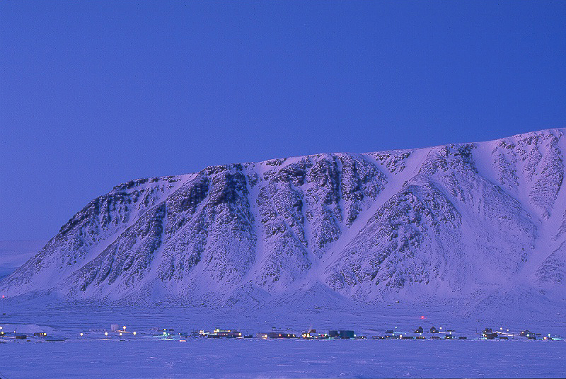
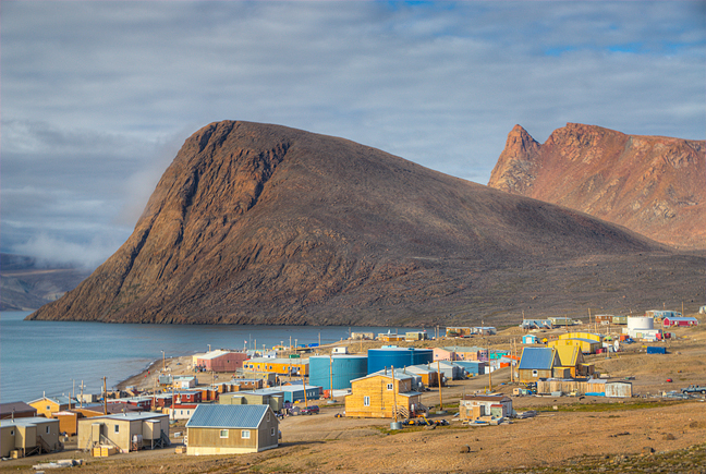
Grise Fiord in late winter, top, and summer. Photos: Jerry Kobalenko
Arctic realities
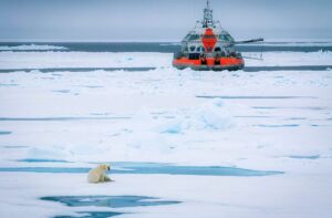
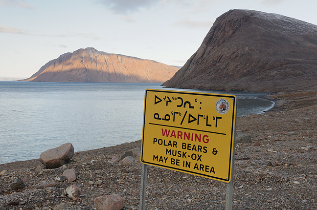
All this is best done in spring. In the High Arctic, spring means winter + sunlight. There aren’t many places to go once the rivers and the ocean open up. Note that even if you want to camp just outside of town, you need a firearm. Polar bears may appear anywhere, any time. Some dreamers have shown up in Grise with their organic food and gentle affect, unprepared for this reality. They make the local RCMP officers very nervous. Grise Fiord is the only place I know where if a cop asks if you’re carrying a gun and you say yes, they visibly relax.
In Grise Fiord, wilderness begins where the last house ends. Photo: Jerry Kobalenko
In recent years, a fellow in Grise Fiord with a small outfitting business has taken visitors by snowmobile the 500km north to the Eureka Weather Station. These excursions were mainly to see wildlife, especially Arctic wolves. But Eureka is a wonderful place to begin an Ellesmere trek, and while the snowmobile ride wouldn’t be cheap, it is less expensive than the $25,000 charter plane flight from Resolute Bay to Eureka. Of course, eventually you also have to get back to Grise/Resolute, and that’s a separate charter. Eureka lies at exactly 80˚N — so far north that a weatherman there once told me that he planned to retire “somewhere south, somewhere like Alaska.”
Park vs non-park
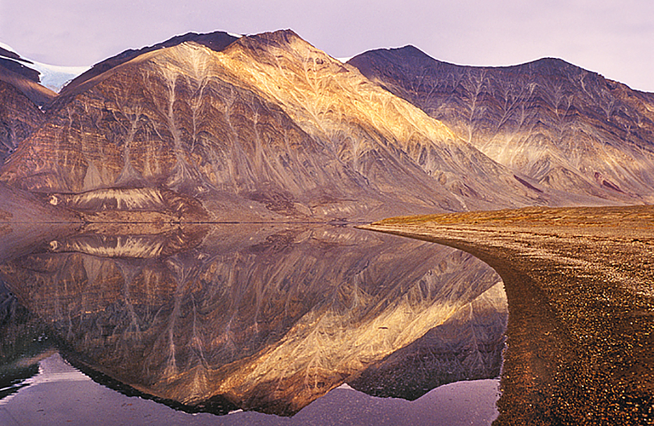
While Quttinirpaaq National Park is beautiful and has some good routes — and the well-established hikes and the presence of seasonal wardens reassure those looking for adventure, but not too much adventure — there are many equally good non-park sites on the island. The first ecotours on Ellesmere, way back in the 1970s, brought sea kayakers to sheltered Alexandra Fiord, about halfway down the east coast. Because cliffs limit mobility, it’s a better summer kayaking destination than a hiking destination. You need to go in late July or early August to ensure there will be enough open water for kayaking.
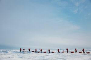
Trekkers on the classic 110km Lake Hazen to Tanquary Fiord route in Quttinirpaaq National Park. Photo: Jerry Kobalenko
Alexandra Fiord is also one of the High Arctic’s five polar oases, with remarkably good weather and rich plant life. (The other four are Ellesmere’s Lake Hazen and Eureka, Devon Island’s Truelove Lowland, and Polar Bear Pass on Bathurst Island west of Resolute Bay.) Travelers whose first experience of the High Arctic is the cold, dank, foggy, windy gravel pit of Resolute Bay, where the jet from the south deposits them, are astonished when they fly 500km further north to Ellesmere and step out into warm sunshine and lush meadows.
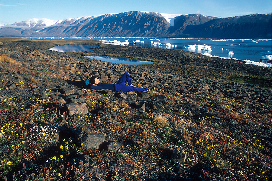
Under the midnight sun at Alexandra Fiord. Photo: Jerry Kobalenko
Peaks and passes
Barbeau Peak, Ellesmere’s high point, was first climbed by glaciologist Geoffrey Hattersley-Smith in 1967. Three parties, including Ousland/Colliard last year, have skied the island from north to south, about 1,100km. There are also four non-glaciated passes from east to west across the island. I’ve done them; they aren’t long and, with one exception — Copes Bay to Cañon Fiord — not particularly difficult.
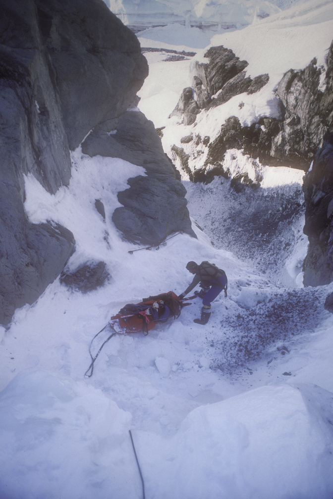
The Copes Bay-Cañon Fiord route. Photo: Jerry Kobalenko
In 2011, Jon Turk and Erik Boomer skied and kayaked completely, or almost completely, around Ellesmere in 104 days, averaging 25km/day. Only three non-motorized parties, including Turk/Boomer, have done the entire north coast, although some military groups have snowmobiled it.
For years, many North Pole expeditions began from the north coast of Ellesmere, but for logistical reasons — it’s hard to convince a chartered aircraft to land on the Arctic Ocean ice these days — it hasn’t been done since 2014. Most began from Ward Hunt Island, a tiny satellite off the north-central coast named for the 300-pound former Lord of the Admiralty during the Victorian era, because from one angle, the island resembles a very large-bellied man lying on his back.
“It was said that he lent weight to Her Majesty’s Councils,” glaciologist Geoffrey Hattersley-Smith once quipped.
Ward Hunt Island on a rare summer day without fog. Photo: Jerry Kobalenko
Discarded items from those North Pole expeditions of the 1970s and 1980s, which had far more failures than successes, may still lie strewn about Ward Hunt. They include shark repellent, curry powder, pineapple juice, and shoe polish. Little wonder they failed.
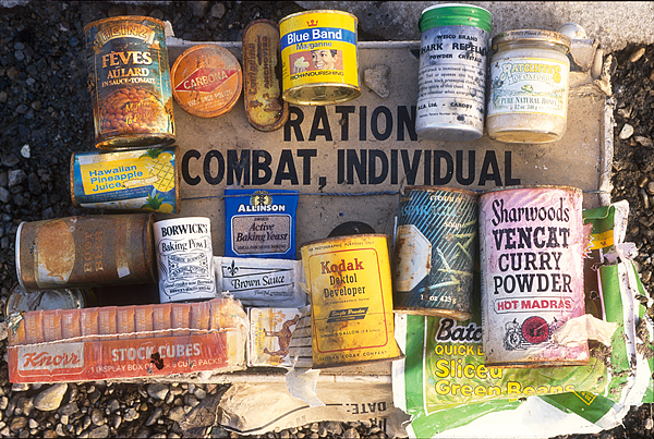
North Pole garbage on Ward Hunt Island. Photo: Jerry Kobalenko