Thru-hiking is a distinctly American term, but long-distance hiking routes aren’t limited to North America. The Great Himalaya Trail (GHT) might eventually encompass a continuous route through Bhutan, Nepal, and India. But for now, the Nepali GHT already offers an almighty 1,750km journey across the entire country and passes over some of the highest trekking passes in the world. Here, we examine the route and hear from those who have completed or guided the GHT.
History of the GHT
Hiking long-distance across the Nepali Himalaya is not new. Locals have covered vast distances since time immemorial, and foreign hikers have completed traverses starting in at least the 1980s.
Notable early long-distance hikers included Peter Hilary (son of Edmund Hilary) Chhewang Tashi, and Graeme Dingle walking from Sikkim, India, to the K2 Base Camp in the Karakorum in 1981, and Hugh Swift and Arlene Blum’s nine-month traverse from Bhutan to Ladakh, India between 1981 and 1982.
More recently, in 1997, Frenchmen Alexandre Poussin and Sylvain Tesson hiked an impressive 5,000km in six months, from Bhutan to Tajikistan.
There have been numerous runners who’ve tackled large distances, too. Richard and Adrian Crane ran from Kanchenjunga to Nanga Parbat in 1983 and in 2023 Rosie Swale-Pope ran 1,700km across Nepal. But both of these trips deviated a long way from what is now the GHT. Swale-Pope ran in Nepal’s mid-hills, and the Crane brothers went far enough south to cross into India.
The modern GHT is a relatively new concept. Between 2008 and 2009, Robin Boustead traced a path over 162 days, linking trekking sections that became the most commonly used route.
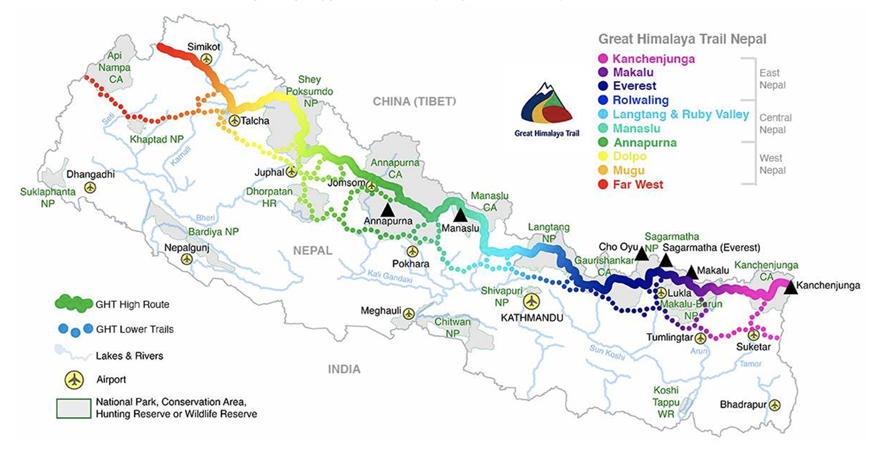
The multicolored solid line represents the Great Himalaya Trail’s high route; the dotted sections, the low route. Photo: Great Himalaya Trail
The high route
There’s both a high and a low route through Nepal. Hikers can easily switch between them, depending on the weather and their tolerance for high-altitude passes. Often you can adapt the route to suit you. This is a network of trails rather than a singular route. But here, we’ll concentrate on one version of the high route.
Most trekking companies divide the route into three regions, East, Central, and West Nepal, and seven (or more) stages: Kangchenjunga, Makalu & Everest, Rolwaling, Langtang & Ruby Valley Link, Manaslu & Annapurna, Dolpo, and finally Nepal’s far west, Rara Lake and Yari Valley.
Hikers tend to start in the east in early March. This is a couple of weeks earlier than the typical trekking season, and it will still be cold with plenty of snow, making for a tough start.
But there is a good reason to start so early. Hikers need to complete the highest passes before the monsoon rains arrive in mid-June. This is also why most people start in the east rather than the west. The GHT’s highest, most difficult passes are bunched in the east and would potentially be more dangerous later in the year.
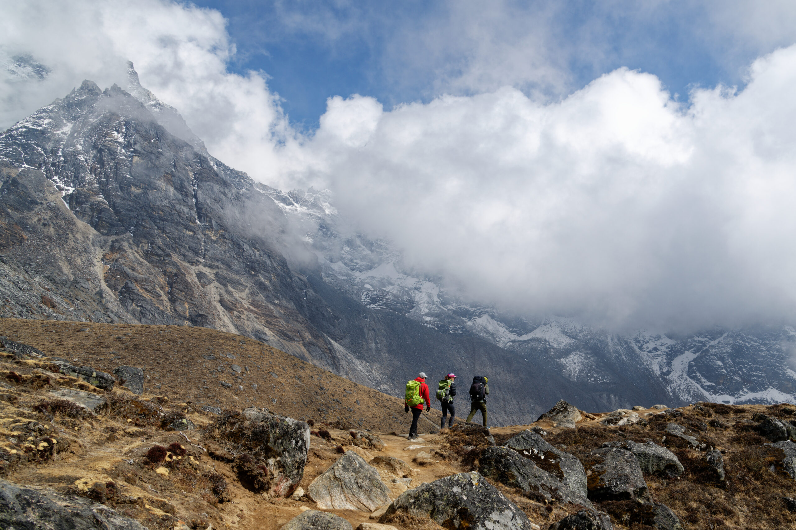
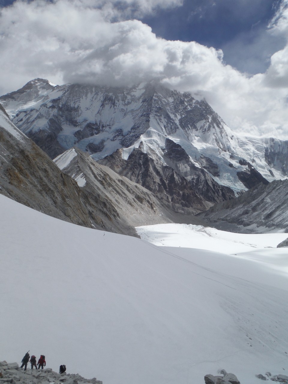
East Nepal: Kanchenjunga
It’s quite the slog just to get to the eastern starting point of the GHT, though it won’t tax your legs. From Kathmandu, you fly to Bhadrapur, tucked into the far south-eastern corner of Nepal on the border with West Bengal, India. From there, it’s a long drive as far north as the roads will take you to Chiruwa. The drive usually takes two long days.
After Chiruwa, you’re on foot, continuing north, parallel with the Indian border, toward Kangchenjunga in Nepal’s northeast. You start low, at around 1,600m, acclimatizing gradually as you push north. Three to four days of hiking brings you to Ghunsa (3,430m), the last village in the area that is inhabited year-round.
Over the next three days, hikers ascend quickly, climbing scree and lateral moraine to Kangchenjunga Base Camp at 5,143m. This marks the furthest east you’ll travel. Hikers then retrace their steps back to Ghunsa before the first pass of the GHT: Nango La.
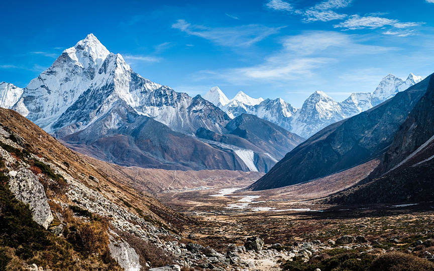
The Kangchenjunga region. Photo: Heather Hawkins
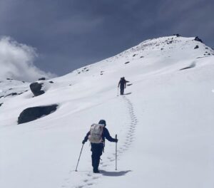
At “only” 4,776m, Nango La is not terribly high, but this early in the season, it can still be tricky, with deep snow. Once over the pass, you drop over 1,000m, heading to the village of Olangchung Gola. It’s possible to do the pass and reach Olangchung Gola in one extremely long day, but most hikers choose to find a camping spot once they’ve descended the pass.
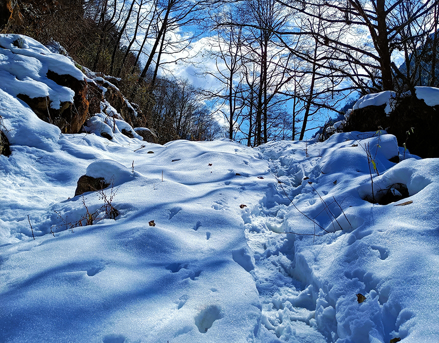
On the trail to Olangchung Gola. Photo: Shutterstock
Makalu and Everest, the crux
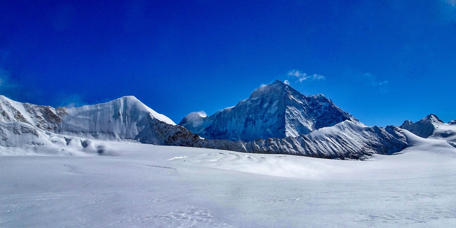
Another reasonably complex pass, Lumbha Sambha, follows Olangchung Gola. Most people camp at a “base camp” and leave before dawn the next morning to cross the saddle of the pass at 5,160m. Expect deep snow and spectacular views of Makalu to the west and Kangchenjunga and Jannu to the east.
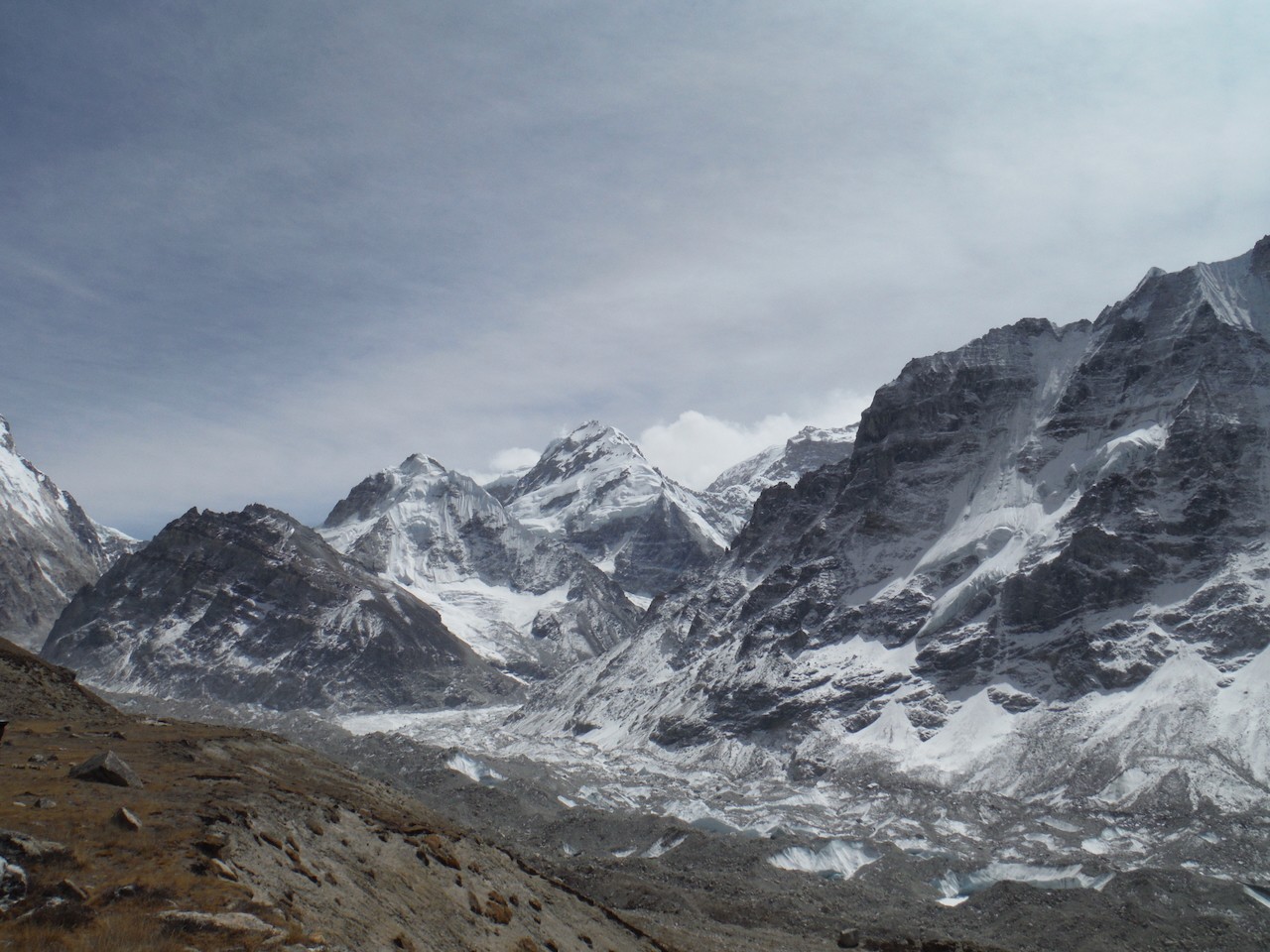
Near Makalu Base Camp. Photo: Shutterstock
Once down from the pass, you’ll hike at a lower altitude for the next few days before gradually climbing toward Makalu Base Camp at 4,870m. From there, it is on to Swiss Base Camp at 5,150m.
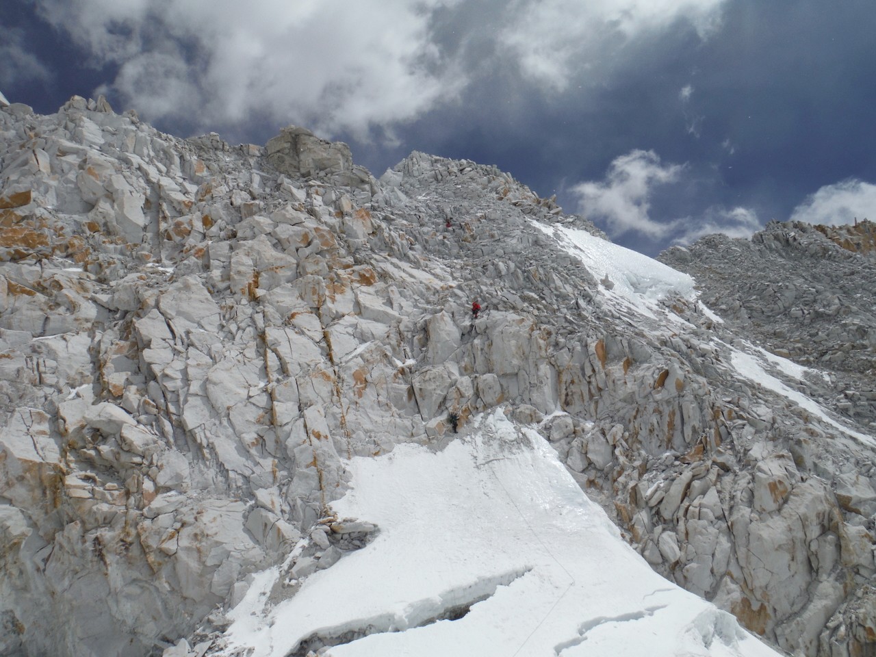
Next comes the crux of the entire traverse: Sherpani Col and West Col.
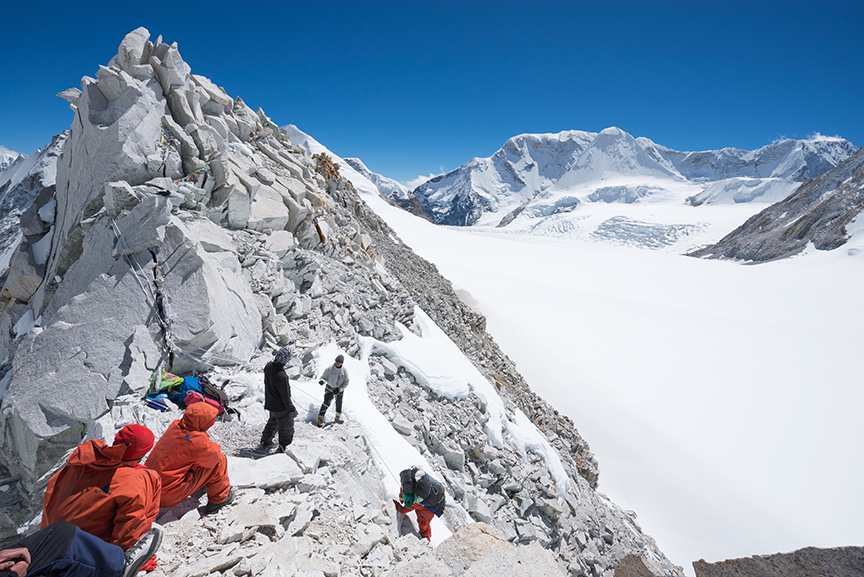
Sherpani Col, 6,155m. Photo: Shutterstock
This crossing should not be attempted in poor weather. It’s wise to take a couple of short days on approach to monitor the weather, acclimatize, and prepare your legs. The route requires crampons and ropes. Some sections require rappeling, and basic mountaineering is a plus. Few people cross Sherpani Col unguided.
It’s best to camp close to the pass. Expedition companies typically stay near the glacier’s snout at 5,688m, leaving only 500m of altitude gain to Sherpani Col at 6,155m.
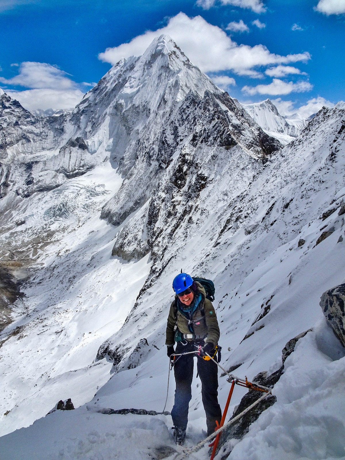
Ascending Sherpani Col. Photo: Heather Hawkins
Sherpani Col
The ascent to Sherpani begins on a gentle snow slope but soon transitions to steep, loose rock. Once on the col, it’s a steep descent (with dangerous loose rock) requiring ropes to the flat glacier that links Sherpani and West Col (6,143m). It’s only a couple of kilometers between the cols, but in deep snow above 6,000m, it can be an energy-sapping slog.
Getting across in one day, especially for large guided groups, is rare but not impossible. Heather Hawkins, who trekked the GHT in 2016 as part of a tour, described the crossing as the hardest of her 152 days during the traverse.
“I had worried about this pass before the trip, but it was a fantastic, challenging day. It took 13 hours through deep snow and across hidden crevasse fields, but we crossed in one day. It was hard because of the altitude, and the weather deteriorated toward the end of the day, but by then, we were preparing to camp.”
Descending Sherpani Col. Photo: Heather Hawkins
Conditions are everything, and the earlier in the day you start, the firmer the snow is, and the more likely you are to cross both cols in a day.
World Expeditions, a tour company specializing in the GHT, builds in at least a day of flexibility for the crossing:
“If conditions are favorable, and the group is moving at a good pace, we may attempt both cols in a day. But in all likelihood, we’ll be camping at Baruntse Camp 1 on the West Col at 6,100m on the first night. [We then] descend the col to the Honku Valley the next day.”
World Expeditions groups camp between Sherpani Col and West Col if they cannot make it over in a single day. Photo: Jasmine Star
The descent from West Col to the Hongku Glacier is not as steep as from Sherpani but still requires fixing ropes. From here, you’ll receive spectacular views of the Khumbu, provided the weather plays ball.
Rappelling down high passes
The next day is more relaxed, hiking across the moraines of the Hongku Basin, but it doesn’t last, the 5,000m+ passes come thick and fast till Rolwaling.
Amphu Labsta, 5,845m, is lower than the cols but a difficult glaciated pass with a narrow, exposed ridgeline. The descent requires fixed lines and rappelling. Hawkins regards this as the most technical section of the trek.
Jasmine Star beginning the descent from Amphu Labsta. Photo: Tsering Lama
From Amphu Labsta, you descend to Chukung and then Dingboche. After some pretty remote trekking and camping, this is a return to civilization, with tea houses and (likely) many other hikers.
From Dingboche, you scramble up to cross 4,759m Cho La and then descend to the Ngozumba, the longest glacier in Nepal (the Khumbu is the largest). After crossing the glacier, you arrive in picturesque Gokyo. Here, you can take a day hike to Gokyo Ri for perhaps the best view of Everest without climbing a major peak. The trek up is brief but unrelenting, a one to three-hour slog depending on your fitness, ascending from 4,750m to 5,357m.
Whether or not you do Gokyo Ri, you’ll make a steep ascent leaving Gokyo. Renjo La (5,360m) is steep but not difficult in good weather. The descent is via huge stone steps. In good conditions, you can do the pass and descend to the village of Thame (famously, the childhood home of Tenzing Norgay and recently hit by catastrophic floods) in one long day. However, most groups either camp en route or stay in one of the tiny Sherpa villages along the way.
From Thame, there is one final big pass before Rolwaling and an extended period of lower-altitude hiking.
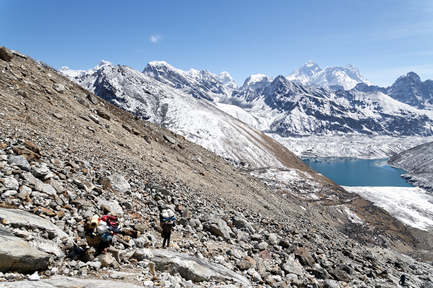
Porters early on the ascent of Renjo La, with Gokyo by the lake in the background. Photo: Martin Walsh
You can read Part II of the Great Himalayan Traverse, covering the route from Rolwaling to the Tibetan border and the differences between guided and unguided hikes, here.