In this series, we consider the 10 largest islands in the world from the perspective of an adventurous traveler looking for new possibilities.
Since there are no new continents to discover and a growing shortage of unclimbed mountains, modern adventurers often focus on lists. Projects involving or linking the 10 largest islands in the world are a great start.
Today, #5: Baffin Island
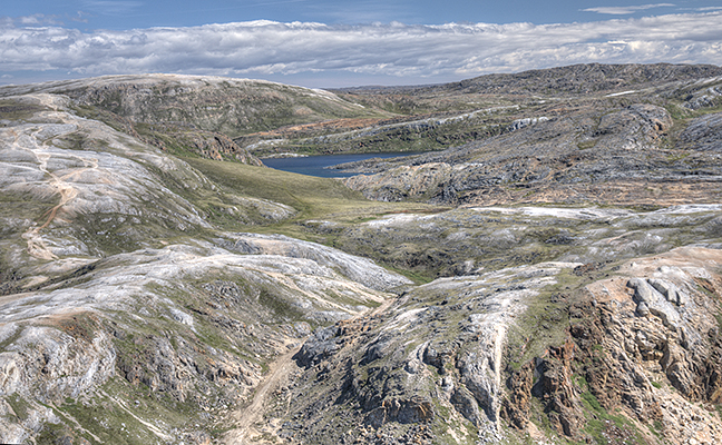
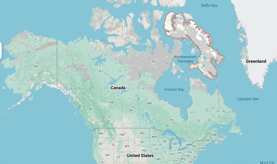
Slightly larger than Spain, Baffin Island is the largest island in Canada and the fifth-largest in the world. As befits such a gigantic place, it has lots of different terrain. Some are more interesting to travelers than others.
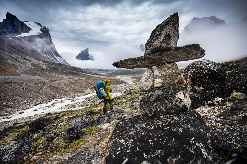
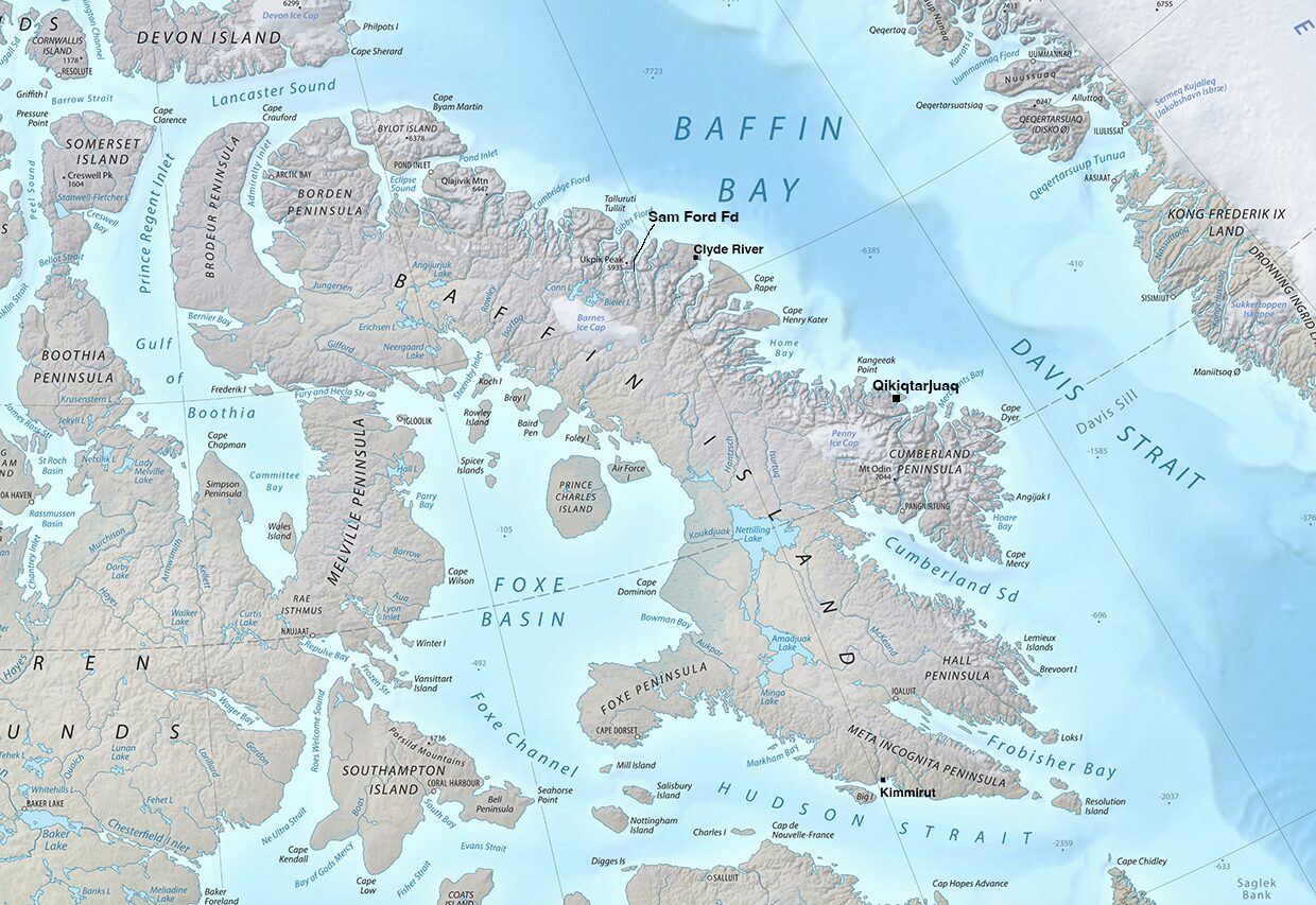
The best-known place on Baffin is Auyuittuq National Park on the Cumberland Peninsula, between the Inuit towns of Pangnirtung and Qikiqtarjuaq. Most visitors come to backpack 97km Akshayuk Pass, a natural corridor and the one non-technical route through the park.
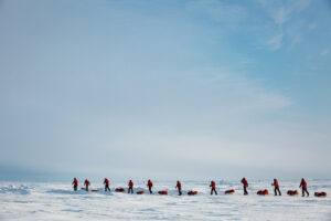
In summer, hikers hire a boat at each end (Pang and Qik) to convey them to the community, or they trek partway through the pass from Pang, then double back. Occasionally, people go in the springtime and pull sleds through that corridor. At this time of year, the sea is frozen, and you can access the park on foot from town.
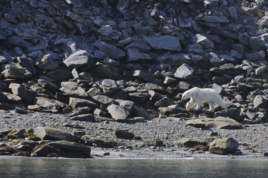
A polar bear prowls the Baffin shore. Photo: Jerry Kobalenko
A park problem
Note, however, that all Canadian national parks, including those in the Arctic, do not allow visitors to carry firearms, which leaves you somewhat vulnerable to polar bears. They rarely venture into Akshayuk Pass, but a freak attack did occur last spring. Fortunately, the victim survived.
The last attack on tourists on Baffin Island occurred 25 years ago, when a couple used a penknife to fight off a polar bear that broke into their tent when they were hiking a territorial park, which has the same no-firearm rules, near Kimmirut in southern Baffin Island.
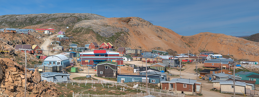
Kimmirut. Photo: Jerry Kobalenko
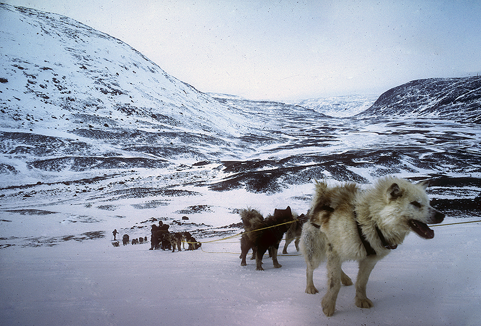
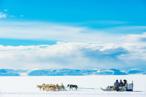
Dogsledding the 118km from Kimmirut to Iqaluit, Baffin Island. Photo: Jerry Kobalenko
Baffin Island near Kimmirut in summer. Photo: Jerry Kobalenko
Because Baffin is so big and lies right on the North Atlantic, explorers could hardly avoid bumping into it and so discovered it early. In 1576, Martin Frobisher, who previously had served time for piracy, sailed deep into what is now Frobisher Bay, where Iqaluit, Nunavut’s capital, resides.
He didn’t go all the way to its end but sailed back to England convinced — or alleging — that this dead-end bay was a channel, perhaps even the fabled Northwest Passage. He brought back some rocks and found an assayer willing to testify that they contained gold. Not surprisingly, this promise of an Arctic El Dorado financed two further expeditions back to what later became known as Baffin Island.
Crossing frozen Frobisher Bay. Photo: Jerry Kobalenko
Baffin’s visionary exporations
William Baffin himself did not spy the island until 1616. He explored the south coast, then kept heading north, until he was hundreds of kilometers north of Baffin Island, at the place where the Atlantic narrows into a channel just 50km wide between Ellesmere Island and Greenland.
No one followed up on his discoveries, and over the years, they came to be considered apocryphal and were dropped from the maps of the day. Not until two centuries later, in 1818, did John Ross rediscover what the precise, visionary Baffin had charted, thereby reinstating the old explorer’s reputation.
Because the gold on Baffin Island had proven illusory, and the island lay at the beginning of the Northwest Passage, which obsessed explorers throughout the 19th century, no one paid this gateway island much attention.
In the mid-1800s, a shaman named Qitdlarssuaq began what’s been called the last great Inuit migration. He murdered someone in southeastern Baffin Island and fled north to avoid retribution. Traveling with families, dogs, and kayaks, it took them years to work their way to the island’s northern end, near what is now Pond Inlet. But the family of the victim pursued them and caught up with them. It forced Qitdlarssuaq, after a skirmish called the Battle of the Iceberg, to migrate even further north, eventually to Greenland.
The Qidtlarssuaq migration.
The modern world encroaches
At the beginning of the 20th century, the modern world began to encroach. In 1920, two Inuit murdered an obnoxious trader named Robert Janes and were put on trial — the first application of white man’s law on Arctic peoples. Apparently, the two culprits found it hard to appreciate that being put in a warm room with plenty of food qualified as a punishment.
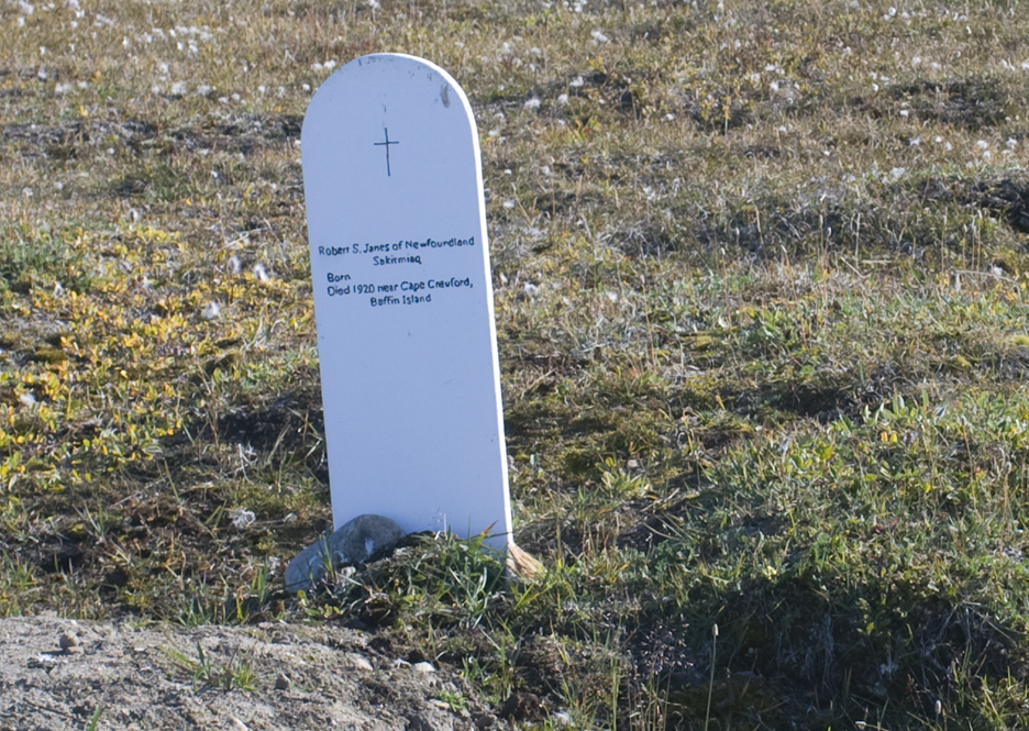
Robert Janes’ grave, Pond Inlet, Baffin Island. Photo: Jerry Kobalenko
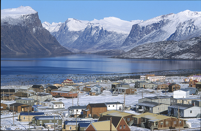
Around this time, the Canadian government began to fret about Arctic sovereignty, which they’d largely ignored till then. Americans, Danes, and Norwegians all had their claims on some Arctic islands. This led to the establishment of Royal Canadian Mounted Police posts in several obscure High Arctic locations, including Pond Inlet, a town at the very north end of the island. (High Arctic is an informal term for those areas at 74˚N and higher. Pond Inlet, at 72˚41′, falls a little short but is usually considered High Arctic.)
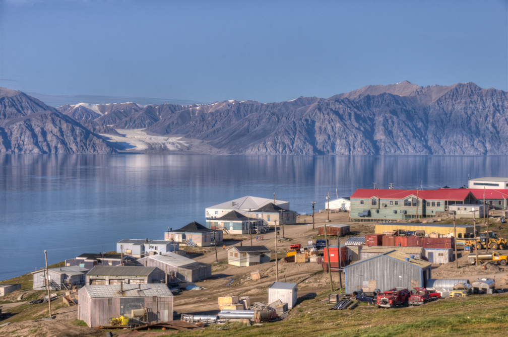
Pond Inlet, looking toward the crags and glaciers of Bylot Island. Photo: Jerry Kobalenko
From their base in Pond Inlet, the RCMP did some remarkable dogsled patrols. When another trader with the delightful name of Hector Pitchforth died of natural causes in southern Baffin, the RCMP dogsledded 1,600km to his little cabin to investigate. Then, satisfied, they dogsledded the 1,600km back.
Where to go, where to avoid
Much of central and western Baffin is flat or lumpy, with a type of ancient granite called the Canadian Shield. It tends not to draw adventure travelers, because the eastern part is so much more striking, with granite cliffs that have drawn big-wall climbers for 40 years. The interior of western Baffin is also the last stronghold of the fiendish black flies — a good reason to avoid that area in summer.
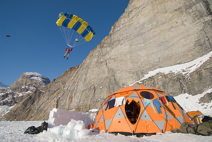
The national park at Auyuittuq offers just the one easy route, but mountaineers can access the Penny Ice Cap or attempt the striking walls of Mounts Asgard or Thor. Asgard was famously the scene of a BASE jump in a James Bond movie.
The highest peak on Baffin Island, 2,147m Mount Odin, also lies within the park but is blockier and less aesthetic than its two Norse-named sister peaks. Odin is the fifth-highest mountain in the territory of Nunavut. Three peaks on Ellesmere and one on Axel Heiberg are higher.
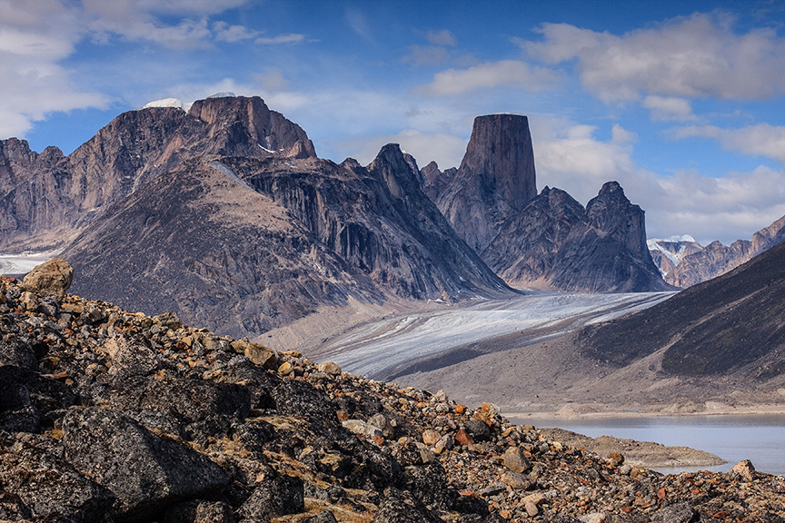
The cylindrical mass of Mount Asgard. Photo: Shutterstock
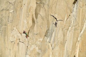
The Arctic Yosemite
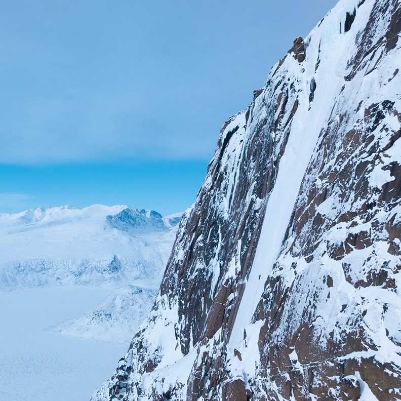
Even more popular with travelers than Auyuittuq is the area around Sam Ford Fiord. Discovered only in the 1980s, at least by climbers, it quickly became a world-class big-wall destination, an Arctic Yosemite with some of the highest cliffs in the world. A few of these, like Polar Sun Spire or Walker Citadel, rise almost 1,300m directly from the ocean. Nearby arms, such as Gibbs Fiord and the Stewart Valley, have similar granite cliffs. Travelers fly to Clyde River, about 80km away, and hire someone to snowmobile them to the fiord.
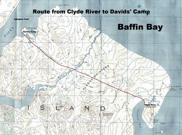
The typical overland snowmobile route from the town of Clyde River to Sam Ford Fiord.
In 1995, a pair of good climbers with little Arctic experience were halfway up a wall when, to their horror, the sea ice broke up far beneath them. Cliffs plunge vertically into the ocean everywhere, and you can’t get around or over them. They eventually went on half rations, then no rations for 10 days. They would have starved if three Inuit caribou hunters in a motorboat had not stumbled across them.
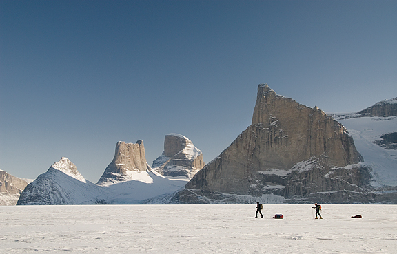
Sledding past Polar Sun Spire, Sam Ford Fiord. Photo: Jerry Kobalenko
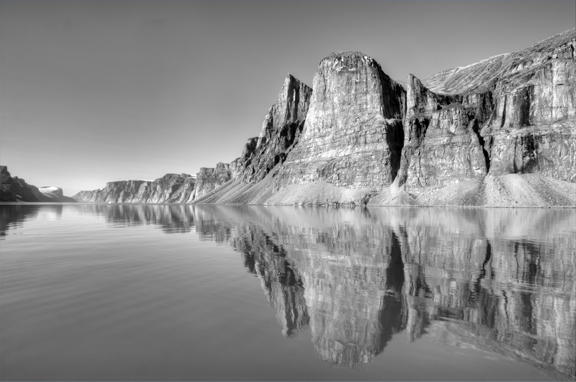
Gibbs Fiord. Photo: Jerry Kobalenko
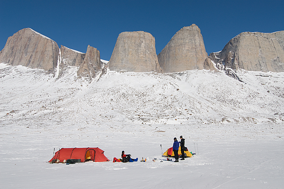
Stewart Valley. Photo: Jerry Kobalenko
BASE jumpers, Sam Ford Fiord. Photo: Jerry Kobalenko
When I was in Sam Ford Fiord one spring, guiding two guys on a week-long sledding trip, we shared the fiord with two large parties of BASE jumpers, a solitary couloir skier, and two parties of big-wall climbers. The Arctic felt almost like a playground.
Modern expeditions
Baffin has been circumnavigated twice by dogteam, once by polar guides Paul Landry and Matty McNair, and once by their daughter, Sarah McNair-Landry and her partner, Erik Boomer. The latter two live in Iqaluit and specialize in long-distance multi-disciplinary travels — climbing, skiing, kite skiing, whitewater kayaking — in the most spectacular parts of Baffin Island.
Sarah McNair-Landry and Erik Boomer on a recent ice climb near Pangnirtung. Photo: Erik Boomer
Sarah also runs a polar training center founded by her parents. Apart from kite-skiing and cold-weather travel experiences, the gigantic tides around Iqaluit create incredibly rough ice around shallow shorelines that are good training for dealing with the pack ice on North Pole expeditions. On his first North Pole expedition, Borge Ousland and his partner spent a month around Iqaluit, practicing in that rough ice.
Pangnirtung, gateway to Auyuittuq National Park in the distance. Photo: Jerry Kobalenko
One lovely spring route that has been done a few times but not often enough to make it cliché is the 600km along the frozen east coast from Clyde River to Pond Inlet. Several routes are possible; you can go over ice caps or stick to sea ice. You can detour through Sam Ford Fiord and its spectacular neighbors. And it ends at Pond Inlet, one of the three prettiest towns in the Arctic, along with Grise Fiord and Pangnirtung.
In 2009, one party of women who called themselves the Baffin Babes even doubled the distance to 1,200km by starting 600km further south, from the village of Qikqiktarjuaq.
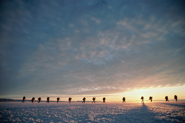
Finally, John Dunn, with various partners who came and went throughout the 196-day journey, trekked 3,000km on Baffin Island from north to south in the 1990s.
Too far south?!
Although I’ve traveled Baffin Island a bit, I’ve always found it a little too far south for my taste. I realize this sounds strange. However, anyone I’ve met who has spent time on Ellesmere or Axel Heiberg Islands prefers these wilder islands, despite the fact that parts of Baffin are as beautiful as those exotic High Arctic spots.
Maybe it’s all those towns on Baffin Island. True, they’re small and typically 500km or 600km from one another — an ideal length for a self-propelled journey. But their presence in every direction somehow makes Baffin Island feel a little more civilized.
Previous stories in this series: