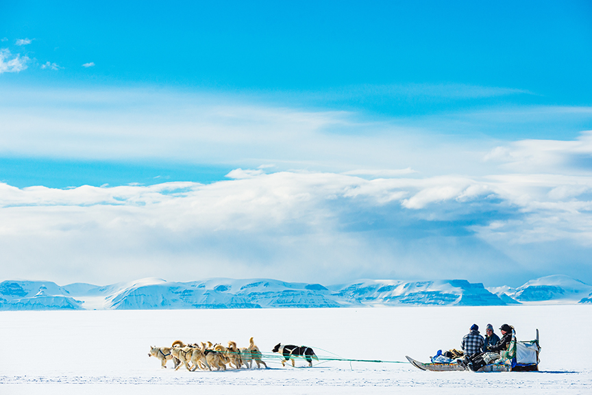
In this series, we consider the 10 largest islands in the world from the perspective of an adventurous traveler looking for new possibilities.
Since there are no new continents to discover and a growing shortage of unclimbed mountains, modern adventurers often focus on lists. Projects involving or linking the 10 largest islands in the world are a great start.
Today, #1: Greenland
Greenland is huge, though not as huge as the Mercator map projection makes it seem. It’s larger than Mexico but smaller than Alaska. At the same time, it is by far the largest island in the world, if you don’t include Australia, which usually counts as a continent.
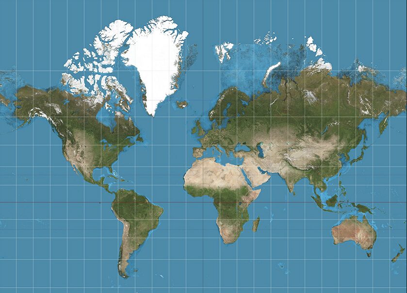
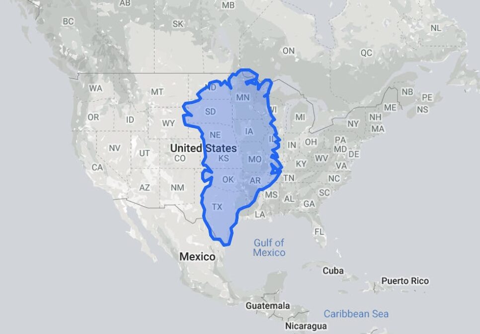
Greenland is a little larger than the U.S. Midwest, bottom map, but not the size of Canada and the United States combined, as the common Mercator projection, top, makes it seem. In the top map, Greenland seems to dwarf Australia, which is, in fact, almost four times as large as Greenland.
Australia and Greenland have one thing in common, however: Their populations live on the coast rather than the interior. Australia does have five percent of its population that lives inland; Greenland has none, for good reason: the interior is a giant ice sheet. All its towns are on the rocky coastal margins.
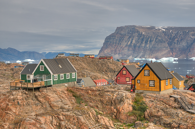
Uummannaq. Photo: Jerry Kobalenko
A Danish territory, Greenland has roads within many of its towns, but no roads between towns. You can only travel between settlements by boat or by air. The photo above, of the West Greenland town of Uummannaq, shows how many towns are laid out: colorful houses artfully perched on bits of rock. Wooden stairways lead from some of these houses down to the main paths or roads. Even small villages like Siorapaluk, the world’s oldest civilian settlement, get regular helicopter flights carrying food, mail, and passengers.
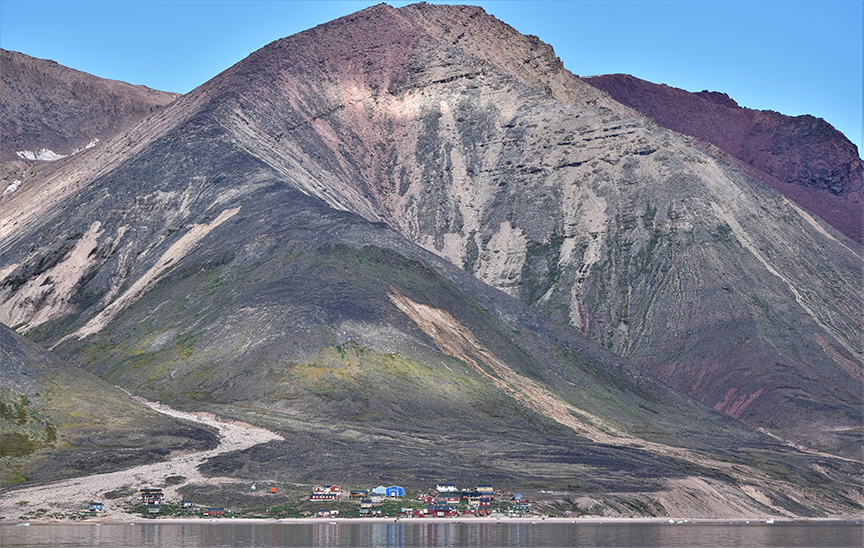
Siorapaluk, population 43, the world’s northernmost village. Photo: Shutterstock
Color-coded houses
The colors of the houses mean nothing now, except to add some cheerful tones to the monochromatic Arctic landscape. But in early colonial times, the Danish authorities used specific colors on official buildings for their Inuit subjects, who could not read. These colors were:
Red for churches and stores, including the houses where the priest or shop owner lived. The most commonly used color.
Yellow for hospitals, including the houses where the doctors or nurses lived.
Green for radio communications, or later, telecommunications buildings in general.
Black for police.
Blue for factories and fish plants.
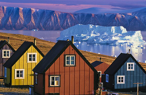
The colors of Greenland houses no longer mean what they once did. Qaanaaq, Greenland. Photo: Jerry Kobalenko
Although the Greenland Ice Sheet has persisted for 2.6 million years, the island wasn’t always this cold, even recently. About 1,000 years ago, Norse settlers grew corn in southern Greenland, during a warm period called the climatic optimum, when temperatures were 2˚ to 3˚C warmer than they are today. During that time, Norse settlements survived, if marginally. But around 1400 CE, the climate flipped from warmer than usual to colder than usual, an event known as the Little Ice Age. The Norse fled, and only the Inuit people, singularly adapted to the cold, remained.
Gulf Stream influence
Even then, it was not as cold in Greenland as in other parts of the Arctic. An offshoot of the warm Gulf Stream current, which keeps Arctic Norway and even the UK mild for their latitude, reaches up the West Coast of Greenland. Even a small, isolated group of about 200 Inuit who lived north of Melville Bay benefited from this mild current. Although they regularly traveled across the sea ice to what is now the Canadian side to hunt muskox, they didn’t settle there because it was bloody cold by comparison with Greenland.
The first European explorers after the Norse came to northern Greenland in 1818. By the mid-19th century, a sprinkling of odd American explorers — the melodramatic but wildly popular Elisha Kent Kane, the difficult Isaac Hayes, and the doomed individualist Charles Francis Hall — began exploring northwestern Greenland. (The east coast of Greenland, lacking that Gulf Stream influence, was icier, colder, and largely ignored.)
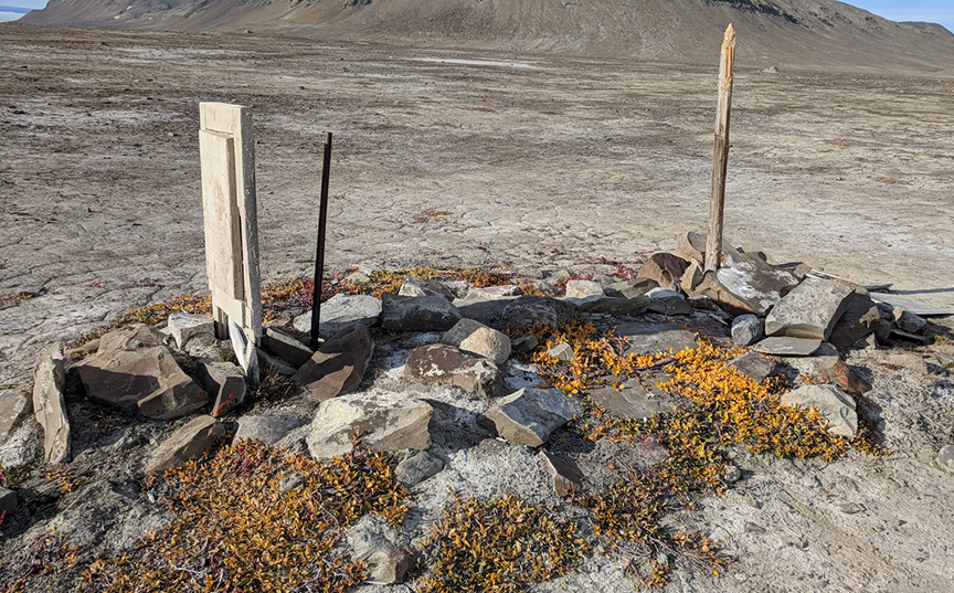
Charles Francis Hall’s grave, Northwest Greenland. Photo: Richard Weber
At the time, no one had been to the North Pole, and it was unknown how far north Greenland extended. Did it go all the way to the Pole itself, perhaps joining another land somewhere in the murky mists? Was it even an island? Beginning in the 1880s, another American, Robert Peary, tried to find out.
A brilliant networker
In 1891-2, Peary, traveling north by dogteam over the Ice Sheet, alleged that he reached the north end of Greenland and saw land beyond, which he called, with characteristic modesty, Peary Land. It was separated from Greenland by a channel, he averred, that he called Peary Channel.
Peary was a good organizer, a brilliant networker — he kept company with U.S. presidents and captains of industry back home — but he was also an unscrupulous and unlikable man who operated by bullying and domination and lied about his discoveries. Peary Channel didn’t exist — it was an inlet, not a channel — and the land beyond it was still Greenland. It is now widely accepted that he knew this. Nevertheless, his claim back in civilization that he had proved Greenland was an island made him famous.
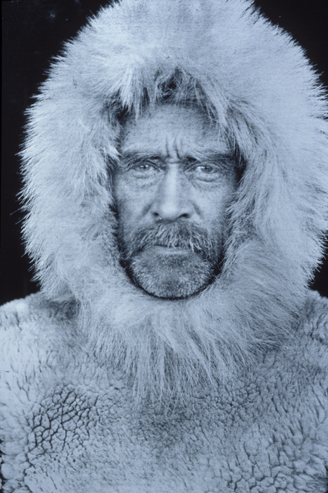
Robert Peary.
Slightly earlier but still in the Peary era, in 1888, Norway’s Fridtjof Nansen and four companions first skied across Greenland. At the time, the East Coast was largely uninhabited. (It has a few small communities nowadays.) They planned to begin at Sermilik Fiord but could not get close because of sea ice, so they started much farther south, then skied the 500km west to Gotthab (now Greenland’s capital, Nuuk).
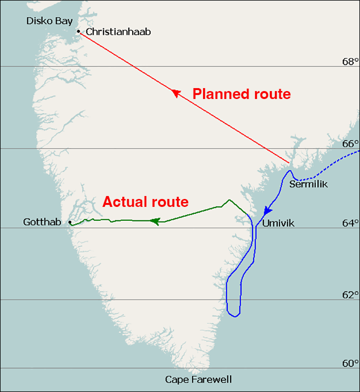
Nansen’s Greenland crossing. Map: Wikimedia
Nansen’s expedition was largely a sporting one. A brilliant polymath, Nansen had earlier helped revive the sport of cross-country skiing, while simultaneously pioneering the sciences of oceanography and neurology. Eventually, he became a diplomat and won the Nobel Peace Prize. Crossing Greenland was in his early expedition phase. It was a famous but very southern and relatively short crossing of the Ice Sheet. Countless others have crossed Greenland since, either by that route or by similar ones. Every year, tours lead fit clients on Greenland ski crossings.
The Thule expeditions
Peary introduced the people of North West Greenland to Western goods as payment for their services on his many expeditions. (At an old Inuit camp, I once found a wooden box lid labeled “Peary Arctic Expedition” that likely once contained some of these trade goods.) When Peary left Greenland in 1909, never to return, two remarkable figures opened a trading post to take over supplying these isolated people with goods. But while Knud Rasmussen and Peter Freuchen began as storekeepers, they were explorers at heart. With his friend, Rasmussen launched a series of fact-finding journeys called the Thule Expeditions.
The first one showed that Peary had been wrong about the existence of a channel separating so-called Peary Land from the rest of Greenland. The Second Thule Expedition mapped a section of Greenland’s north coast. The third one, in 1919, laid depots for a future Amundsen expedition that never came off. The distinctive russet-colored supply cans they left in caches on that expedition still turn up on both the northern Greenland and Ellesmere Island sides.
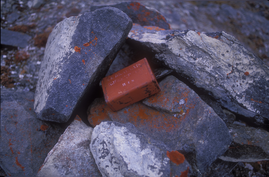
One of the distinctive russet cans from the Third Thule expedition. The white lettering stenciled on the cans reads, ‘J D Beauvais. Kjobenhavn.’ Beauvais was the supplier. Photo: Jerry Kobalenko
Mischief in Greenland
In the 1950s and 1960s, British climber and writer H. W. Tilman began a series of expeditions to Greenland in a small boat, which he archly called Mischief. Here, in his fifties and sixties, Tilman happily began climbing its world-class coastal cliffs. His Mischief in Greenland is a classic early work of modern Greenland adventure.
“Only a man in the devil of a hurry would wish to fly to his mountains, forgoing the lingering pleasure and mounting excitement of a slow, arduous approach under his own exertions,” he wrote.
Many modern climbers have followed Tilman’s lead, using a small yacht, either their own or someone else’s, to reach Greenland. They then begin poking around for virgin cliffs to climb. Recently, some climbers have used kayaks rather than sailboats to reach climbing areas. Some climbers have paddled two weeks each way to reach their cliffs of choice.
For a long time, Greenland’s size thwarted more ambitious ski expeditions than the relatively short east-west crossings. Then in the 1990s, ski sails and kite-skiing began to make longer distances possible in places where the winds are fairly reliable, such as Antarctica and the Greenland Ice Sheet.
South to north
In 1996, Rune Gjeldnes and Torry Larsen traveled Greenland entirely from south to north by ski, kayak, and ski sail. It took them 86 days to cover the 2,900km. To make the expedition more interesting (!), these Norwegian ex-military guys parachuted to their starting point.
Another significant crossing took place in 2010. Erik McNair-Landry and Sebastian Copeland kite-skied 2,300km in 43 days from Narsarsuaq in the south to Qaanaaq, where many of the modern Polar Inuit live. On one day, they kited 595km in 24 hours, still a record.
Many other long kite-ski expeditions have taken place on the Greenland Ice Sheet. Every year, it seems, there’s one or two.
No one has circumnavigated Greenland in a continuous fashion. Lonnie Dupre and John Hoelscher attempted it by dogsled and kayak in 1997, but only managed a piece of it. They decided to keep returning and resuming where they left off the previous year until they closed the loop, which they finally did in 2001.
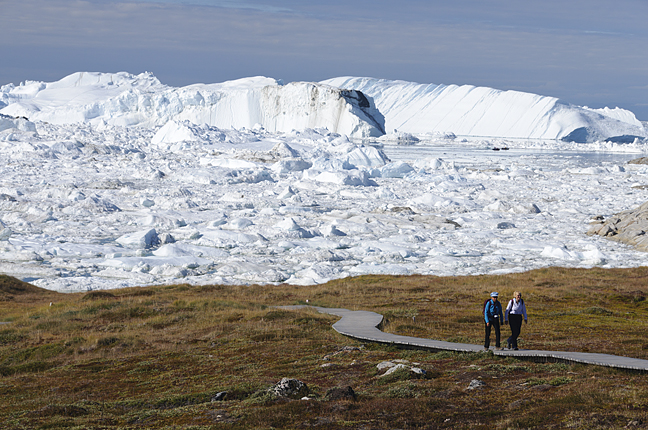
Tourists hike the boardwalk beside the Icefiord in Ilulissat, Greenland’s most-visited town. Photo: Jerry Kobalenko
Arctic tourism
Greenland is largely a European adventure destination, in part because Greenland is European and there are regular flights there from Copenhagen. Flights from North America to Greenland were rare to non-existent until recently, when the international airport at Nuuk opened. Now, there are summer flights from New York and from Iqaluit, in Arctic Canada.
Apart from independent adventures, which are subject to increasing restrictions because of the potential cost of rescue — solo travel has long been forbidden — Greenland has surprisingly well-developed adventure tourism. This ranges from the many cruise ships that visit the Greenland coast every summer to the three-day Arctic Circle Race, a 160km cross-country ski loop that begins and ends in the town of Sisimiut.
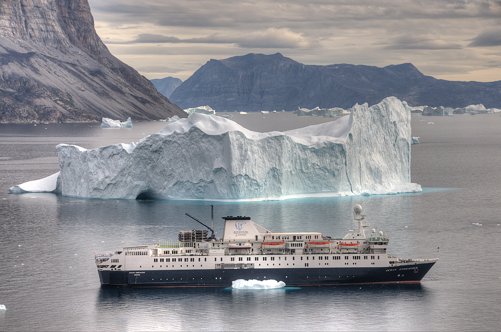
A cruise ship off Greenland. Photo: Jerry Kobalenko
There is also a 160km backpack from Kangerlussuaq — an old U.S. base which until recently, was the only airstrip in Greenland that could accommodate commercial jets — to Sisimiut. Known as the Arctic Circle Trail, it typically takes a week to 10 days to complete.
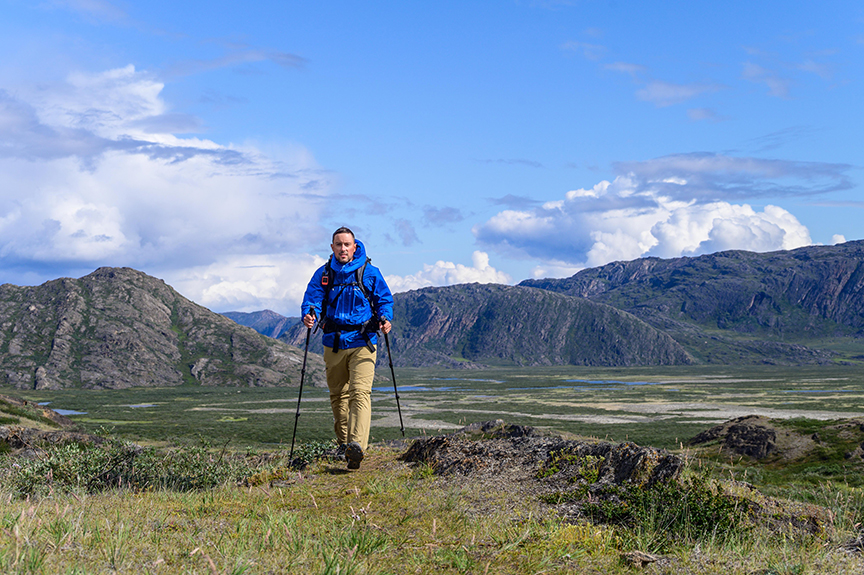
Backpacking the Arctic Circle Trail. Photo: Ash Routen
Climbing Greenland’s highest peak
Apart from ski tours across the Greenland Ice Sheet, the most extreme tour is a five-day climb up Greenland’s highest mountain, 3,694m Gunnbjørn Fjeld. The mountain is so isolated that the only way to reach it is by charter aircraft from Iceland. While not as expensive as Antarctica, the roughly $25,000 cost is bracing. In that sense, it’s similar to Ellesmere Island’s highest mountain, Barbeau Peak, where the main hardship is not the climbing but the cost of getting there.
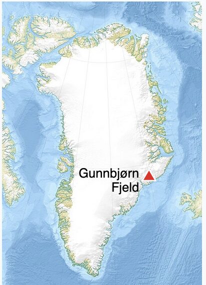
Map: Wikipedia
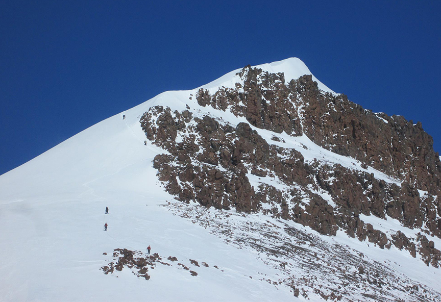
Climbers creep toward the summit of Gunnbjørn Fjeld. Photo: Greg Slayden/Peakbagger
Greenland is not only the world’s largest island, but also the northernmost. It reaches almost 83˚40′, just over 700km from the North Pole. However, North Pole expeditions have always begun further east, on northern Ellesmere Island, despite the slightly longer distance, to avoid the unfavorable ocean currents around Greenland.
The Sirius Patrol
Since World War II, an elite Danish naval unit has patrolled northern and northeast Greenland by dogteam as a gesture of sovereignty — similar to how Canada’s Royal Canadian Mounted Police patrolled their High Arctic in the 1920s and early 1930s. This Sirius Patrol covers vast distances across the wildest part of Greenland, typically sleeping in one of 50 huts along the way.
The Sirius Patrol is justifiably famous, but Greenland’s greatest travelers remain the Polar Inuit, a small, isolated group living north of Melville Bay in Northwest Greenland. Expertly adapted to their environment, they were the ones that Peary used to hunt, supply dogs, and sew clothing for his expeditions. Some less knowledgeable explorers, figuring all native people were the same, hired guides from more southerly parts of Greenland. Some of these proved inadequate for the rigors of the extreme northern areas in which the Polar Inuit excelled.
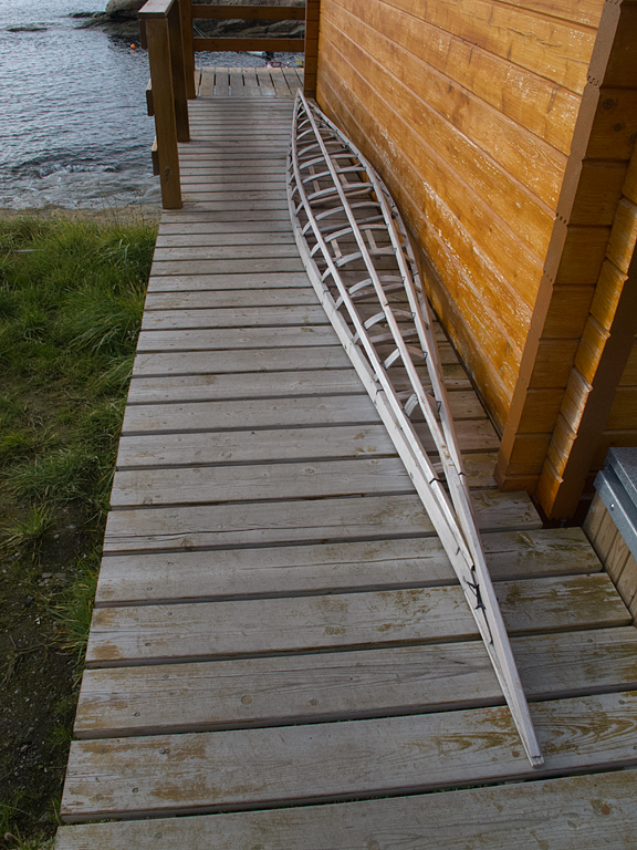
A kayak frame in Greenland. Early hunters built their kayaks using driftwood from Siberia, lashed together with caribou sinew and covered with sealskin. Photo: Jerry Kobalenko
Even in modern times, the Polar Inuit have been known to dogsled for weeks at a time, hunting seals to feed themselves and their dogs. They’re comfortable traveling on glaciers, on the funny sea ice around the North Water Polynya, in all weather.
In places like Qaanaaq, the biggest town in that harsh region, you may see these men coming back from a hunt, wearing traditional polar bear skin pants and sealskin kamiks, while yakking on their smartphones. Some things have changed.
Previous stories in this series: