In this series, we consider the 10 largest islands in the world from the perspective of an adventurous traveler looking for new possibilities.
Since there are no new continents to discover and a growing shortage of unclimbed mountains, modern adventurers often focus on lists. Projects involving or linking the 10 largest islands in the world are a great start.
Today, #2: New Guinea
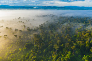
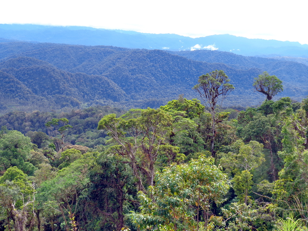
Few people realize that New Guinea is the second-largest island in the world. Spanning an immense 785,753km², it contains the third-largest rainforest on Earth, giving it the highest plant biodiversity of any island. Geographically, it can be confusing, as the eastern half forms the independent country of Papua New Guinea, while the western half belongs to Indonesia.
The least-known Seventh Summit
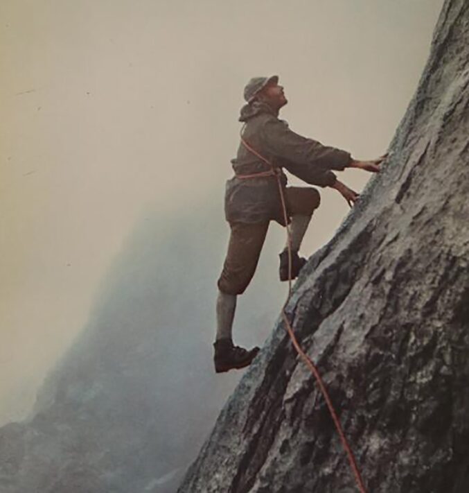
Carstensz Pyramid, also known as Puncak Jaya, is the lowest and arguably least well-known of the Seven Summits. Unlike Mount Kosciuszko in Australia, which some climbers choose as an easier alternative, Carstensz is a climb, with sections graded up to around 5.8. The ascent combines rock climbing with an often unpredictable climate.
The mountain is named after the Dutch explorer Jan Carstenszoon, while Puncak Jaya, meaning “Glorious Peak,” is the Indonesian name introduced in the 20th century. Among the indigenous Amungme people, it is known as Nemangkawi Ninggok, or “Peak of the White Arrow.”
It lies in the central highlands on the western side of the island, within the Maoke Mountains. Rising to 4,884m, it’s the highest point between the Andes and the Himalaya, standing about 130m higher than Russia’s Klyuchevskaya Sopka volcano.
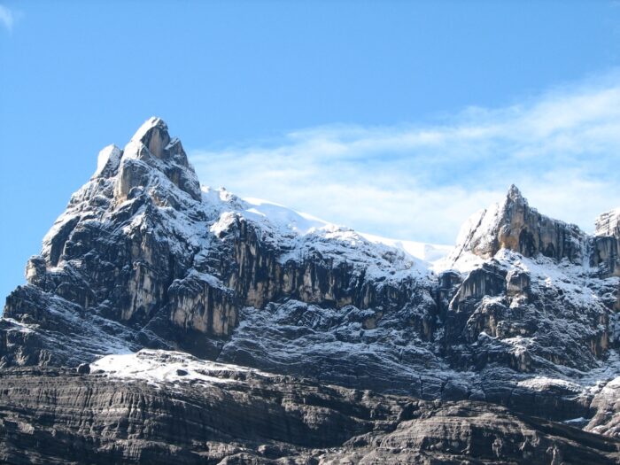
Cartensz Pyramid. Photo: Shutterstock
Stature and mystique
In his book Beyond Everest, Canadian climber Pat Morrow, who was the first to climb the harder Seven Summits list in 1986, wrote, “Exotic equatorial glaciers, jagged limestone ridges, and a firm waterworn north face make Carstensz Pyramid a coveted but seldom-climbed mountaineering prize. In addition to its pleasing aesthetics and challenging routes, it is the highest summit on the continental shelf of Australasia, and l had been drawn to it not only by its seven-summits stature but also by its mystique.”
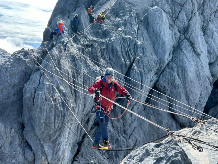
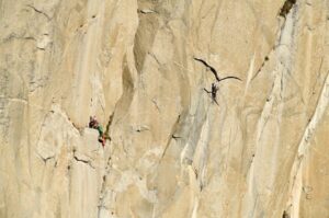
A climber on the rope bridge near the summit. Photo: Climbing the Seven Summits
Although the range had been sighted previously, its highest summit was not reached until 1962, when an expedition led by Austrian climber Heinrich Harrer, of Seven Years in Tibet fame, made the first ascent with a multinational team that included Philip Temple of New Zealand. Temple had earlier led an exploratory journey into the area and played a key role in establishing the approach route.
On the north face of Carstensz Pyramid. Photo: Heinrich Harrer
Not without danger
In 1961, Michael Clark Rockefeller, a member of the wealthy Rockefeller clan, disappeared during an expedition in the Asmat region. His fate remains unknown, but his twin sister, Mary Rockefeller Morgan, wrote in a 2012 memoir that she believed he likely drowned while swimming to shore. By contrast, Carl Hoffman’s 2014 book Savage Harvest, based on interviews and Dutch colonial records, reports that some Asmat villagers claimed Rockefeller was killed after reaching land.
Michael Clark Rockefeller. Photo: https://peabody.harvard.edu
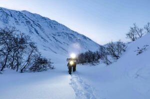
In 2017, British adventurer Benedict Allen made headlines by disappearing in the interior of northern Papua New Guinea while attempting to reconnect with the Yaifo, an isolated community he had first encountered three decades earlier.
Photo: Benedict Allen
Paddling adventures
Paddlers will look at New Guinea and wonder if a loop of its over 6,000km shoreline is possible. There is little available information online, but in 2016, Danish adventurer Thor Jensen and Papua New Guineans Job Siyae, Justin John, and Sanakoli John completed a 6,300km, 14-month circumnavigation of the island in a traditional sailing canoe. The crew struggled to catch enough fish to sustain themselves and faced harsh weather and rumored encounters with pirates.
Photo: Thor Jensen
German-born kayaker Oskar Speck undertook one of the most extraordinary solo journeys of the 20th century, paddling an estimated 50,000km from Germany to Australia between 1932 and 1939 in a folding kayak. Traveling through Europe, the Middle East, Southeast Asia, and into the Pacific, Speck also kayaked a long passage along the northern shores of New Guinea. He later followed sections of the island’s southern coastline before continuing south to his eventual destination in Australia, where he arrived just as the Second World War began.
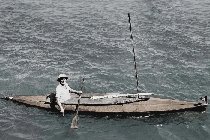
Oskar Speck in his folding kayak. Photo: Public domain
More than seven decades later, in 2016, Australian sea kayaker Sandy Robson set out to retrace part of Speck’s remarkable expedition. While shorter in distance, at approximately 23,000km, her journey replicated Speck’s New Guinea route, becoming the first female to paddle the coastline.
Cross-country treks
In 2014, Patrick Hutton and Richard Johnson of the UK completed an unmotorized and unsupported crossing of Papua New Guinea at its widest point. The pair traveled roughly 1,000km from Vanimo on the north coast to Daru in the south. Over 83 days, they bushwhacked through dense jungle, crossed the 3,000m Star Mountains, and rafted a crocodile‑inhabited river.
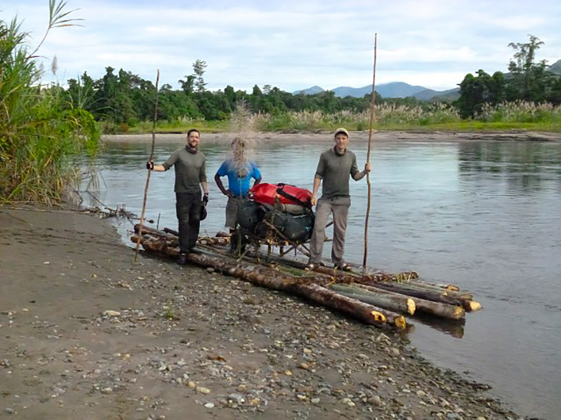
Richard Johnson, left, and Patrick Hutton. Photo: thepursuitzone.com
In 1927–1928, Australian patrol officers Charles Karius and Ivan Champion led the groundbreaking North-West Patrol, becoming the first Europeans to cross New Guinea at its widest point, from the Fly River in the south to the Sepik River in the north. Their months-long trekking and river expedition pushed through largely unmapped terrain of dense rainforest, swamps, and rugged highlands, relying heavily on Papuan carriers and local knowledge.
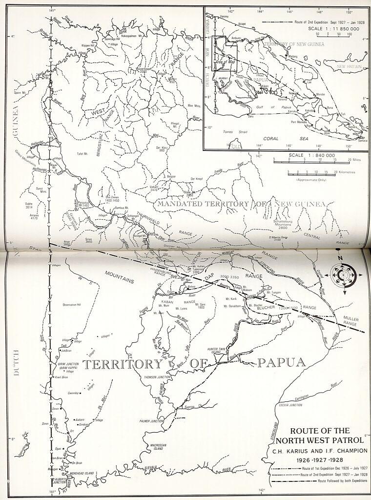
Karius and Champion’s 1927 patrol route, illustrating their full overland crossing of the island. From James Sinclair’s 1988 biography of Champion, Last Frontiers. Map: savageminds.org
Subsequent crossings of New Guinea’s interior have followed similar patterns, combining river travel with long overland treks across the central mountain ranges. During the Second World War, Catholic missionaries, accompanied by patrol officer James Searson and prospector Dan Leahy, fled inland and made a demanding trek across the central highlands.
Post-WWII adventures
Photo: Kira Salak
In 2020, a Polish team led by Michal Lukaszewicz completed a month-long traverse of the little-known Blucher Range in western New Guinea. Traveling inland from Kiunga by dugout canoe along the Fly, Palmer, and Black rivers, they then continued on foot through largely unmapped terrain, using local knowledge to navigate swamp forest and steep jungle ridges in an effort to link isolated communities across the range. In all, they covered 250km of dense, roadless rainforest.
Cave exploration
Previous stories in this series: