In this series, we consider the 10 largest islands in the world from the perspective of an adventurous traveler looking for new possibilities.
Since there are no new continents to discover and a growing shortage of unclimbed mountains, modern adventurers often focus on lists. Projects involving or linking the 10 largest islands in the world are a great start.
Today, #4: Madagascar
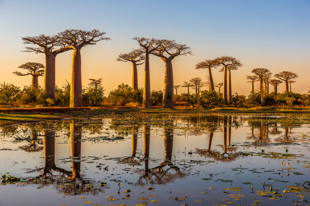
The fourth-largest island in the world lies 400km off of the African mainland, in the Indian Ocean. Madagascar’s island separation and diverse geography make for a land of unique flora and fauna and a wide variety of environments, from coastal plains to deserts to rainforests, all spotted with volcanoes. The island’s 591,896 square kilometers, many of them sparsely inhabited, offer a wide range of opportunities for the adventurous traveler.
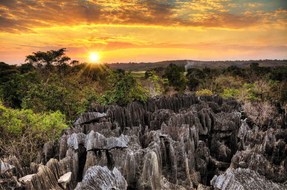
Distinctive karst geology in Tsingy de Bemaraha Nature Reserve. Photo: Shutterstock
Exploring Madagascar’s history
Austronesian people sailing from Taiwan expanded across the Pacific and Indian Oceans, eventually reaching Madagascar in the late first millennium BCE. Recent controversial discoveries, however, suggest earlier visitors. Some academics now point to stone tools and bones with cut marks as evidence of earlier occupation. This remains a matter of debate. For now, these first-millennium voyagers are the first confirmed explorers of Madagascar.
By the time Europeans arrived in the 16th century, the Malagasy (people of Madagascar) were a disparate collection of small states. Their culture was further diversified by the arrival of mainland Bantu people and by Afro-Arab traders. Portuguese explorer Diogo Dias was the first European to visit, landing by accident in 1500 when a storm blew his ship, bound for India, off course. He eventually made it back to Portugal with only seven of his men still alive.
In 1642, the French arrived. They built a fort and maintained a colonial presence on the island. They weren’t the only ones: Pirates like Captain William Kidd used the island as a base for their operations in the Indian Ocean. Over the next two centuries, Madagascar became a battleground in France and England’s ongoing battle for colonial domination. The French formally annexed it in 1896, but it has been a series of independent republics since 1958.
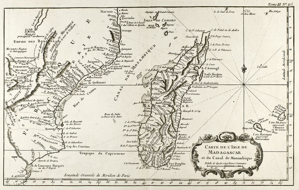
An 18th-century map of Madagascar. Photo: Public Domain
Madagascar’s highest peak
Madagascar’s highest mountain, Maromokotro, isn’t topping height records, but its remote location means few people visit the 2,876m summit. Situated on the Tsaratanana Massif of northern Madagascar, Maromokotro is considered a sacred site by the Malagasy and is located in a strict nature reserve.
Mountaineer Nigel Vardy climbed Maromokotro in 2007, during his challenge to climb the seven tallest peaks on the world’s seven largest islands. Just getting to the mountain, he found, required eight days of trekking through savanna and then jungle, fording rivers and finding and cutting a path as he went. Rather than a technical climb, it’s an uphill endurance trek.
It took botanists from the UK’s Kew Gardens two attempts to successfully summit. A 2017 expedition in search of an elusive bamboo species had to turn back 780m below the top. Making slow progress through the dense jungle, they found themselves too far from the next water source to proceed safely.
In 2022, the Kew team returned, taking extra care to follow local customs. Malagasy belief holds that, in addition to making offerings of honey at every camp, anyone hoping to reach the summit must bring a live white cockerel and leave it at the top. In 2017, their chicken was only, they admit, “almost” white. In 2022, they successfully summited, fully white chicken in hand. Do with that information what you will.
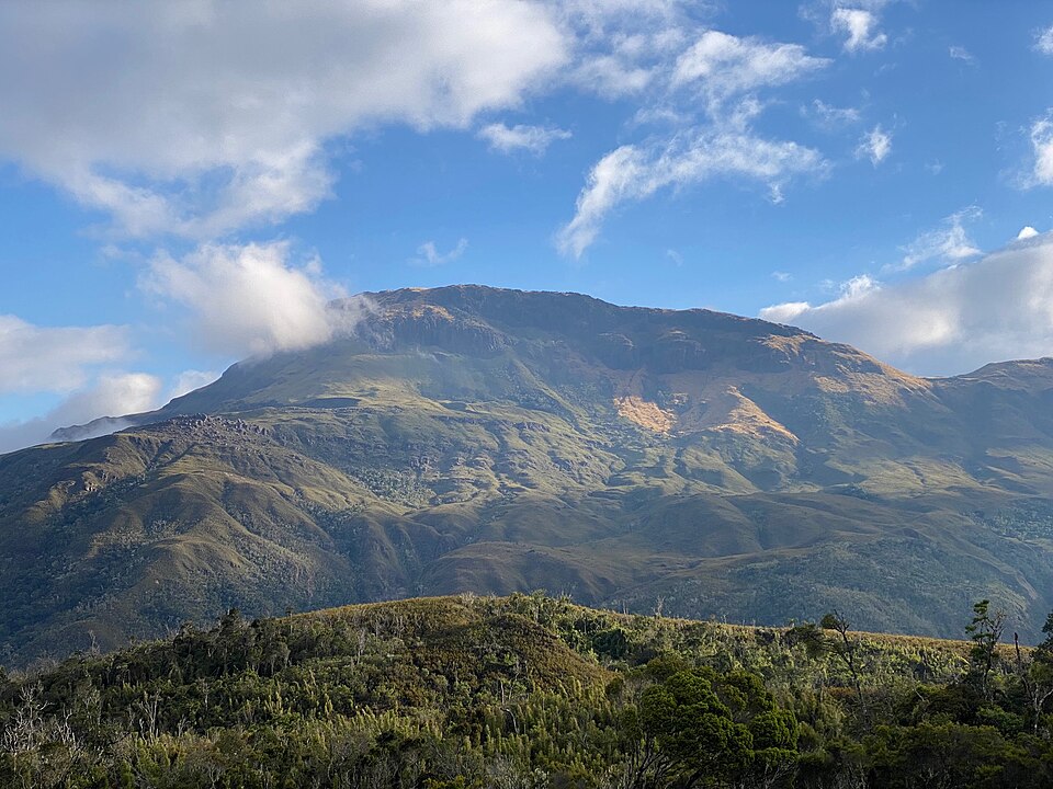
Maromokotro. Photo: Wikimedia Commons/Yann Mayette
Imarivolanitra and the Tsaranoro massif
The French named the second-highest peak Mount Boby, though locals prefer the Malagasy name, Imarivolanitra. Reaching its 2,658m summit is more technical than Maromokotro, as the route crosses several sections of Madagascar’s unique geology, including the Lunar Valley, a jagged granite landscape. With the town of Ambalavao only about 50km from the foot of the massif, it’s far more accessible than Maromokotro.
The route back from the summit to the nearest town takes you across the Tsaranoro Valley, Madagascar’s climbing mecca. The black-and-orange granite cliffs of the Tsaranoro Massif are a global destination for ambitious climbers. Modern climbing legend Adam Ondra visited in 2010, when he achieved the first free ascent of the 8b+ rated Tough Enough, as well as the first free ascent of Tsananoro’s other iconic line, the 8c Mora Mora.
American Sasha DiGiulian and Spaniard Edu Marin bagged the second free ascent of Mora Mora seven years later. Afterward, DiGiulian admitted that it was the most difficult multi-pitch climb she’d ever done.
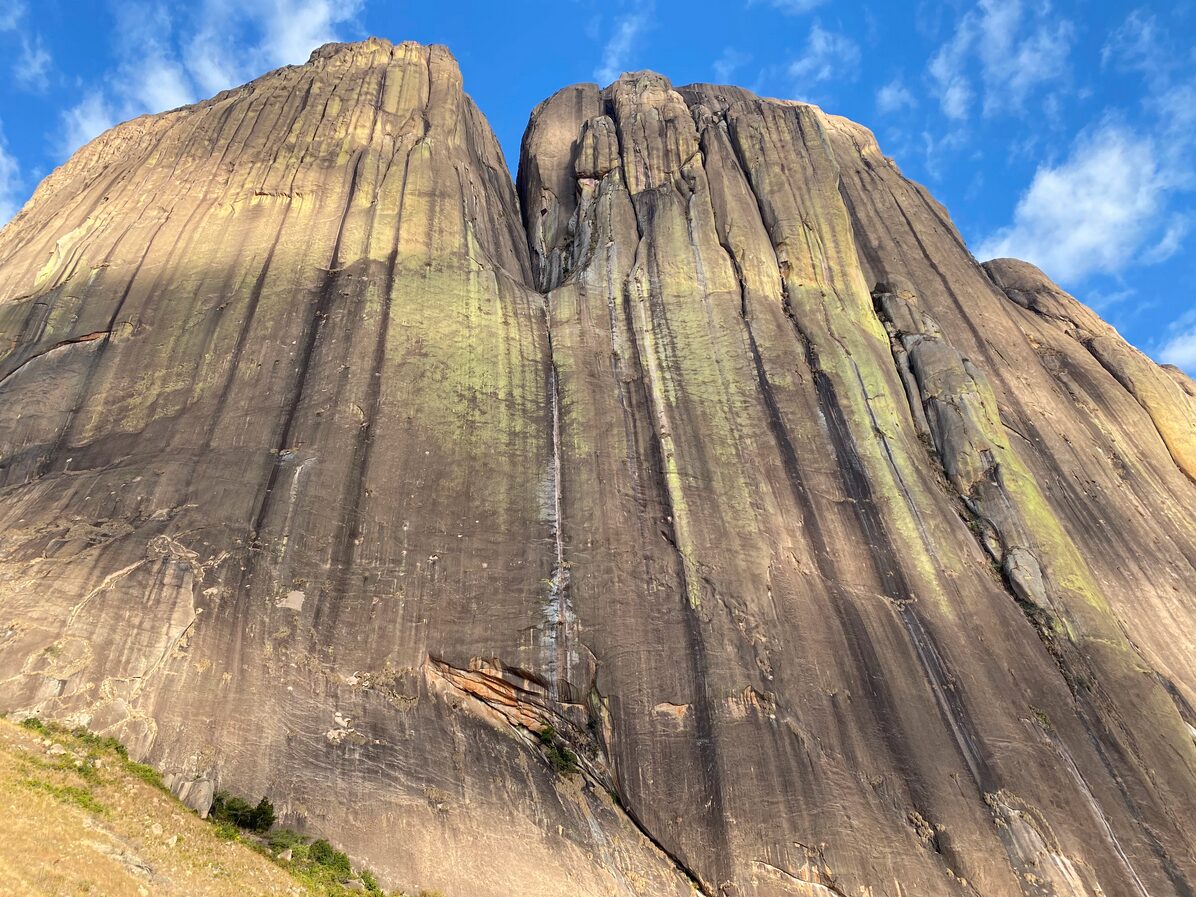
Photo: A 7c+ line on Tsaranoro Atsimo. Photo: The Crag/Tom Baanders
By river and by sea
Madagascar has over a dozen major rivers whose tributaries run throughout the width and breadth of the island. The longest is the 564km-long Mangoky, which Oscar Scafidi and Ben Ziehm Stephen followed from source to sea on a 2022 expedition. The 24-day, 700km journey included long, brutal portages, as both battled illness, rough terrain, and confusing geography.
Many of Madagascar’s dozens of rivers lack first descents on record, or have only recently been paddled. The Onive River, which runs through 200km of eastern Madagascar, was the site of an ambitious paddling expedition by kayakers Henry Munter and Evan Ross. The Onive plummets over 1,200m along its path from the central plains to the sea, with sections too rough for the local pirogue canoes.
Their account of the expedition, now only accessible via the Wayback Machine, describes encountering “one Class Five rapid after another.” At other times, the shallow river threatened to destroy their boat while hopeful crocodiles waited half-submerged.
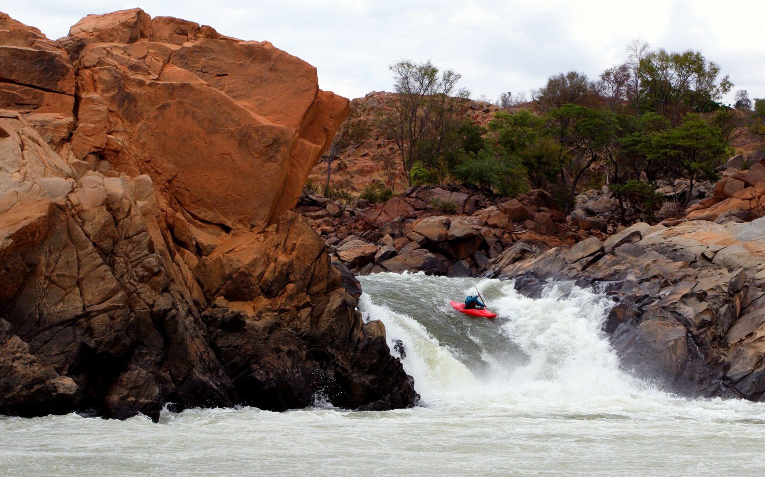
Descending a waterfall on the Onive. Photo: Evan Ross (archived)
Like many islands, some may even say all islands, Madagascar is surrounded by water. In 2009, South African adventurer Riaan Manser completed the first circumnavigation of Madagascar by kayak. The 5,000km solo journey took 11 months. Regularly stymied by red tape and ongoing political instability, Manser also documented close encounters with curious humpback whales, sharks, and sea turtles.
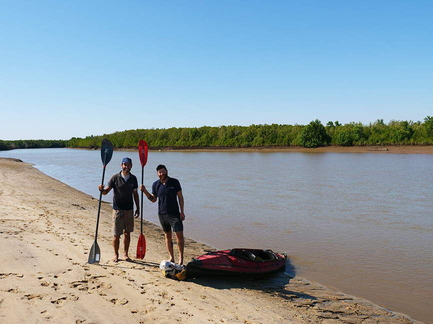
Scafidi and Stephen beside the Mangoky River. Photo: Oscar Scafidi
Trekking Madagascar
By kayak is not the only way to traverse the length of a river. In one of our Top 10 Expeditions of 2019, adventurer Chaz Powell, ecologist Emilie Gorse, and filmmaker Justin True crossed Madagascar from east to west, following the path of the Mangoky. They crossed 780km, including sections of Madagascar where bandit groups operate in defiance of the local government.
The Mangoky is a tricky river to map. With geographers still undecided about exactly where the river begins, both Powell’s team and kayakers Scafidi and Stephen had to choose which tributary to follow as the river’s source. Powell stuck to the largest tributary, the Matsiatra, which Scafidi and Stephen also selected as the most likely source. Forced into a lengthy portage, the kayakers took to another tributary, the Mananantanana.
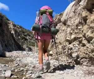
In 2016, Welsh gonzo trekker Ash Dykes became the first to cross the 2,574 km length of Madagascar on foot. The 155-day trek allowed him to experience, or perhaps pitted him against, the full range of the island’s ecology. Along the way, he summited eight peaks, including the Maromokotro. And yes, he did bring a chicken.
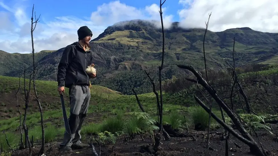
Ash Dykes with Gertrude the white chicken. Photo: Ash Dykes
Unique ecology, under threat
Madagascar is one of the most ecologically diverse locations on Earth, with a vast majority of its plants and animals found only on the island. This unique ecology is the focus and attraction for many Madagascar-bound adventurers.
The attraction can also be a danger. Every year, there are dozens of reports of crocodile attacks, and many more that go unrecorded. But as usual, it is the small, disease-carrying critters one must watch out for. Ash Dykes, the trekker who crossed the island on foot, got both an arm-blistering spider bite and a case of malaria during his journey. Kayaker Stephen contracted bilharzia, a dangerous infection of parasitic worms.
As in any place, our fellow humans can pose dangers. As Chaz Powell’s team discovered, in some remote regions on the island, political instability and desperation have forced some to turn to banditry. Anglophone adventurers may also struggle to be understood outside of major cities, as most people speak some combination of Malagasy or French.
Extensive slash-and-burn agriculture, logging, and mining have stripped the island of 90% of its forests, and continue to do so at an alarming rate. Still, there are unexplored rivers and remote peaks, dense jungles and expansive deserts. Any readers who take it upon themselves to explore the adventurous possibilities of Madagascar are urged to travel with chickens of the correct color when required. I’m not superstitious, but, well, it can’t hurt.